Download Agreement, Release, and Acknowledgement of Risk:
You (the person requesting this file download) fully understand mountain climbing ("Activity") involves risks and dangers of serious bodily injury, including permanent disability, paralysis, and death ("Risks") and you fully accept and assume all such risks and all responsibility for losses, costs, and damages you incur as a result of your participation in this Activity.
You acknowledge that information in the file you have chosen to download may not be accurate and may contain errors. You agree to assume all risks when using this information and agree to release and discharge 14ers.com, 14ers Inc. and the author(s) of such information (collectively, the "Released Parties").
You hereby discharge the Released Parties from all damages, actions, claims and liabilities of any nature, specifically including, but not limited to, damages, actions, claims and liabilities arising from or related to the negligence of the Released Parties. You further agree to indemnify, hold harmless and defend 14ers.com, 14ers Inc. and each of the other Released Parties from and against any loss, damage, liability and expense, including costs and attorney fees, incurred by 14ers.com, 14ers Inc. or any of the other Released Parties as a result of you using information provided on the 14ers.com or 14ers Inc. websites.
You have read this agreement, fully understand its terms and intend it to be a complete and unconditional release of all liability to the greatest extent allowed by law and agree that if any portion of this agreement is held to be invalid the balance, notwithstanding, shall continue in full force and effect.
By clicking "OK" you agree to these terms. If you DO NOT agree, click "Cancel"...
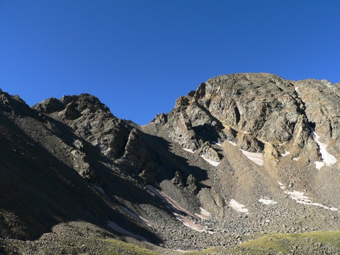
Back in May, I made a futile attempt at Mount Belford from Missouri Gulch, but was turned back on the northwest shoulder (a combination of wind, snow, wind, months of forgoing hiking for actuarial exam studies, wind, and stomach discomfort).
Now with a day off, I decided to try again with a summer-conditioned Belford. Fearing a mental block on the route taken in May, I chose to ascend via Elkhead Pass. The route:
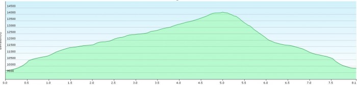
Overall, the hike was just over ten miles in length (despite what my GPS says).
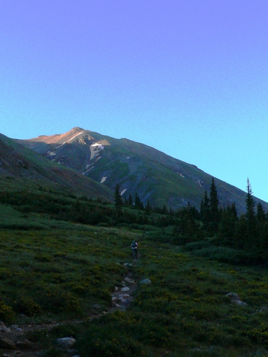
The switchbacks are nice - nicer using hiking books than hiking boots plus microspikes - and the early altitude is gained quickly.
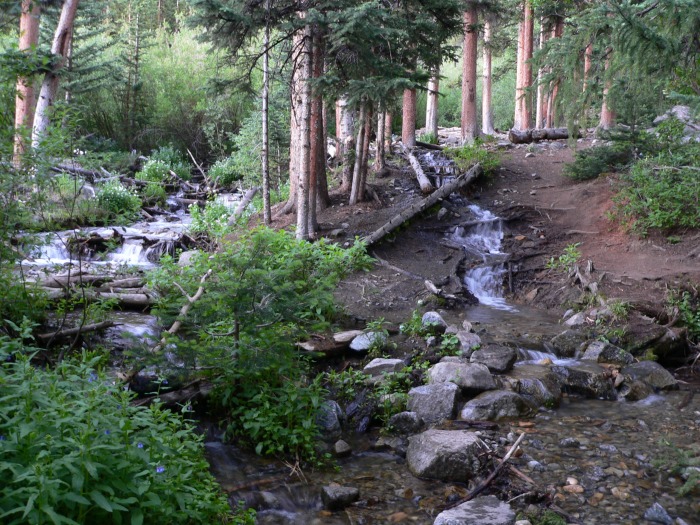
I was already starting to get an altitude headache (ten concussions have left me a bit scrambled), so I made sure to take it nice and easy with plenty of photo breaks. We arrive at a chock-full creek crossing:
And after some more elevation, Mount Belford makes its first appearance of the morning.
Missouri Gulch is really popping with color in mid-July!
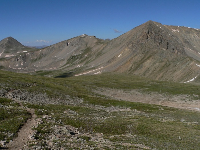
As we ascend towards Elkhead Pass, Missouri Mountain casts an imposing shadow (both figuratively and literally):
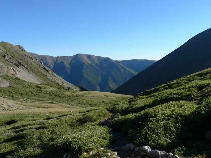
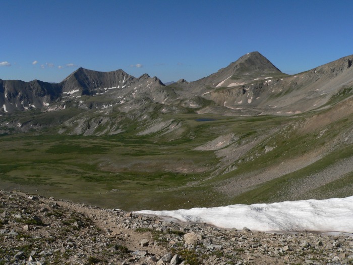
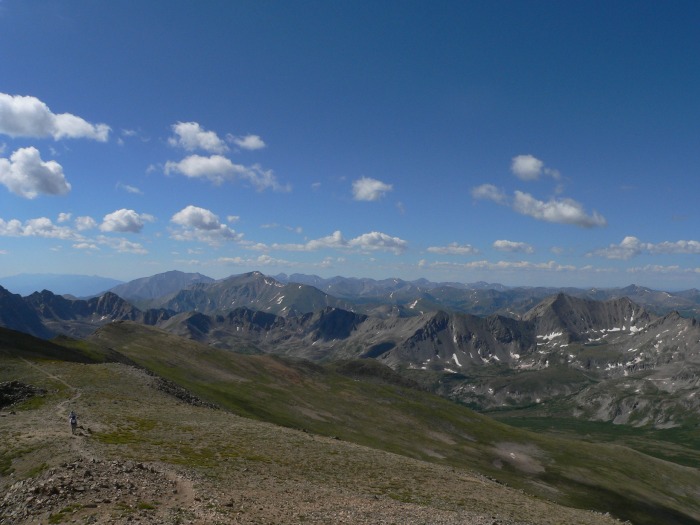
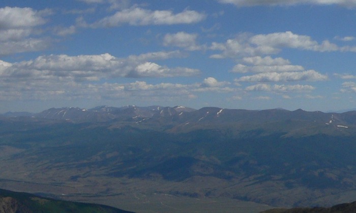
The hike to Elkhead Pass is slow and gradual, but the views of the Missouri Basin are worth it once we arrive:
Before we contour towards Belford's summit, let's check out Emerald Peak, Iowa Peak and Missouri Mountain:
Mount Harvard, Mount Princeton, and Mount Yale round out a fine collection of Collegiate Peaks:
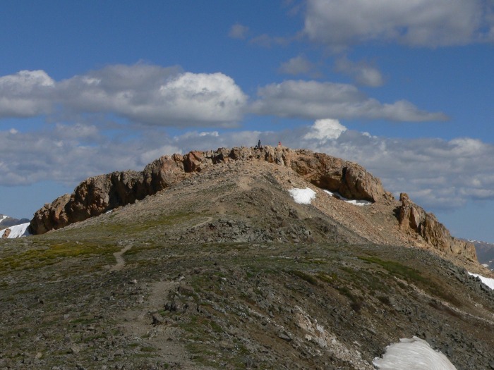
The unusual summit of Belford:
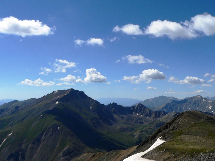
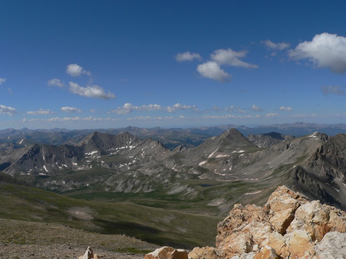
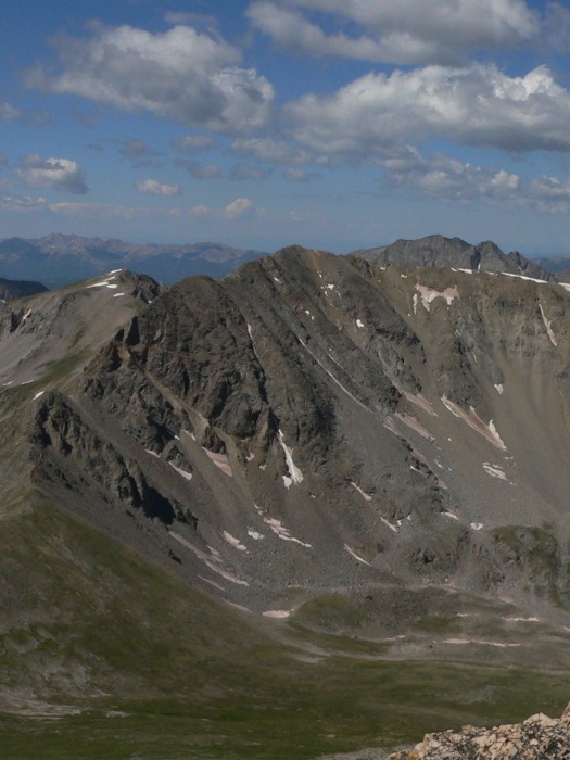
A look across at Belford's sister, Mount Oxford. The traverse is about one mile each way, but it may as well have been fifty miles today. I just wasn't feeling it.
You can see both Buffalo Peaks (West and East) behind Oxford, and Pikes Peak waaaaay back in the distance. In retrospect, I should have gone for it - the weather held out a lot longer than I expected. Now to get Oxford, I'm going to have to either reclimb Belford or do some crazy stuff over Waverly or something.
A complement of the southern Sawatch! Princeton, Yale, Shavano, and Tabeguache:
And another shot of the Missouri Gulch:
Snowmass Peak, Capitol Peak, Grizzly Peak, and La Plata Peak:
Mount Elbert front and center, with Mount Massive trying to peek around. Way back in the right, you can make out the Mount of the Holy Cross:
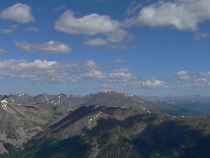
And the Mosquito Range, with Mount Sherman in the middle:
Mount Huron, back and to the left:
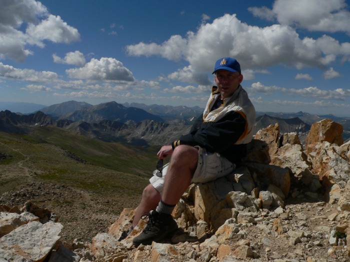
Obligatory summit shot:
The Apostles peek out from behind Missouri Mountain:
I returned to my car via the northwest ridge. It's a long way back down, and my knees felt it every step of the way:
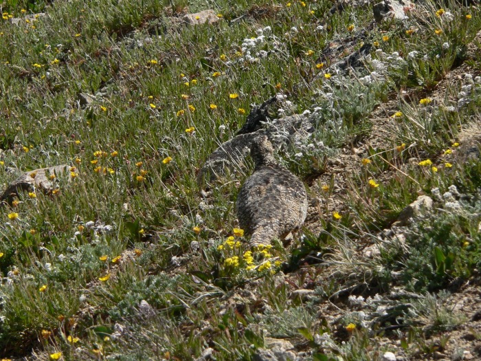
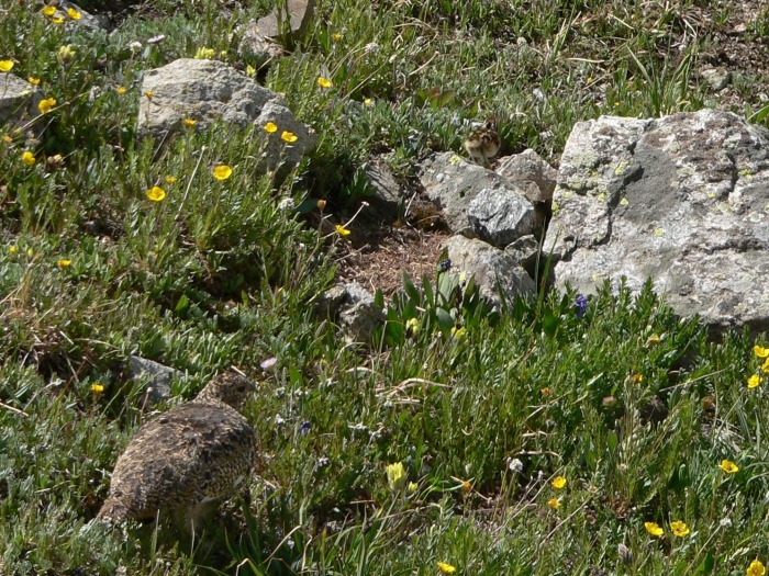
Spot the ptarmigan time! Very well-camouflaged to protect the newborns from interlopers (namely, me):
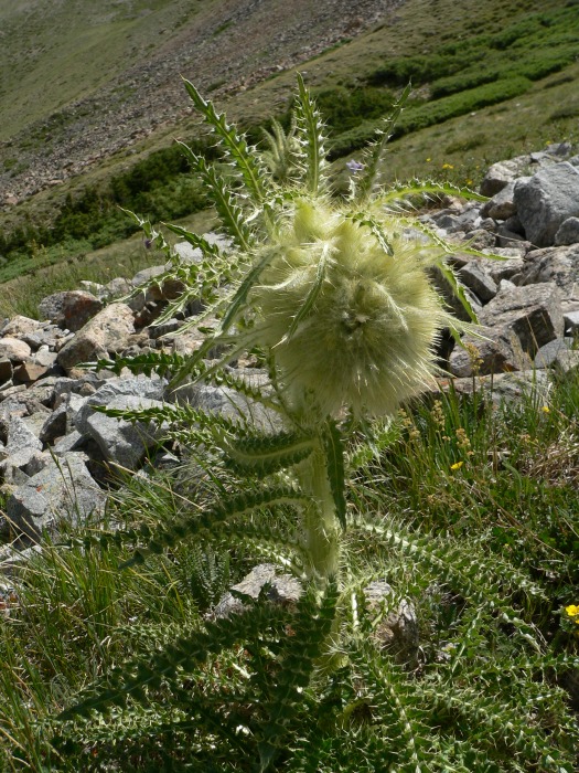
Thistleriffic:
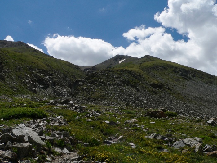
A look back at the northwest ridge:
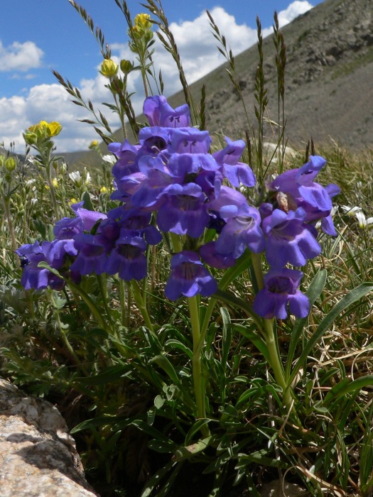
A lupin? As a Monty Python fan, I should know this.
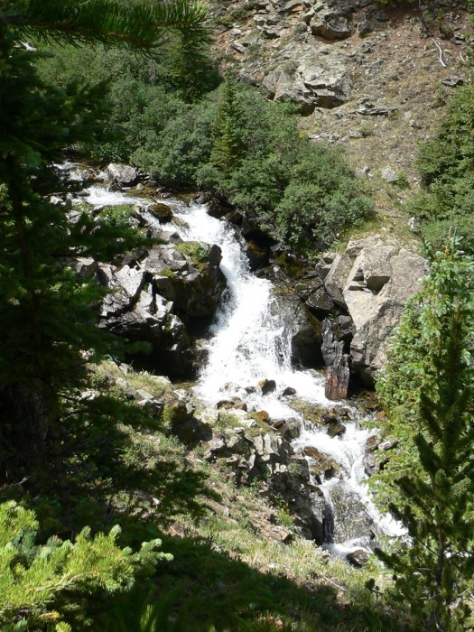
The waterfalls were a lot more interesting than they were in May:
I was back at the trailhead in time to drive to Denver and have a new fuel pump installed in my Ranger - after very rough starts in the Sangres (Lindsay) and the Sawatch over a four-day period, I finally decided that it needed to be taken care of.
My GPS Tracks on Google Maps (made from a .GPX file upload):
Great report, Dr! Some really nice shots you took! I've never been able to take good pictures of ptarmigans. It's always been too early with low light, and they've always come out slightly blurry.
If I'd ever get back into the Missouri Gulch, I'd like to do a loop hike of it as well. But I think I'd also do the reverse of what you did. I can much easier go up the steep sections, as down really gets to my knees., But then, looking over the map again, a nice descent diversion would be Pecks Pk. too. Choices, choices... :?
If I had to do it again, I would have reversed my steps, but Pecks was also part of my original goal (of course, so was Oxford :D ).
For someone with bad knees, I sure leave my trekking poles in the car an awful lot.
Caution: The information contained in this report may not be accurate and should not be the only resource used in preparation for your climb. Failure to have the necessary experience, physical conditioning, supplies or equipment can result in injury or death. 14ers.com and the author(s) of this report provide no warranties, either express or implied, that the information provided is accurate or reliable. By using the information provided, you agree to indemnify and hold harmless 14ers.com and the report author(s) with respect to any claims and demands against them, including any attorney fees and expenses. Please read the 14ers.com Safety and Disclaimer pages for more information.
Please respect private property: 14ers.com supports the rights of private landowners to determine how and by whom their land will be used. In Colorado, it is your responsibility to determine if land is private and to obtain the appropriate permission before entering the property.