Download Agreement, Release, and Acknowledgement of Risk:
You (the person requesting this file download) fully understand mountain climbing ("Activity") involves risks and dangers of serious bodily injury, including permanent disability, paralysis, and death ("Risks") and you fully accept and assume all such risks and all responsibility for losses, costs, and damages you incur as a result of your participation in this Activity.
You acknowledge that information in the file you have chosen to download may not be accurate and may contain errors. You agree to assume all risks when using this information and agree to release and discharge 14ers.com, 14ers Inc. and the author(s) of such information (collectively, the "Released Parties").
You hereby discharge the Released Parties from all damages, actions, claims and liabilities of any nature, specifically including, but not limited to, damages, actions, claims and liabilities arising from or related to the negligence of the Released Parties. You further agree to indemnify, hold harmless and defend 14ers.com, 14ers Inc. and each of the other Released Parties from and against any loss, damage, liability and expense, including costs and attorney fees, incurred by 14ers.com, 14ers Inc. or any of the other Released Parties as a result of you using information provided on the 14ers.com or 14ers Inc. websites.
You have read this agreement, fully understand its terms and intend it to be a complete and unconditional release of all liability to the greatest extent allowed by law and agree that if any portion of this agreement is held to be invalid the balance, notwithstanding, shall continue in full force and effect.
By clicking "OK" you agree to these terms. If you DO NOT agree, click "Cancel"...
Not sure what others really think of San Luis, but our group loved the hike. If you're looking for the technical excitement of the Crestones you won't find it here. But if you're looking for great views of the San Juans, and Sangres, wonderful wildflower meadows, and a true feeling of the wilderness, then this is your peak. San Luis was the perfect follow-up for our group after having done DeCaLiBro yesterday and having run into 300+ people.
We left Frisco around 7pm to head for Stewart Creek. We got rained on the entire drive till we left CO114. Driving Monarch Pass in the rain was a fright as the mixture of rain and fog made visibility near zero. This was then coupled with the danger of rock fall on the road. After all this fun we finally hit the dirt roads heading for Stewart Creek. This is one long drive. We hit the trailhead and parked along the road around midnight. We decided to shoot for 4:30am as a departure time to beat any of the predicted bad weather.
WEATHER: No rain. Near clear skies till about 6am. A thin cloud deck formed above us and most of the general vicinity. As we neared the summit the clouds near us became darker but no rain was happening. As we descended things clear some for an hour.
CROWDS: Saw 13 people on the trail today. Met a great couple from Illinois whom we shared the summit with. Met another fascinating man who hiked up from the south and met us on the summit. He'd done all the CO traverses.
TRAIL BETA: This is truly a classic class 1 trail. Quite easy to follow from start to finish. Even the last 700 feet of the trail on the rocks was well defined and easy going. Only troubles with the trail came in the upper portion of the basin as the trail is right next to the upper part of Stewart Creek. The trail was washing out in parts and as it went above the creek one last time on the grass, the trail was muddy and we couldn't avoid getting our shoes a little wet.
TIME: We summited in 3 hours 37 minutes. Descent was 2 hours 50 minutes.
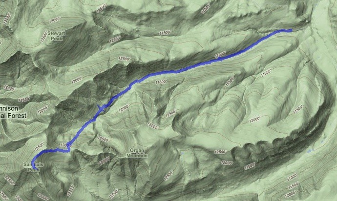
TRACK:
I took a GPX track of our hike on my Nokia N800 with Maemo Mapper. I'm happy to share that here (you'll find it matches up nearly identical to the GPX provided here on 14ers.com, this is a testament to how clear this trail is): http://www.polarhaven.net/tracks/100801-SanLuis-Up.gpx
PICTURES:
The full moon we had lighting up camp a few nights ago is now waning. Still makes for a pretty sight in the early morning.
As the sun first hits the trees and meadows along Stewart Creek, its an awesome sight.
The colors of the basin and skies in the early morning were just spectacular.
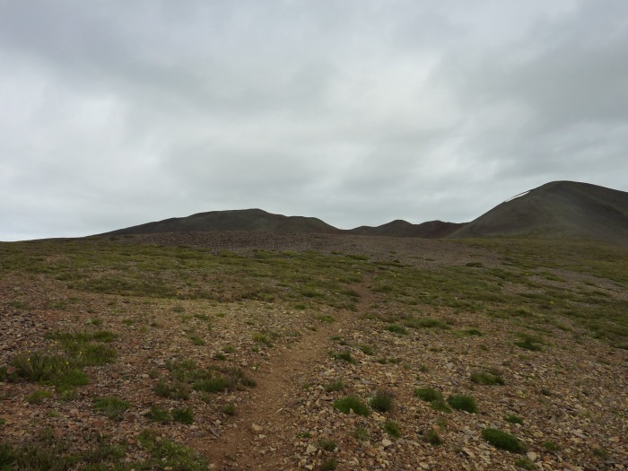
This is your first view of San Luis Peak. For most of the hike you will be seeing Baldy Alto at the west end of the basin. At a few points such as this you can see San Luis poking its head above the ridge.
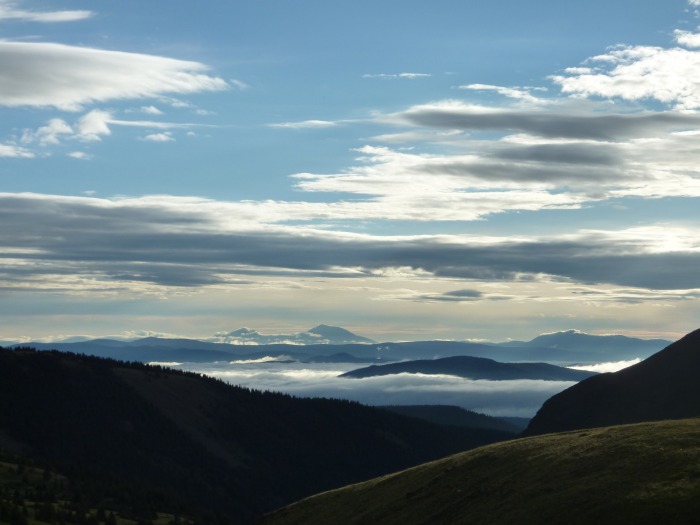
Looking east to the valley provides an amazing sight of low-hanging clouds, sunlight, and mountains on the horizon.
This is on the saddle at 13400 before the summit push for San Luis. The remaining route involves skirting the south side of the 13000ft point to the summit ridge and then crossing to the NW side of the ridge for the final ascent.
Looking to the west at Wetterhorn and Uncompaghre
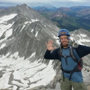
Myself on the summit of San Luis. It was *COLD*. I'd already been on Harvard/Columbia and DeCaLiBro this week and met cool, but manageable temps. On San Luis? Well someone had a thermometer that read low 40s. Brrr.
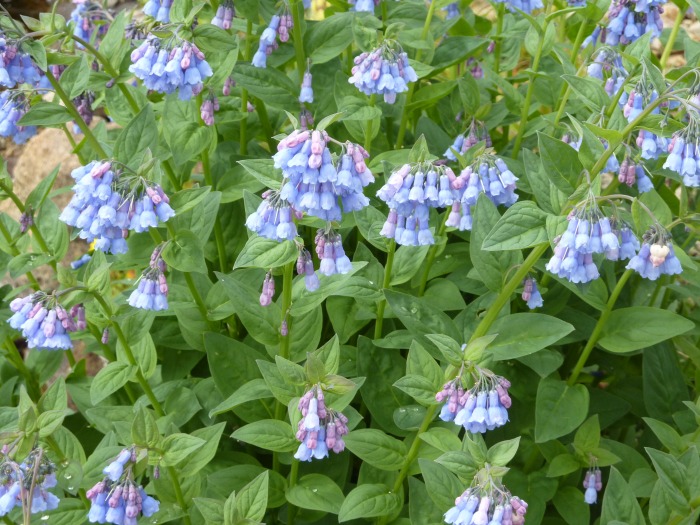
The wildflower meadows were abundant in the upper parts of the basin. Just amazing.
Did I mention the abundance of wildflowers?
Thanks for reading my report. San Luis is truly a wonderful hike for the wilderness lover! Wish we'd seen more wildlife out there.
Thumbnails for uploaded photos (click to open slideshow):
Together with Handies, San Luis is one of the few technically easy 14ers where you won't have to deal with crowds; I loved it. The 40 miles of dirt roads is just plain weird. Sorry it was so cold, but that's this year's weather for you! You say the trail is easy to follow: Is there now a decent bridge where you have to cross the creek? (We had to build our own!)
Just natural bridges for the creek crossings. Water may be low this year, the crossings were no problem with various rock steps in the creek.
Caution: The information contained in this report may not be accurate and should not be the only resource used in preparation for your climb. Failure to have the necessary experience, physical conditioning, supplies or equipment can result in injury or death. 14ers.com and the author(s) of this report provide no warranties, either express or implied, that the information provided is accurate or reliable. By using the information provided, you agree to indemnify and hold harmless 14ers.com and the report author(s) with respect to any claims and demands against them, including any attorney fees and expenses. Please read the 14ers.com Safety and Disclaimer pages for more information.
Please respect private property: 14ers.com supports the rights of private landowners to determine how and by whom their land will be used. In Colorado, it is your responsibility to determine if land is private and to obtain the appropriate permission before entering the property.


")
")
")
")
")
")
")
")
")
")
")