| Report Type | Full |
| Peak(s) |
Unnamed 13552 - 13,552 feet |
| Date Posted | 08/03/2010 |
| Modified | 10/12/2012 |
| Date Climbed | 06/29/2010 |
| Author | jdorje |
| 13546 only, via Willow Creek |
|---|
|
(Note, this is a report from some weeks ago; I've had it sitting around for a while.) For my first major climb of the summer, and first 13000+ peak in several years, I'd been intending to climb 13546 and (conditions permitting) Adams. Visiting in Crestone this is just a backyard jaunt so little scheduling is needed; the trick is just to pick the perfect day. Twice I woke at 4:30 and found the weather report to have deteriorated, and went back to bed. The third time was the charm, though as the title gives away only one peak was in store for me. Total distance: 11-13 miles Elevation gain: 4700-4900' 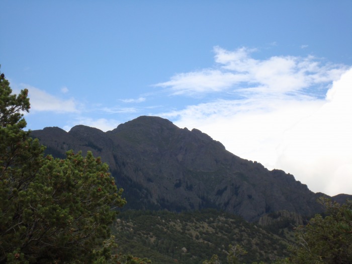 Willow Creek TrailI drove up to the alternate trailhead and was on the trail around 6:15. After the 4:30 alarm clock I'm not sure how this always takes so long. I took the first part slow, but made it to the lake around 9:15. Normally I like to sit around and appreciate the beauty of the waterfall and surrounding mountains (even though you can only actually see 13517 and 13541), but no time for that today. After ~5 miles and 2700' of class 1 hiking I was ready to go off trail. Adams basin and Adams-13546 SaddleOnce at the lake, I cut straight to the left/north from near the bottom portion of the lake. I'd like to have or find a good picture that shows where to cut to climb up here, but unfortunately I've never found the right spot. I ended up going up-slope a bit too far to the west and having to cut east to get around some rocks. An alternative might have been to follow the route around to the top of the lake and cut back once you get high enough, but I don't think that would be any better. Coming down there seems to be a trail but I haven't marked it sufficiently to be able to find it the next time around. The slope right above the lake was one of the two steep portions of this hike. It didn't last long though and then I was in the pretty upper basin.  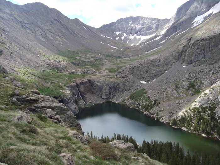 From the upper basin, the next destination was the saddle between 13546 and Adams, and it was in sight almost from the start though there was still nearly a mile and 1000' vertical to go. The next obstacle was the bushes (are these willows?) covering the lower portion of this basin. A cairned semi-trail seemed to lead right through them, but I had better luck cutting to the left and following the creek straight up. This creek feeds off of snowmelt and rainfall from these mountains with just a few ponds to buffer it, and connects down to Willow Creek between the campground and the lake. Given the sketchiness of the upper lake and how much stuff is living in the lower lake, this is probably the best water source around. It's in a bit of a canyon though and following it directly up from Willow Creek would be extremely steep. Instead I just followed a partial trail right along the top of the canyon. I also took note based on a prior trip report to make quite sure to stay on the east side of the creek/canyon on my return. 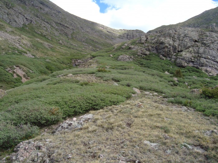 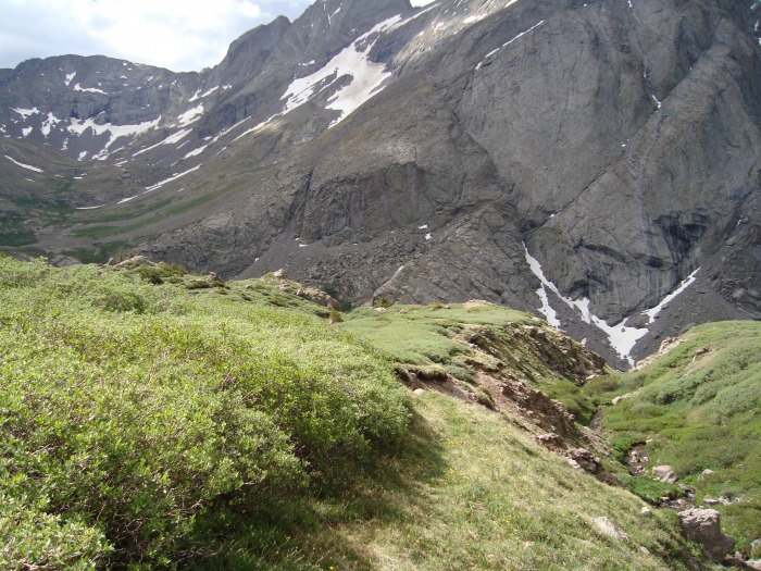 Once around the willows, I followed a beeline toward the base of the saddle. At this point the creek took a turn to the east and I crossed it. The upper basin here was amazingly full of flowers, even though it was a few weeks until full bloom. With 13546 on my left and Adams on my right, I advanced up to the saddle. The pictures show scree running right down the middle of the obvious "path" up to the saddle, but by staying on the tundra to the right I avoided it. Another option that would have saved a bit of time would have been to cut over to the left, diagonally up to 13546, but I chose to go straight to the saddle instead. 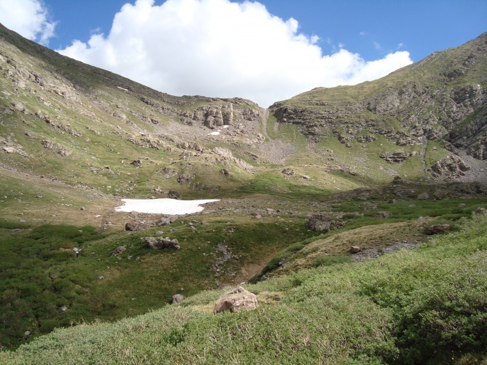 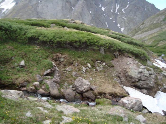  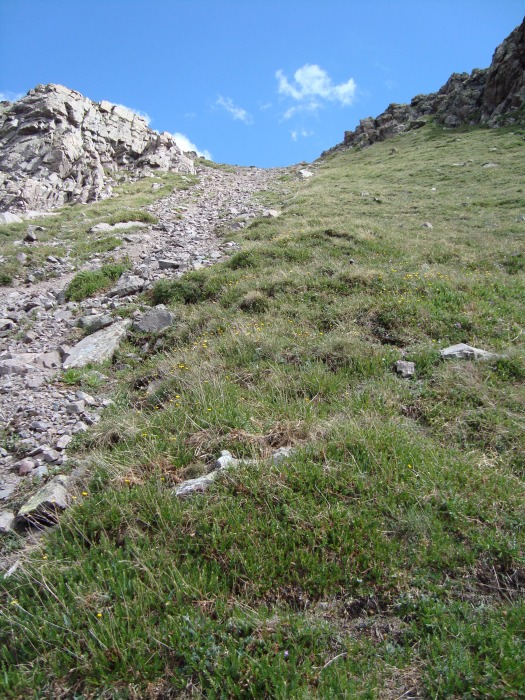 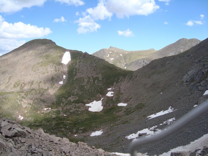 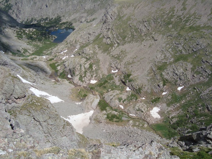 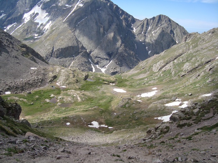 Ridge and summitMost trip reports say that it's a "class 2 hike" up to the summit along this ridge. It's a little more that that, but still nothing to write home about. Climbing straight up the ridge line would be mostly a class 2+ with a few spots of class 3, I'd say. Right from the start I went off this track, cutting to the left of the first block of rock that guards the saddle. From there I stuck mostly to the grass to the left/south of the ridge, which is mostly a class 2 with a few spots of 2+. A few places this brought me up to the ridge line, showing a moderate amount of exposure on the north side of the ridge and some nice views down into the South Crestone basin. I took this part easy, stopping often to admire the views, but it's only 600-700 feet gain up to the summit so it wasn't long at all before I came over the last ridge and found that I was there. The summit register was intact (which seems like a rarity) but, IIRC, lacking a pen, so I was unable to sign it. Walking along the summit ridge I found a sheep waiting at the far end; I quickly brought my camera up to get a blurry picture before he ran over the other side of the mountain though. This would turn out to be a theme for the rest of the day.    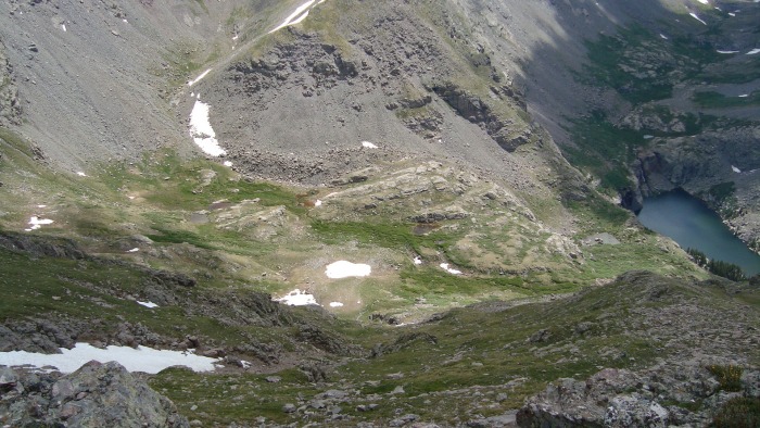 The summit of this peak is a bit of a Y-shaped ridge, with the true summit at the base of the Y facing northeast. This sounds pretty boring, but I found it interesting considering from below it looks like a flat, rounded summit. The picture at the top of this report makes it look flat, for instance, but that's an effect of looking at both forks of the Y nearly head-on. The views from all three ends of the Y were marvelous, and after eating a couple of granola bars and alternating hanging out at each one I ended up spending an hour on the summit. As it was after 12 at this point and clouds were borderline, I decided to give up on hopes for Adams on the day. I knew I would return soon though!  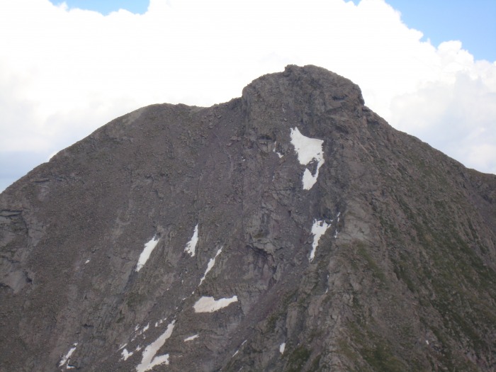 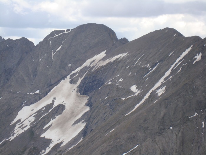  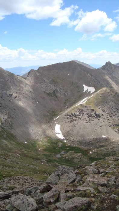 Trip downRather than return to the saddle, I took a bit of a diagonal down the hill to the southeast. This looked like a shortcut and wasn't particularly difficult, but in hindsight I think it was probably slower than simply returning down the ridge. About halfway down to the basin, I lost focus a bit and ended up sending a hundred-pound-rock tumbling downhill. Watching it roll I saw about 5 bighorn well downhill sprinting out of the way. I considered this a lesson both on maintaining focus, and on keeping an eye out for cool wildlife. Looking around, another bighorn was watching me from back near the top of the mountain (I got just one quick picture before he disappeared) and 3-4 more were grazing below me to the right. Continuing down, this group had one gal just lying down watching me steadily while the others grazed in peace. I snapped a dozen pictures of them from various angles, but in the end they all looked pretty much the same. Still it was cool to have these mountain experts "watching over me" for thirty minutes as I descended below them and they eventually went out of sight. Naturally, I saw a few marmots on the way too but in a rare display of cowardice they all got out of sight before I could get any good pictures. 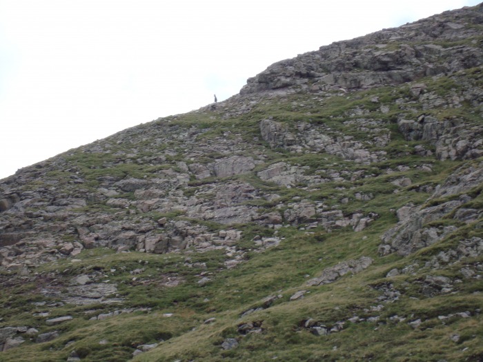 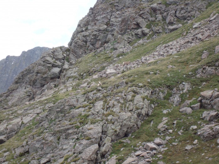 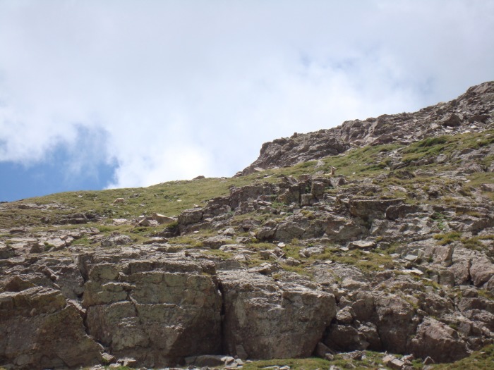 I ended up making it down to the basin right around where I had crossed the creek before. From here it was a straightforward though mosquito-filled hike back to the trailhead. Hanging out on the summit of this peak for an hour was awesome, and really motivated me to return to the high peaks and tundra.  Thumbnails for uploaded photos (click to open slideshow):
|
| Comments or Questions |
|---|
|
|
Caution: The information contained in this report may not be accurate and should not be the only resource used in preparation for your climb. Failure to have the necessary experience, physical conditioning, supplies or equipment can result in injury or death. 14ers.com and the author(s) of this report provide no warranties, either express or implied, that the information provided is accurate or reliable. By using the information provided, you agree to indemnify and hold harmless 14ers.com and the report author(s) with respect to any claims and demands against them, including any attorney fees and expenses. Please read the 14ers.com Safety and Disclaimer pages for more information.
Please respect private property: 14ers.com supports the rights of private landowners to determine how and by whom their land will be used. In Colorado, it is your responsibility to determine if land is private and to obtain the appropriate permission before entering the property.

