| Report Type | Full |
| Peak(s) |
Crystal Peak - 13,860 feet Pacific Peak - 13,965 feet Atlantic Peak - 13,856 feet |
| Date Posted | 07/23/2010 |
| Date Climbed | 07/13/2010 |
| Author | kaiman |
| Crystal Peak East Slope via Crystal Lake Trail |
|---|
|
Looming behind the Breckenridge ski area and Peak Ten in the northern Ten Mile Range, 13,852 foot Crystal Peak is ranked #82 of the 100 highest peaks in the state of Colorado. This peak is climbed year round and is a favorite of back country skiers in Summit County. A peak for mountaineers of all ages and abilities, this mountain is a new favorite of mine and I plan to climb it again soon (along with neighboring Father Dyer Peak). The trip report that follows is actually a portion of a much longer Ten Mile ranger traverse that I did (in an effort to finish the Centennial Thirteeners in the Ten Mile range) that included Crystal, Pacific, and Atlantic peaks. However, I feel that Crystal Peak stands as a worthwhile climb itself so I have included a report on just it here for those newly interested in moving beyond Fourteeners and climbing peaks of all sizes. Crystal Peak's East Slope route can be reached by driving south of Breckenridge to the Spruce Creek Road and continuing up the steep/narrow 4WD road for about 2.5 miles to reach Lower Crystal Lake. I arrived at my campsite about 3/4 mile below lower Crystal Lake around 5 PM, set up my tent, cooked dinner and prepared for the next day. 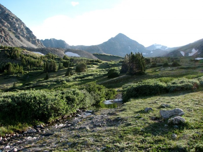 Knowing that I had a big day ahead of me, I rolled out of bed at around 4 AM and was on the trail about 5:15. Luckily, the sky was mostly clear and the sun soon rose to fill the valley with early morning light as I began to hike up the road towards Lower Crystal Lake. 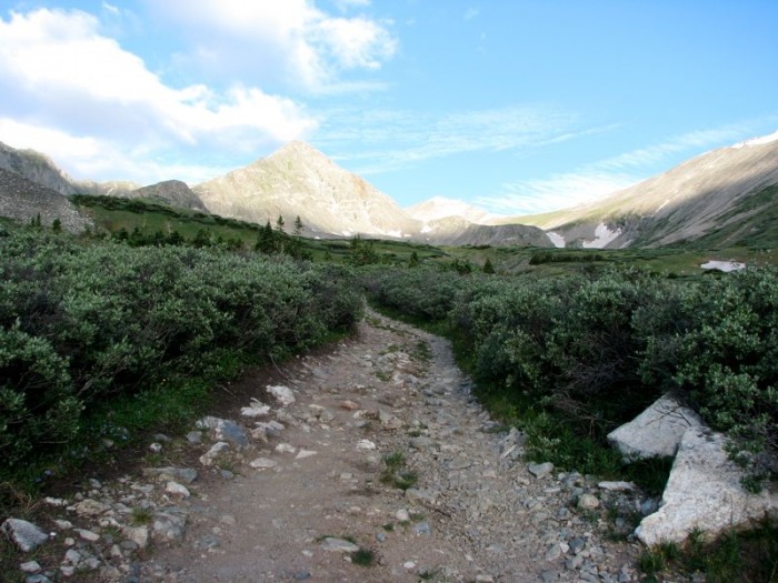 Following Bill Middlebrook's excellent instructions from 13ers.com, after hiking about 1/2 mile I cam to about 11,900 feet, dropped down to the creek, and crossed to other side (to avoid the bigger stream crossing just below the lake). From here I began to traverse along the north side of the creek for about an 1/8 of a mile before leaving it and zigzagging through a field of willows to a small ridge crest just northeast of Lower Crystal Lake. 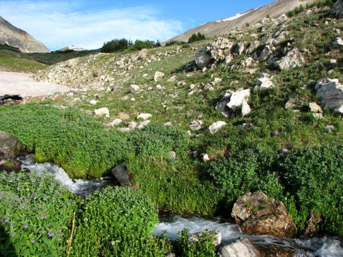 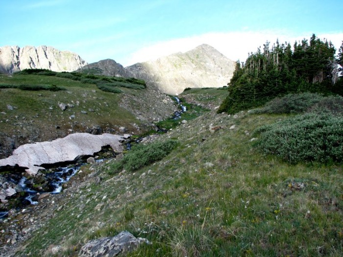 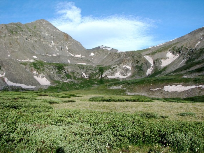 Just before reaching the lake, I passed the remnants of an old cabin on my left and picked up a set of faint jeep tracks that I followed around the lake and which eventually turned into a single-track trail. 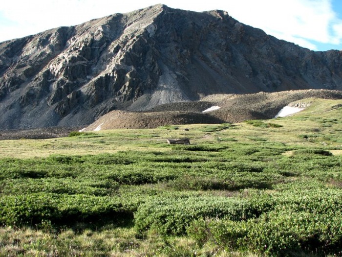 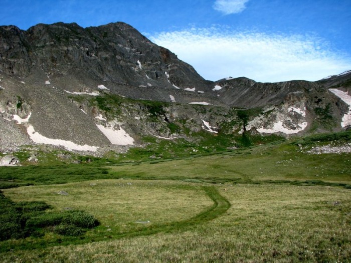  From here I followed the well worn trail as it did a long ascending traverse to the northwest below the shoulder of Peak 10. 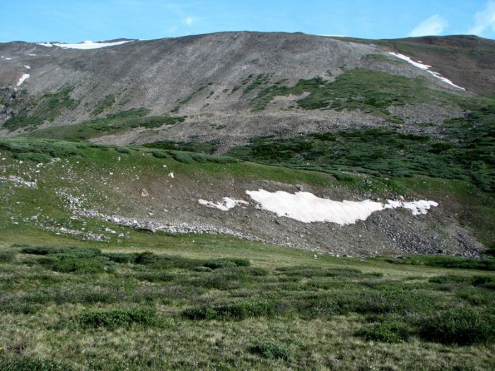 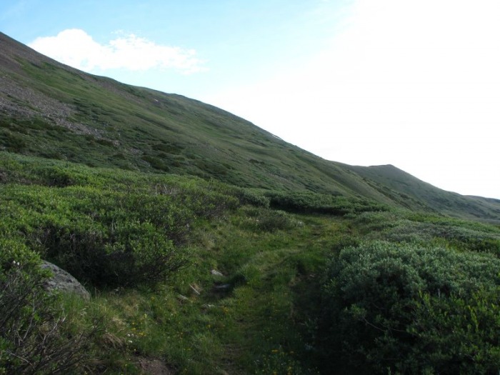 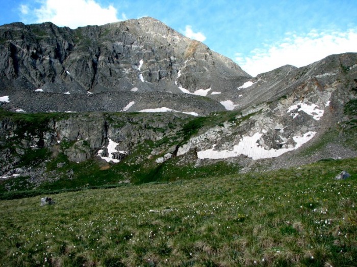 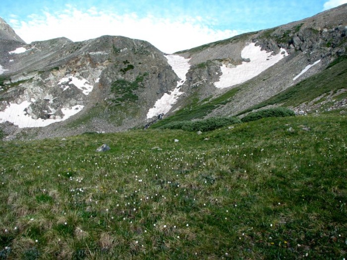  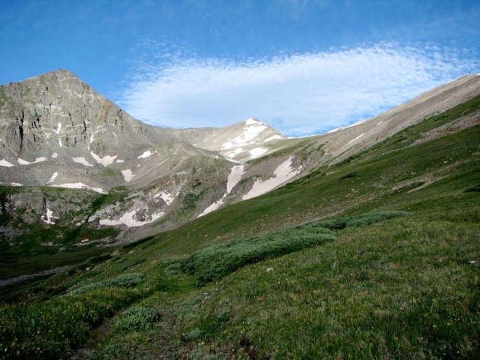 After climbing to the top of the switchback, I began the long traverse to the southwest. Here the trail became rockier as it climbed towards Upper Crystal Lake. 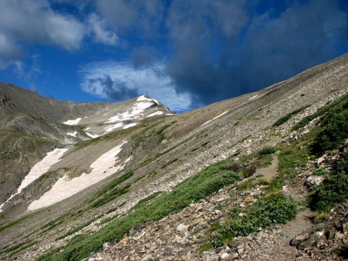 Just as the trail leveled out an began a long descent towards Upper Crystal Lake, I left it and began climbing over grassy slopes towards the Peak 10/Crystal saddle. 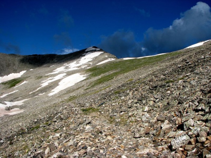  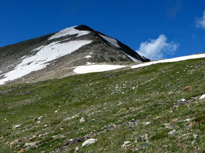  From the ridge (saddle), I found a use trail and began following it as it climbed towards the summit. Soon the trail disappeared into the snowfields on the east side of the ridge and I found myself climbing the rougher crest of the ridge in order to avoid the snow on the left hand side.  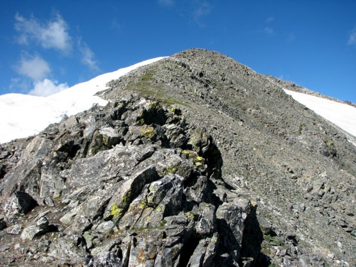 After about 20 minutes of climbing up this ridge I reached the summit (topping out about 7:35 AM), ate a quick snack and snapped some photos before continuing on my way to Pacific and Atlantic peaks. 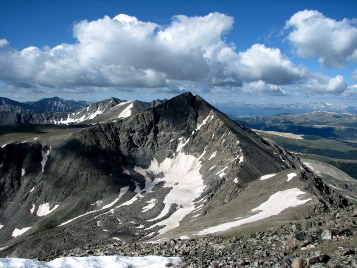 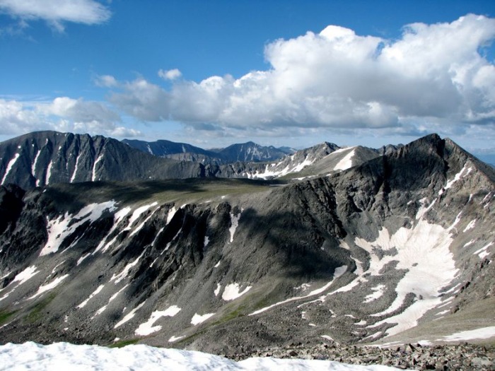  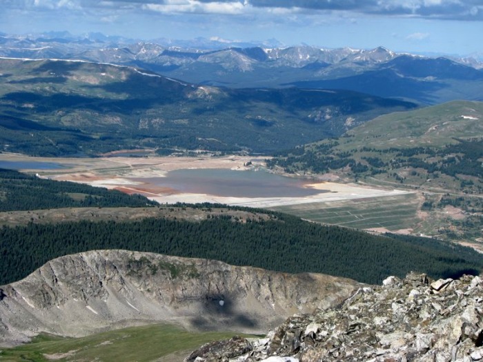 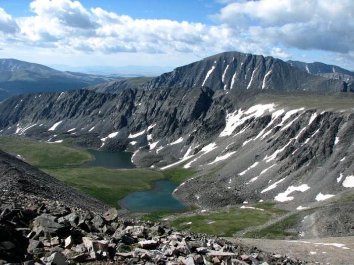 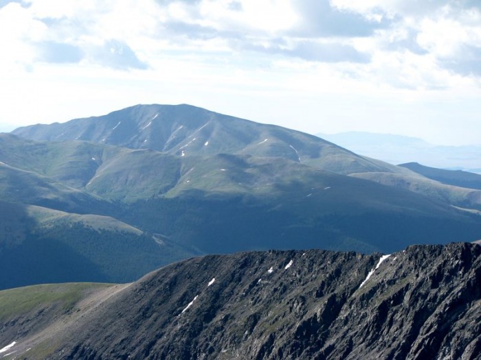  All in all this was a great day in the Ten Mile Range with a long traverse over 10 miles and around 5,000 feet of elevation gain in about 9 hours. Fun, fun, fun! Thumbnails for uploaded photos (click to open slideshow):  Father Dyer Peak (center) and Crystal Peak (right background) from my camp below Lower Crystal Lake")
 Morning sun hits the Crystal valley")
 The creek crossing below Lower Crystal Lake")
 Following the creek below Lower Crystal Lake")
 Working my way through the willows just below Lower Crystal Lake (this is easy bushwacking here)")
 A delapidated cabin next to Lower Crystal Lake (Mount Helen is in the background)")
 Reaching the jeep tracks/trail near Lower Crystal Lake")
 Looking back at Lower Crystal Lake with a cloud overhead")
 The long traverse up the side of Peak 10 (this has to bee one of the longest switchbacks in Colorado)")
 Beginning the traverse above Lower Crystal Lake")
 Father Dyer Peak looms over the trail to Upper Crystal Lake")
 The headwall above Lower Crystal Lake (the trail traverses well above this to the right)")
 Another shot of Lower Crystal Lake with Mount Helen in the background")
 The upper portion of the route comes into view")
 Reaching the beginning of talus on the Upper Crystal Lake Trail")
 Photo taken just before I left the trail and began my climb to the ridge")
 Upper Crystal Lake from near the Crystal Peak ridge")
 Taken from just below the ridge (I was able to avoid the snow fields by crossing the small dry spot in the middle)")
 The Gore Range above Copper Mountain ski area (as seen from just above the Crystal/Peak 10 saddle)")
 The remainder of the Crystal Peak route")
 A close-up of the Crystal summit ridge (taken from half-way up)")
 A shot of much of the remainder of my route (Pacific and Atlantic peaks on the right)")
 From left to right: Quandary (center left), Lincoln group (center background), Fletcher (right background), Atlantic (right c")
 The Sawatch Range over Pacific's mighty northwest ridge")
 Progress")
 The Spruce Creek drainage and Upper Mohawk Lakes")
 Mount Silverheels puts on her dancing shoes above Hoosier Pass")
 The ridge to Father Dyer Peak (some day I'll be back for you)")
|
| Comments or Questions | ||||||
|---|---|---|---|---|---|---|
|
Caution: The information contained in this report may not be accurate and should not be the only resource used in preparation for your climb. Failure to have the necessary experience, physical conditioning, supplies or equipment can result in injury or death. 14ers.com and the author(s) of this report provide no warranties, either express or implied, that the information provided is accurate or reliable. By using the information provided, you agree to indemnify and hold harmless 14ers.com and the report author(s) with respect to any claims and demands against them, including any attorney fees and expenses. Please read the 14ers.com Safety and Disclaimer pages for more information.
Please respect private property: 14ers.com supports the rights of private landowners to determine how and by whom their land will be used. In Colorado, it is your responsibility to determine if land is private and to obtain the appropriate permission before entering the property.