| Report Type | Full |
| Peak(s) |
London Mountain - 13,199 feet |
| Date Posted | 07/19/2010 |
| Modified | 09/25/2012 |
| Date Climbed | 07/18/2010 |
| Author | BobbyFinn |
| London Mountain |
|---|
|
Mountain: London Mountain, near Mosquito Pass, west of Alma Trailhead: Mosquito Pass road, 2 options: 1) South London Mine site or 2) 0.5 miles uphill from the South London Mine site. Mosquito Pass road from Alma is passable for most stock SUVs to the South London Mine site. Above here, it gets much worse but could probably be driven in a stock SUV by a good 4WD driver. At this date, the pass was still officially closed about 200 yards above the "standard trailhead" due to a snowdrift. (But very high clearance vehicles were getting through.) Time: ~2 hours, taking my time Class: The way I will describe this, it can be done via mostly class 2, but some class 2+ or very easy class 3 while crossing an eroded gully. 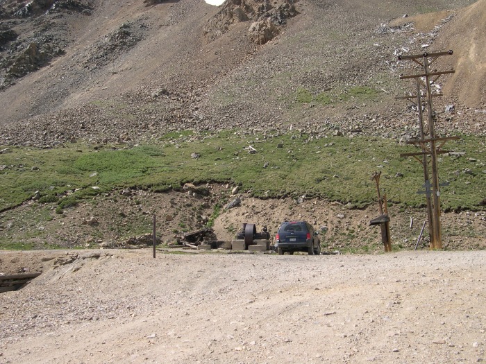  My lovely wife was out of town and she didn't want me to hike a new 14er without her, but she said that 13ers were fair game. I didn't feel like driving very far from Denver so the Mosquito Gulch 13ers seemed like a good choice. Also, after getting the 14er "bug" over the last few years, in the last 6 months or so I've been getting into hiking 13ers - fewer people and often a more interesting hike. There wasn't a good trip report of this mountain from summer conditions so I hope this is useful to someone. This mountain is, generally, very easy in terms of effort and class level. After getting into class 3 and 4 scrambling in the last couple of years and really disliking hiking on roads, I took a "road less traveled" up to London's ridge instead of walking up the road to the standard trailhead. I don't recommend this route for anyone not comfortable with difficult class 3 and scrambling up loose, crumbly gullies. However, if you want to take a more solid, but harder, rock route I'm sure you could find a suitable line. Here's my ascent route from just hikers left of the South London Mine site. 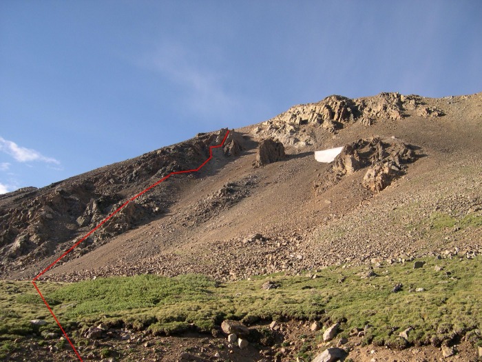 The rest of this report will be written as if ascending the "standard" route. I put that in quotes because while there is a good trail to start it soon gets eroded away, though it reappears as just a slight depression in the ground after a short rocky/loose section. From the standard parking spot (photo 2) take the obvious trail up. Soon you'll come to this rock outcropping that you'll avoid to the right. 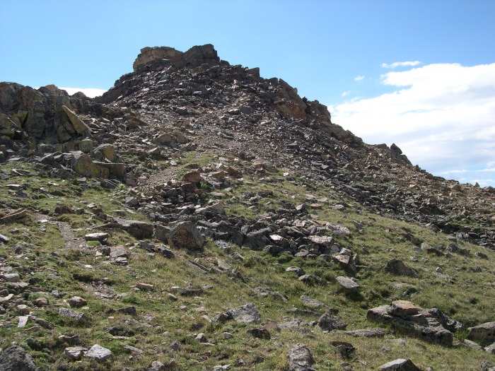 To the right of this outcropping, you'll see how this part of the mountain is crumbling away and the trail is hard to find/follow. It seemed to me that there were generally two clear options through this area. The first is the "high road," which I took. The second is a low road that seemed to be flatter, but since I didn't take it I can't comment on it too much. 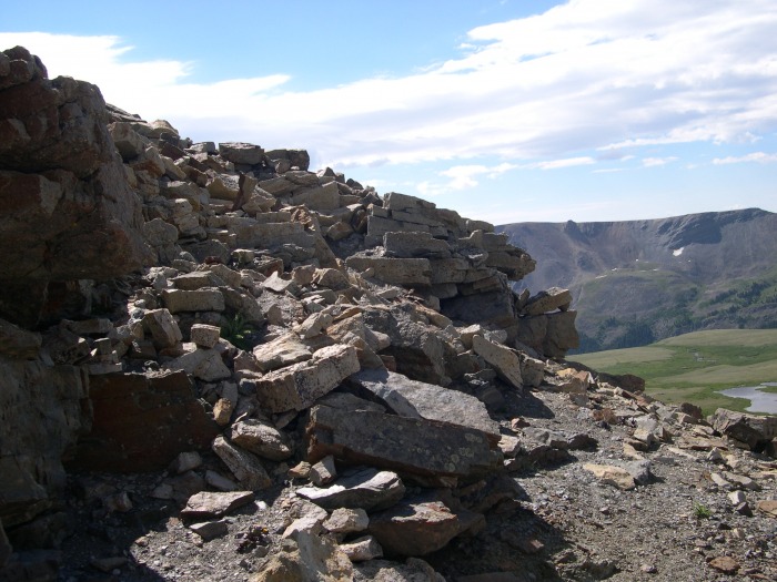 I'm sure other routes could be invented through here. A little farther along, the high and low road options become clearer.  This gully (photo 7) is where the trail appears to be completely eroded away. This is the area (maybe it lasts 50 or 100 yards) that makes this route class 2+ or maybe easy class 3 depending on your line. There is also some exposure, but it isn't too bad and your footing is generally pretty solid. Care must still be taken... Here is some more of the eroded section. Again, the rock is pretty stable, but it is not a class 2 walk up. 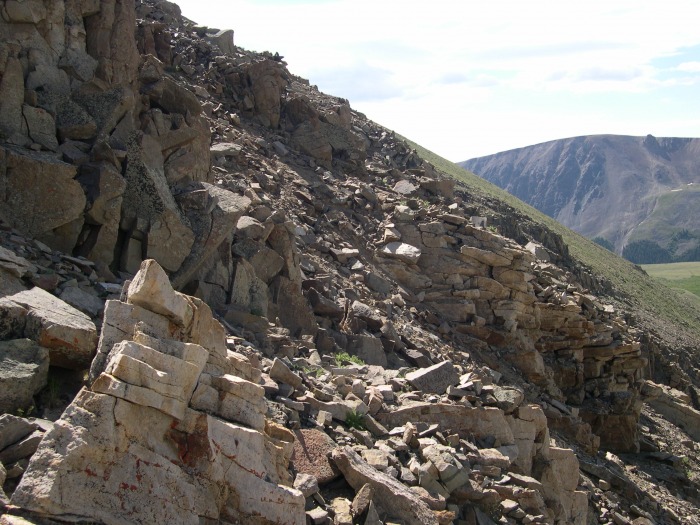 I added some cairns here and there in the eroded section to make the route finding a bit easier. This is the last of the rough area. The rest of the route is a pretty easy walk on a grass/dirt "trail." You can see the faint trail leading toward the cairn in picture 8.  Go past the cairn and up to the left by that rock wall. Go around the wall and you'll come to the grassy part of the hike. If you look closely, you can kind of see a faint depression in the ground where the trail is. At this point, you could just head straight up the the ridge if you wanted, but I was trying to follow the trail. 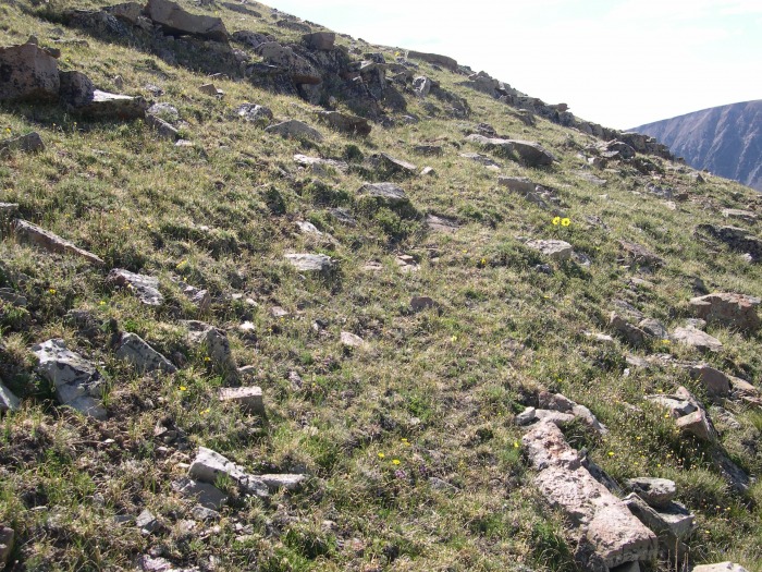 A little farther along and you can see the trail better. Again, you could just head to the top of the ridge if you wanted. 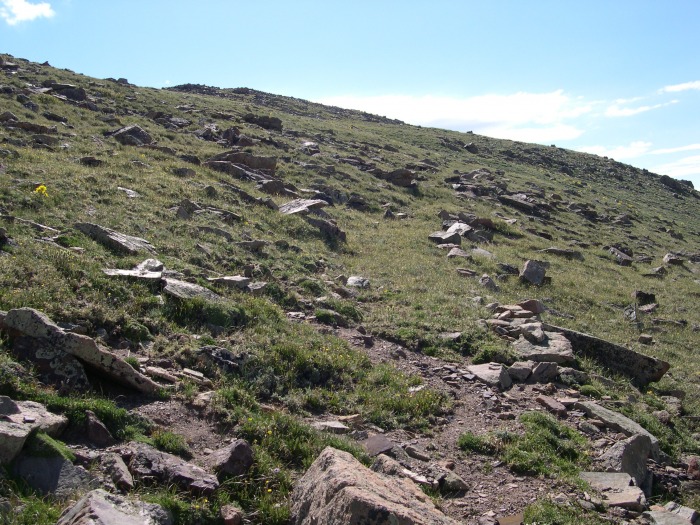 A steep part near the top of the ridge. Gain the ridge here and the rest of the hike becomes clear. 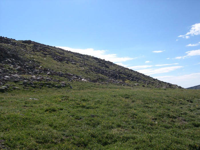 After that steep part, you'll see the rest of the easy route to the summit (including a false summit). 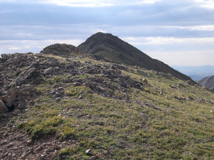 Looking back from just below the false summit. 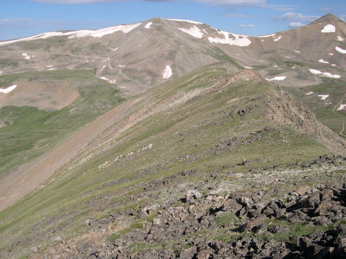 The trail avoids the false summit to the hiker's right. The close pile of rocks is not the false summit. However, the false summit is pretty close the the real summit and it is hardly an obstacle. The trail takes you around it nicely, but it wouldn't be a big deal to just talus hop up it. 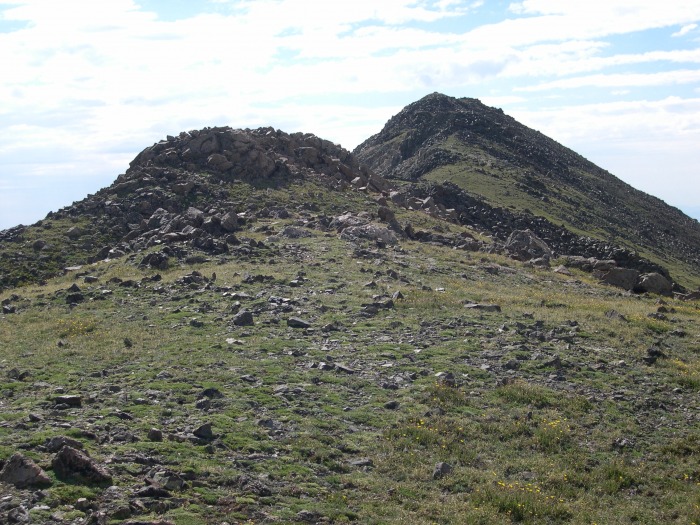 The summit is just a few yards past the false summit. 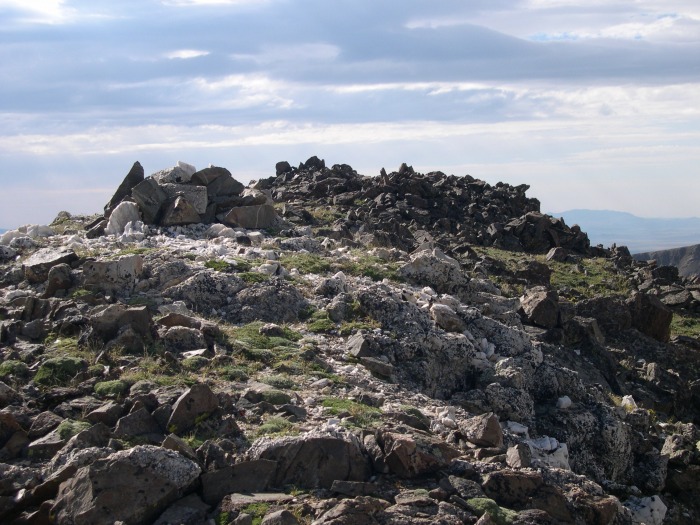 This was a very enjoyable, though short, hike. The views of the rest of the Mosquito Gulch including 13ers Loveland, Buckskin, Tweto, Treasurevault, Mosquito, Repeater, Pennsylvania, Dyer, and Gemini are great. I hiked this on a Sunday and I saw only 2 other hikers all day and they were hiking up the road and I was walking down it. I'm sure a more technical climb could be made of this mountain by just going straight up the ridge from the "standard" parking area. (Edit - We recently repeated this mountain and took the ridge proper all the way down after taking the route described here up. The ridge proper can be kept at class 2/2+ the whole way and makes a nice "loop" to go up one way and down another way.) Here's a picture of London Mountain from Loveland Mountain the day before. This shows the ridge, but it doesn't show the details of the ridge very well. 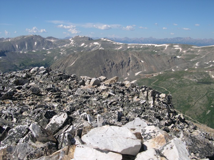 Thumbnails for uploaded photos (click to open slideshow):
|
| Comments or Questions | ||||||
|---|---|---|---|---|---|---|
|
Caution: The information contained in this report may not be accurate and should not be the only resource used in preparation for your climb. Failure to have the necessary experience, physical conditioning, supplies or equipment can result in injury or death. 14ers.com and the author(s) of this report provide no warranties, either express or implied, that the information provided is accurate or reliable. By using the information provided, you agree to indemnify and hold harmless 14ers.com and the report author(s) with respect to any claims and demands against them, including any attorney fees and expenses. Please read the 14ers.com Safety and Disclaimer pages for more information.
Please respect private property: 14ers.com supports the rights of private landowners to determine how and by whom their land will be used. In Colorado, it is your responsibility to determine if land is private and to obtain the appropriate permission before entering the property.


