| Report Type | Full |
| Peak(s) |
Mt. Democrat - 14,154 feet Mt. Lincoln - 14,293 feet Mt. Bross - 14,178 feet |
| Date Posted | 07/18/2010 |
| Modified | 07/19/2010 |
| Date Climbed | 07/17/2010 |
| Author | catullus |
| Demo N. Ridge + CaLiBron |
|---|
|
Peaks: Democrat, Cameron, (Maybe) Bross, Lincoln Route Ascended: Democrat North Ridge Route Descended: Cameron Amphitheater / Putnam Gulch On Friday, July 9th, a close friend of mine died while climbing in Yosemite. Chris Chan lived life to its fullest in the short time she was here and continues to be an inspiration to me to live the most meaningful existence possible. Chris once wrote the following about the deaths of Micah Dash and Erica Kutcher: "The way they lived is a constant reminder to me to never be complacent, to do everything with heart, to pursue the most intense and meaningful experiences possible, and to be awake and alive for all of it." Yesterday, I decided to climb Democrat, Cameron, Bross, and Lincoln with a picture of Chris taken by Andrew Burr (http://andrewburr.blogspot.com/) that I think embodies Chris's beautiful and vibrant outlook on life. Where I could find a register, I left a copy of this picture with the above quote.  Chris was never one to take the easy route up a mountain. In this vein, I decided to ascend Democrat via the 3rd class North Ridge -- a round-about way to reach the four summits. I drove up to Alma's Nature Preserve on County Road 4 the night before and car-camped there. It took me a while to pack up, so I didn't actually get to sleep until midnight. Normally, I like to get an early start, but I also like to be well-rested, so I let myself sleep until 4:30a. I drove up to the Montgomery Reservoir, parked in my favorite (secret) shady spot, and was on the trail by 5:05am. The "trail" is actually a tough 4x4 road maintained by the S. Park 4x4 enthusiasts that winds around the beautiful valley below Lincoln and Democrat. Here is a picture from the valley of a deer in front of the slopes of Mt. Lincoln.  In order to reach the North Ridge, you have to get off the trail after a while and head towards the Democrat-Travers saddle. I reached the start of the north ridge at 8am, and I was rewarded by this breathtaking view of the route. 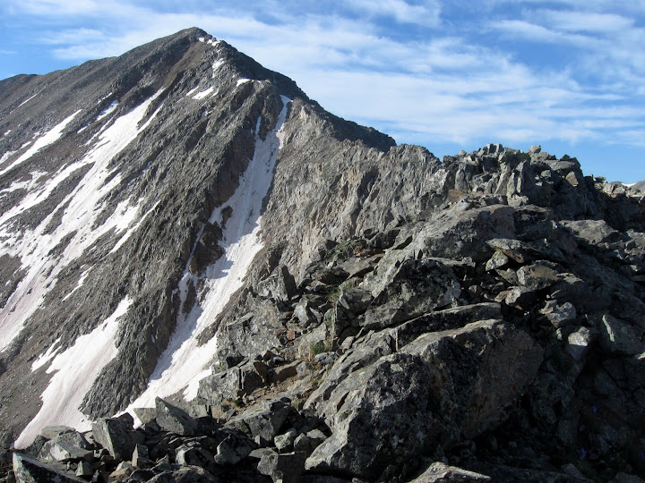 I started the route right on top of the ridge, but it felt pretty chossy. With the loose rock and exposure to the east, I decided it'd be safer to downclimb a bit to the west. I was rewarded with even looser, chossier rock, but with less exposure. This part of the climb was not pleasant. Eventually (~1/4 the way along the ridge), I got frustrated with the looseness below the ridgeline and opted to regain the ridge proper. Luckily, at this point on the ridge, the rock quality was much better. From here on out, I was rewarded with delightful 3rd class moves on mostly solid rock with beautiful exposure to the east -- what an amazing place. After the ridge meets up with the north couloir (which you can see pretty well in the image above), it's class 2 to the summit. I reached the summit of Democrat at 11am. Here is Chris on the summit. 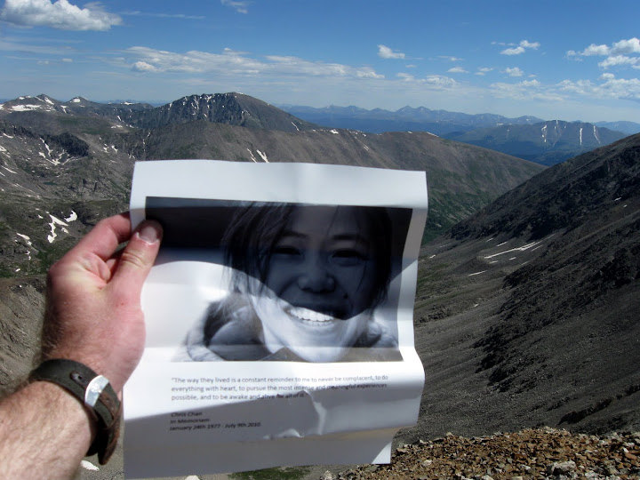 I hiked over the Cameron and got this picture of Chris there. 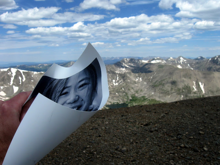 Chris and I may or may not have visited the top of Bross. And here's Chris on top of Lincoln 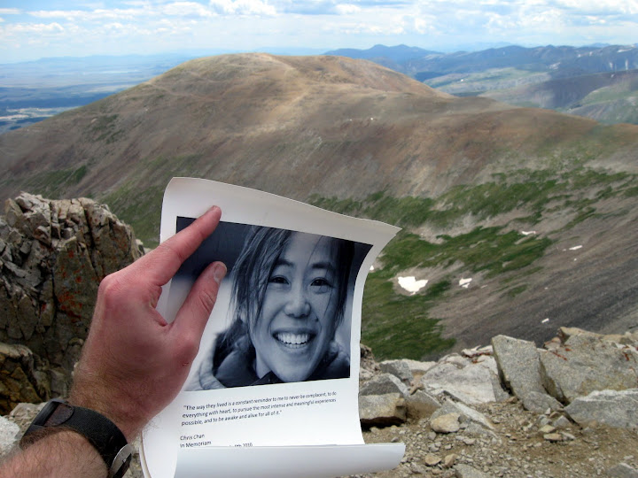 I reached the top of Lincoln at 1:30am and began the descent. Route-finding on this descent is challenging. The east side of Lincoln is littered with abandoned mineshafts -- please be careful. Much of it is also private property -- carefully study your topo map to avoid private property. There are really two descent options here: Cameron Amphitheater to Putnam Gulch or the south ridge of Lincoln Amphitheater to Putnam Gulch. The south ridge of Lincoln Amphitheater is faster, but it's easier to avoid private property descending via the Cameron Amphitheater. With GPS and a very carefully-planned route, it is possible to avoid private property in this area (PM me for more info), but it does end up costing you a lot of time. Because I was meticulous about where I traveled in this area, I did not get back to my car until 5:30pm, and I was moving pretty fast. Whichever way you go, it's a bit of a bushwhack once the vegetation starts up again. I would discourage trying this descent in the dark if you can avoid it. Overall, I had a delightful time on these four summits, and it was a meaningful way for me to remember Chris. Chris was never happier than when she was climbing, and whenever I am having a joyful experience on big mountains, I will always think of her. |
| Comments or Questions |
|---|
|
|
Caution: The information contained in this report may not be accurate and should not be the only resource used in preparation for your climb. Failure to have the necessary experience, physical conditioning, supplies or equipment can result in injury or death. 14ers.com and the author(s) of this report provide no warranties, either express or implied, that the information provided is accurate or reliable. By using the information provided, you agree to indemnify and hold harmless 14ers.com and the report author(s) with respect to any claims and demands against them, including any attorney fees and expenses. Please read the 14ers.com Safety and Disclaimer pages for more information.
Please respect private property: 14ers.com supports the rights of private landowners to determine how and by whom their land will be used. In Colorado, it is your responsibility to determine if land is private and to obtain the appropriate permission before entering the property.

