Download Agreement, Release, and Acknowledgement of Risk:
You (the person requesting this file download) fully understand mountain climbing ("Activity") involves risks and dangers of serious bodily injury, including permanent disability, paralysis, and death ("Risks") and you fully accept and assume all such risks and all responsibility for losses, costs, and damages you incur as a result of your participation in this Activity.
You acknowledge that information in the file you have chosen to download may not be accurate and may contain errors. You agree to assume all risks when using this information and agree to release and discharge 14ers.com, 14ers Inc. and the author(s) of such information (collectively, the "Released Parties").
You hereby discharge the Released Parties from all damages, actions, claims and liabilities of any nature, specifically including, but not limited to, damages, actions, claims and liabilities arising from or related to the negligence of the Released Parties. You further agree to indemnify, hold harmless and defend 14ers.com, 14ers Inc. and each of the other Released Parties from and against any loss, damage, liability and expense, including costs and attorney fees, incurred by 14ers.com, 14ers Inc. or any of the other Released Parties as a result of you using information provided on the 14ers.com or 14ers Inc. websites.
You have read this agreement, fully understand its terms and intend it to be a complete and unconditional release of all liability to the greatest extent allowed by law and agree that if any portion of this agreement is held to be invalid the balance, notwithstanding, shall continue in full force and effect.
By clicking "OK" you agree to these terms. If you DO NOT agree, click "Cancel"...
Well, there has always been something about Capitol that has always made me want to climb it... maybe it was the knife edge, its prominence or the wonderful wilderness that surrounds it.. either way, I decided it was time!
Limited by my transportation (1974 VW beetle) and my desire to avoid hiking up a 4x4 road, I choose the West Snowmass Creek Approach. It seemed similar to the standard route so I figured I would give it a go.
My plan was to backpack up to Moon Lake and set up camp, then attempt Capitols Northeast ridge. I arrived at the trail head at 2:30 pm, got packed up and hit the trail by 3. A ridiculously crazy rain storm and a little wandering in Basalt looking for a place to eat lunch contributed to a late.
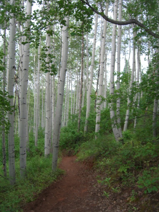
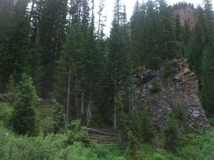
The initial portion of the trail is great, very solid and well traveled.
The well maintained West Snowmass Creek trail
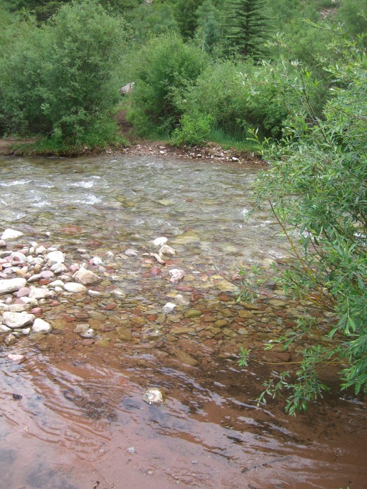
The river crossing wasn't too bad at this time of year.
Snowmass Creek
I brought some extra water shoes but fellow hiker crossed right behind me with bare feet. Both methods worked.
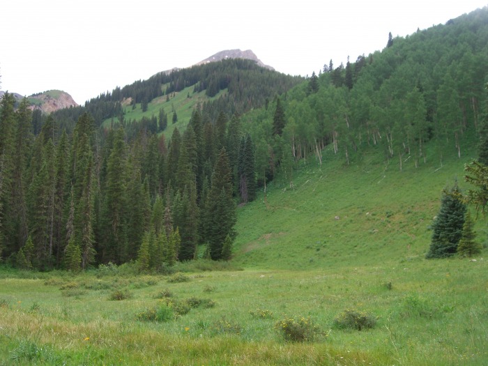
The trail continues to be excellent for about two miles to the meadow described in Gerry Roaches book. This meadow is where the forest service trail heads up to ward haystack mountain.
The view of from the large meadow where the trail to Moon Lake breaks off the trail to Haystack Mt.
Also, in his book, he refers to the trail from this point on to be faint... and I whole heartedly agree. There are certain points where the trail is quite good, then it's just gone. There were also multiple areas while going through the pines where multiple trees had fallen and blocked the trail which made getting through with a back pack quite hard.
I ended up following the trail that ascends out of the south west corner of the meadow (see the picture below)
This is a picture of the trail leaving the large meadow in it's south west corner
I stayed on this trail for as long as I could, but as mentioned earlier, it is very hard to follow, and quite steep... and really didn't seem to lead anywhere in particular once I got up further. I followed this faint trail for about one mile, then crossed to the east side of the creek. This was a bit easier, however the trail was still basically non existent. I was forced to put my tent up as it began to rain and I was pretty much exhausted.
17>
I ate, hung my food as best I could and passed out around 8pm.
Unfortunately, my cell (alarm clock) decided to turn itself off in the middle of the night so I didnt get the early start I wanted. But I still managed to get going a bit after sun up, I'm estimating 5:45ish. The trail up to moon lake was quite steep and the intermittent trail lead through wet flowers and plants so needless to say my feet were pretty wet. The following pictures are taken from my camp site up to Moon Lake.
The trail moves up into the trees to the left of the deadfall in this picture
A portion of the trail above my campsite before the rockslide
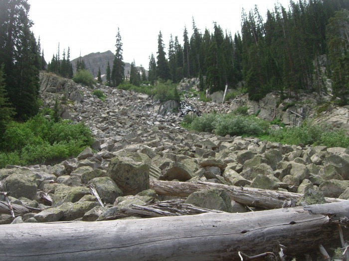
The trail leading up to the rockslide
This is the rock slide that covers the river, actually the river runs under and through it now
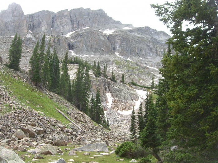
Looking up the route I took to Moon Lake
By the time I arrived at moon lake at 7:30. A change of socks and some breakfast and I was on my way! After making my way up over the saddle leading to the basin where we ascend to K2 Looking back at Mook Lake
I sat, looking up at what I had left to go, and remembered long hard route I would have to return in order to get back to my car after... I met up with a fellow I had talked to briefly at the trail head and then again at the river crossing. I was encouraged by his positive attitude and decided that despite my late start, tired legs the prospect of trudging back out after, I would try to make it up to K2 and see how the time/weather was looking.
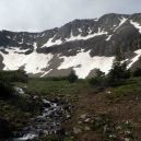
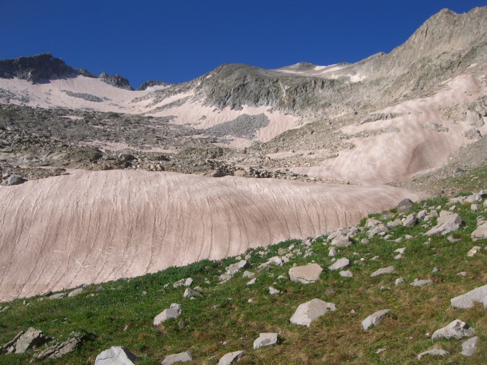
Looking up the basin where the West Snowmass Creek approach meets the Capitol Lake approach, K2 is the peak to the center-rig
There was still quite a bit of snow in the basin but it was pretty easy to walk across and I managed to make good time, arriving at K2 at 9:45. With the weather looking clear and the fantastic view of Capitol right in my face, I couldn't resist moving forward and found some new energy!
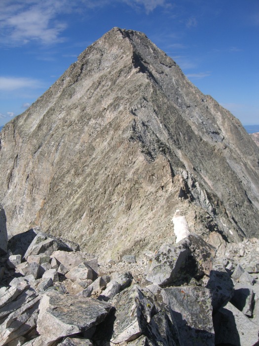
The view from K2, spectacular!
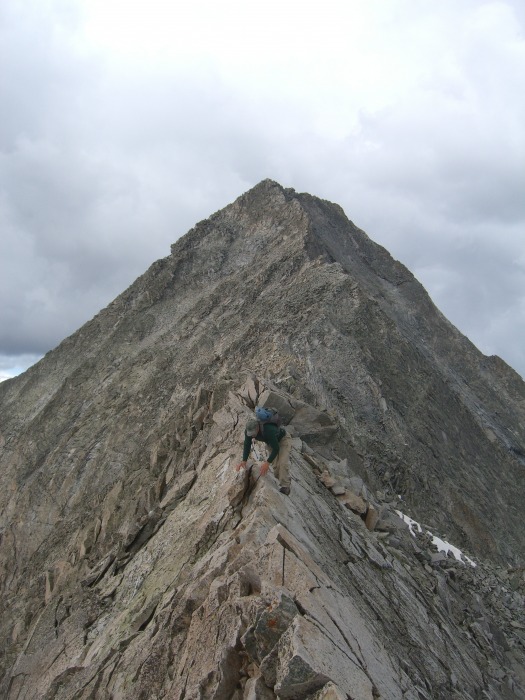
I carefully made my way across the ridge and with particular delight the knife edge! I had seen videos of people walking across it and had partially entertained giving it a whirl... but that notion didnt last long as I was certainly content just moving across it the standard way. The rest of the climb was pretty much awesome! I really really enjoyed this ridge and the scrambling it provided! I met up with the same hiker from earlier and one other on the traverse and arrived there at 10:45.
Coming back across the knife edge
Making our way across the ridge
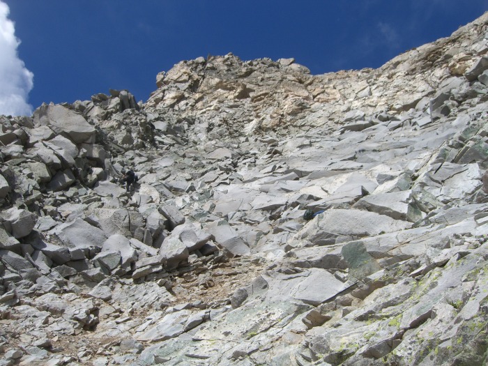
Looking up the route at the top of the gully near the top
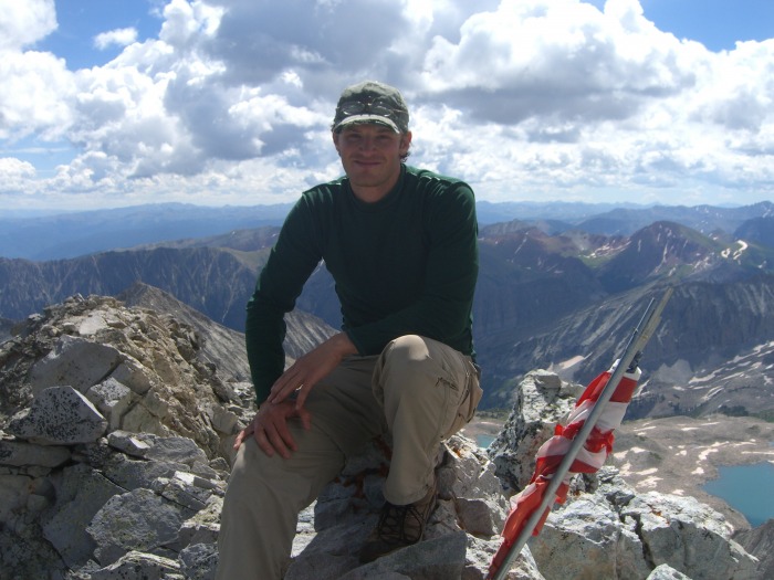
Summit picture
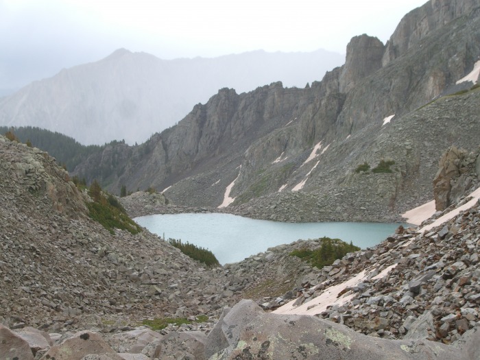
Capitol Lake from the ridge
The view from the top was also quite amazing! I love the Elks !! A storm was forming off in the distance, so we only stayed a bit, then made our way back across the north east ridge. After a short break at a lake hear Moon lake, I made my way back down to my tent, packed up and continued down to my car.
Taking into consideration the difficulties I had had finding the trail, I paid close attention to where the trail went and what the best way was to try to keep on the best parts of it. In retrospect I think the best way would be as follows:
From the large Meadow where the forest service trail breaks off to the west, I would still choose to follow the initial trail leading up out of the southwest (the far right of the meadow as pictured above) corner of the meadow. However, I would only follow this trail up until the first clearing where you have a view down to the river.
19>
This is a picture of the trail leaving the large meadow in it's south west corner
Make your way down to this river and cross it and proceed to follow the river up on the east side. Search for the trail which follows the river all the way up to where a rock slide has covered the river. The trail then makes it's way up on the east (left) side of these rocks, I choose to go right up the rocks. At the top of this incline, the trail continues up and crosses to the right side of the rocks/river and makes it's way up to a smaller lake where there are a few good campsites (at the lake and a bit before the lake). Moon lake is up a bit more over some more rocks and if you continue past moon lake to the right and up over the saddle, you will end up at the basin where you joint the Capitol lake route.
22
>
This is an excellent approach but it IS hard to follow the trail. I hope that this description will help and if it confuses anyone or if anyone would like more information, feel free to pm me Happy trails!
Thumbnails for uploaded photos (click to open slideshow):
Your absolutely right Doggler, it was completely worth it in the end! I really like that the flag was still up there too.. It gives this mountain even more character than it already has, but that is just my opinion.
Thanks Dances! I suppose there ARE worse places to camp :)
I would say that the distance Roach provided was pretty accurate (11.5 miles for the approach), although it did seem longer to me considering the bushwacking, trail loosing and my tired legs.
I‘m hearing conflicting things about how far this route is: any idea as to how far?
Caution: The information contained in this report may not be accurate and should not be the only resource used in preparation for your climb. Failure to have the necessary experience, physical conditioning, supplies or equipment can result in injury or death. 14ers.com and the author(s) of this report provide no warranties, either express or implied, that the information provided is accurate or reliable. By using the information provided, you agree to indemnify and hold harmless 14ers.com and the report author(s) with respect to any claims and demands against them, including any attorney fees and expenses. Please read the 14ers.com Safety and Disclaimer pages for more information.
Please respect private property: 14ers.com supports the rights of private landowners to determine how and by whom their land will be used. In Colorado, it is your responsibility to determine if land is private and to obtain the appropriate permission before entering the property.


 My makeshift campsite")
 The initial clearing after the large meadow as viewed from across the stream")
 The clearing as viewed from the trail looking down at the river")
 The beetle on the return trip over Independence Pass")