Download Agreement, Release, and Acknowledgement of Risk:
You (the person requesting this file download) fully understand mountain climbing ("Activity") involves risks and dangers of serious bodily injury, including permanent disability, paralysis, and death ("Risks") and you fully accept and assume all such risks and all responsibility for losses, costs, and damages you incur as a result of your participation in this Activity.
You acknowledge that information in the file you have chosen to download may not be accurate and may contain errors. You agree to assume all risks when using this information and agree to release and discharge 14ers.com, 14ers Inc. and the author(s) of such information (collectively, the "Released Parties").
You hereby discharge the Released Parties from all damages, actions, claims and liabilities of any nature, specifically including, but not limited to, damages, actions, claims and liabilities arising from or related to the negligence of the Released Parties. You further agree to indemnify, hold harmless and defend 14ers.com, 14ers Inc. and each of the other Released Parties from and against any loss, damage, liability and expense, including costs and attorney fees, incurred by 14ers.com, 14ers Inc. or any of the other Released Parties as a result of you using information provided on the 14ers.com or 14ers Inc. websites.
You have read this agreement, fully understand its terms and intend it to be a complete and unconditional release of all liability to the greatest extent allowed by law and agree that if any portion of this agreement is held to be invalid the balance, notwithstanding, shall continue in full force and effect.
By clicking "OK" you agree to these terms. If you DO NOT agree, click "Cancel"...
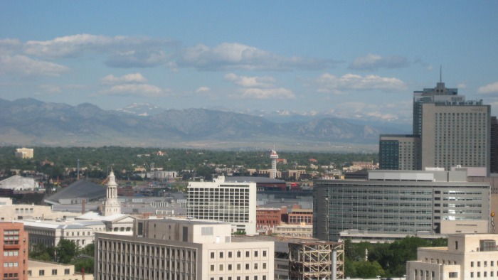
Being visible from most areas of the front range, North & South Arapaho peaks had always appealed to me. I finally decided to give them a shot on Tuesday, 7/13/10. Here is a pic of the peaks from the roof of my building in Denver:
They are left of center above the City/County building
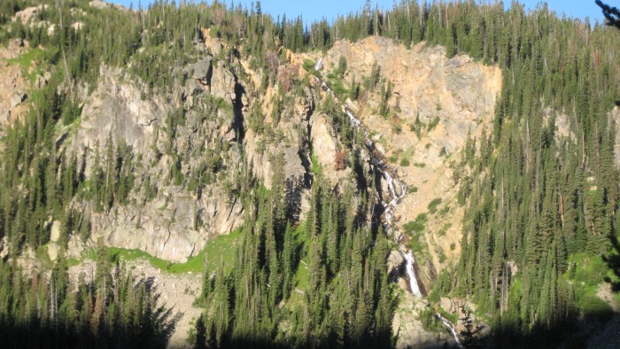
I arrived at the 4th of July trailhead (el. 10,120) and hit the Arapaho Pass trail at about 7AM. The mellow trail slowly rises through the forest and is very scenic. You are immediately treated to a beautiful cascading waterfall on the other side of the valley.
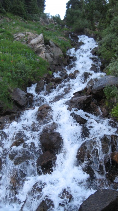
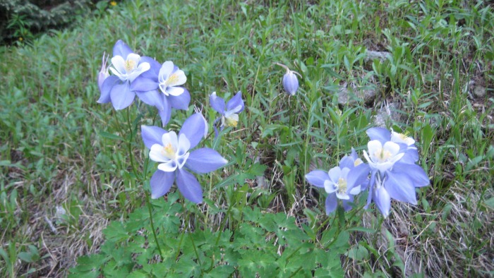
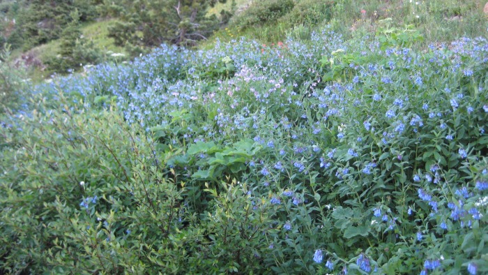
There are numerous stream crossings and lots a wildflowers along the way.
As you begin approaching treeline, the views open up and are dominated by Mt. Jasper (12,963) and Mt. Neva (12,814).
Jasper far left and Neva far right
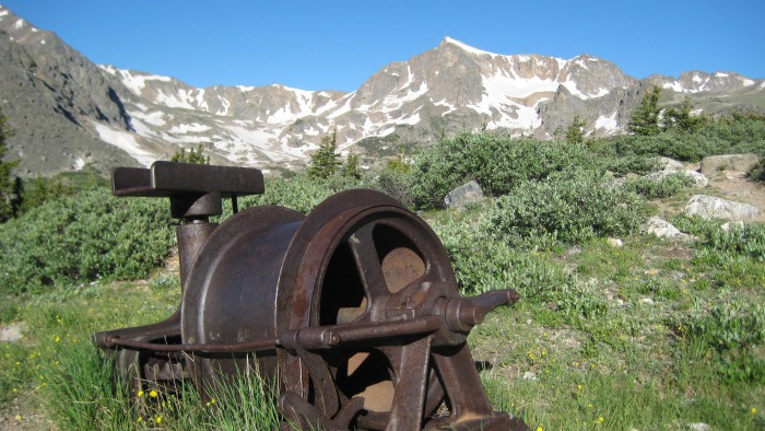
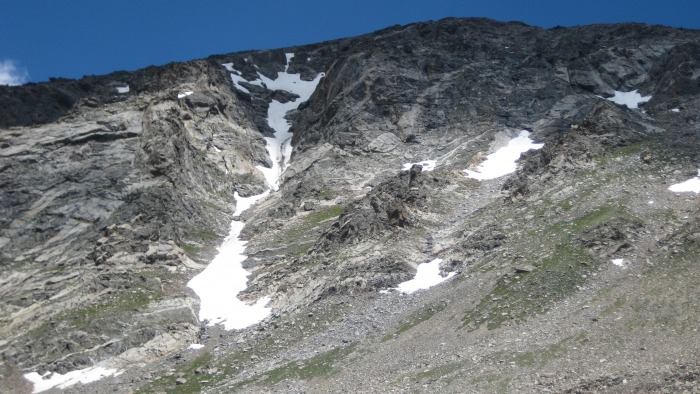
After about an hour, I reached the Arapaho Glacier trail junction and 4th of July mine. There is some abandoned mining equipment still there from long ago.
Skywalker Couloir from 4th of July mine
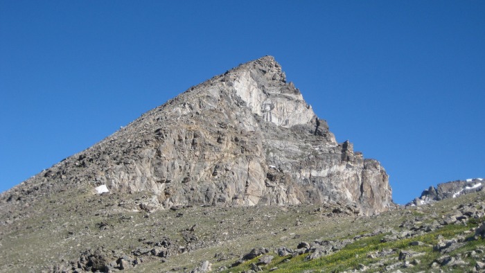
From here, the trail begins to gain elevation much faster as you switchback repeatedly up towards the 12,700 foot saddle between S. Arapaho and Old Baldy (13,038). Once at the saddle, the rest of the climb comes into view. The final pitch towards the summit is much steeper, but it still just easy rock hopping.
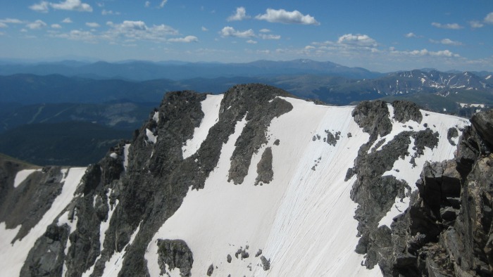
Remaining climb up S. Arapaho
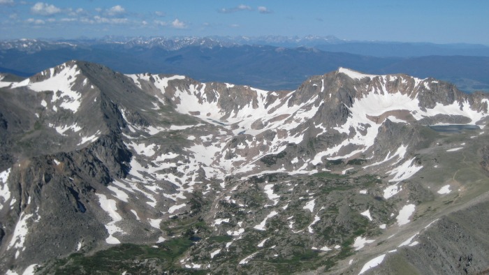
I reached the summit of S. Arapaho at about 9:30. The weather could not have been better (excluding the wind), and the views were spectacular.
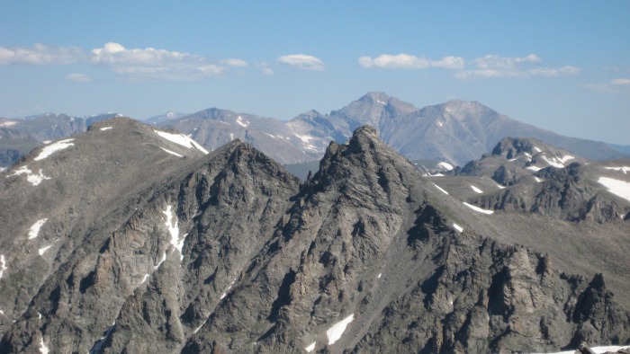
Jasper & Neva Traverse to N. Arapaho
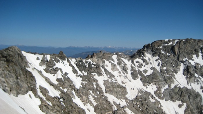
The traverse was to be my first experience with actual scrambling/climbing, and I was eager to get started. The wind was absolutely brutal for most of the traverse. At first, it was easy to follow the orange arrows painted on the rocks, but after the crux, I eventually couldn't find any more of them and had to do a bit of route finding.
Climbing is fun Crux slab
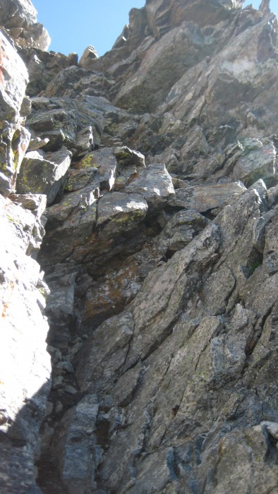
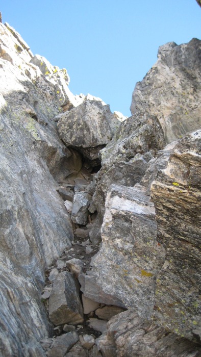
At one point, an arrow pointed me through a small notch only to find a 10-15ft cliff to downclimb. That was interesting.
N. Arapaho from through a notch just prior to steep downclimb
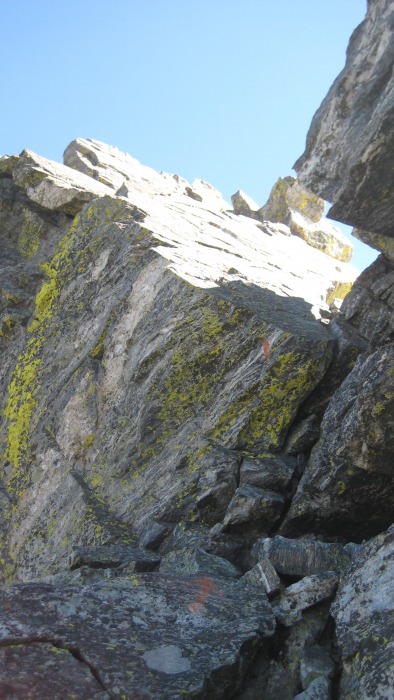
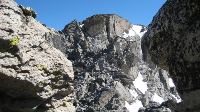
I eventually found the final gully to climb which left me just a short walk to the summit.
Final gully climb to summit
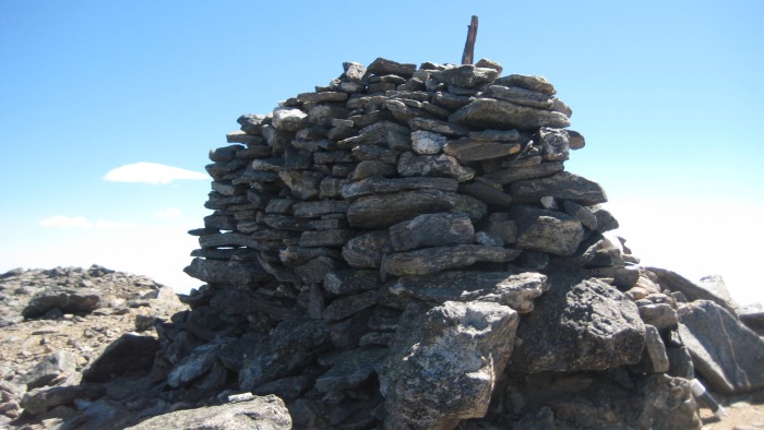
The huge wind shelter up there was such a relief.
Welcome sight!
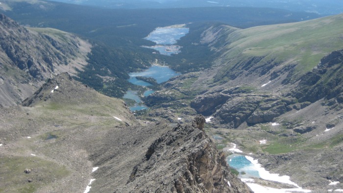
It took me about an hour to complete the traverse, and I spent some time relaxing in the sun at the summit. Some summit pics:
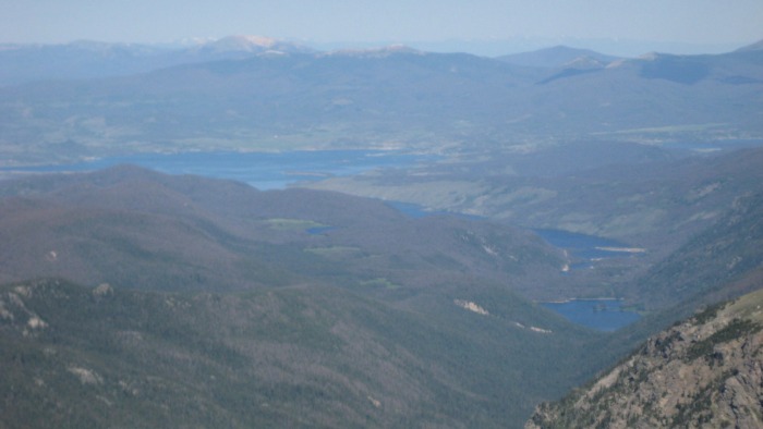
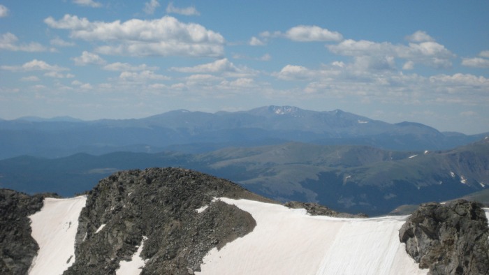
Longs & Meeker Lake Granby, etc. Looking back to S. Arapaho Evans in the distance
The return trip was uneventful, and at this point, I was ready to get out of the wind and back down to the car. I finally started seeing some people on the return trip on the Arapaho Pass trail, and by the time I reached the parking lot at 1:45, it was absolutely packed. It was a real surprise considering I hadn't seen anyone for hours.
Thumbnails for uploaded photos (click to open slideshow):
Comments or Questions
Caution: The information contained in this report may not be accurate and should not be the only resource used in preparation for your climb. Failure to have the necessary experience, physical conditioning, supplies or equipment can result in injury or death. 14ers.com and the author(s) of this report provide no warranties, either express or implied, that the information provided is accurate or reliable. By using the information provided, you agree to indemnify and hold harmless 14ers.com and the report author(s) with respect to any claims and demands against them, including any attorney fees and expenses. Please read the 14ers.com Safety and Disclaimer pages for more information.
Please respect private property: 14ers.com supports the rights of private landowners to determine how and by whom their land will be used. In Colorado, it is your responsibility to determine if land is private and to obtain the appropriate permission before entering the property.