| Report Type | Full |
| Peak(s) |
North Maroon Peak - 14,022 feet |
| Date Posted | 07/11/2010 |
| Modified | 07/12/2010 |
| Date Climbed | 07/10/2010 |
| Author | JA_son27 |
| N. Maroon Peak |
|---|
|
I left Broomfield around 5:30p for the infamous Maroon Bells, and wasn't too sure what was going to happen. The weather report from NOAA stated a 50% chance of rain, and rain possible the night before as well. I had made plans to meet 14er.com member Doggler at the summit of S. Maroon and continue on to the traverse to N Maroon, but I wasn't sure if I would have the stamina at this point in the climbing season to do it. I arrived at the TH around 9:30p and promptly fell asleep. My alarm woke me up too early for mortal man to have to deal with, I made breakfast, drank my coffee and was on the trail around 3:15. Once I neared the turnoff for Pyramid Peak I noticed some headlights approaching, of course it was Sean a.k.a. Doggler and his buddy Patrick, so now I had to figure out what I wanted to do, because he would surely outpace me in no time. I had hoped to start much earlier than him to meet up much higher, oh well! He had mentioned a group of 14er.com members not too far behind me, snapped a few pics and was on his way. After our meeting I had answered at least one of my questions: I wouldn't be doing the traverse today. Shortly after Doggler left, the other group had made their appearance. Eric(Lostsheep5), Paul(paulperea), Mike(Shogun) and Jim. They were going up N. Maroon today, and I thought it would be cool to tagalong with these guys instead of going up S. Maroon. 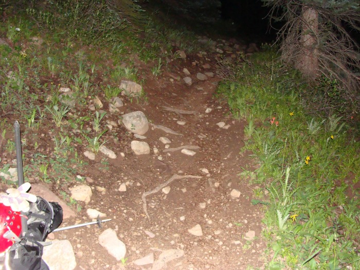 We quickly made our way through the trees and took our left turn down to the river crossing(I really dislike crossing rivers by headlamp). After the river crossing we were greeted with a nice steep muddy trail. It was very muddy from the previous night's rain and thus very annoying.  We weren't quite finished with the muddy trail just yet but we were gaining elevation pretty quickly. 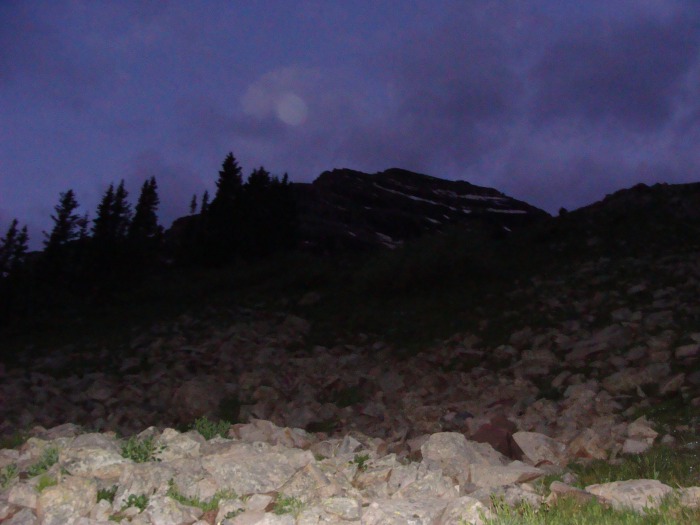 After we hurdled the wall, the trail mellowed out for a little while as it skirted around the base of N Maroon's massif. At this point you are near the large rock glacier below N Maroon's large North face. 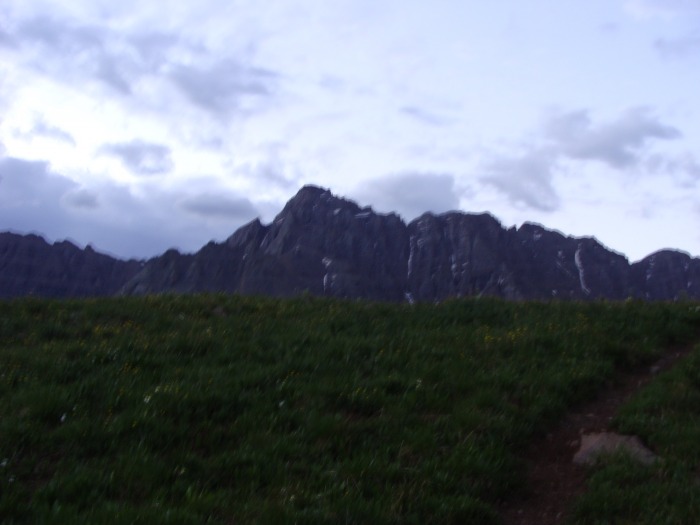 After the nice rolling grassy trail, we entered the rock glacier. I knew there would be no more nice easy trail beyond this point, so we all decided to put our headgear on. I felt a sense of unease while crossing underneath this large behemoth's face surrounded by all this rubble. But it's better to be safe than sorry. 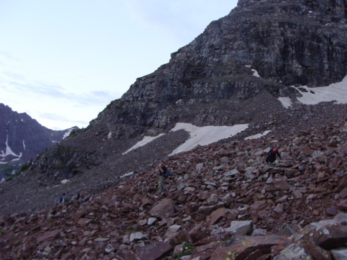 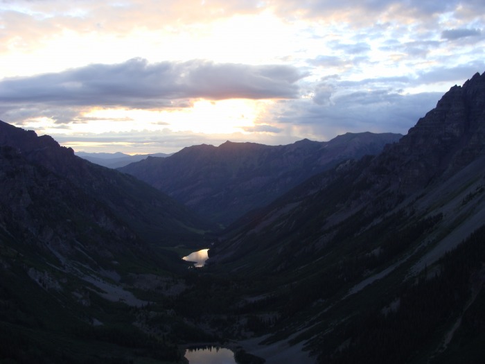 Once the sun hit I felt great! It seemed to break up some of the clouds and it lifted my spirit! 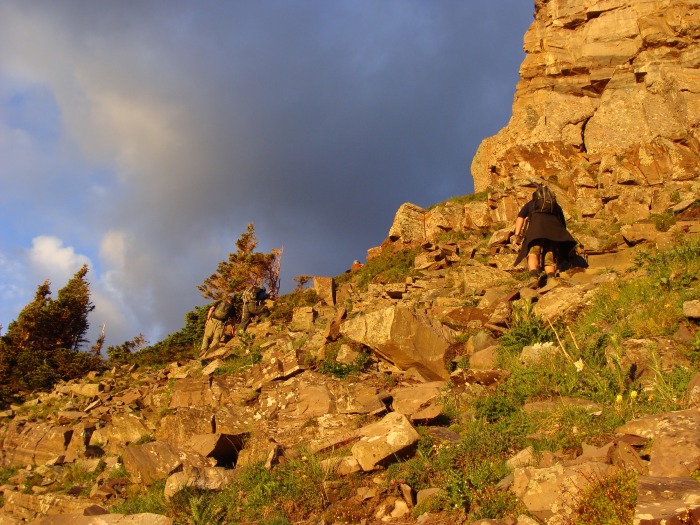 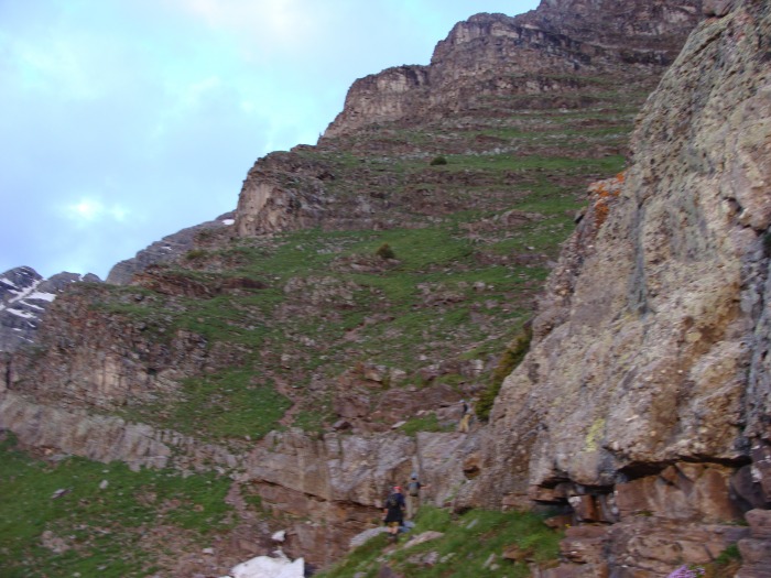 This part of the climbing was tough for me. I was surprised at how moderate this gully was because when I looked at it from a distance it looked almost vertical. 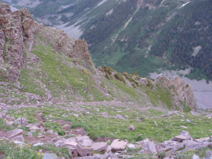 Once we reached the white rock band we veered left and crossed over into the much steeper second gully. 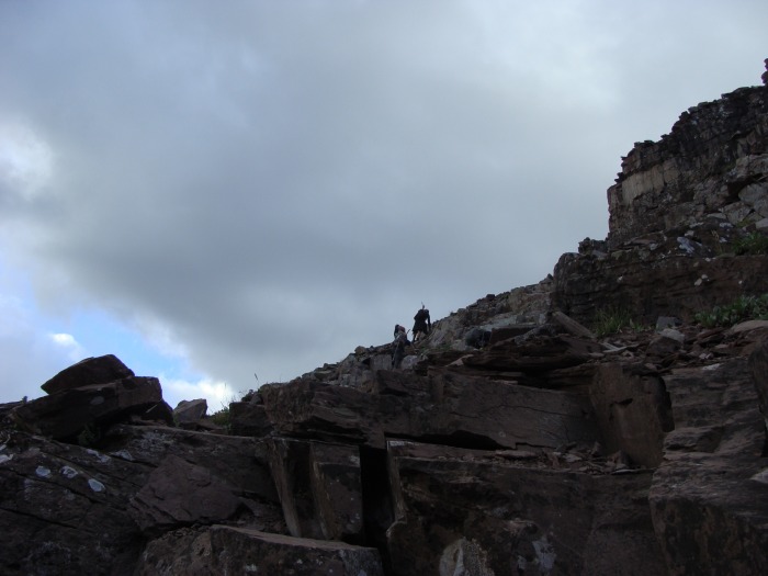 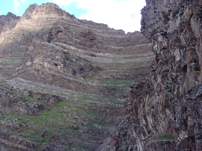 Both of these gullies are considerably steep! And all that nice greenery you see? A lot of it is composed of prickly weeds that somehow kept finding their way into my hands. 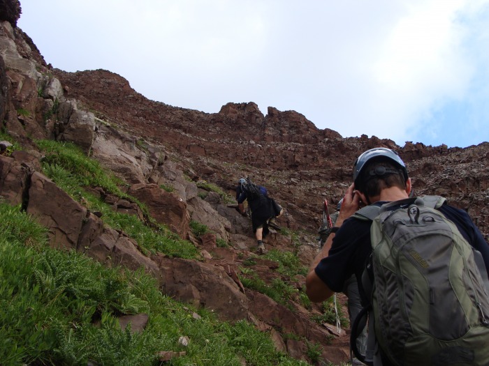 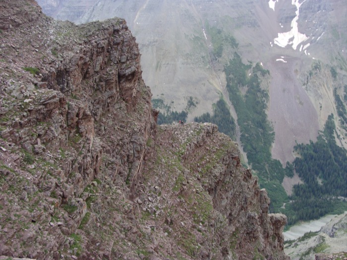 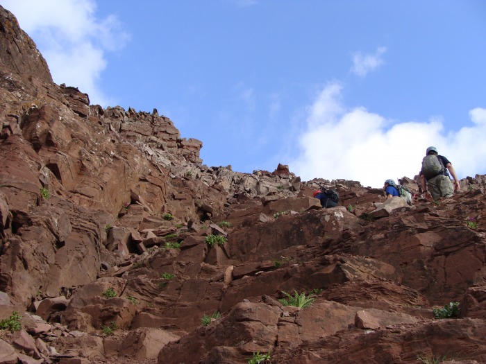 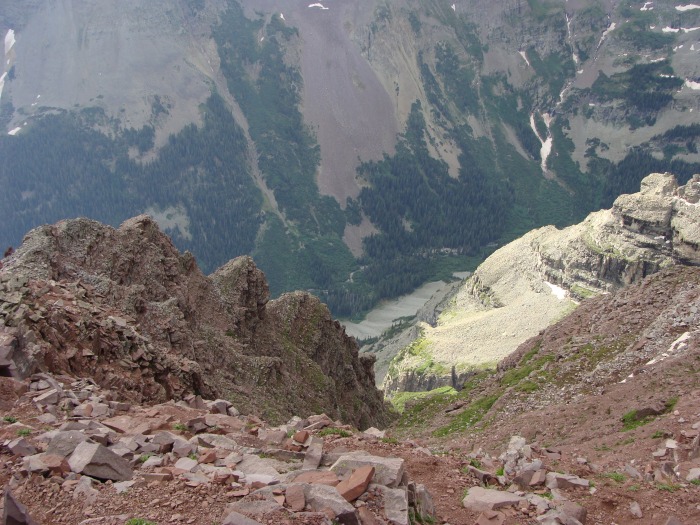 It was around this time that a very large rock (maybe the size of a car tire) was dislodged and went hurling down towards the climbers below us. I have to admit, this was the most terrified I have ever been on a 14er. The gully was instantly permeated with our yells of "ROCK!" The climbers moved out of harm's way and gave us a "Thank you for warning us" wave and continued on. This climb was very loose. Thankfully we reached the notch a few minutes later without incident. Once we hit the notch, I put on my jacket anticipating heavy wind and we started climbing left towards the summit. 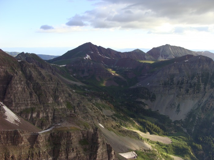 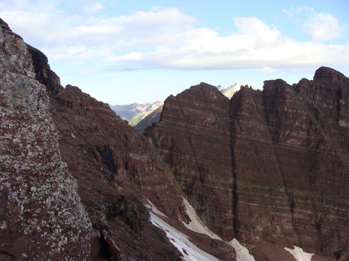 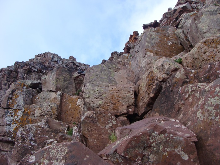 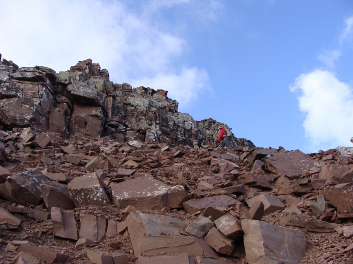 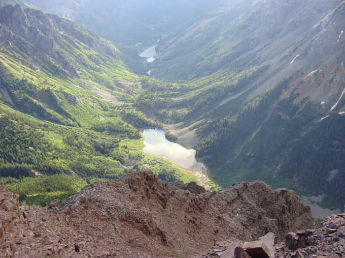 On the whole route up North Maroon, the chimney was technically the most difficult hurdle to subjugate. There were plenty of foot and handholds so if you take your time it shouldn't be an issue. 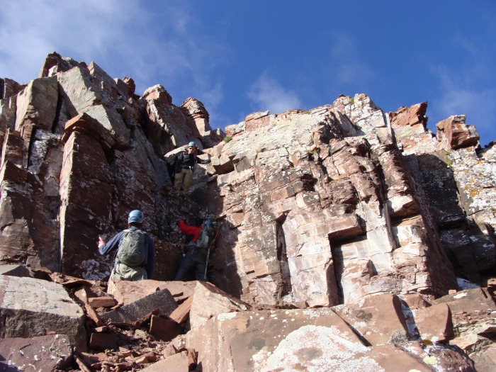 Quickly after the chimney the summit makes its first appearance. 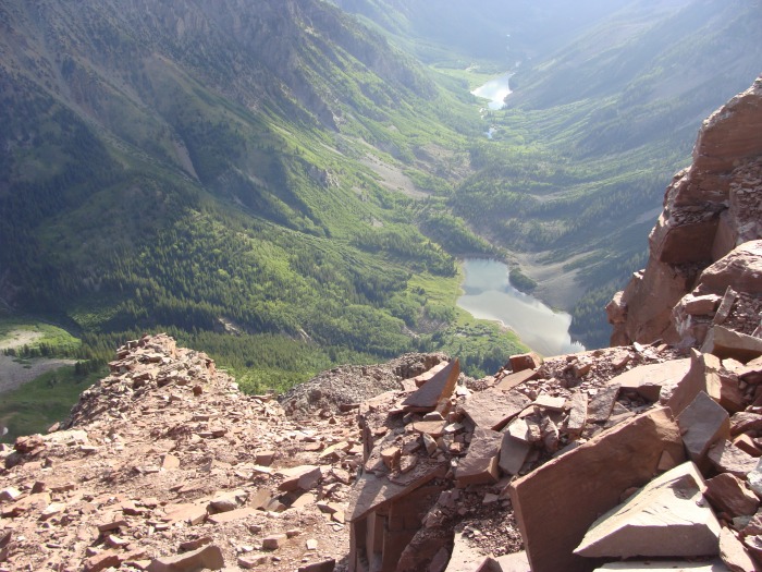 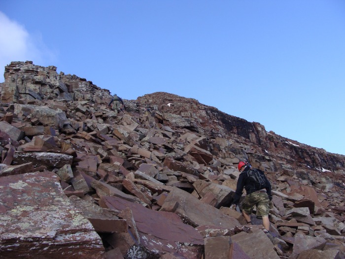 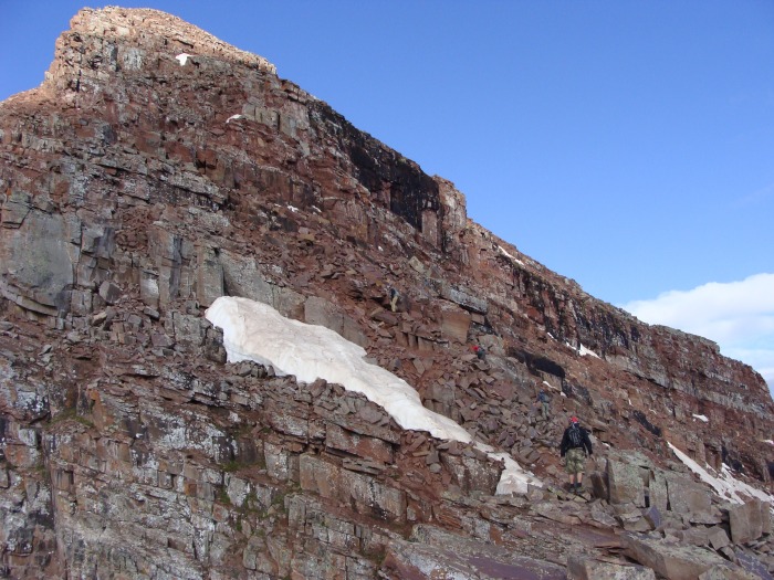   There still was some climbing left to do once we passed the precipice. We made our way up to the summit block, but we kind of chose our own way. Eric, Jim and Paul went around the back side and up while Mike and I chose to go directly up through a crack to hit the final ridge up to the summit. 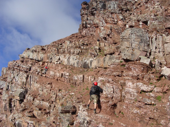 Continued from the caption above-from this vantage point. Paul (Red Jacket) and Jim(not pictured) followed suit. A mistake here would not be good. Mike and I decided -based on the advice of a Maroon Bell veteran- to go directly left of where Eric was shown standing in the above picture. This led us up an easy crack to the final summit ridge. At this point my legs were cramping like mad and I had to practically limp to the summit. Talk about a grand entrance! 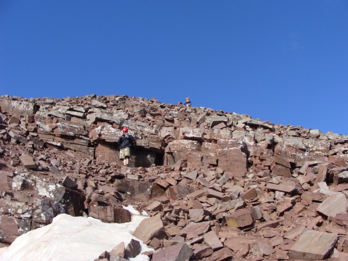 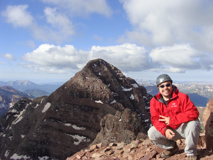 Doggler ended up catching up with us while we were descending the 2nd gulley! He had summited Maroon Peak, completed the traverse over to N. Maroon and met up with us in the second gully all in the time it took us to summit N. Maroon and start heading back down. Amazing. 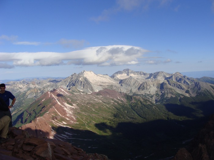 This was an amazing trip for me, and it worked out perfectly. I wasn't able to complete the traverse but I had a great time with some good guys on a tough mountain. Eric, Paul, Jim and Mike thank you for letting me tag along I had a blast! Good luck on your next adventures! Sean, it was good spending a few minutes with you on the descent, good luck with your traverses! Thumbnails for uploaded photos (click to open slideshow):
|
| Comments or Questions | |||||||||
|---|---|---|---|---|---|---|---|---|---|
|
Caution: The information contained in this report may not be accurate and should not be the only resource used in preparation for your climb. Failure to have the necessary experience, physical conditioning, supplies or equipment can result in injury or death. 14ers.com and the author(s) of this report provide no warranties, either express or implied, that the information provided is accurate or reliable. By using the information provided, you agree to indemnify and hold harmless 14ers.com and the report author(s) with respect to any claims and demands against them, including any attorney fees and expenses. Please read the 14ers.com Safety and Disclaimer pages for more information.
Please respect private property: 14ers.com supports the rights of private landowners to determine how and by whom their land will be used. In Colorado, it is your responsibility to determine if land is private and to obtain the appropriate permission before entering the property.


