Download Agreement, Release, and Acknowledgement of Risk:
You (the person requesting this file download) fully understand mountain climbing ("Activity") involves risks and dangers of serious bodily injury, including permanent disability, paralysis, and death ("Risks") and you fully accept and assume all such risks and all responsibility for losses, costs, and damages you incur as a result of your participation in this Activity.
You acknowledge that information in the file you have chosen to download may not be accurate and may contain errors. You agree to assume all risks when using this information and agree to release and discharge 14ers.com, 14ers Inc. and the author(s) of such information (collectively, the "Released Parties").
You hereby discharge the Released Parties from all damages, actions, claims and liabilities of any nature, specifically including, but not limited to, damages, actions, claims and liabilities arising from or related to the negligence of the Released Parties. You further agree to indemnify, hold harmless and defend 14ers.com, 14ers Inc. and each of the other Released Parties from and against any loss, damage, liability and expense, including costs and attorney fees, incurred by 14ers.com, 14ers Inc. or any of the other Released Parties as a result of you using information provided on the 14ers.com or 14ers Inc. websites.
You have read this agreement, fully understand its terms and intend it to be a complete and unconditional release of all liability to the greatest extent allowed by law and agree that if any portion of this agreement is held to be invalid the balance, notwithstanding, shall continue in full force and effect.
By clicking "OK" you agree to these terms. If you DO NOT agree, click "Cancel"...
Mt Bierstadt July 10, 2010
Summit Elevation: 14,060 feet
Trailhead Elevation: 11,669 feet
Elevation Gain: 2,850 feet
Round-trip Length: 7.00 miles
Trailhead: Guanella Pass
Cimbers: Kent (greenwok), Michael (MWB)
Time: TH 6:40 AM, Summit 9:00 AM, Depart Summit 9:40 AM, TH 11:30 AM
Beautiful day - clear skies becoming partly cloudy with likely afternoon T-Storms sometime after we left. Cold at or near the top really due to a northwest wind chill - we were plenty comfortable except our fingers felt like popsicles despite wearing wind gloves!
We had done Evans 3 years ago via the Gulley as well as slogging through the muddy marsh and swore we would never be back up here again...thankfully the trail to Bierstadt avoids most if not all of the mud
Enjoy the gallery!
Mt Bierstadt Trail Head
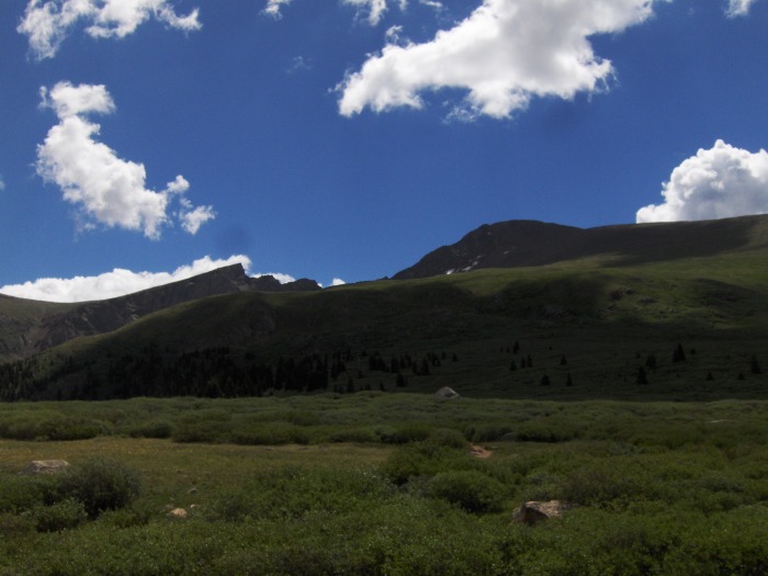
Mt Bierstadt & Sawtooth to Evans on ascent
Grays & Torreys
Gulley to Evans - Glad to not be doing it this time!
Another shot of the Sawtooth
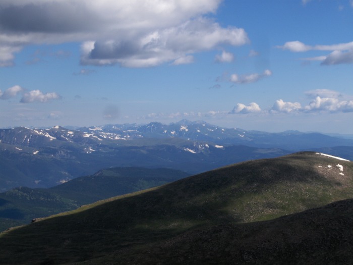
Longs Peak in the far distance - on the list this summer!
Pikes Peak in the far distance
Views from Bierstadt summit
Michael on the summit
Kent on the summit - for you Kevin!
The photo card I was holding didn't transpose as well as I had anticipated so took a close up here - Kevin knew Bierstadt & t
Mt Bierstadt Summit Marker
Alpine flowers - many were just beginning to bloom
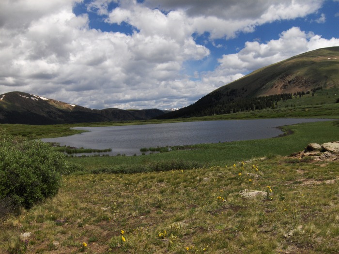
A small alpine lake
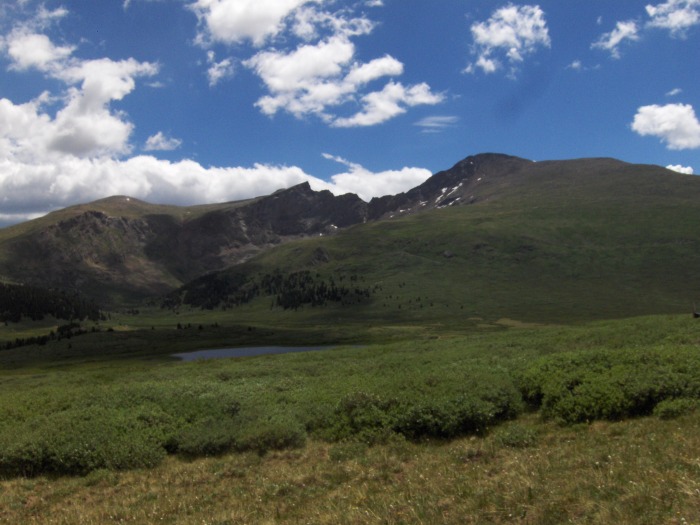
Nice shot of Bierstadt and the Sawtooth on our descent
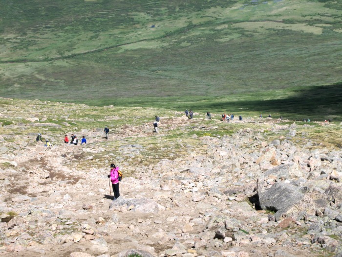
Line of hikers - very heavily traveled esp on weekends!
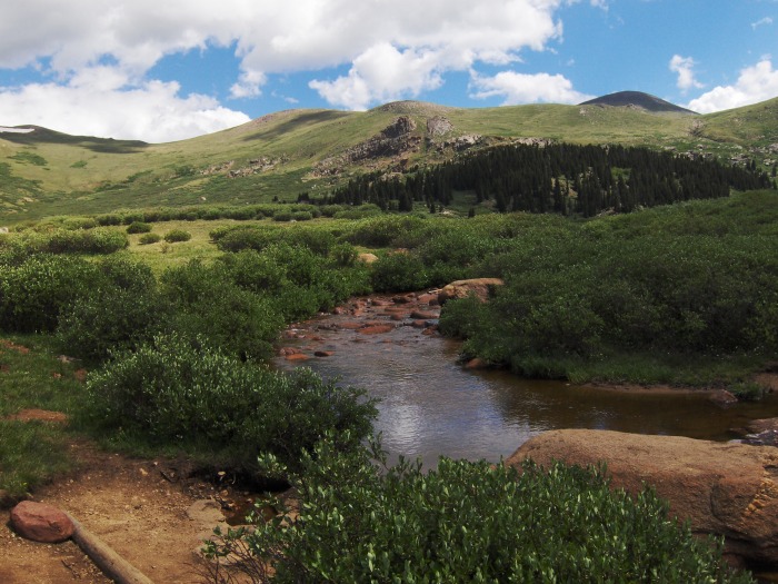
Scott Gomer Creek
Scott Gomer's other creek! :-)
A very full parking lot upon arrival back to our car to head home!
Thumbnails for uploaded photos (click to open slideshow):
@MountainsnBluegrass: We did see quite a number of tents along the Guanella Pass highway between 285 and the parking lot. No clue on reservation requirements - others may have insight.
I have always thought Bierstadt was one of the prettiest 14er hikes with so much green. I also really like to see photos that highlight some of the not so obvious beauty along the way. I love your picture of Scott Gomer creek (both of them!).
Caution: The information contained in this report may not be accurate and should not be the only resource used in preparation for your climb. Failure to have the necessary experience, physical conditioning, supplies or equipment can result in injury or death. 14ers.com and the author(s) of this report provide no warranties, either express or implied, that the information provided is accurate or reliable. By using the information provided, you agree to indemnify and hold harmless 14ers.com and the report author(s) with respect to any claims and demands against them, including any attorney fees and expenses. Please read the 14ers.com Safety and Disclaimer pages for more information.
Please respect private property: 14ers.com supports the rights of private landowners to determine how and by whom their land will be used. In Colorado, it is your responsibility to determine if land is private and to obtain the appropriate permission before entering the property.


 Mt Bierstadt Trail Head")
 Mt Bierstadt & Sawtooth to Evans on ascent")
 Grays & Torreys")
 Gulley to Evans - Glad to not be doing it this time!")
 Another shot of the Sawtooth")
 Longs Peak in the far distance - on the list this summer!")
 Pikes Peak in the far distance")
 Views from Bierstadt summit")
 Michael on the summit")
 Kent on the summit - for you Kevin!")
 The photo card I was holding didn't transpose as well as I had anticipated so took a close up here - Kevin knew Bierstadt & t")
 Mt Bierstadt Summit Marker")
 Alpine flowers - many were just beginning to bloom")
 A small alpine lake")
 Nice shot of Bierstadt and the Sawtooth on our descent")
 Line of hikers - very heavily traveled esp on weekends!")
 Scott Gomer Creek")
 Scott Gomer's other creek! :-)")
 A very full parking lot upon arrival back to our car to head home!")


