| Report Type | Full |
| Peak(s) |
San Luis Peak - 14,023 feet |
| Date Posted | 07/01/2010 |
| Modified | 07/29/2011 |
| Date Climbed | 06/26/2010 |
| Author | Doctor No |
| Ring Around The Organ (Stewart Creek up, Colorado Trail down) |
|---|
|
Our initial intent was to ascend San Luis Peak via the Stewart Creek trail, then climb Organ Mountain, and descend from there south to the Colorado Trail. However, the clouds were looking a bit sketchy when we neared San Luis' summit, and we knew that we would have a long day ahead. Discretion and valor and all that. The topography of what we did: 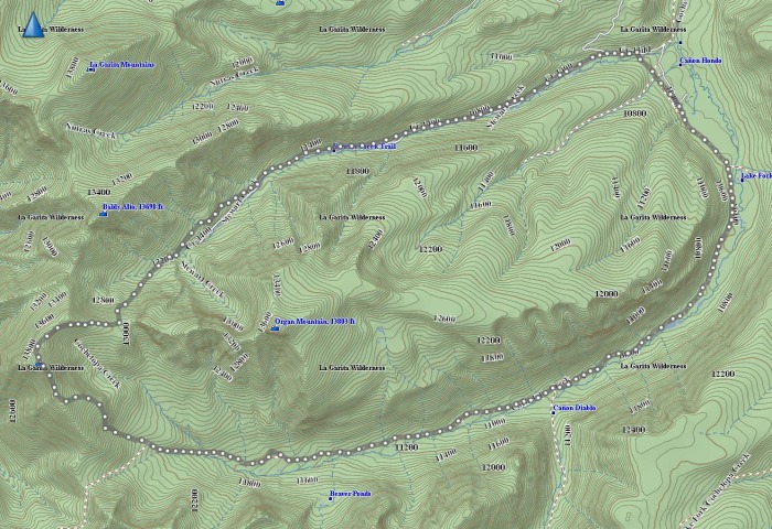 A full day of work caused us to leave Denver at 7:30pm, and arrive at the trailhead around 12:30. After 3.5 hours of the two of us sleeping in the cab of my pickup truck, we were finally uncomfortable enough to began hiking at 4:30am. The full moon was there, but so were a full cadre of clouds. Stewart Creek wasn't too high on this morn, but we did have to negotiate several creek crossings: 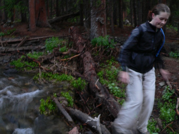 Finally, the beautiful valley opens behind us, while we ascend to the first ridge. 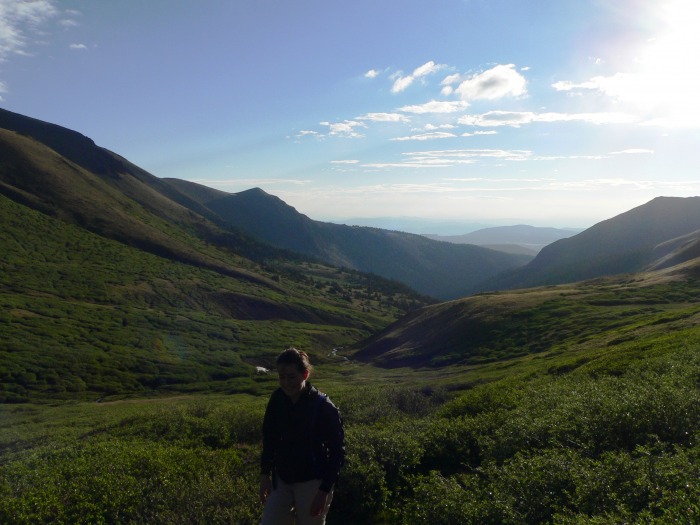 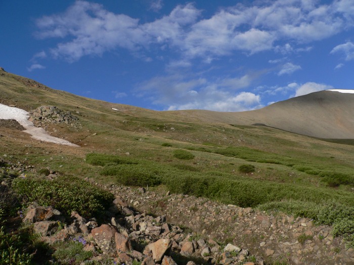 Baldy Alto and wildflowers conspire to greet us.  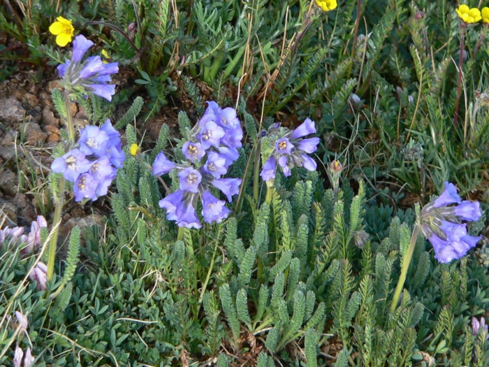 Organ Mountain still looks like a good idea, although the west ridge looks steep. It looks like the north side is the way to go. 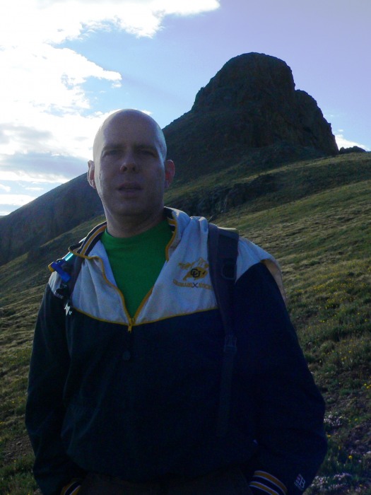 At the same time, the long, graceful summit approach to San Luis Peak comes into view. 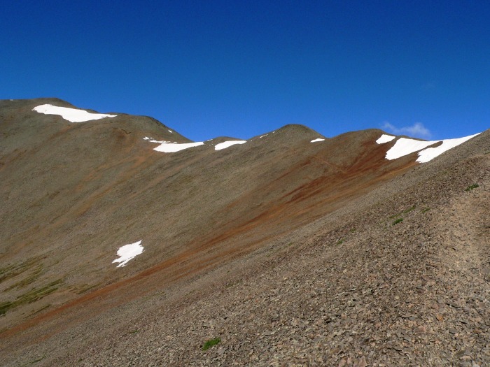 It was not really a great day for mountain tourism - the Sawatch was completely clouded over, as were the mountains to the east. Wetterhorn and Uncompahgre were willing participants: 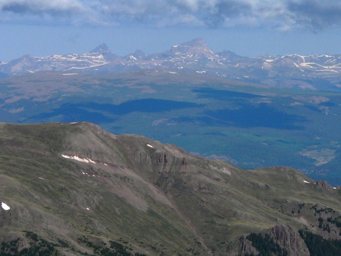 All too soon, the last pitch up the north ridge was upon us: 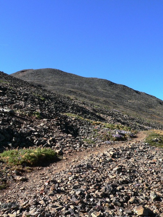 We summitted at 9am - not bad for us, since we like to take our time. Our obligatory summit shot: 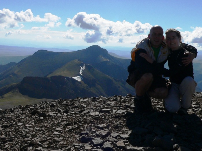 As you can see, there are enough clouds in the air, so Colleen and I decided to skip Organ for today, and head directly down into the Cochetopa Creek valley: 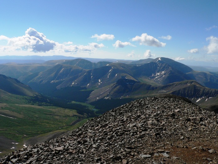 Before we do - is this Mount Sneffels in the faded background? If not, what is it? (EDITED TO ADD: It is! Thank you to Yalegirl09!) 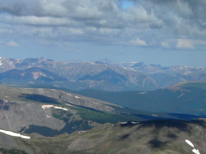 We began to wind our way down the south ridge of San Luis, tracking in the direction where we would hopefully catch the Colorado Trail a bit further east (and closer to the car): 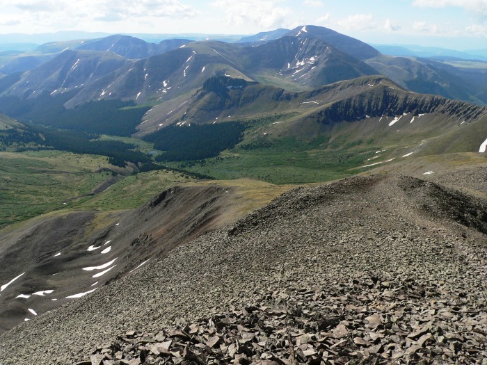 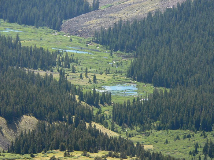 Meanwhile, Organ Mountain mocks us - it knows that we had a date, and broke it. I took a shot of the west ridge gully, which appears to have a lot of snow in the bypass area. 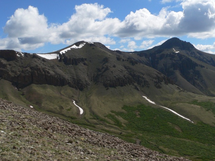 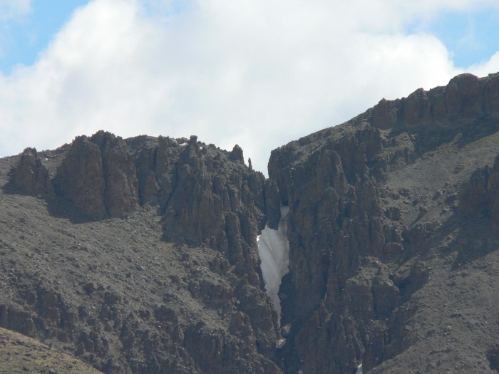 Audience participation time! What is the name of the peak on the south side of the Cochetopa Creek valley, opposite Organ Mountain? Looks like some great rotten rock to scramble! (EDITED TO ADD: Thank you to Doug Shaw; this is Point 12,798!) 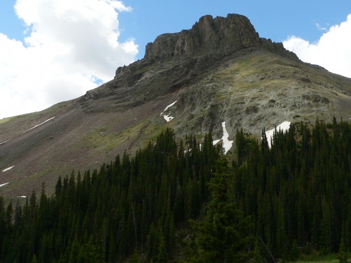 A warning for those who choose to return to the Stewart Creek trailhead via this route - aside from being beautiful, Organ Mountain both relentless and indefatigable. The ridge (which we need to circumvent) just keeps going, and going, and going, and going. 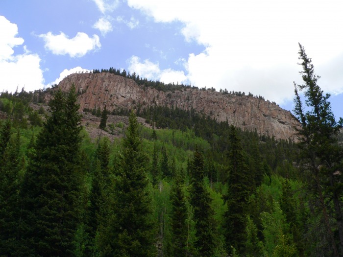 Finally, the ridge relents, and we are able to return to the trailhead 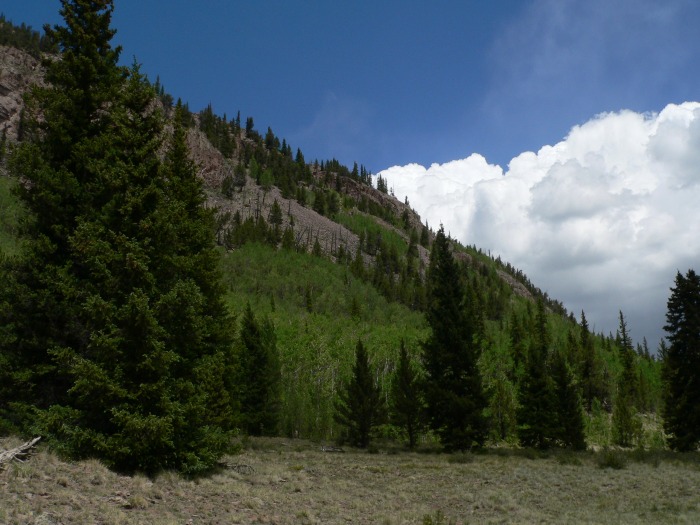 Another warning - if you choose to return this way, by the time you get to this point, you will be looking for a shortcut to the car. We decided that instead of going all the way to the Colorado Trail trailhead, and taking the road back to Stewart Creek, to just bushwack to Stewart Creek directly. This leads to a big creek crossing (not pictured). Final altitude profile: 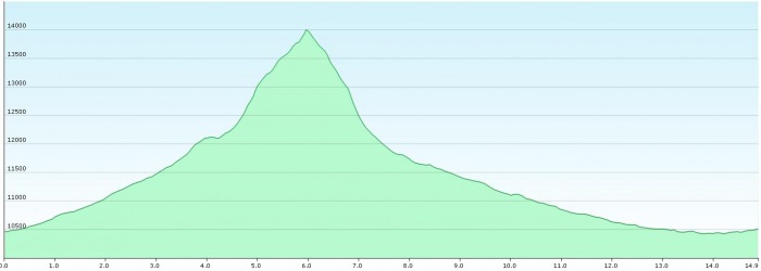 We got back to the car at approximately 2pm, for about 9.5 hours in total (which included a long break at the summit among other breaks). I estimate about 16 miles in total - my Garmin GPS is very unforgiving with switchbacks. We arrived just in time for a heavy thunderstorm, during which I would rather not have been navigating through 30-plus miles of dirt roads. However, it's much preferable to navigating miles of dirt trails while hiking. Thumbnails for uploaded photos (click to open slideshow):  Topographic profile (Garmin Basecamp)")
 Colleen navigating the largest of the creek crossings")
 Stewart Creek valley")
 The climb to the ridge")
 Baldy Alto")
 Wildflowers")
 Organ Mountain's west ridge")
 San Luis Peak's glorious northern slopes.")
 Wetterhorn, Matterhorn, Uncompahgre")
 The last few hundred feet")
 Summit photo, with Organ Mountain in the background.")
 The upper Cochetopa Creek valley")
 Sneffels!")
 The south ridge of San Luis")
 There's a lot of water right now in the upper Cochetopa Creek drainage.")
 Organ Mountain")
 The gully on the west ridge approach to Organ Mountain")
 Point 12,798")
 Organ's relentless east side")
 We can finally hike north!")
 Altitude profile (Garmin Basecamp)")
|
| Comments or Questions | ||||||
|---|---|---|---|---|---|---|
|
Caution: The information contained in this report may not be accurate and should not be the only resource used in preparation for your climb. Failure to have the necessary experience, physical conditioning, supplies or equipment can result in injury or death. 14ers.com and the author(s) of this report provide no warranties, either express or implied, that the information provided is accurate or reliable. By using the information provided, you agree to indemnify and hold harmless 14ers.com and the report author(s) with respect to any claims and demands against them, including any attorney fees and expenses. Please read the 14ers.com Safety and Disclaimer pages for more information.
Please respect private property: 14ers.com supports the rights of private landowners to determine how and by whom their land will be used. In Colorado, it is your responsibility to determine if land is private and to obtain the appropriate permission before entering the property.


