Download Agreement, Release, and Acknowledgement of Risk:
You (the person requesting this file download) fully understand mountain climbing ("Activity") involves risks and dangers of serious bodily injury, including permanent disability, paralysis, and death ("Risks") and you fully accept and assume all such risks and all responsibility for losses, costs, and damages you incur as a result of your participation in this Activity.
You acknowledge that information in the file you have chosen to download may not be accurate and may contain errors. You agree to assume all risks when using this information and agree to release and discharge 14ers.com, 14ers Inc. and the author(s) of such information (collectively, the "Released Parties").
You hereby discharge the Released Parties from all damages, actions, claims and liabilities of any nature, specifically including, but not limited to, damages, actions, claims and liabilities arising from or related to the negligence of the Released Parties. You further agree to indemnify, hold harmless and defend 14ers.com, 14ers Inc. and each of the other Released Parties from and against any loss, damage, liability and expense, including costs and attorney fees, incurred by 14ers.com, 14ers Inc. or any of the other Released Parties as a result of you using information provided on the 14ers.com or 14ers Inc. websites.
You have read this agreement, fully understand its terms and intend it to be a complete and unconditional release of all liability to the greatest extent allowed by law and agree that if any portion of this agreement is held to be invalid the balance, notwithstanding, shall continue in full force and effect.
By clicking "OK" you agree to these terms. If you DO NOT agree, click "Cancel"...
When I first climbed Grays and Torreys, I remember seeing some people on Kelso Ridge and thinking they were out of their minds! Now I realize they had it right all along. This ridge is totally fun, not crowded, not too long and it gives you just the right amount of a thrill factor. I posted for a climbing partner for this one and Sam aka Geno71 expressed interest. We agreed to meet at the Grays Peak TH at 6am and I was stoked!
Even after hiking this mountain three times, I still am surprised at how many people hike here, and how full the very large parking lot gets! I recommend arriving early if you want a decent spot. Shortly after Sam pulled up into the lot we hit the trail, around 615pm.
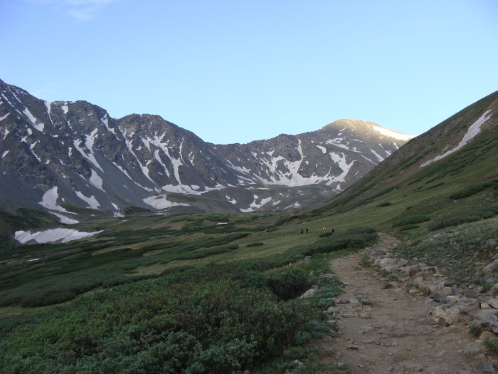
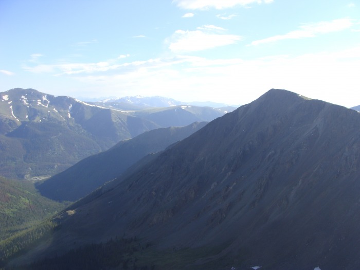
First light on Grays
According to Sam's GPS roughly 1.8 miles in give or take a few we arrived at the Kelso ridge junction. There is a cairn that marks the entrance. Once you start towards the ridge you are immediately taken away from the crowds.
Kelso Ridge Mine Shack
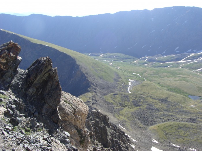
Looking towards the main trail from Kelso ridge trail
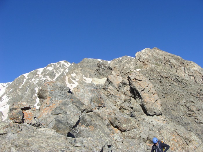
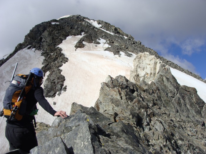
Once you pass the mine shack you are presented with a view of your incredible challenge!
Most of the ridge can be seen from here
There is a good trail up the ridge for a majority of the time, and when there was no trail present, it wasn't too difficult to stay en route. The next picture shows a look back on the first little section.
We mostly stayed on the ridge for the first few hundred yards
Shortly after the last section in the above picture we encountered our first actual climbing wall.
The dirt trail leads you right up the middle
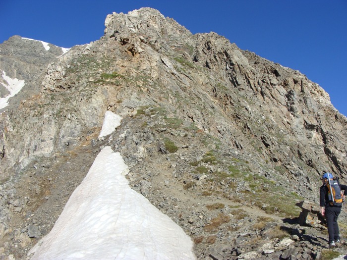
After we climbed up the first of our many encumbrances, we hit a nice little scree slope. Once the scree slope was surmounted we confronted our first piece of snow.
Scree slope above Sam's left shoulder
The first snowfield, as you can see the trail skirts around
We were starting to gain elevation!
We stuck to the scree right below the solid rock rib, then ascended the wider scree slope towards the middle right side of th
Looking at the west side of Kelso Mountain
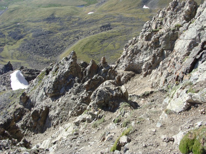
Once we climbed our way out of the wider scree slope (which can be seen in photo 10), the trail led us around to the right side of the rock ribs. We opted not to stick to the actual ridge at this point because there was a faint hikers trail that could be followed.
Looking back at the snow field that was seen a few pics back
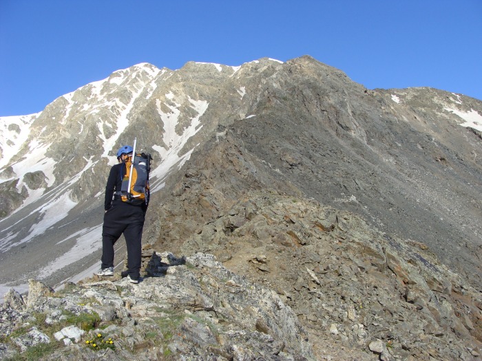
At his point we were about halfway up and we were both feeling good! We just wanted to sit back relax and enjoy the scenery. I was totally surprised at how fun this ridge is!
Sam checking out our next moves
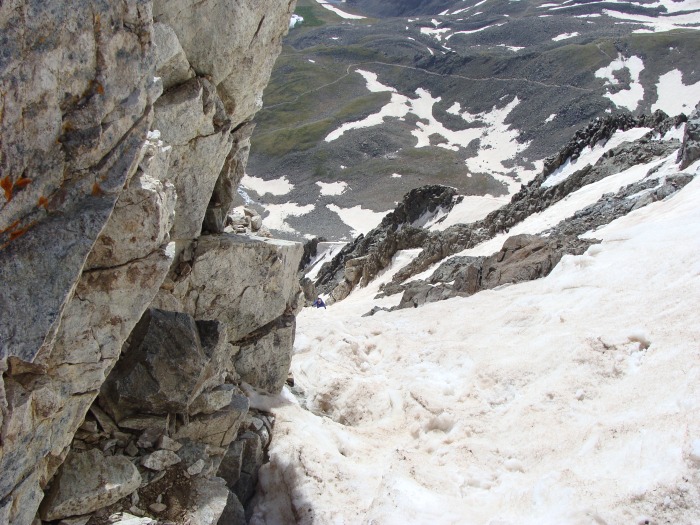
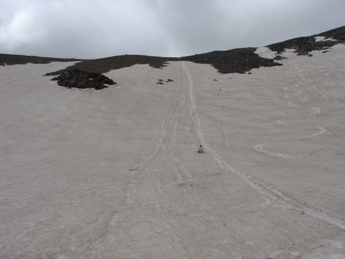
Checking out our possible glissade path on Grays. There looks to be three fingers of snow, we went down the middle finger(Do
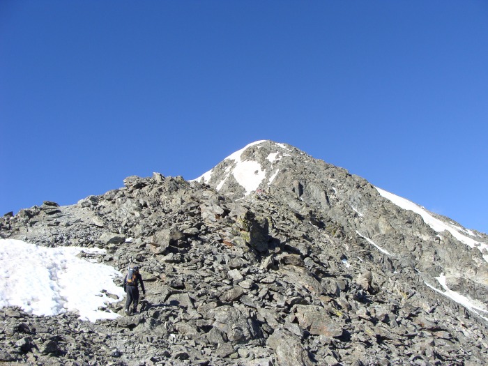
Getting closer!
Right after this little bit of snow the trail flattens out for a few hundred yards or so.
Another little patch of snow
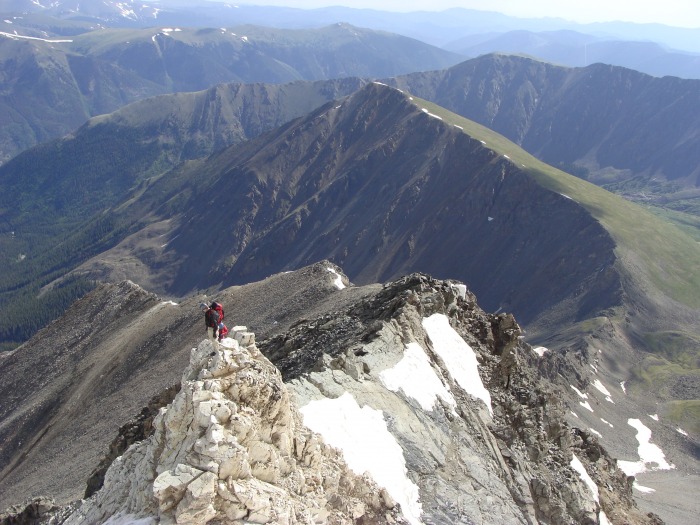
The remaining route as seen from above the last snowfield. Climbers can be seen near the edge of the ridge in the photo below.
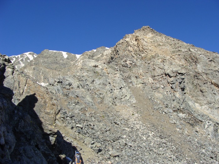
I welcome this brief respite, but I know we still have a bit of climbing to go!
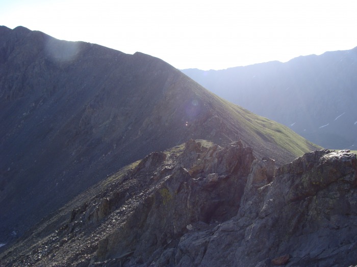
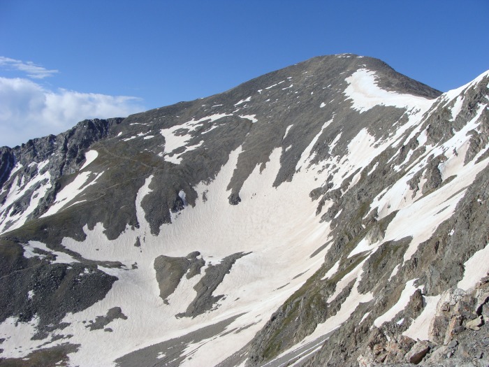
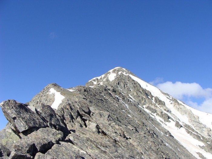
The remaining route
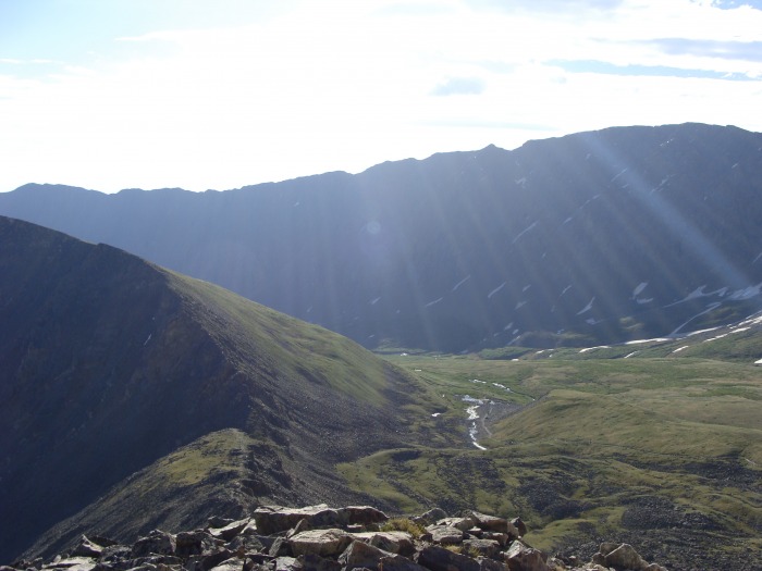
Looking back on Kelso Mountain
Photo where the climbers were seen
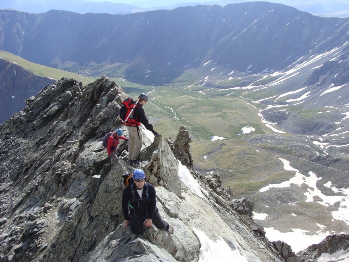
The trail was starting to get rocky again, and I knew the fun would be amped up! We caught up to the climbers in a rather steep gulley below the white rock outcropping and knife edge. There was ice and snow in the gulley and this gave me a bit of trouble. I wasn't wearing the best shoes because my "new" boots had killed my ankles last week. My shoes were very slick when wet so Sam and I had climbed a little higher to the left of the gulley to avoid the snow and ice.
While contemplating this move in the gulley, we met the two climbers, Brian and Connie. It turns out I had run into them on Shavano last year. They were a very nice couple, and we kind of ended up hiking with them the rest of the way.
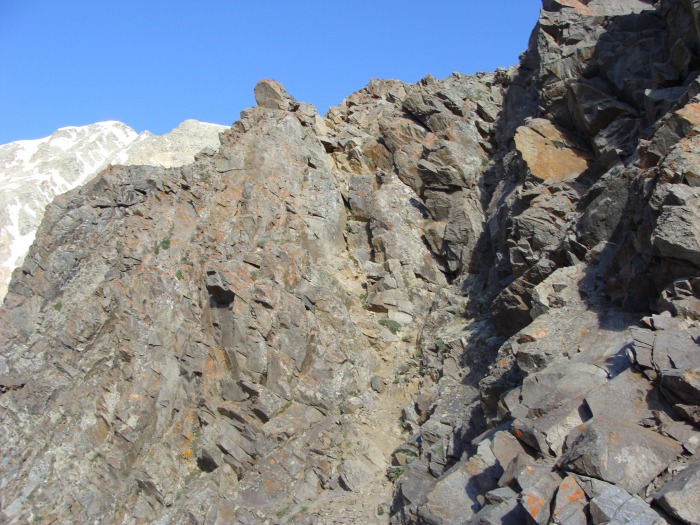
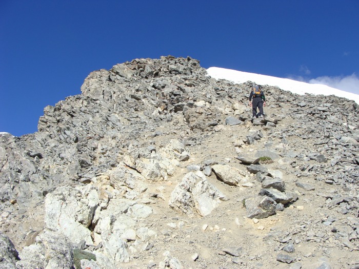
Starting to get rocky again!
Immediately following the summit of the last gulley the white rock outcropping come into view
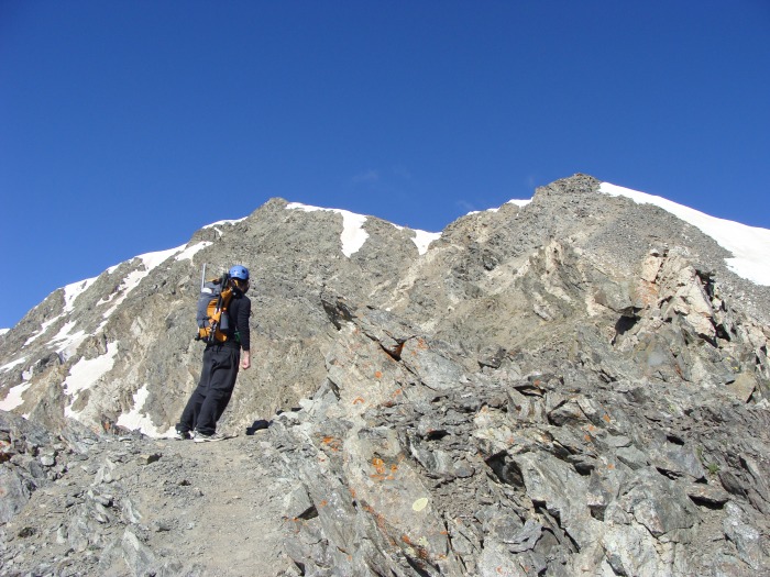
Sam on the knife edge, Brian and Connie await their turn
Once we seized the crux it was a quick little jaunt to the summit! This was the only point on the ridge where snow couldn't be avoided, it was about a 10-20ft section.
Climbers seen in Dead Dog
Brian and Connie conquer the "knife edge"
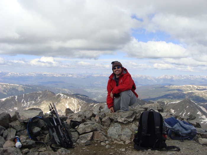
Summit success!
After hitting the summit, we were greeted by the crowds, it was the same feeling I had when I summited Mt. Evans! But on our way down, Sam and I decided we would give the glissade a go. We weren't sure if the snow would be too soft or not but we decided to try at any rate. This would help us avoid the crowds even while we were descending!
It turned out to be a blast! I think it was the longest continued glissade I have ever done!
Connie busting out a long, fast glissade!
This climb was a very nice change for Torreys! I had a blast on this ridge, and I too enjoyed climbing with you Sam, pm me for future hikes! Brian and Connie, I'm sure I'll see you again! If I don't then get registered here and PM me and we'll all go again sometime!
The people that hike this trail amaze me, they run the gamut from totally prepared, to not. As we were coming down we heard a few rumbles of thunder and people were still going up!
Anyhow, I hope you've enjoyed this report and I hope it helps someone out there!
Thumbnails for uploaded photos (click to open slideshow):
How was the road in, last year we almost could not make it in because of big wash outs that made deep ruts in the road and you had to have a high clearence truck/ jeep. so can you make it in a car, camry ect.
zoomie83 and I just came back from doing Kelso Ridge a couple hours ago, second time up but a lot of fun! We ended up continuing to Grays, but that glissade picture almost makes me wish we had dropped earlier! Regarding cars:...we followed a ford escort to the TH. The road is MUCH better than last summer. Which also means it is busier...
Connie and I had a great time on that hike as well - the glissade was the icing on the cake! Great pics and great report! We are hoping to spend some time in the Elks this summer, so PM me and we‘ll see if we can‘t do it again some time soon.
Caution: The information contained in this report may not be accurate and should not be the only resource used in preparation for your climb. Failure to have the necessary experience, physical conditioning, supplies or equipment can result in injury or death. 14ers.com and the author(s) of this report provide no warranties, either express or implied, that the information provided is accurate or reliable. By using the information provided, you agree to indemnify and hold harmless 14ers.com and the report author(s) with respect to any claims and demands against them, including any attorney fees and expenses. Please read the 14ers.com Safety and Disclaimer pages for more information.
Please respect private property: 14ers.com supports the rights of private landowners to determine how and by whom their land will be used. In Colorado, it is your responsibility to determine if land is private and to obtain the appropriate permission before entering the property.