Download Agreement, Release, and Acknowledgement of Risk:
You (the person requesting this file download) fully understand mountain climbing ("Activity") involves risks and dangers of serious bodily injury, including permanent disability, paralysis, and death ("Risks") and you fully accept and assume all such risks and all responsibility for losses, costs, and damages you incur as a result of your participation in this Activity.
You acknowledge that information in the file you have chosen to download may not be accurate and may contain errors. You agree to assume all risks when using this information and agree to release and discharge 14ers.com, 14ers Inc. and the author(s) of such information (collectively, the "Released Parties").
You hereby discharge the Released Parties from all damages, actions, claims and liabilities of any nature, specifically including, but not limited to, damages, actions, claims and liabilities arising from or related to the negligence of the Released Parties. You further agree to indemnify, hold harmless and defend 14ers.com, 14ers Inc. and each of the other Released Parties from and against any loss, damage, liability and expense, including costs and attorney fees, incurred by 14ers.com, 14ers Inc. or any of the other Released Parties as a result of you using information provided on the 14ers.com or 14ers Inc. websites.
You have read this agreement, fully understand its terms and intend it to be a complete and unconditional release of all liability to the greatest extent allowed by law and agree that if any portion of this agreement is held to be invalid the balance, notwithstanding, shall continue in full force and effect.
By clicking "OK" you agree to these terms. If you DO NOT agree, click "Cancel"...
We decided to head up to the Castle Creek trailhead the night before to get a head start on the climbs. We were unsure if my jeep was going to be able to cross the river, so our plan was to park just before the bridge and then to hike all the way into the basin and set up camp. Once we reached the river and after some debate we decided that we should go ahead and cross it.
Pic of the river cossing from the way out
After we crossed the river we drove up the road and parked just a little ways before the junction to Pearl Pass road. From there we put on our packs and starting hiking into the first basin at 12,800'.
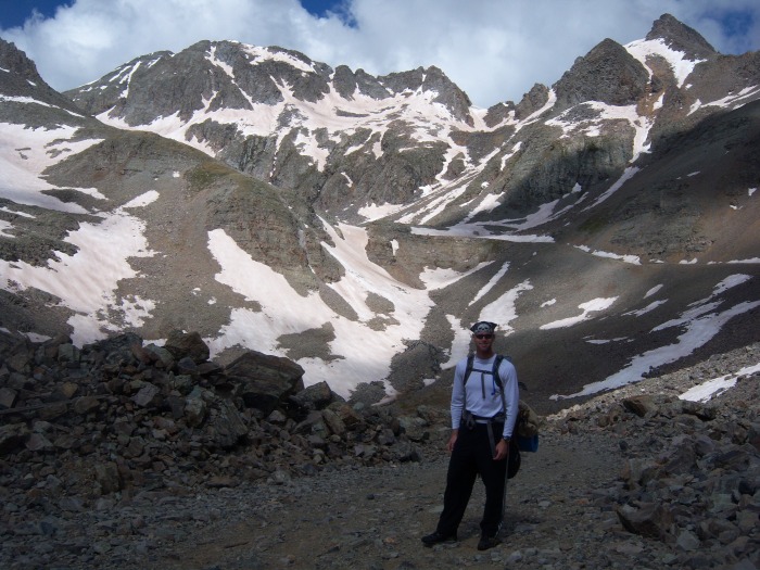
The next few pics are ones on the way into the basin, but were taken on the hike out since the night before it was dark.
The hike into the basin was uneventful, just staying on the road hoping it wasn't going to start down pouring on us. Luckily it just sprinkled off and on and before we knew it we were in the basin and setting up camp. Neither one of us had camped that high before, so it was pretty cool to be sleeping just below 13,000 feet.
Our morning view from inside the tent. Looking up the steep hill to reach the upper basin
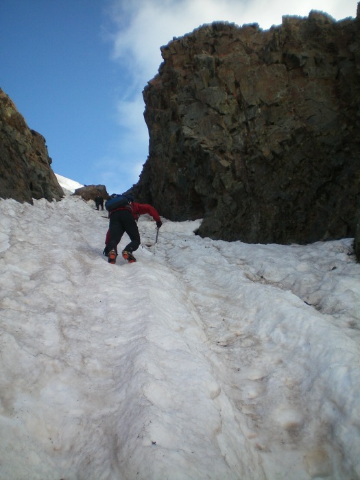
The couloir starts just a few hundred feet from the top of the hill. The snow was nice and hard all the way up, perfect for crampons.
Starting up the climb
Working our way up
About 3/4 of the way up there are some rocks to negotiate, but its not that big of a deal, just go to the far left side.
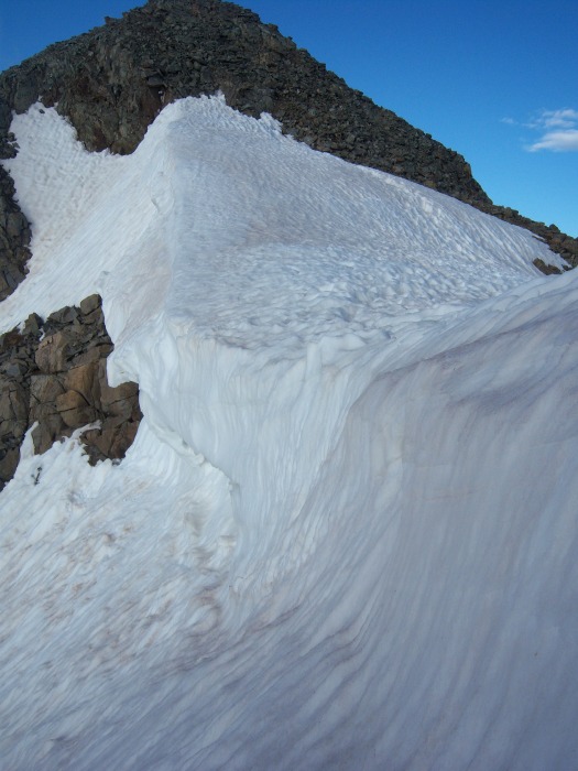
Climbing under the cornice
Side view of the cornice
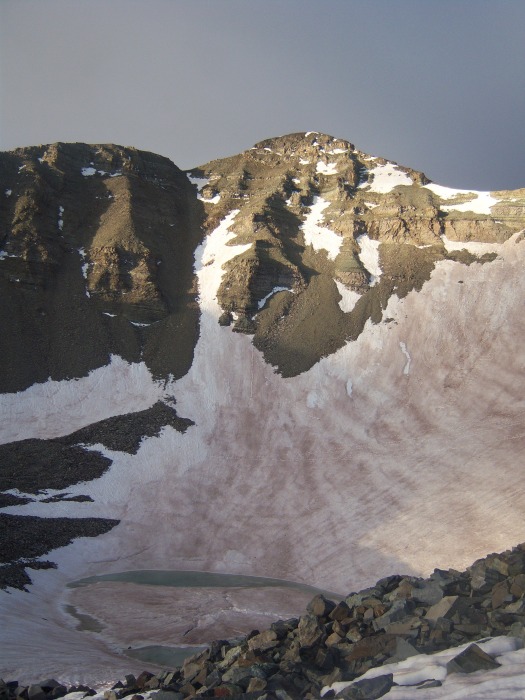
Castle from the top of the couloir.
We exited the couloir on the right and went for the summit. The rock here is a little loose, but not to bad.
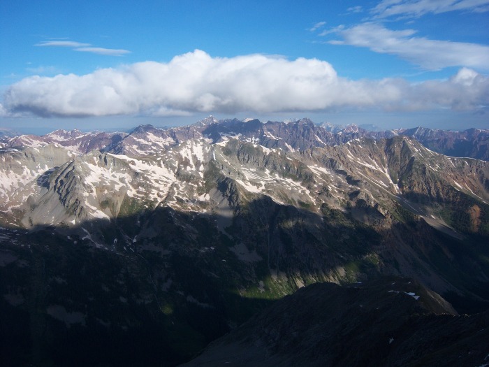
Views from the top of Conundrum.
We stayed on top of Conundrum only for a few minutes and headed toward Castle.
The ridge to Castle
We made it to the top of Castle in roughly 40 minutes.
Conundrum from Castle.
Summit of Castle.
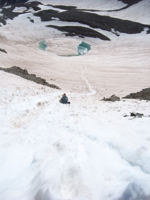
We were thinking about taking the standard route of castle back down, but the glissade from the saddle was to tempting.
After the fun of that glissade we couldn't pass up the one off of the steep hill back into the lower basin and to our camp. Only this one we had a long run out, so we just cut loose and went as fast as we could.
We broke down camp and started back down the road. Making it back to the jeep in about an hour.
Close to the trailhead, looking back up towards the valley.
Thumbnails for uploaded photos (click to open slideshow):
Conundrum Couloir is still climbable, maybe not really all that enjoyable of a ski, but what is these days?
Nice photos as well
Caution: The information contained in this report may not be accurate and should not be the only resource used in preparation for your climb. Failure to have the necessary experience, physical conditioning, supplies or equipment can result in injury or death. 14ers.com and the author(s) of this report provide no warranties, either express or implied, that the information provided is accurate or reliable. By using the information provided, you agree to indemnify and hold harmless 14ers.com and the report author(s) with respect to any claims and demands against them, including any attorney fees and expenses. Please read the 14ers.com Safety and Disclaimer pages for more information.
Please respect private property: 14ers.com supports the rights of private landowners to determine how and by whom their land will be used. In Colorado, it is your responsibility to determine if land is private and to obtain the appropriate permission before entering the property.


")
")
")
")
")
")
")
")
")
")
")
")
")
")
")
")
")
")
")
")
")
")
")
")
")
")
")


