Download Agreement, Release, and Acknowledgement of Risk:
You (the person requesting this file download) fully understand mountain climbing ("Activity") involves risks and dangers of serious bodily injury, including permanent disability, paralysis, and death ("Risks") and you fully accept and assume all such risks and all responsibility for losses, costs, and damages you incur as a result of your participation in this Activity.
You acknowledge that information in the file you have chosen to download may not be accurate and may contain errors. You agree to assume all risks when using this information and agree to release and discharge 14ers.com, 14ers Inc. and the author(s) of such information (collectively, the "Released Parties").
You hereby discharge the Released Parties from all damages, actions, claims and liabilities of any nature, specifically including, but not limited to, damages, actions, claims and liabilities arising from or related to the negligence of the Released Parties. You further agree to indemnify, hold harmless and defend 14ers.com, 14ers Inc. and each of the other Released Parties from and against any loss, damage, liability and expense, including costs and attorney fees, incurred by 14ers.com, 14ers Inc. or any of the other Released Parties as a result of you using information provided on the 14ers.com or 14ers Inc. websites.
You have read this agreement, fully understand its terms and intend it to be a complete and unconditional release of all liability to the greatest extent allowed by law and agree that if any portion of this agreement is held to be invalid the balance, notwithstanding, shall continue in full force and effect.
By clicking "OK" you agree to these terms. If you DO NOT agree, click "Cancel"...
Uncompahgre: 14309 - South Ridge from Nellie Creek (std rt) June 18, 2010 - unclegar
I drove down to Lake City on Thursday evening after leaving later than expected as usual. You'd think by now I would expect it, since it is usual, but it seems to surprise me again each time. I had decided to attempt Uncompahgre and Wetterhorn from the Nellie Creek side, thinking the road would be better than Matterhorn Creek. I was hurriedly scanning trip reports and trying to find the answer about which road might be better suited for a CRV, all the while knowing I should have driven away hours earlier. With 2 speeding tickets in the last 3 months, driving the speed limit was a given. So was a long, slow trip. When I arrived at Lake City, the town looked dark but familiar and reminded me of the two weeks in a row that I traveled there last year and climbed Redcloud, Sunshine and half the route to Handies from American Basin before turning back with frozen feet. I returned the following week to climb Handies in all its glory and snow from Grizzly Gulch. Good times. Good memories. After going where no CRV should ever go in the dark for 4 miles of narrow rough 4WD terrain that included 2 river crossings, I arrived at the TH about midnight. To my surprise there were 2 other vehicles parked there. When you hike during the week, like I do, you get used to empty trailheads and trails. As quietly as possible I tried to find a spot to park and car camp. As it turned out, I parked on too much of a slant and woke up all night long due to sliding down to the tailgate. I tried turning around but it kind of felt like I was hanging upside down. Anyway, my estimation is that I may have gotten 2 hours of sleep max. I had planned on leaving at 4am and trying to get both peaks in a day, but when my alarm went off, I ducked back into my sleeping bag and didn't appear until more like 5:30. I think that is the hour and a half of sleep I got. I started at the TH at about 6:50.
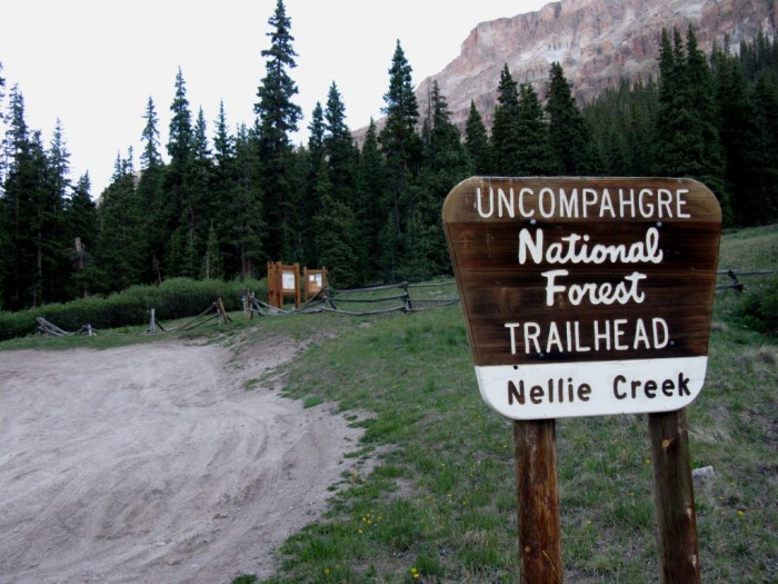
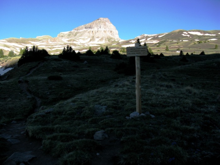
The Nellie Creek Trailhead.
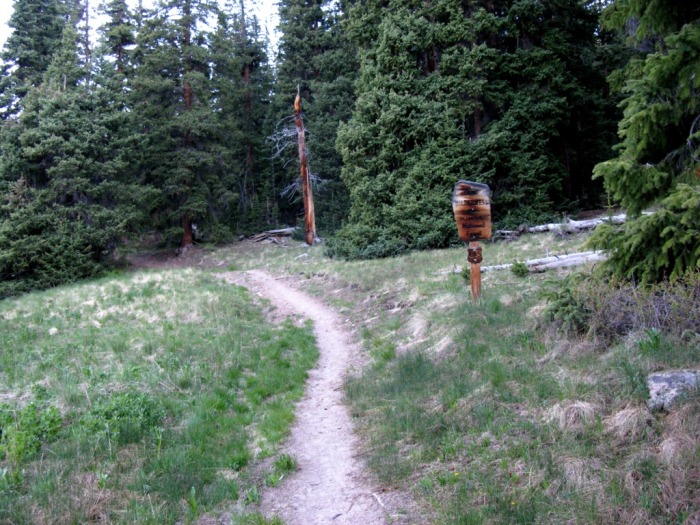
The hike started into the woods on a good trail that was free of snow.
Trail through the woods.
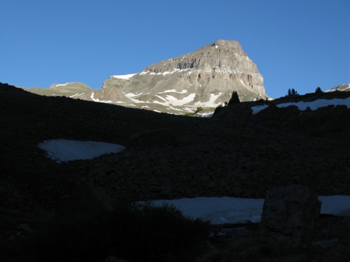
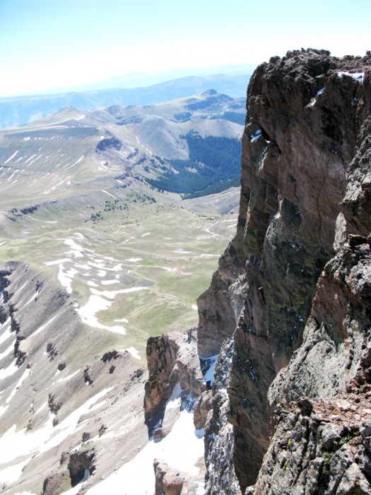
Uncompahgre was almost immediately the center of attention.
Uncompahgre.
The trail followed a stream and there was a junction at one of the switchbacks that had a trail heading down toward the small stream. This is not the junction at which you take a left turn. Instead turn right and continue to follow the larger trail uphill.
Don't turn here.
After walking in a direction that seemed counter-productive for a while and at the same time gaining some altitude, the trail turns back toward Uncompahgre and there is another junction. This is where you want to stay left.
Follow the trail Left here.
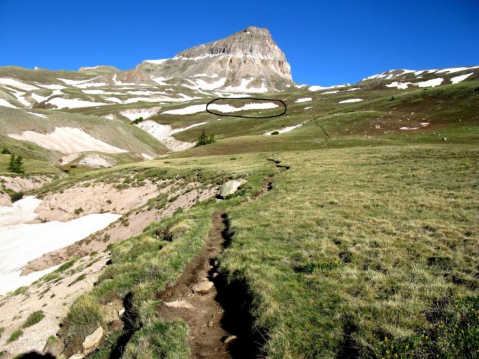
The trail was very obvious and clear of snow. The first snow field that had to be crossed is in the distance. I chose to put on microspikes for the crossing at 12380. There was another one at about 12525 and several others as the hike progressed. The microspikes did very well for me.
First snowfield in the distance.
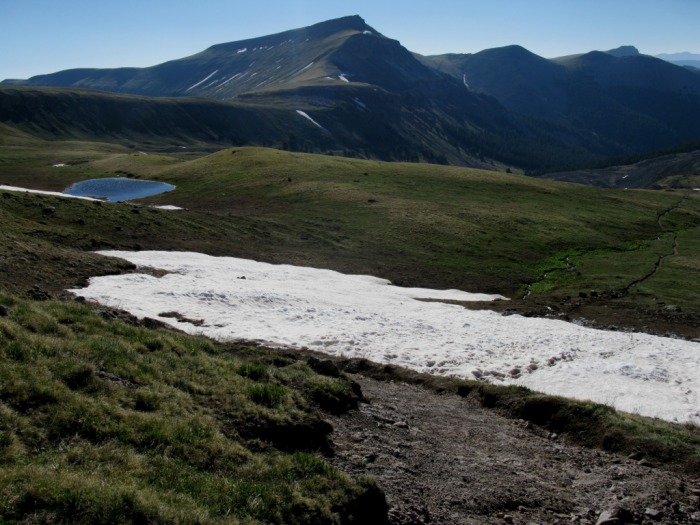
Looking back at the trail and a snow field covering the trail.
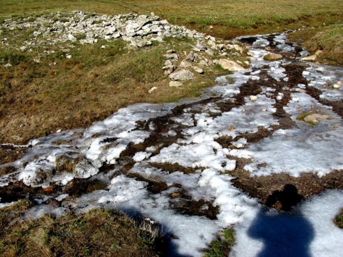
There was a small stream but it was easily crossed.
Stream crossing.
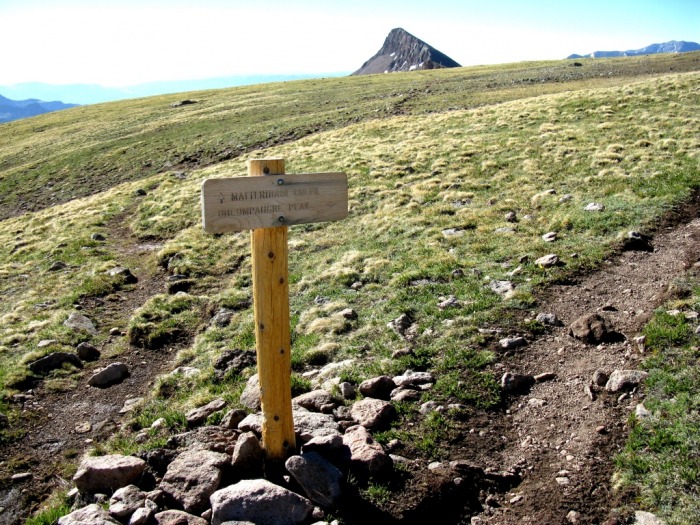
I passed the junction for Matterhorn Creek. This is where you would turn if you were to include Wetterhorn and/or Matterhorn in the same day.
Matterhorn junction
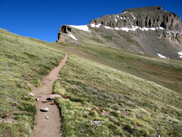
After this, the trail turned toward the ridge to Uncompahgre.
Trail on the ridge.
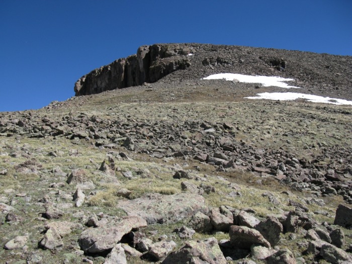
There was a small class 3 section to reach the plateau. I stayed to the right to use the solid wall for handholds as much as practical. From there it was pretty much a walk up.
Small class 3 section.
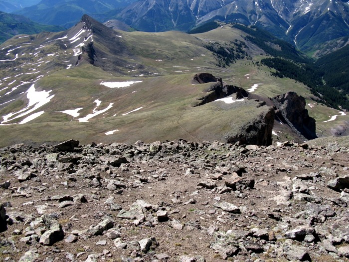
Looking toward the summit.
Looking back down at the ridge and the trail
I reached the summit at 10:20. Hero shots abounded but there was no hero to be found! I did not find a register but I did locate the marker.
Classic hero shot ( - hero)
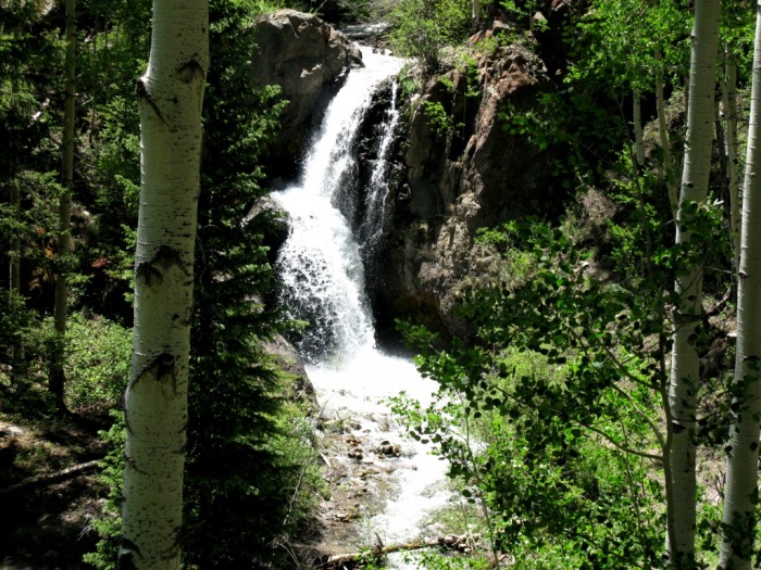
I ended up talking with several people on the way down, including one who thought his partner may have turned around at the class 3 section. He asked if I'd wait there and watch for his partner while he dropped his pack and made a sprint for the summit. His partner did show up after a while and I talked with him a bit too. Then I talked with a family that was going to turn around just before the last snow field. All the waiting and visiting added at least an hour to my trip and pretty much ensured that if having only 1-1/2 hours of sleep wasn't a good enough reason to wait until tomorrow for Wetterhorn, then getting back to negotiate the ridge around dark and then driving down the Nellie Creek Rd (again in the dark) in my CRV was. I decided to drive on down in daylight while there were still vehicles at the TH who would have to help me if I got stuck if they wanted out. I left the Nellie Crk TH at 1:30pm and made it down without a problem. I stopped on the road and took this picture of a waterfall.
Waterfall on Nellie Creek Rd
This was a beautiful area with a perfect weather day. I'm not sure a CRV should really be at the top of this road, but it worked. Hope this helps with current conditions on Uncompahgre.
Thumbnails for uploaded photos (click to open slideshow):
Thanks for your report. I‘m hiking Unc on July 3. Glad to have info on current conditions. I‘ll have to watch for that left turn going down to the stream, and hang a right instead.
If I were to do the combo, I think it would be preferable to do it from the Matterhorn TH. The road is much better up until the last .6 mi. And the trail layout makes more sense to do both peaks from this TH. Wish I knew that before I went.
Caution: The information contained in this report may not be accurate and should not be the only resource used in preparation for your climb. Failure to have the necessary experience, physical conditioning, supplies or equipment can result in injury or death. 14ers.com and the author(s) of this report provide no warranties, either express or implied, that the information provided is accurate or reliable. By using the information provided, you agree to indemnify and hold harmless 14ers.com and the report author(s) with respect to any claims and demands against them, including any attorney fees and expenses. Please read the 14ers.com Safety and Disclaimer pages for more information.
Please respect private property: 14ers.com supports the rights of private landowners to determine how and by whom their land will be used. In Colorado, it is your responsibility to determine if land is private and to obtain the appropriate permission before entering the property.