Download Agreement, Release, and Acknowledgement of Risk:
You (the person requesting this file download) fully understand mountain climbing ("Activity") involves risks and dangers of serious bodily injury, including permanent disability, paralysis, and death ("Risks") and you fully accept and assume all such risks and all responsibility for losses, costs, and damages you incur as a result of your participation in this Activity.
You acknowledge that information in the file you have chosen to download may not be accurate and may contain errors. You agree to assume all risks when using this information and agree to release and discharge 14ers.com, 14ers Inc. and the author(s) of such information (collectively, the "Released Parties").
You hereby discharge the Released Parties from all damages, actions, claims and liabilities of any nature, specifically including, but not limited to, damages, actions, claims and liabilities arising from or related to the negligence of the Released Parties. You further agree to indemnify, hold harmless and defend 14ers.com, 14ers Inc. and each of the other Released Parties from and against any loss, damage, liability and expense, including costs and attorney fees, incurred by 14ers.com, 14ers Inc. or any of the other Released Parties as a result of you using information provided on the 14ers.com or 14ers Inc. websites.
You have read this agreement, fully understand its terms and intend it to be a complete and unconditional release of all liability to the greatest extent allowed by law and agree that if any portion of this agreement is held to be invalid the balance, notwithstanding, shall continue in full force and effect.
By clicking "OK" you agree to these terms. If you DO NOT agree, click "Cancel"...
Day #1: Mt. Massive: Southwest Slope
Trailhead: North Halfmoon TH
Hike start time: 5:45 AM
Summit time: 9:35-10:35 (Excellent ridge hike, beautiful day!)
Back to camp: 12:35 PM
We drove up and set up camp Friday afternoon. No problem getting all the way up to TH. There were Subarus, trucks, and SUV's, but for that last ½ mile 4WD is recommended. While a bit chilly with the raging river, we enjoyed our spot and got a decent night's rest.
We'll keep this report short and to the point since it is a well traveled peak. The first 1.25 miles are truly pleasant"wooded, easy to follow, relaxing, scenic...
The turn to the right is very clearly marked with both a cairn and a sign. We took this on Day #2
The trail is incredibly well maintained with a clear path, stone steps, and although it shoots up pretty steeply, it's fine until you hit the snow fields. This is where the trail was buried and most people continued straight up to the saddle. Having a dog and not knowing for sure if the ice fields were safe to traverse, our trail was lost and we too headed for the saddle, happy to see the ridge/trail to S. Massive once there.
Glancing to the right, the standard route sure looked easy compared to our steep--at times class 3 --maneuvers made to reach the ridge.
We spent an hour hanging out on the summit and hiking along the ridge of S. Massive and Mt. Massive.
We decided against the traverse over to N. Massive as our dog Anna was pooped.
Here is a shot of Massive Green Also, spot the marmot. There were a couple HUGE ones! Spotting the North Halfmoon Lakes, we mentioned possibly hiking them the next day.
The highlight of our hike was meeting some other nice hikers"Hugh (who we watched hiking a bit ahead of us), Jody (following just below us) and Scott (who caught up to us). We found the actual trail again on the down-climb and made sure to enjoy some riveting glissades. The first one was quite steep. Jody, Ella (her pooch), Jen and Anna (our pooch) We almost wiped out a couple times...
Day #2: North Halfmoon Lakes
Hike time: approximately 3.5 hours round trip (not positive since we spent well over an hour enjoying the absolutely gorgeous morning at both lakes.
Since we camped out again, we woke up itching to hike some more. Taking the same 1.25 miles to the juncture, we snapped a photo of Massive's South Face where you can see the patch of snow we glissaded down.
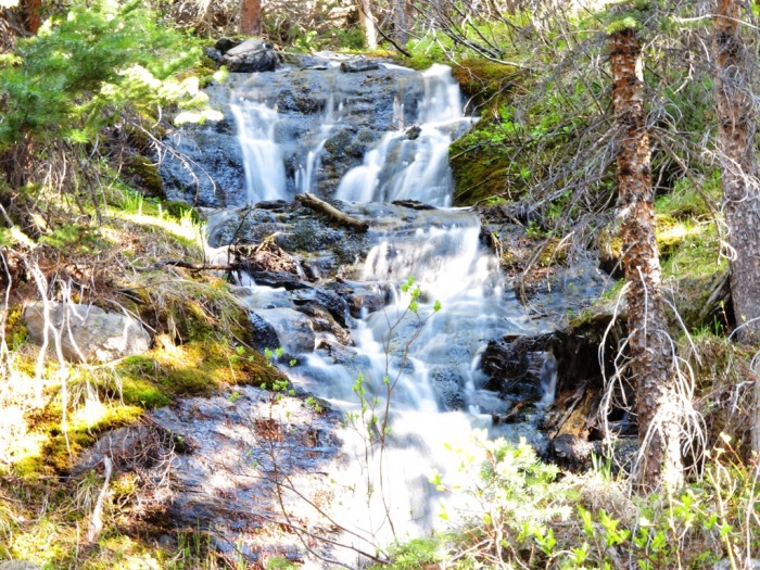
This hike is so serene with a lush forest-lined trail, creek crossings, raging rapids, waterfalls... ... rock climbs (easy enough)
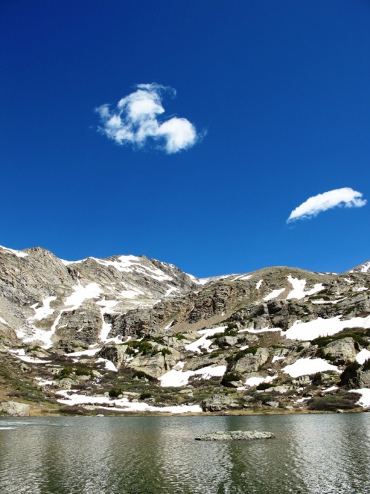
and the grand finale... one glistening lake and one frozen lake.
We also had to stop and check out the thick snow next to a stream.
Thumbnails for uploaded photos (click to open slideshow):
Nice pictures and thanks for the timely report (for me at least).
I was wondering how much area above treeline is rocky versus grassy/trail. I‘m considering bringing my brother‘s dog up this trail this weekend and she has had problems with her paws on rocky hikes (Mt. Sopris in particular).
Above treeline you will run into your typical scree for this area. Our dog does well on scree, but if it‘s an issue, you may consider the standard route as it is a more hard-packed trail from what I could see.
Would crampons be of use--if snow is still prevalent? thanks.
Caution: The information contained in this report may not be accurate and should not be the only resource used in preparation for your climb. Failure to have the necessary experience, physical conditioning, supplies or equipment can result in injury or death. 14ers.com and the author(s) of this report provide no warranties, either express or implied, that the information provided is accurate or reliable. By using the information provided, you agree to indemnify and hold harmless 14ers.com and the report author(s) with respect to any claims and demands against them, including any attorney fees and expenses. Please read the 14ers.com Safety and Disclaimer pages for more information.
Copyright: Route information, text, risk factors, maps, GPX files, charts, photos, 14ers.com-created map imagery, flythroughs, and other content provided in this route description are copyrighted by 14ers.com and may not be copied, reproduced, republished, distributed, modified, or used to create derivative works without prior written permission.
Please respect private property: 14ers.com supports the rights of private landowners to determine how and by whom their land will be used. In Colorado, it is your responsibility to determine if land is private and to obtain the appropriate permission before entering the property.