Download Agreement, Release, and Acknowledgement of Risk:
You (the person requesting this file download) fully understand mountain climbing ("Activity") involves risks and dangers of serious bodily injury, including permanent disability, paralysis, and death ("Risks") and you fully accept and assume all such risks and all responsibility for losses, costs, and damages you incur as a result of your participation in this Activity.
You acknowledge that information in the file you have chosen to download may not be accurate and may contain errors. You agree to assume all risks when using this information and agree to release and discharge 14ers.com, 14ers Inc. and the author(s) of such information (collectively, the "Released Parties").
You hereby discharge the Released Parties from all damages, actions, claims and liabilities of any nature, specifically including, but not limited to, damages, actions, claims and liabilities arising from or related to the negligence of the Released Parties. You further agree to indemnify, hold harmless and defend 14ers.com, 14ers Inc. and each of the other Released Parties from and against any loss, damage, liability and expense, including costs and attorney fees, incurred by 14ers.com, 14ers Inc. or any of the other Released Parties as a result of you using information provided on the 14ers.com or 14ers Inc. websites.
You have read this agreement, fully understand its terms and intend it to be a complete and unconditional release of all liability to the greatest extent allowed by law and agree that if any portion of this agreement is held to be invalid the balance, notwithstanding, shall continue in full force and effect.
By clicking "OK" you agree to these terms. If you DO NOT agree, click "Cancel"...
Last Friday we set off to ski the Crooked Couloir on Mt Audubon. We had already been in the area the last week of May to ski Paiute Peak. It was amazing how much snow melted from one week to another.
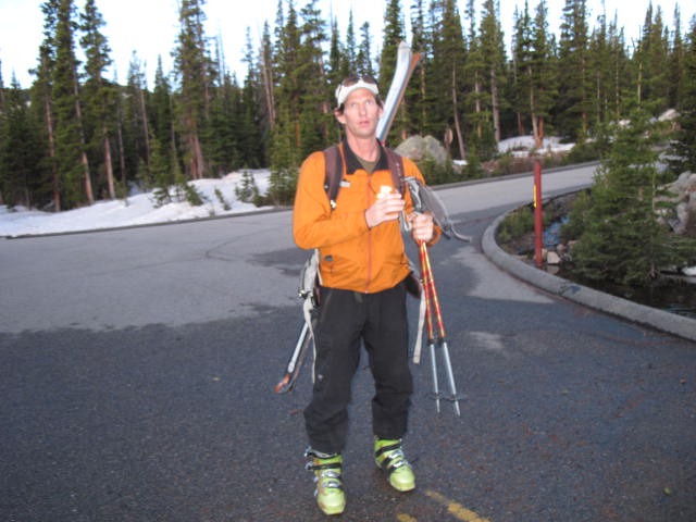
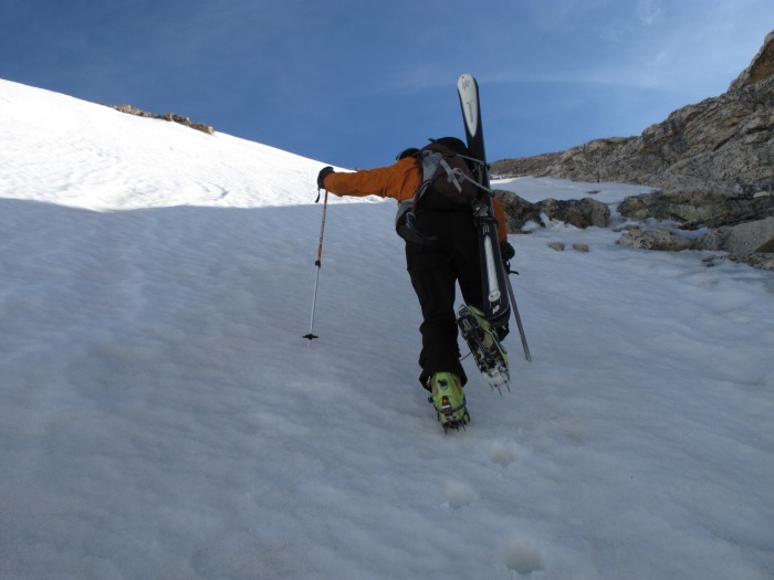
Kevin ready for action...
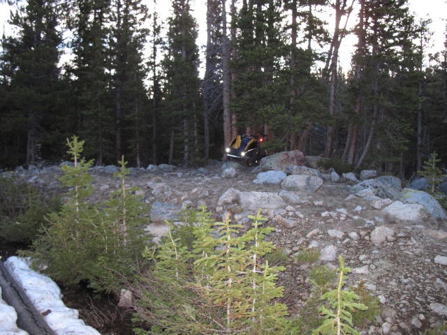
As of June 4th the gate was still closed a couple of miles east of Brainard Lake. We rode bikes to within a quarter mile or so of Mitchell Lake TH. We stashed the bikes and started walking the road.
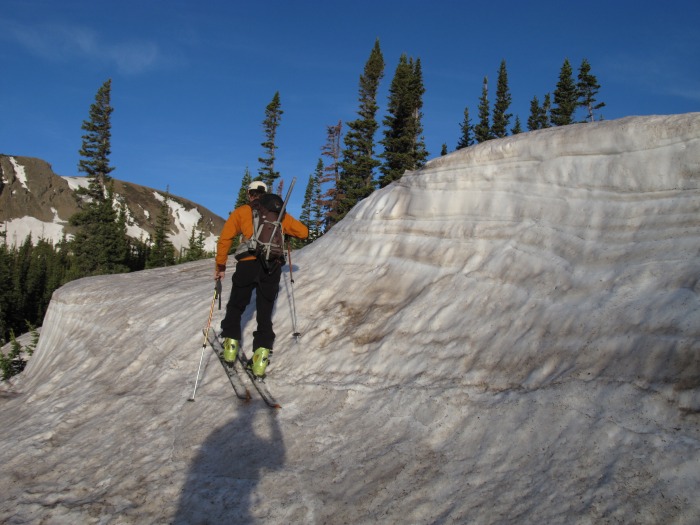
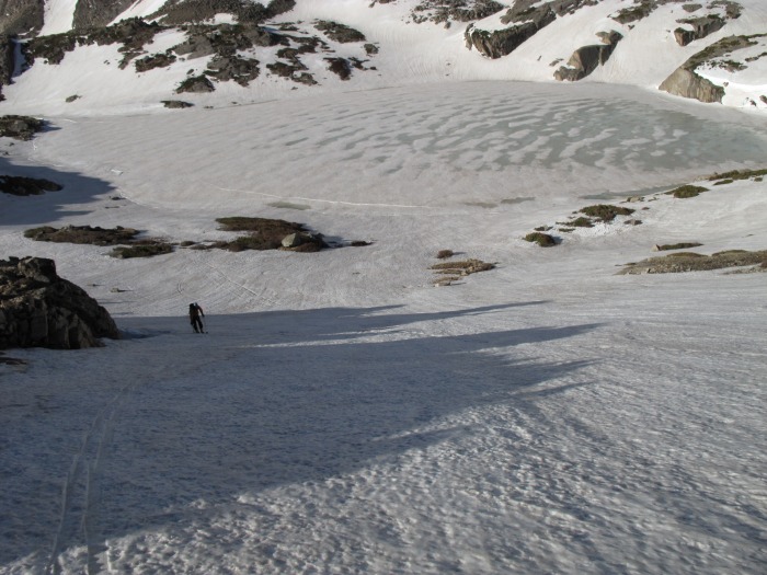
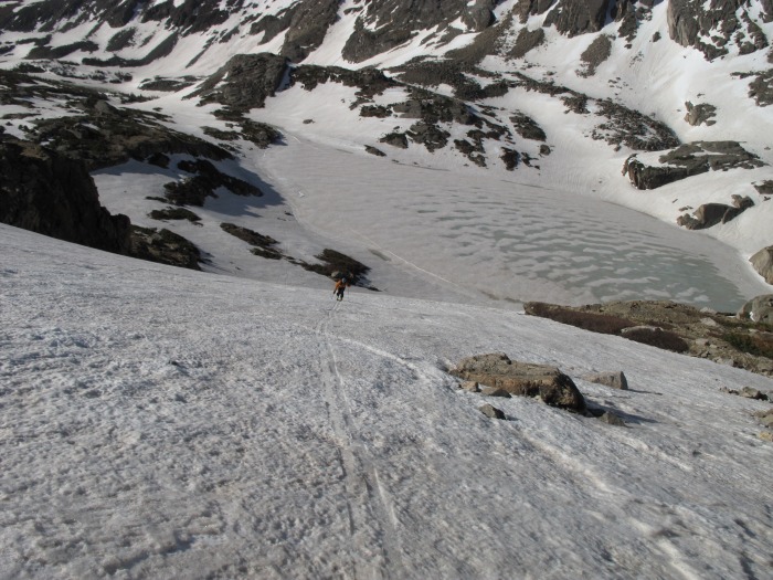
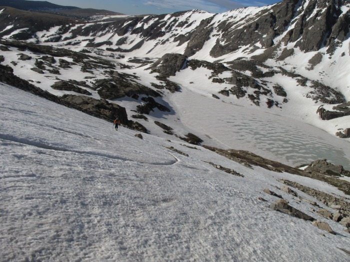
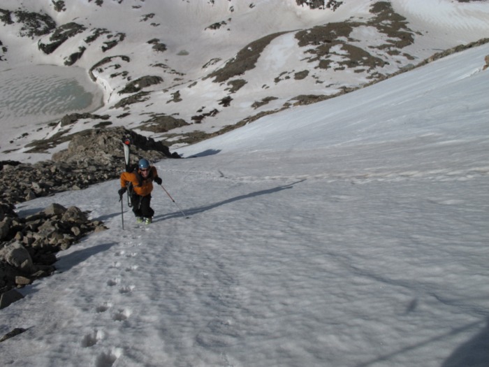
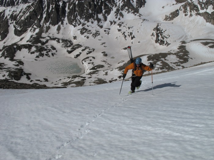
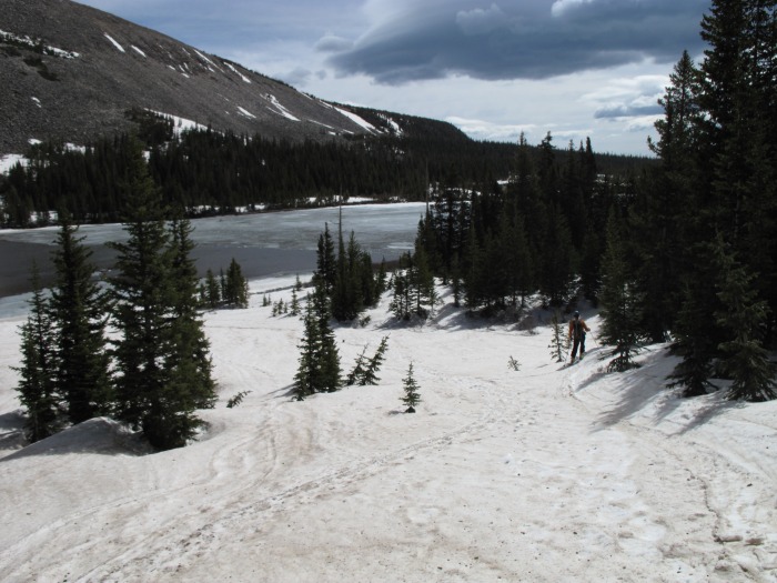
As we neared Mitchell Lake it became clear there wasn't a hard freeze the night before. We decided to press on and assess the snow conditions at the base of the couloir. Here are some shots skinning up:
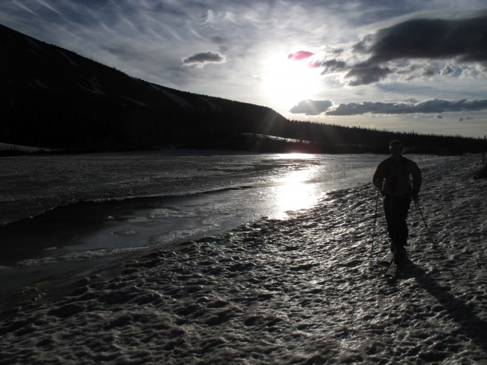
Sunrise at Mitchell Lake
We stayed along the south side of Mitchell Lake because the ice is melting fast. Nice looking couloirs on the north west side of the lake. There was a faint ski track down one of them:
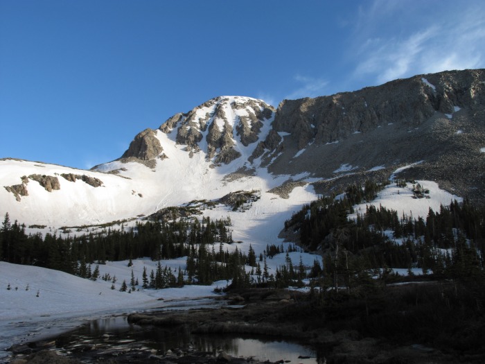
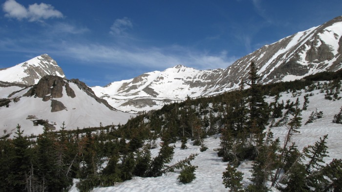
Mt Audubon's south side
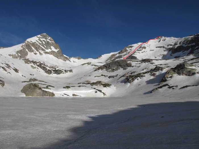
Paiute Peak. Last week's ski descent in red. I think the line is called the Curvaceous Couloir. The west face of Paiute is shear and you get great views of Granby Lake. Fun line to climb and ski.
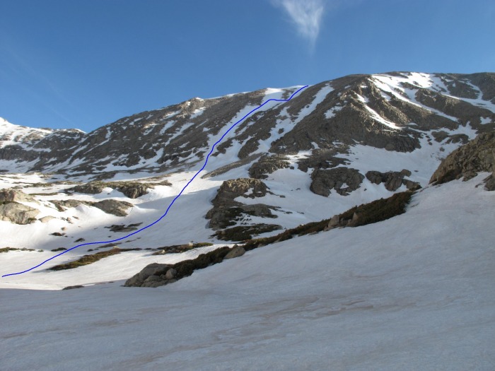
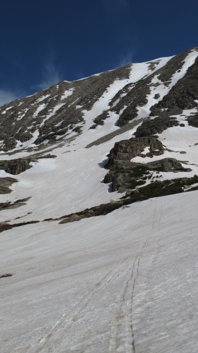
Here is our proposed climb up Crooked Couloir (in blue). Depending on conditions and how we felt, the north side of Audubon has two prominent couloirs to ski as well (Coney Couloirs). We wanted to ski one of them and then return to ski down into the Blue Lake area.
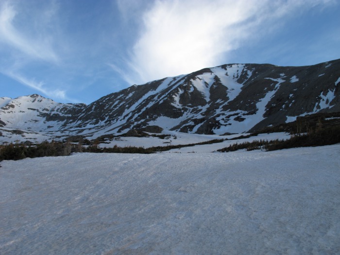
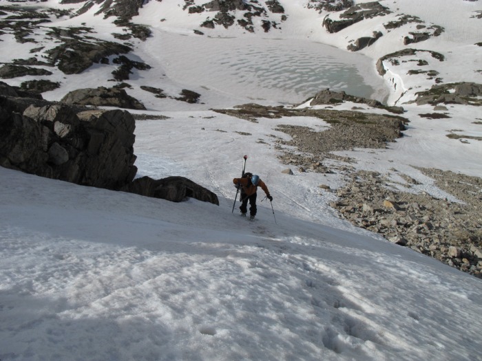
Kevin skinning up with Blue Lake behind him:
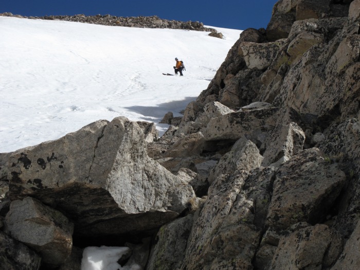
Once we were to the bottom of the couloir and started to gear up for the climb we both felt the snow was firm enough for at least a climb- and if things became dicey we would descend the scree to the right or left. We gave it a go.
Crooked Couloir is steeper than it looks from Blue Lake. Parts of it are probably in the 40 degree range. Very fun climb. We didn't posthole and stayed on the right side of the couloir almost to the top, then we cut right to gain the ridge.
Once on top of the ridge we decided that it would be really stupid to go for the north side. It was 9am and conditions were becoming soft very quickly. We felt there was still a window to ski down what we climbed, but we wanted to get moving fast. We didn't summit, shot a few pics of the surrounding areas then started moving.
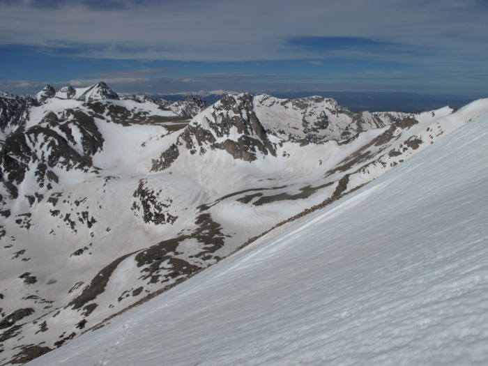
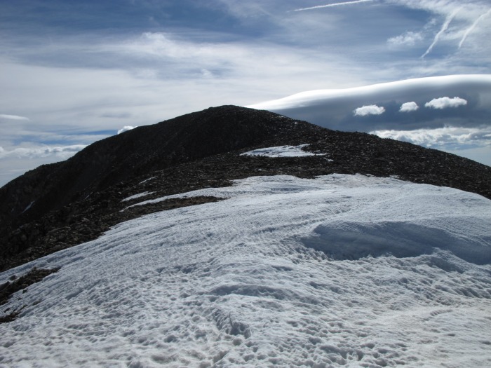
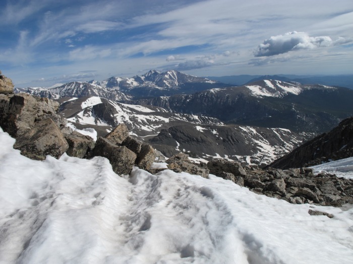
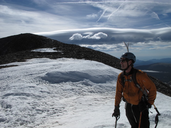
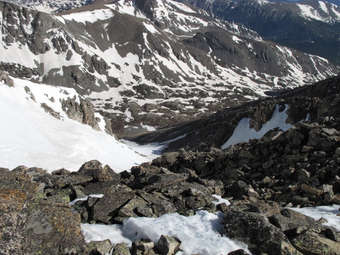
Here are the pictures from the ridge below the summit:
A look towards Toll's north east face.
Audubon's summit
Meeker and Longs
Posing with the summit
The west Coney Couloir off of the north side. Looked well filled in. Steep at the top but mellowed quickly. We will definitely be back next year to ski this one.
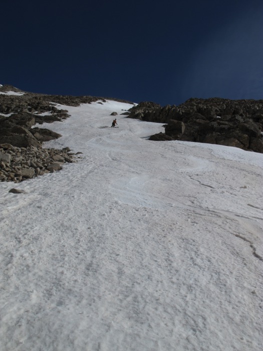
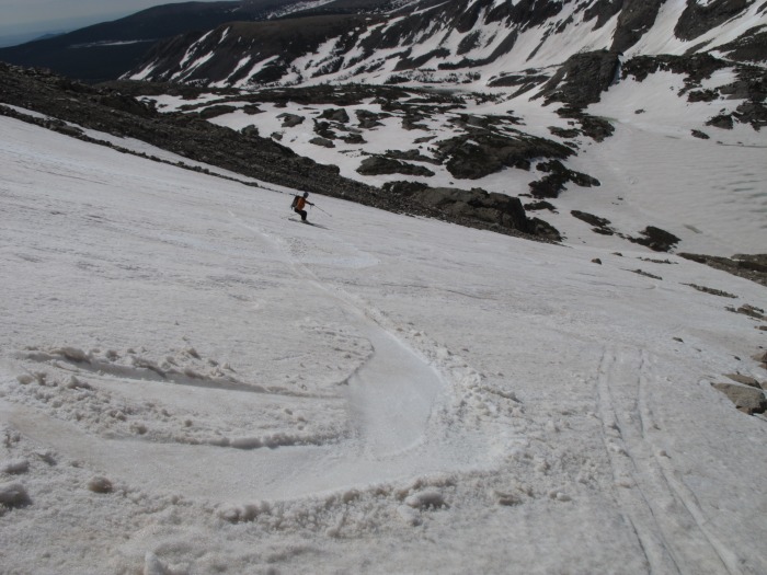
Kevin dropping in...
We managed our time well and skied the couloir with decent conditions. The bottom was softening quick since it has melted down to the dust layer. Overall it was a very fun descent bagging about 1600 vertical feet to Blue Lake.
A look back at our line from Blue Lake.
We were done by 9:30 am and it was already getting very hot. The trail out was very soft and unpredictable.
Our playground for the past two weeks! Fun area and will be back next year to ski some other lines in the area.
Thumbnails for uploaded photos (click to open slideshow):
I‘ve been wondering how the conditions are up past Brainard. I‘ve been anticipating getting back up there, Paiute Peak in particular. Thanks for the beta. Nice photos :D
Caution: The information contained in this report may not be accurate and should not be the only resource used in preparation for your climb. Failure to have the necessary experience, physical conditioning, supplies or equipment can result in injury or death. 14ers.com and the author(s) of this report provide no warranties, either express or implied, that the information provided is accurate or reliable. By using the information provided, you agree to indemnify and hold harmless 14ers.com and the report author(s) with respect to any claims and demands against them, including any attorney fees and expenses. Please read the 14ers.com Safety and Disclaimer pages for more information.
Please respect private property: 14ers.com supports the rights of private landowners to determine how and by whom their land will be used. In Colorado, it is your responsibility to determine if land is private and to obtain the appropriate permission before entering the property.


")
")
")
")
")
")
")
")
")
")
")
")
")
")
")
")
")
")
")
")
")
")
")
")
")
")
")
")
")
")


