Download Agreement, Release, and Acknowledgement of Risk:
You (the person requesting this file download) fully understand mountain climbing ("Activity") involves risks and dangers of serious bodily injury, including permanent disability, paralysis, and death ("Risks") and you fully accept and assume all such risks and all responsibility for losses, costs, and damages you incur as a result of your participation in this Activity.
You acknowledge that information in the file you have chosen to download may not be accurate and may contain errors. You agree to assume all risks when using this information and agree to release and discharge 14ers.com, 14ers Inc. and the author(s) of such information (collectively, the "Released Parties").
You hereby discharge the Released Parties from all damages, actions, claims and liabilities of any nature, specifically including, but not limited to, damages, actions, claims and liabilities arising from or related to the negligence of the Released Parties. You further agree to indemnify, hold harmless and defend 14ers.com, 14ers Inc. and each of the other Released Parties from and against any loss, damage, liability and expense, including costs and attorney fees, incurred by 14ers.com, 14ers Inc. or any of the other Released Parties as a result of you using information provided on the 14ers.com or 14ers Inc. websites.
You have read this agreement, fully understand its terms and intend it to be a complete and unconditional release of all liability to the greatest extent allowed by law and agree that if any portion of this agreement is held to be invalid the balance, notwithstanding, shall continue in full force and effect.
By clicking "OK" you agree to these terms. If you DO NOT agree, click "Cancel"...
I've gotten so much information from 14ers.com over the past few years, so I thought it was time for me to contribute a trip report from a really nice hike in the Sangres.
I had been wanting to hike Marble Mountain early in the hiking season for several years because I had heard it was very low risk for avalanches and knew that it would provide great views of the Crestones. It didn't disappoint.
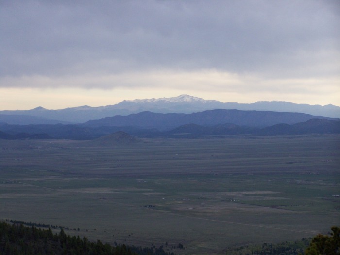
I postponed my hike 1 day because of forecasts for 70 mph wind gusts on the date I orginally planned to hike. I had great weather this day with very little wind and warm temperatures. There was no snow on S. Colony Rd. as far as the Rainbow Trail crossing. Pikes Peak
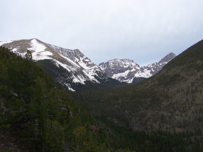
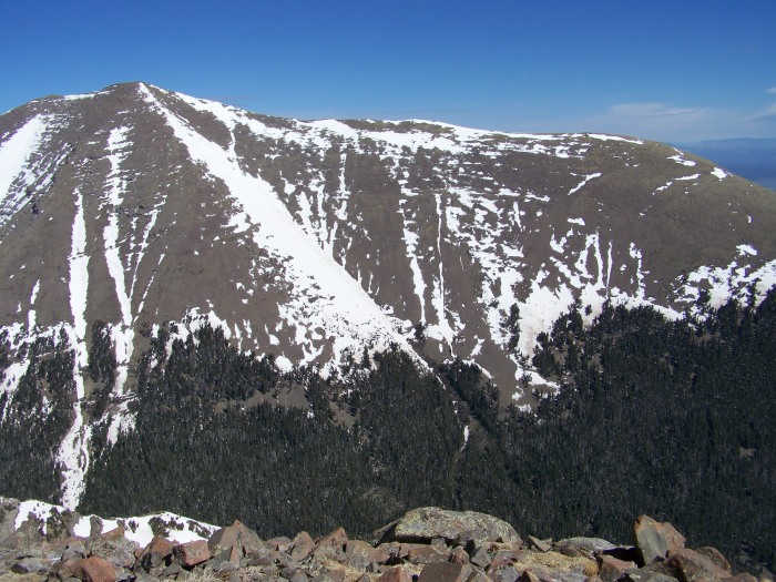
The day started with some really nice views back to the east toward Pikes Peak and the Wet Mountains. I started hiking at 6:30 a.m.The first hour and a half I was in the trees, but a few times I wandered over to the north edge of the ridge to look up into the South Colony basin. I started seeing Crestone Needle fairly early in the hike. The snow below treeline was consolidated and still firm for my ascent. Marble, Broken Hand Pk., Crestone Needle
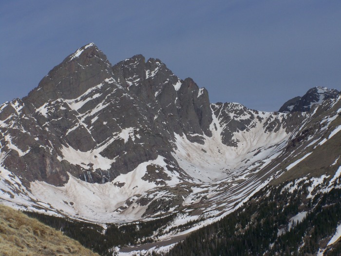
After breaking through treeline, I immediately hiked over to the north part of the ridge to get great views of the Crestones and surrounding peaks. I had these views for the rest of the ascent and stopped often to take pictures and catch my breath. I'm definitely not in mid-season shape yet. Crestones Crestones close-up
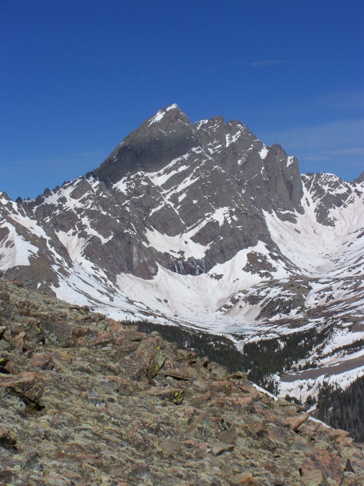
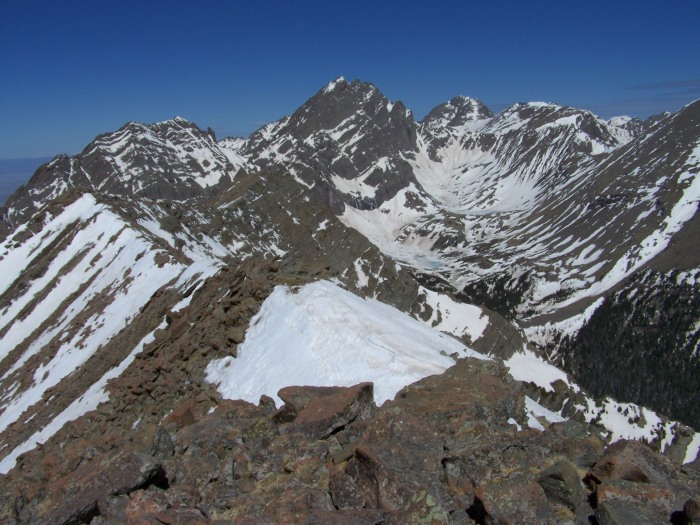
As I climbed higher, Kit Carson and Columbia Pt. (I think) came into view. Upper and Lower S. Colony lakes also became more and more visible.
S. Colony Lakes, Crestones, Kit Carson Broken Hand Pk., Crestones, Kit Carson Crestones
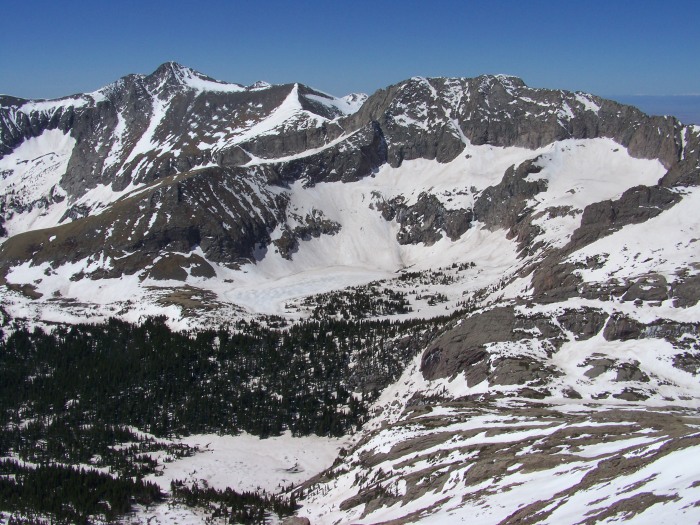
Humboldt
From my vantage point it looked like much of the east slopes route of Humboldt was dry, except some of the areas on the ridge (although I'm not sure of the exact course of that route ) summit
It took me 3 hours and 15 minutes to reach the summit. I would have liked to have continued west on the ridge that leads towards Milwaukee Peak, but the snow on it made it a little beyond my comfort level . summit looking south
I was very impressed with the basins to the south of Marble Mtn. (the Music Pass area) It took me 2 1/2 hours to get back to my car. By the time I got below tree line the snow had softened a lot. I postholed fairly often, but not enough to put on my snowshoes which remained attached to my pack all day. It was a great day in the mountains. Thanks to the 14ers.com members who helped me with information in the forum prior to this hike.
Thumbnails for uploaded photos (click to open slideshow):
Caution: The information contained in this report may not be accurate and should not be the only resource used in preparation for your climb. Failure to have the necessary experience, physical conditioning, supplies or equipment can result in injury or death. 14ers.com and the author(s) of this report provide no warranties, either express or implied, that the information provided is accurate or reliable. By using the information provided, you agree to indemnify and hold harmless 14ers.com and the report author(s) with respect to any claims and demands against them, including any attorney fees and expenses. Please read the 14ers.com Safety and Disclaimer pages for more information.
Please respect private property: 14ers.com supports the rights of private landowners to determine how and by whom their land will be used. In Colorado, it is your responsibility to determine if land is private and to obtain the appropriate permission before entering the property.