| Report Type | Full |
| Peak(s) |
Buford Mountain - 1740 Bald Knob - 1574 |
| Date Posted | 12/28/2009 |
| Date Climbed | 12/27/2009 |
| Author | stlouishiker |
| Winter Solitude on Buford Mountain |
|---|
|
Yesterday, we decided to take a hike somewhere. At first we thought we would do the 8 mile loop on the Lewis and Clark Trail. That trail is a nice hike on bluffs above the Missouri River, but we've done it before and decided to go somewhere different. After consulting one of our books, 60 Hikes Within 60 Miles of St. Louis, we choose to go to Buford Mountain. Buford is one of Missouri's six 1,700 ft. peaks. Taum Sauk, Russel, and Lead Hill are three of the six and are all easy, level walks of less than a quarter mile. Buford, Bell, and Proffit Mountain are all mountains that require some real hiking to get to. Buford is a two mile round trip hike from the trailhead, but the trail is steep by Missouri standards. It gains almost 600 feet in one mile. The true summit is a large, flat plateau and kind of boring, but Buford has a 4 mile long summit ridge that has five summits on it. We would get four of the five summits. Bald Knob is the forth summit and is the gem on Buford. There is a massive glade on the summit that has one of the best views in Missouri. We woke up early this morning and drove two hours down to the Arcadia Valley. The valley has historic little towns like Caledonia and, Buford Mountain rises 700 ft. above the valley floor to the east. Buford is one of the more prominent Missouri peaks rising up 700 ft. The trailhead for Buford is located at the southern end of Buford Mountain Conservation Area. There aren't any marked, maintained trails on Buford. There is just a rugged, old road that is full of large ankle twisting rocks and follows the spine of the mountain. Buford's highest point is the first summit and requires an elevation gain of almost 600 ft. in a mile. The route follows the old road up through the side of the peak. We drove up the gravel road and started our hike around 9:00. Throughout the woods, mossy boulders that had bright green lichen added splashes of color to the drab winter woods of Missouri. We topped out of the summit plateau half an hour after leaving the trailhead. We hiked on the level top of the peak for five minutes before we reached a trail junction. The left fork led 100 yards down to a nice glade. The glade was one of the biggest ones I've seen in Missouri. The glade had lots of exposed rock and grasses grew in between the rocks. After the glade, the trail made a half mile descent to a saddle. At the saddle, there was a stock pond that was frozen over. We threw a couple of rocks on the ice, but the ice was only 1/8 of an inch thick. After the pond, the road climbed up through two great glades to the second summit. The trail descended to another saddle with a stock pond before climbing to the small third summit at two miles. The third summit is the only one that doesn't have a glade. From the third summit, we continued on the ridge of the mountain towards Bald Knob. In a mile, the trail went to a saddle and climbed up to the fourth summit. Bald Knob is a knob on the ridge of Buford and it has a giant glade on the summit. The glade has amazing views down into Arcadia Valley and has lots of rocky outcroppings. The wind, which wasn't bad on the saddles, really picked up on the treeless expanse of Bald Knob. The air temperature was in the upper twenties with wind blowing at a steady 30 mph. That weather made the wind chill a chilly 8 degrees. Since the wind was so cold, we spent about five minutes at the glade before starting the hike out. The road went up and down over the three peaks before going down to the trailhead. The road down from the summit was steep and loose. The leaves that fell off the trees gave us better views, but covered rocks so you tripped on them. Three hours and eleven minutes after we left the car, we got back to the car. Our out and back hike to Bald Knob was six miles with a total of about 1,100 feet of elevation gain. 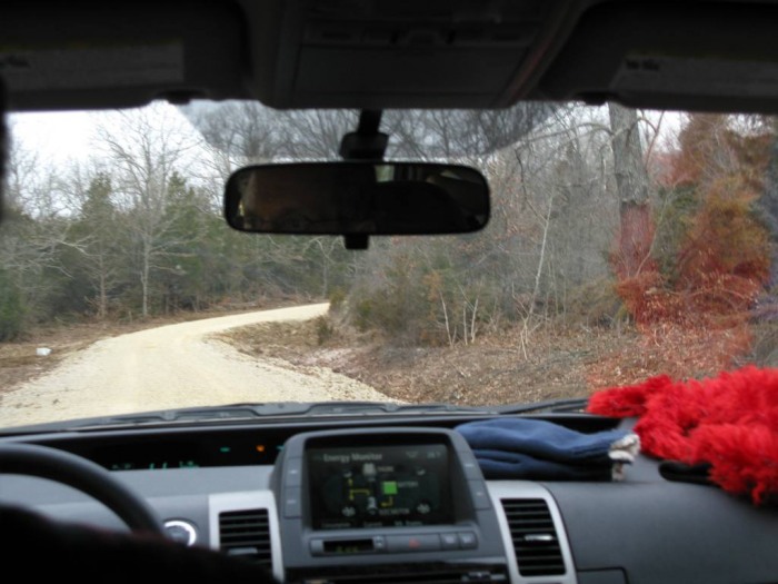 Driving up to the trailhead  The parking area   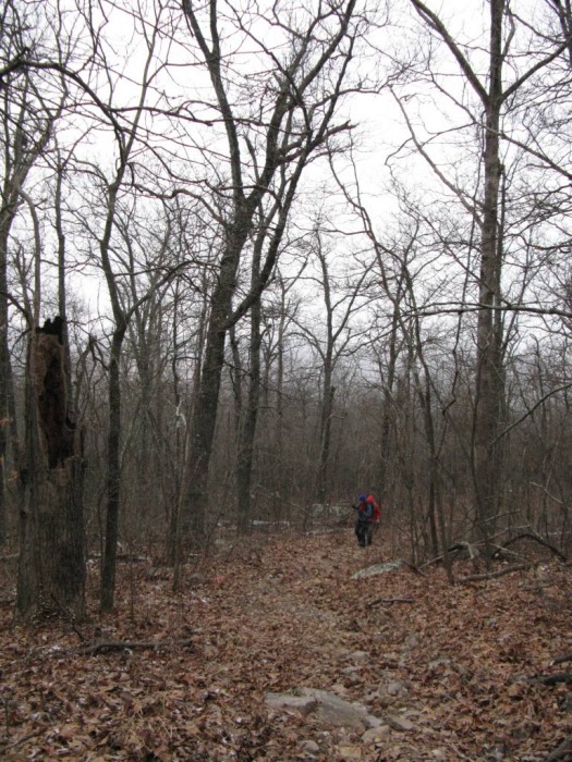  Heading up the old road to the summit  Summit Plateau  Summit Plateau  The glade at the first summit 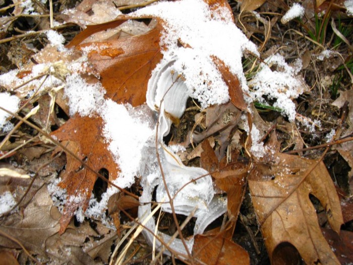 A frost flower. Frost flowers occur where water leaking out of a plant freezes into a delicate ribbon of ice. 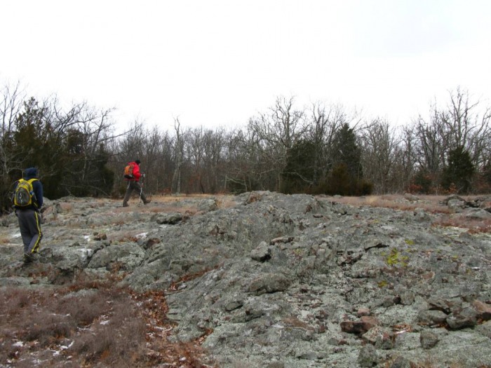 The glade on the second summit  Nate checking out the route to Bald Knob from a tree.   Entering the glade at Bald Knob  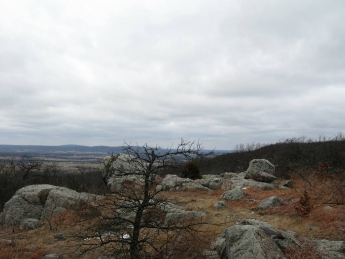 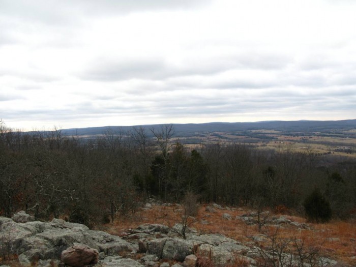   Bald Knob views 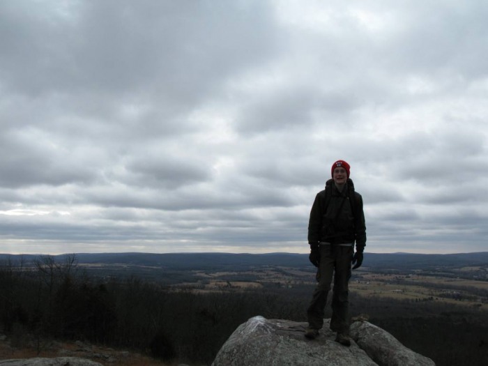 Summit picture 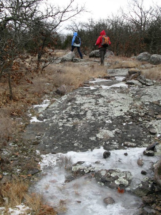 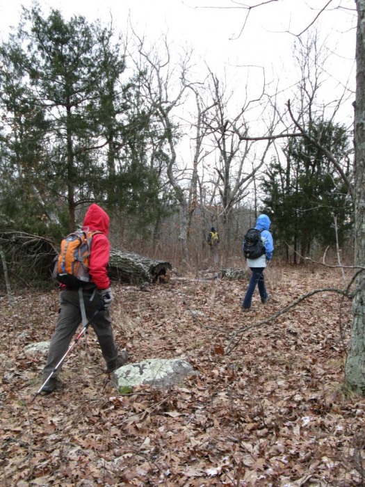 Hiking out  One of the stock ponds 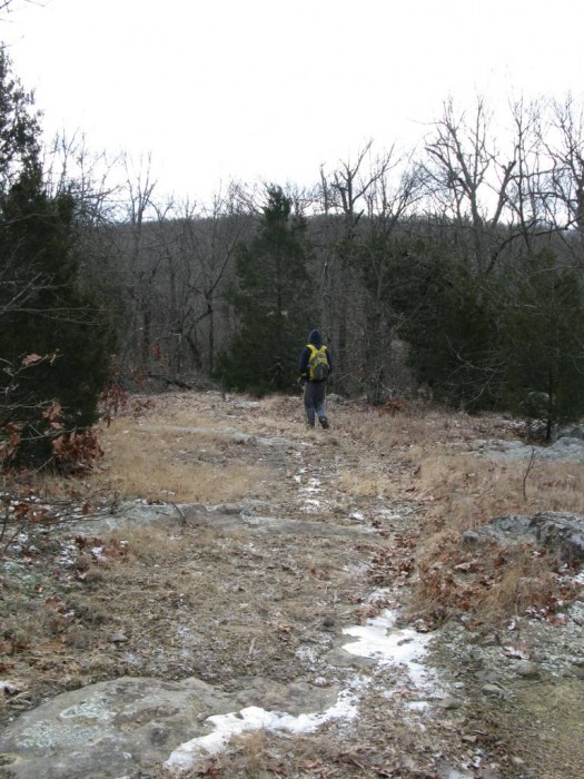 The glade on the second summit  Storm damage from the May 8 storm on the trail  Hiking out over the first summit  Descending the road Thumbnails for uploaded photos (click to open slideshow): ")
")
")
")
")
")
")
")
")
")
")
")
")
")
")
")
")
")
")
")
")
")
")
")
")
")
")
|
| Comments or Questions |
|---|
|
|
Caution: The information contained in this report may not be accurate and should not be the only resource used in preparation for your climb. Failure to have the necessary experience, physical conditioning, supplies or equipment can result in injury or death. 14ers.com and the author(s) of this report provide no warranties, either express or implied, that the information provided is accurate or reliable. By using the information provided, you agree to indemnify and hold harmless 14ers.com and the report author(s) with respect to any claims and demands against them, including any attorney fees and expenses. Please read the 14ers.com Safety and Disclaimer pages for more information.
Please respect private property: 14ers.com supports the rights of private landowners to determine how and by whom their land will be used. In Colorado, it is your responsibility to determine if land is private and to obtain the appropriate permission before entering the property.

