Download Agreement, Release, and Acknowledgement of Risk:
You (the person requesting this file download) fully understand mountain climbing ("Activity") involves risks and dangers of serious bodily injury, including permanent disability, paralysis, and death ("Risks") and you fully accept and assume all such risks and all responsibility for losses, costs, and damages you incur as a result of your participation in this Activity.
You acknowledge that information in the file you have chosen to download may not be accurate and may contain errors. You agree to assume all risks when using this information and agree to release and discharge 14ers.com, 14ers Inc. and the author(s) of such information (collectively, the "Released Parties").
You hereby discharge the Released Parties from all damages, actions, claims and liabilities of any nature, specifically including, but not limited to, damages, actions, claims and liabilities arising from or related to the negligence of the Released Parties. You further agree to indemnify, hold harmless and defend 14ers.com, 14ers Inc. and each of the other Released Parties from and against any loss, damage, liability and expense, including costs and attorney fees, incurred by 14ers.com, 14ers Inc. or any of the other Released Parties as a result of you using information provided on the 14ers.com or 14ers Inc. websites.
You have read this agreement, fully understand its terms and intend it to be a complete and unconditional release of all liability to the greatest extent allowed by law and agree that if any portion of this agreement is held to be invalid the balance, notwithstanding, shall continue in full force and effect.
By clicking "OK" you agree to these terms. If you DO NOT agree, click "Cancel"...
Report Type
Full
Peak(s)
Twin Peaks East - 11032
Cathedral Mesa - 7183
Mt. Tukuhnikivatz - 12482
2009's been an atypical year for me"no peaks higher than some Centennials, no trip reports filed here, and less than 1/2 my summits located in CO. However, the recent TRs from southern Utah by Kiefer/Mike, Furthermore, and others spurred me to share my last trip to the Beehive state. Life in the Four Corners provides easy access to the Moab area; it's less than two hours away from my workplace. Once summer heat subsides and snow starts falling on higher peaks in Colorado, Utah looks awfully good to me.
So... I'd been injured for six weeks and was jonesing for a summit and some scenery. Having only the weekend, I decided to visit the Abajo Mountains, which tower over the Needles District, take a detour to search for the Canyonlands NP highpoint on Cathedral Mesa, and take a stroll up Mt. Tukuhnikivatz (Tuk) across the valley in the La Sals.
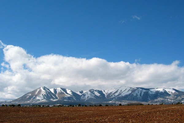
When heading northwest from the rez, the Abajos loom ahead, rising well above the desert to 11,000ft plus.
(photo from wikipedia)
While they have a distinct character once you get into the range itself, their rounded summits usually take a backseat to the higher and more sharply defined La Sals. In general, I like exploring mountains, regardless of summit elevations, especially those that see little hiker traffic"like the Abajos.
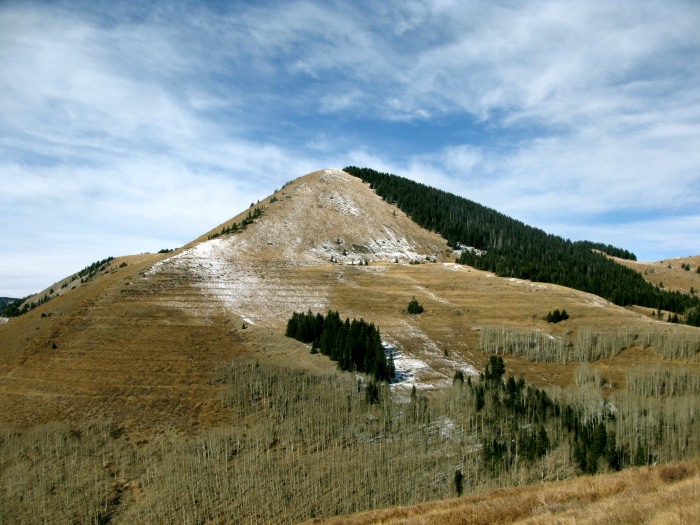
I'd set my sights on two 11ers that have >1000ft of prominence: West Mountain and Twin Peaks East. Both are short strolls, hardly qualifying as hikes, but the views and chance to spend time in a range that resembles nothing I've seen in Colorado seem worthwhile. Since it was hunting season, I borrowed a bright orange vest (think roadside prison crew) from my neighbor and hit the road. The year's first significant snowfall days before had left most north-facing slopes covered in various depths of snow. The road that accesses West Mountain was closed, so I headed to Twin Peaks East. After parking my truck, I was at the summit 1100ft of vertical and less than an hour later.
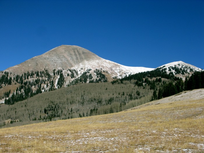
Along the way, I looked across at the La Sals.
Looking over unranked Twin Peaks West at the Henry Mountains
A look back at Twin Peaks East
After returning to Monticello for some grub, I picked up a hitchhiking hippie kid (way out of place in a predominantly LDS town) loaded down with groceries, dropped him off at his campsite, then took the scenic route over to UT 211, the road into the Needles District.
View of Canyonlands from the Abajo Loop scenic byway http://www.go-utah.com/Abajo-Loop/
One last note on the Abajos... If you use google to check the road access, the map truly is not the territory. At the time I post this, google maps (and its proxy on LoJ) omit the road used to get up there. The Delorme and Benchmark maps, however, can show you the way.
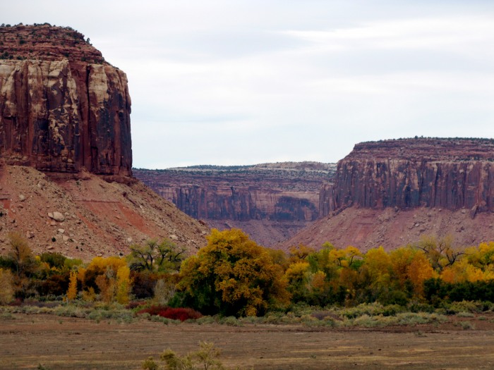
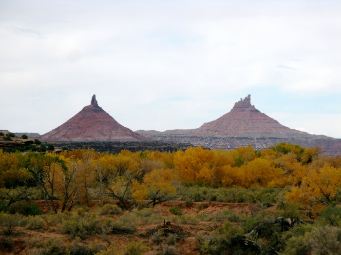
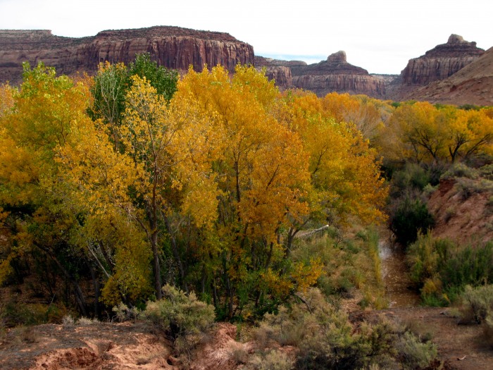
Getting to Cathedral Mesa requires a long drive on the unpaved Beef Basin road, which is passable by most cars. I'd been hoping to find a last vestige of fall color down low in the desert. I was not disappointed.
The highpoint itself lies on the edge of Cathedral Mesa, which barely overlaps the boundary of the park, and is pretty nondescript. It's a bugger to find, though, as wandering through trees and brush on a mostly flat surface gets old after a while.
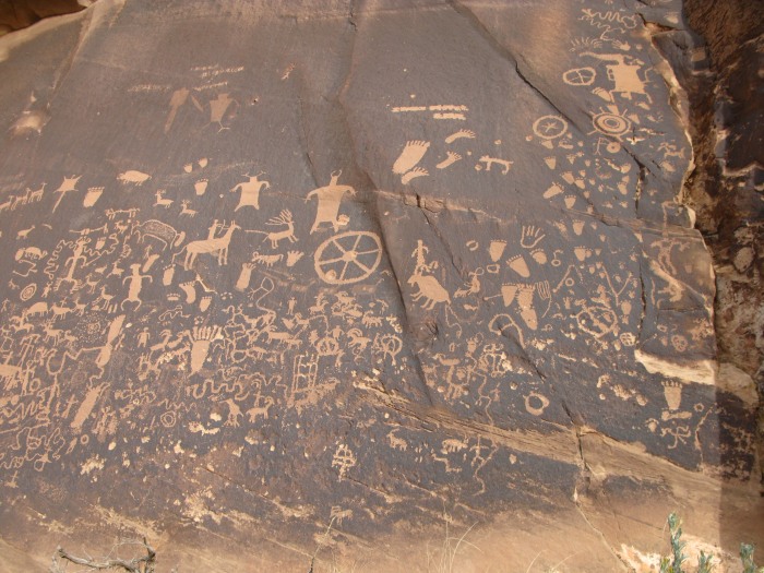
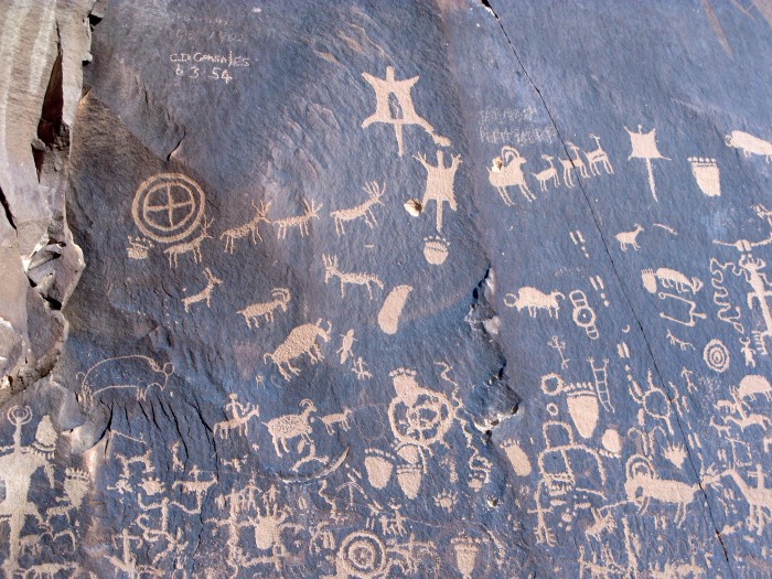
On the way out, I stopped to look at Newspaper Rock, a panel of petroglyphs dating back at least 2,000 years, with "updates" from Utes, Navajos (who call it Tse Hane, "the rock that tells a story"), and plain old white folks who scrawled their names into the panel.
That night featured whiteout conditions up high in the La Sals, forcing me to surrender in my attempt to access La Sal Pass via the 4wd road that leaves Moab. At about 9000ft, snow was sticking on the road, and zero visibility makes narrow, rocky roads more than I want to risk. I camped lower down and took the La Sal Pass road the next morning.
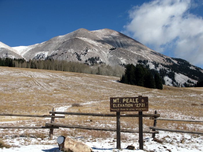
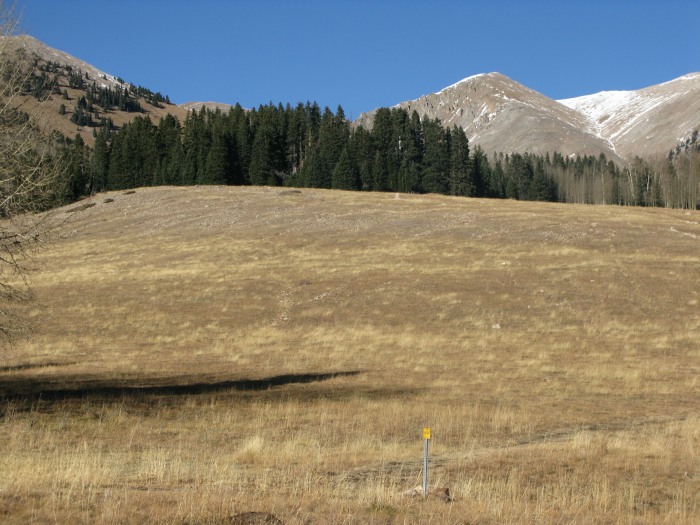
The hike for Tuk or nearby 12ers Mts. Peale & Mellenthin, begins here
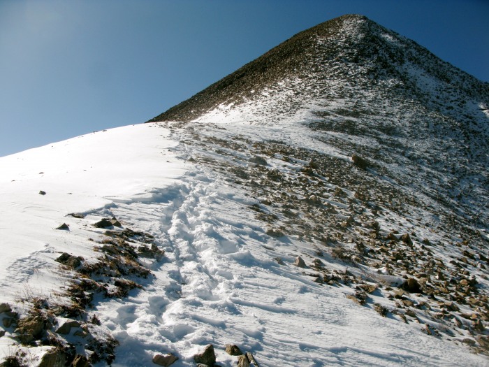
Towering Tuk stands to your left
I donned the prisoner garb once again and headed out. An old road leads through the forest to a grassy slope, and can be picked up just next to the downed tree partially seen in this shot:
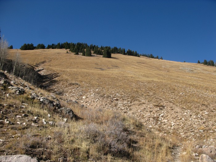
As you reach the grassy slope, Mt. Peale dominates the view to your right
Here (~10,600ft), leave the road and go NW and upward to the ridgeline at about 11,150ft.
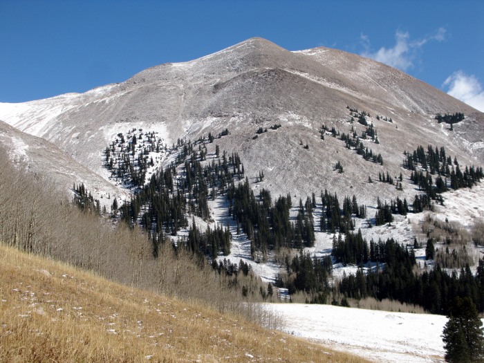
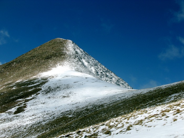
Once you reach the crest, start chugging up to meet the summit ridge at about 11,900ft. Tuk comes in to view along the way:
Once on the ridge, the route is obvious, if it wasn't already. Despite abundant sunshine, the temperature was in the 20s and the wind was chilling. Having thought of Kiefer and his "sock mittens" on this peak, I was glad to have my ski gloves. The class 2+ talus was more stable than expected, thanks to the snow, which kept rocks from sliding and provided surprising traction.
View from the summit, 8,000ft above Moab:
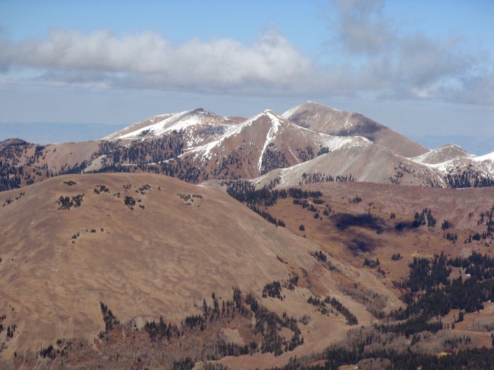
La Sal 12ers to the north
The cold was getting to me, pizza at the Dolores River Brewery was calling my name, and I was back to my car in no time... http://www.doloresriverbrewery.com
Looking upward from the saddle
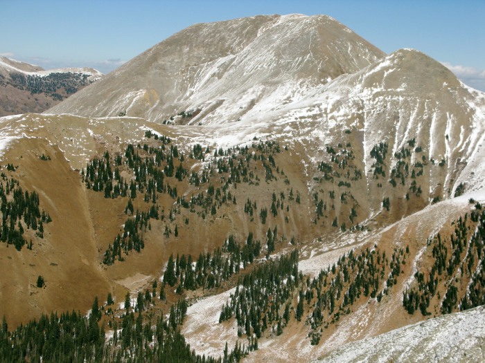
Mt. Peale across the way
This is hardly a chronicle of some big adventure, but it was a great way to spend the weekend, get back in the mountains, and enjoy some things in southern Utah that usually don't find their way onto most vacation itineraries.
Thumbnails for uploaded photos (click to open slideshow):
good to see you posting here again. One of these days, I‘ll finally make it to the La Sal‘s, hopefully with good spring corn :D Your pics of the peaks there remind me a lot of the Latirs in the NM Sangres. Let‘s hit some powder soon at Wolf Creek!
Great trip! Thanks for showing us some ”new stuff” to do. The national park highpoints are - by default - in some interesting, beautiful places. And if this - wandering around Utah, picking off various peaks and highpoints - doesn‘t qualify as an ”adventure,” I don‘t know what does!
nice circumnavigation of the La Sals, looks like a cool range. Drive into Canyonlands is quite an event, never gets old, neither does a view of it from 12,000 ft.
Nice trip out, Matt! Good call on the vest too. A hunter let me borrow one of his a few weeks back up in the Flattops.
The Abajo Mtns need to be checked out. Pictures look awesome.
Presto, when you make it down here for Hesperus, the DRB will make your day.
Scott, Wolfie got 20” of snow last night. Too bad I‘m working today... I hope you made it up. Let‘s make some turns before your priorities shift next month.
Gene, thanks for the kind words.
Centrifuge, thanks for the positive spin.
Susan, I forgot to mention... Large Marge sent me!!!
Caution: The information contained in this report may not be accurate and should not be the only resource used in preparation for your climb. Failure to have the necessary experience, physical conditioning, supplies or equipment can result in injury or death. 14ers.com and the author(s) of this report provide no warranties, either express or implied, that the information provided is accurate or reliable. By using the information provided, you agree to indemnify and hold harmless 14ers.com and the report author(s) with respect to any claims and demands against them, including any attorney fees and expenses. Please read the 14ers.com Safety and Disclaimer pages for more information.
Please respect private property: 14ers.com supports the rights of private landowners to determine how and by whom their land will be used. In Colorado, it is your responsibility to determine if land is private and to obtain the appropriate permission before entering the property.