Download Agreement, Release, and Acknowledgement of Risk:
You (the person requesting this file download) fully understand mountain climbing ("Activity") involves risks and dangers of serious bodily injury, including permanent disability, paralysis, and death ("Risks") and you fully accept and assume all such risks and all responsibility for losses, costs, and damages you incur as a result of your participation in this Activity.
You acknowledge that information in the file you have chosen to download may not be accurate and may contain errors. You agree to assume all risks when using this information and agree to release and discharge 14ers.com, 14ers Inc. and the author(s) of such information (collectively, the "Released Parties").
You hereby discharge the Released Parties from all damages, actions, claims and liabilities of any nature, specifically including, but not limited to, damages, actions, claims and liabilities arising from or related to the negligence of the Released Parties. You further agree to indemnify, hold harmless and defend 14ers.com, 14ers Inc. and each of the other Released Parties from and against any loss, damage, liability and expense, including costs and attorney fees, incurred by 14ers.com, 14ers Inc. or any of the other Released Parties as a result of you using information provided on the 14ers.com or 14ers Inc. websites.
You have read this agreement, fully understand its terms and intend it to be a complete and unconditional release of all liability to the greatest extent allowed by law and agree that if any portion of this agreement is held to be invalid the balance, notwithstanding, shall continue in full force and effect.
By clicking "OK" you agree to these terms. If you DO NOT agree, click "Cancel"...
Handies snow and solitude - East Slopes from Grizzly Gulch
Handies Peak:14048 - East Slopes from Grizzly Gulch - Nov 06, 2009 - unclegar
I had some unfinished business from 2 weeks ago when I climbed Redcloud and Sunshine on a Thursday and slept (translate froze) in my car at the Grizzly Gulch/Silver Creek TH, then rode up to the American Basin TH with hobo13 and jf32. I then went about ½ way up the standard route to Handies only to have my toes stay so cold that I could no longer feel them and could not seem to get them to revive to the land of the living. I made the tough decision to stop. It took literally ½ hour per foot to get the feeling back in my toes and then make the disappointing descent to the waiting Jeep. I was only there about an hour when the others arrived victoriously. It was a tough decision but clearly the correct one.
This time I approached Handies from Grizzly Gulch because (A) I couldn't get my vehicle up to the American Basin TH and (B) my preference was to climb from Grizzly Gulch anyway. I started the trip from the TH at about 10am after driving from Bailey that morning. I was armed with hand warmers, foot warmers and warming patches this time. They were all intended for my shoes if needed.
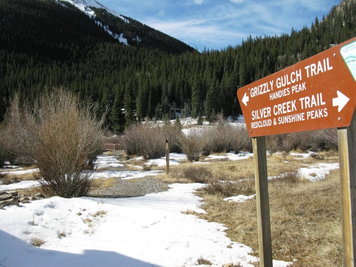
The trailhead sign and beginning of the trail. (Bridge in the background)
The trail to Handies starts next to the restrooms at the parking area. I had not even gone 100 feet before I decided to stop and put on my Kahtoola microspikes.
I saw that nobody had signed in at the register for about a week. There was snow on the trail immediately but there were still footprints to follow. I was able to load the gps track into my gps before I came. This was a first as I usually only used the gps for tracking of my route.
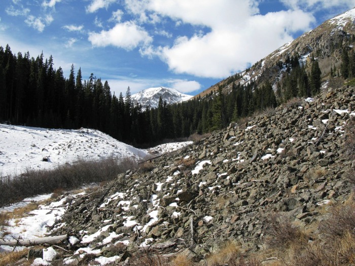
More nice scenery to look at. To the left of the trail.
To the right.
Redcloud/Sundog.
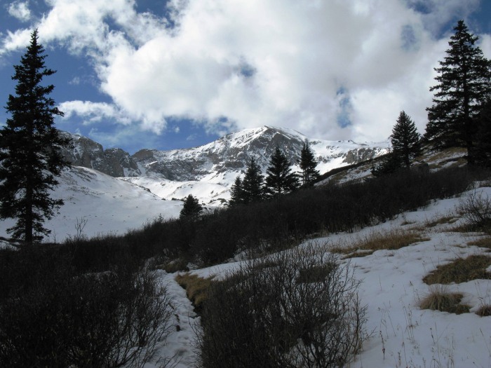
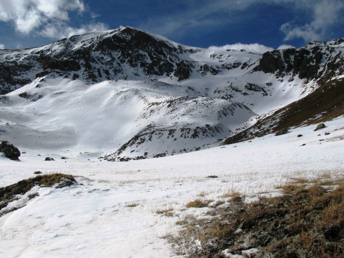
This was to the left of Handies while ascending the trail. It was a beautiful sunny day.
More snow on the trail.
The snow was becoming deeper. At this point I put hand warmers in my shoes on the top of my toes.
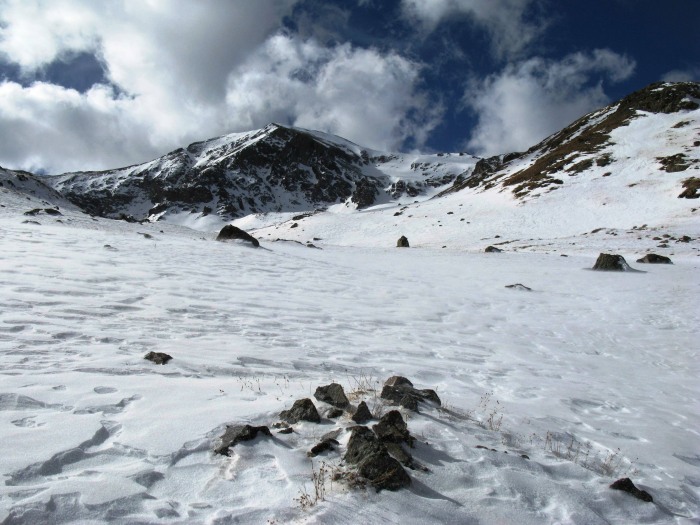
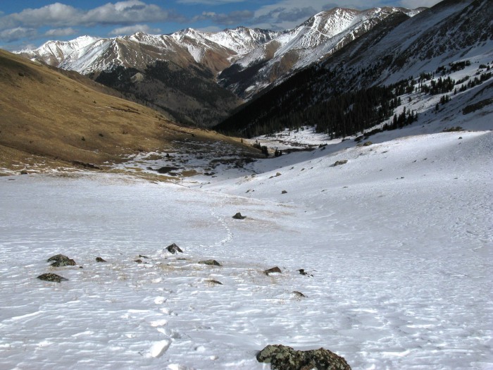
Approaching the basin. There was a lot of snow from this point on.
Looking back.
The trail went around this pole and then back to the right away from Handies.
The snow becoming deeper still.
Looking back at the snow. Redcloud/Sunshine in the background.
The snow was becoming even deeper toward the saddle. Postholing up to the knees in places.
Looking back at my tracks. Having the route preloaded in my gps was a definite advantage since there were no tracks to follow once I hit the basin.
Toward the top of the saddle I was post-holing up to my waist. The clouds and wind were both increasing.
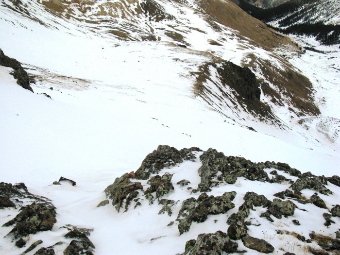
Looking back again as I approached the saddle. I was able to get on some of the rocks for some relief from the snow.
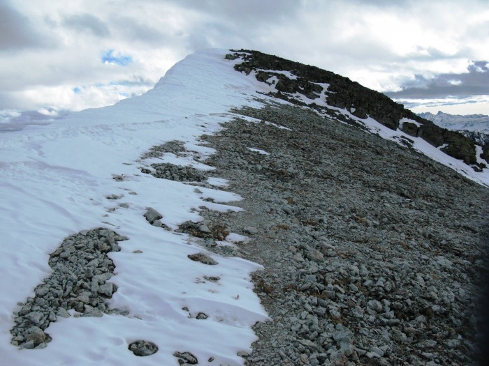
On the saddle looking at the steep trail up the false summit.
The summit in the distance.
Almost there. It was very windy on the ridge.
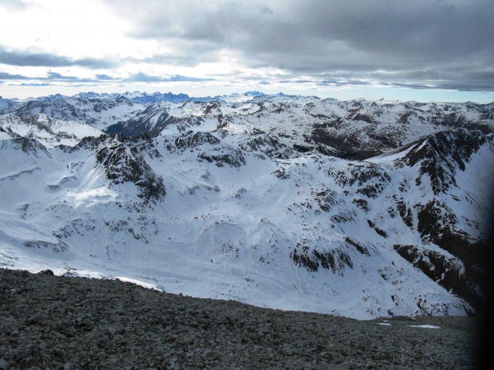
View from the summit. The wind was brutal so I didn't hang out.
Uncompahgre and Wetterhorn.
The register is still there on this one. Beer can on the end.
I packed up the camera,etc for glissading down. When I reached the ridge again and looked down the back, there were rock formations and snow that would have made a beautiful picture but I was all packed up for the glissade and just too cold to pull off the pack and dig through it. Oh well...
Snow on the trail on the way back.
Redcloud looking red in the evening light.
The last part of the hike was in the dark. It took 5 hours to summit and 2-1/2 to return. Another beautiful day in the San Juans!
Thumbnails for uploaded photos (click to open slideshow):
Looks like a great day to be in the San Juans. I loved this hike and the awe inspiring views of Handies from Grizzly Gulch. We descended through American Basin and hiked the road around Whitecross when we did this one last year and it is one of my favorites.
Thanks for all the nice comments! Definitely a beautiful area both times I was there. Come on back to CO Barry, and Paul you know you‘ve already done this one. :wink:
Great day in the San Juans thanks for the invite! :cry:
Caution: The information contained in this report may not be accurate and should not be the only resource used in preparation for your climb. Failure to have the necessary experience, physical conditioning, supplies or equipment can result in injury or death. 14ers.com and the author(s) of this report provide no warranties, either express or implied, that the information provided is accurate or reliable. By using the information provided, you agree to indemnify and hold harmless 14ers.com and the report author(s) with respect to any claims and demands against them, including any attorney fees and expenses. Please read the 14ers.com Safety and Disclaimer pages for more information.
Please respect private property: 14ers.com supports the rights of private landowners to determine how and by whom their land will be used. In Colorado, it is your responsibility to determine if land is private and to obtain the appropriate permission before entering the property.


")
")
")
")
")
")
")
")
")
")
")
")
")
")
")
")
")
")
")
")
")
")
")
")
")
")
")
")
")
")


