Download Agreement, Release, and Acknowledgement of Risk:
You (the person requesting this file download) fully understand mountain climbing ("Activity") involves risks and dangers of serious bodily injury, including permanent disability, paralysis, and death ("Risks") and you fully accept and assume all such risks and all responsibility for losses, costs, and damages you incur as a result of your participation in this Activity.
You acknowledge that information in the file you have chosen to download may not be accurate and may contain errors. You agree to assume all risks when using this information and agree to release and discharge 14ers.com, 14ers Inc. and the author(s) of such information (collectively, the "Released Parties").
You hereby discharge the Released Parties from all damages, actions, claims and liabilities of any nature, specifically including, but not limited to, damages, actions, claims and liabilities arising from or related to the negligence of the Released Parties. You further agree to indemnify, hold harmless and defend 14ers.com, 14ers Inc. and each of the other Released Parties from and against any loss, damage, liability and expense, including costs and attorney fees, incurred by 14ers.com, 14ers Inc. or any of the other Released Parties as a result of you using information provided on the 14ers.com or 14ers Inc. websites.
You have read this agreement, fully understand its terms and intend it to be a complete and unconditional release of all liability to the greatest extent allowed by law and agree that if any portion of this agreement is held to be invalid the balance, notwithstanding, shall continue in full force and effect.
By clicking "OK" you agree to these terms. If you DO NOT agree, click "Cancel"...
The north ridge route to Huron is a good alternative to the standard route. It throws in some tundra hiking and a bit of scrambling on the gentle ridge. Haters of road-hiking may be put off by the amount of off-road, but I appreciated the quiet of the route (the road on the ascent doesn't seem to get much/any traffic).
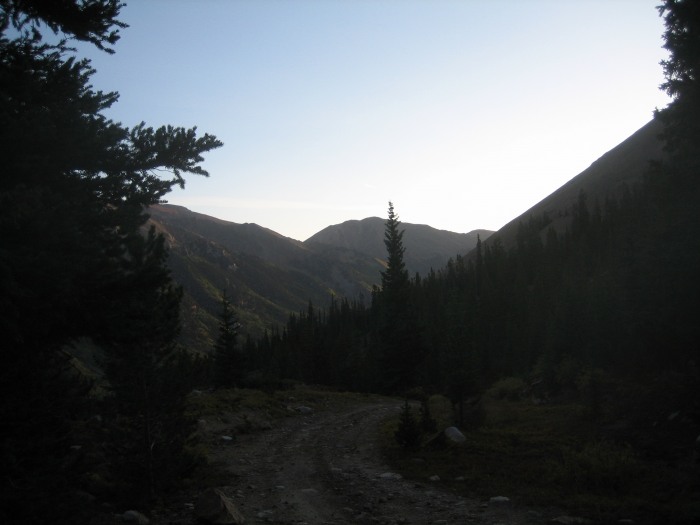
I parked off the 390 road at the turnoff about 3/4-mile up on the left, across from a direction sign. Perfect timing - I wasn't sure how much farther my 2WD pickup could get up the road (and I was a little embarrassed when I subsequently saw a minivan coming down the road).
The route can't get much more obvious at this point - the road zig-zags up Lulu Gulch beside a creek. The main road continues left past a side road at 11400', and crosses the creek at about 11700'.
Looking off toward Hope Mountain.
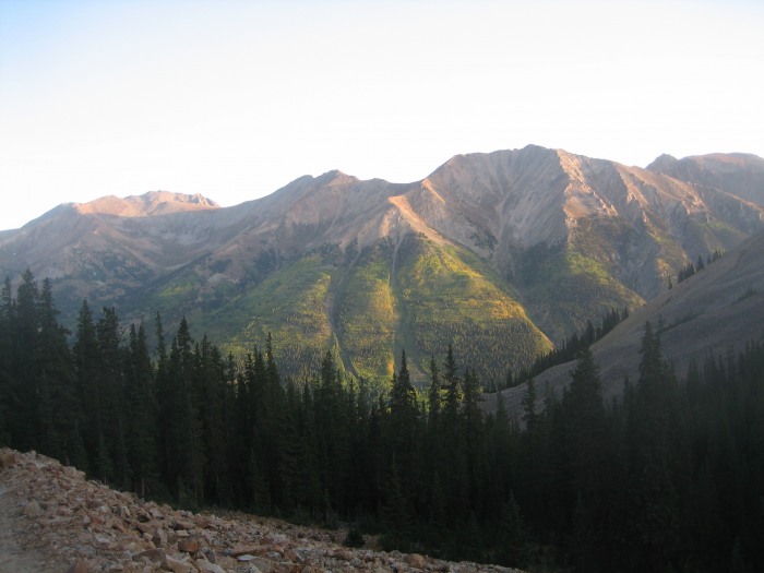
Nice view back across Clear Creek Canyon to La Plata Peak. Looks like fall is here!
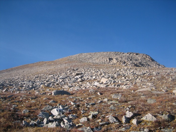
At about 11900', where the road takes a hard turn to the north, I headed SE across talus. (The road continues switchbacking up to a subpeak of Middle Mountain.) Brown's Peak is directly ahead at this point. Most of the slope up to the ridge is sloppy rock, but there's a nice patch of tundra that avoids most of that and leads to the saddle north of the summit.
The ridge up to the summit of Brown's is an easy tundra/talus mix.
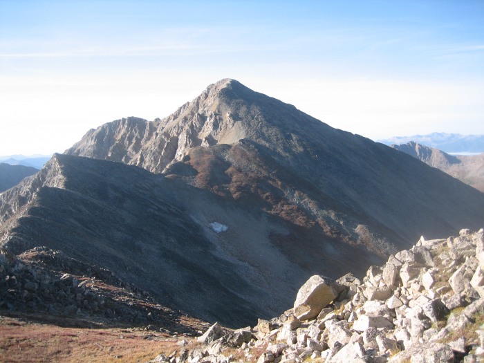
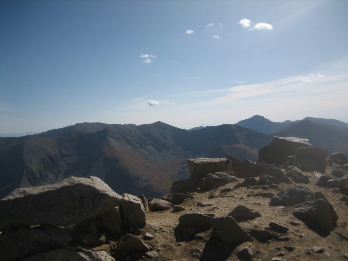
Summit view of Huron and the ridge leading to it.
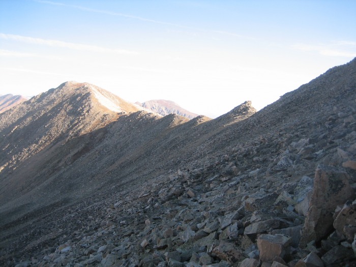
The ridge walk is easy/moderate scrambling. There are faint trail segments here and there, but it was easier to just eyeball the best route to take. I could've contoured around most of the bumps, but it didn't take much extra work to just go over most of them (although I bypassed Pt. 13513 easily on the west side).
Looking back at the ridge from just past Pt. 13513.
From here, it's just a matter of following the ridge until the standard trail joins it at about 13500' and quickly gains the summit.
Belford, Missouri and Harvard across the gulch.
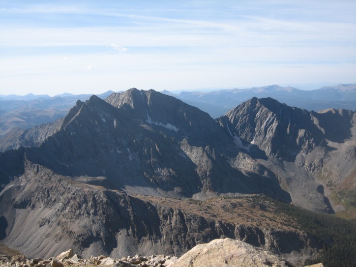
The Three Apostles sit and brood.
I chilled on the summit for 15 minutes, then headed down the standard route (where I finally made my first human contact of the day 20 minutes later - not bad for a "popular" 14er!). As advertised, this trail is in great condition with plenty of rock steps and switchbacks. So with the great weather, this was a memorable hike with a peaceful ascent one gulch north of the hubbub.
Thumbnails for uploaded photos (click to open slideshow):
We did this route last year later in September. It is interesting to compare the aspens and the snow (there was a dusting last year) from your pics.
I like how uncrowded this route is; most of the Huron summiteers were off by the time we got there; we didn‘t see anybody until heading down below tree line.
I have done this route twice, and agree that it‘s a nice alternative.
Plus, if you‘ve never hiked Huron before and you go this route, the final steps to the summit are so rewarding when you get your first look at the Apostles! That‘s what happened to me!
Nice TR and thanks for sharing.
Caution: The information contained in this report may not be accurate and should not be the only resource used in preparation for your climb. Failure to have the necessary experience, physical conditioning, supplies or equipment can result in injury or death. 14ers.com and the author(s) of this report provide no warranties, either express or implied, that the information provided is accurate or reliable. By using the information provided, you agree to indemnify and hold harmless 14ers.com and the report author(s) with respect to any claims and demands against them, including any attorney fees and expenses. Please read the 14ers.com Safety and Disclaimer pages for more information.
Please respect private property: 14ers.com supports the rights of private landowners to determine how and by whom their land will be used. In Colorado, it is your responsibility to determine if land is private and to obtain the appropriate permission before entering the property.