| Report Type | Full |
| Peak(s) |
Little Bear Peak - 14,041 feet |
| Date Posted | 09/13/2009 |
| Date Climbed | 09/09/2009 |
| Author | cftbq |
| Schmoozing up to the Bear |
|---|
|
Schmoozing up to the Bear Date: 9-9-09 Participants: cftbq, trishapajean RT: 2.95 mi. from camp, 7.2 mi. from car Vertical: 2,220 ft. from camp, 4,900 ft. from car This is just a short report on the standard route, with the hope of being helpful to other first-timers. We had looked forward to this storied peak with a mix of dread and tingling excitement for quite a while, and it was finally time to give it a try. I apoligize for the fact that there are few pictures; I had neglected to re-charge my camera's batteries. Tuesday: Approach Day With a decent 4WD vehicle, we were able to get to around 9,300 ft. on the abyssmal Lake Como road, roughly 4.5 miles up from the highway. We counted our blessings. We hiked the roughly two-and-a-half miles (and 2,400 feet!) to the lake on Tuesday afternoon. The hike in took us about two-and-a-half hours. Along the way, we finally got to witness the spectacle of tricked-up vehicles negotiating the outrageous rock obstacles of this road. 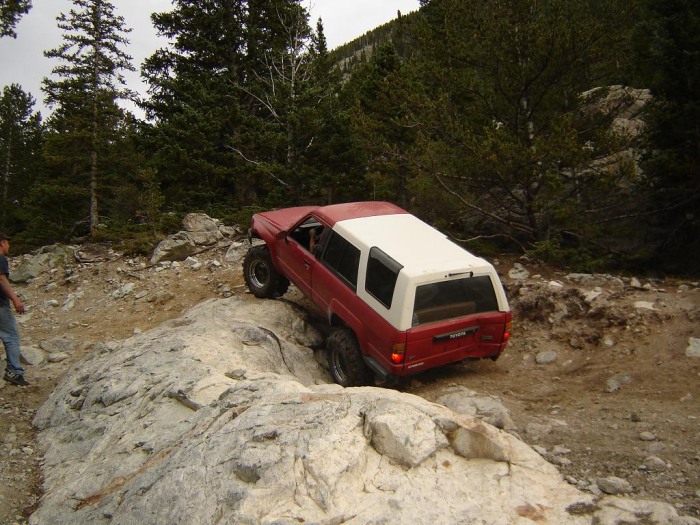 We, on foot, leap-frogged these guys several times, and arrived at the lake quite a while before they did. We found an abundance of comfortable campsites near the lake, and settled in to one of them as light was fading Wednesday: Climb Day Despite nearly eight hours of potential sleep time (not real sleep, just potential...), we passed on our 4 am alarm, and de-bagged ourselves at the secondary alarm at 4:30. An hour under beautiful, star-filled skies, in moderate temperature and with virtually no wind, got our camp secured, us breakfasted and ready to head up the trail. Dawn had come by the time we got to the rather obvious cairn, with the rock arrow, which marks the point to leave the trail and head up toward the notch. It really isn't hard to find. There are also cairns to mark the route over the talus pile that stands between the trail and the entrance to the gully but, truth be told, it's operator's choice, and any path you can find over or around this first obstacle will work to deliver you to the base of the gully. The notch in the ridge is clearly visible above. 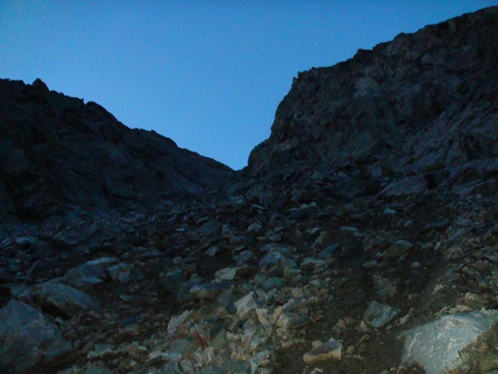 The lower part of the gully is the worst, because it's full of loose dirt. Numerous visible paths of previous climbers lead through this section. We found it generally best to stay mainly to the right. Higher up, the ground steepens, but it actually gets better because there is more solid rock. And the whole thing only goes on for a few hundred vertical feet. (After enduring the seemingly endless gully on El Diente two weeks earlier, this one seemed mercifully short!) Topping out on the ridge brings a big change in the view, looking down on Little Bear Lake.  The ascending traverse that leads east from here, below the ridge crest, is reasonably well cairned. It also must be more of a climb than it looks like, because we found ourselves stopping every few minutes to rest our lungs and legs. We also had to go considerably lower than we had anticipated in a couple of places to dodge cliffs and fins of rock. The general rule is: follow the cairns and the well-worn trail. Except for the top of one incredibly narrow, steep couloir down the north side, this route mostly stays below the ridge crest, but does eventually deliver you to the last saddle, where you can, finally, clearly see the entrance to the Hourglass not too far above. 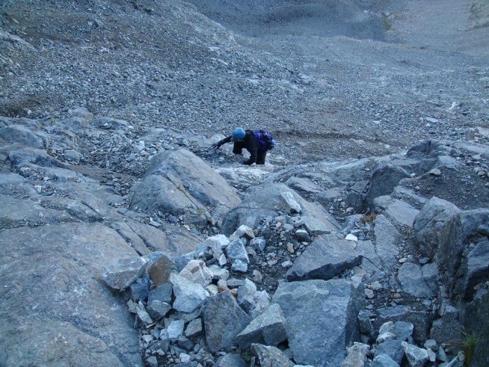 The best advice I can offer is to stay generally to the left of center to find climbable rock, unless you want to trust the installed ropes hanging in the ever-trickling water. (Does this damn thing ever dry out? I doubt it...) After coming up about halfway of the distance spanned by the dangling ropes, this strategy finally delivered us right back to the middle of the gully, and said ropes. (It gets really steep in places, including this one, if you actually try to stay away from the middle to avoid the water.) At this point, we decided that there was no shame in making tentative use of the ropes. I avoided trusting my entire weight to them as much as possible, and kept my left hand on whatever hand holds I could find, but found that I could make good, steady progress upward despite the fact that the rock is wet and sloped the wrong way almost everywhere. For one thing, I estimated that there was probably at least $500, and perhaps $1,000, worth of rope sitting there. Sombody, or somebodies, had made that considerable donation to the worthy cause of ensuring the safety of later climbers, such as us. Might as well make something of their generosity. With six strands of rope, it seemed reasonable that at least one of them would hold, no matter what. After getting to the anchor, I called down to trishapajean to follow me up this section. Above the Hourglass, we went sharply left. There are wisps of trail, and cairns, here. More importantly, the terrain looks a little easier. Mind you, it's still very steep, and treacherously loose in places. But a route can be pieced together that leads first left, then right, up toward the ridge. The view of the ridge above does not make it easy to see just where the actual summit is located. It's hidden among the pinnacles which can be seen. This pinnacle is too far to the climber's right, and is part of the ridge leading to South Little Bear: 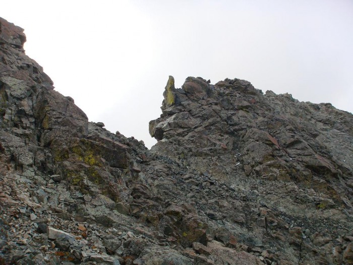 We probably didn't choose the most efficient path to the ridge crest, and the summit. OTOH, it probably wasn't far off, either. By just doggedly going up, looking for what cairns we could find, and trying for the path of least resistance, we finally popped out on the tiny summit. 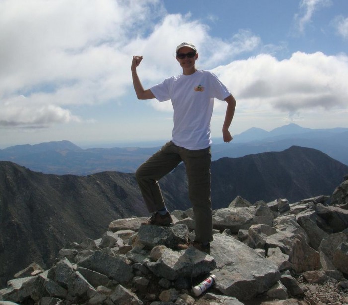 We had had good, clear weather all the way up, but clouds were forming, and the afternoon did not look promising. For this reason, we decided to forego an attempt on South Little Bear: 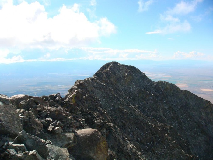 which I estimated would take at least 45 minutes in each direction. Too bad, but it turned out to be certainly the right decision, in light of later events. Heading down, we had to resist the temptation to turn left too soon--i.e., too far above the Hourglass. We crossed several small ridges/ribs before finally sighting the rope anchor point below us. We headed for it once we had a clear visual, having found a cairned route virtually the entire way. The cairns are easier to see and to follow going down than they are going up. We had not cleared the Hourglass when the graupel began to fall. It was very light at first, posing no real problem, and I hoped that it would only be a brief shower, followed by clearing. This was not the case. Even scarier, just as we both reached the bottom, we heard a pair of rocks bouncing down from above. The smaller of the two glanced off to our right and finally stopped. But the larger one, about the size of a basketball, continued right down the middle, finally caromming off a point a dozen or so yards above us, and spun with impressive velocity some twenty or thirty feet directly over trishapajean's head! There was no one above us, so this must have been the result simply of thawing and freezing. This is a dangerous place, no matter what you do. Over the course of the next hour or so, the snowfall continued to intensify. Ultimately, this is what we were facing: 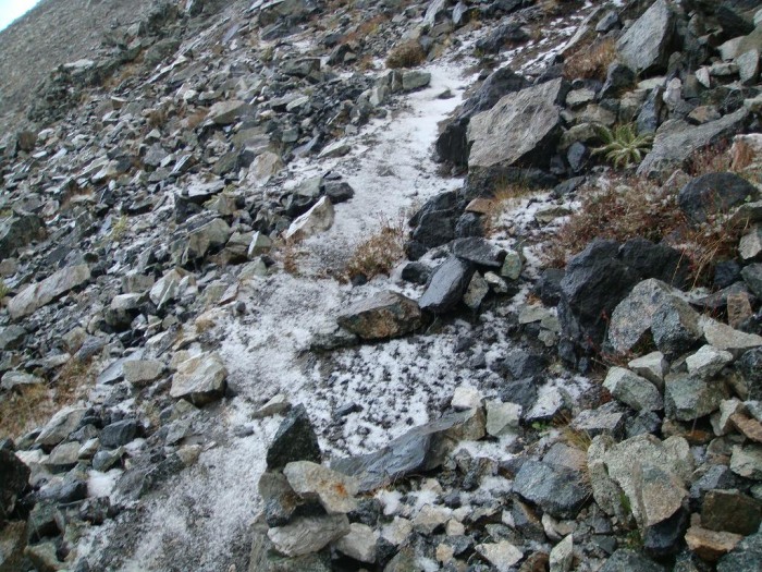 We also began to hear thunder claps, and to see flashes of lightning in the clouds above. Nevertheless, we made it back to the notch where we could start down the north slope in about an hour less than it had taken us to make the same journey in the opposite (upward) direction. When we finally dropped off the ridge crest and started down the gully, we left most of the precipitation (and wind) behind us. We also found that it had rained/snowed less on this side of the ridge, and there was less of a problem with slippery rocks. Other than picking our way through the rocks, and the dirt lower down, there were no further route finding problems, as we could see the trail below us all the way down. We made it back to camp about three-and-a-half hours after leaving the summit. There, we actually enjoyed some filtered sunshine, which helped to dry out our gear before we packed it up. And that's basically it. After some lunch and coffee, it was only about a two-hour hike back to the car, followed by some 45 minutes of granny-low four-wheel driving to get back down to a real road. If I go back to tag South Little Bear, my preference is going to be to take the northwest face route up. It's more exposed, and possibly technically a tad harder, but it avoids the Hourglass. This peak can be climbed by any experienced climber, but do not take it lightly! Thumbnails for uploaded photos (click to open slideshow): ")
")
")
")
")
")
")
")
|
| Comments or Questions | |||||||||
|---|---|---|---|---|---|---|---|---|---|
|
Caution: The information contained in this report may not be accurate and should not be the only resource used in preparation for your climb. Failure to have the necessary experience, physical conditioning, supplies or equipment can result in injury or death. 14ers.com and the author(s) of this report provide no warranties, either express or implied, that the information provided is accurate or reliable. By using the information provided, you agree to indemnify and hold harmless 14ers.com and the report author(s) with respect to any claims and demands against them, including any attorney fees and expenses. Please read the 14ers.com Safety and Disclaimer pages for more information.
Please respect private property: 14ers.com supports the rights of private landowners to determine how and by whom their land will be used. In Colorado, it is your responsibility to determine if land is private and to obtain the appropriate permission before entering the property.


