Download Agreement, Release, and Acknowledgement of Risk:
You (the person requesting this file download) fully understand mountain climbing ("Activity") involves risks and dangers of serious bodily injury, including permanent disability, paralysis, and death ("Risks") and you fully accept and assume all such risks and all responsibility for losses, costs, and damages you incur as a result of your participation in this Activity.
You acknowledge that information in the file you have chosen to download may not be accurate and may contain errors. You agree to assume all risks when using this information and agree to release and discharge 14ers.com, 14ers Inc. and the author(s) of such information (collectively, the "Released Parties").
You hereby discharge the Released Parties from all damages, actions, claims and liabilities of any nature, specifically including, but not limited to, damages, actions, claims and liabilities arising from or related to the negligence of the Released Parties. You further agree to indemnify, hold harmless and defend 14ers.com, 14ers Inc. and each of the other Released Parties from and against any loss, damage, liability and expense, including costs and attorney fees, incurred by 14ers.com, 14ers Inc. or any of the other Released Parties as a result of you using information provided on the 14ers.com or 14ers Inc. websites.
You have read this agreement, fully understand its terms and intend it to be a complete and unconditional release of all liability to the greatest extent allowed by law and agree that if any portion of this agreement is held to be invalid the balance, notwithstanding, shall continue in full force and effect.
By clicking "OK" you agree to these terms. If you DO NOT agree, click "Cancel"...
Really looking forward to this one - and not just because it the first time this summer where I had slept in the cab of my pickup truck. I had heard a lot about Shavano and Tabeguache; moreover, I'd read a few discouraging trip reports. But my friend Eric and I had not hiked together in over a month, and we were rarin' to go.
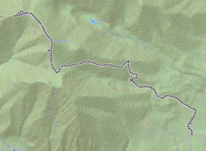
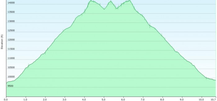
Our (my) trip profile:
We both drove in to the trailhead the night before, camping off in the overflow area. Watch for the cows on the last few miles in - especially in the dark, I thought I was in trouble a few times.
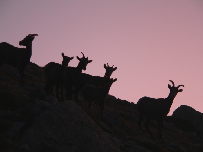
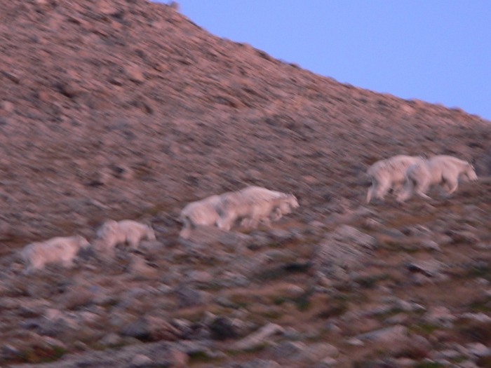
Our plan was to start at 4:30 in the morning, but we were both ready to go at 4:10, and it's good to get started early on such a long journey. We made the right turns - thanks in part to my GPS - but we were making good time, about halfway up the ridge when we started to see the wildlife:
The Angel of Shavano, sadly, was no longer with us at this late of a date in August:
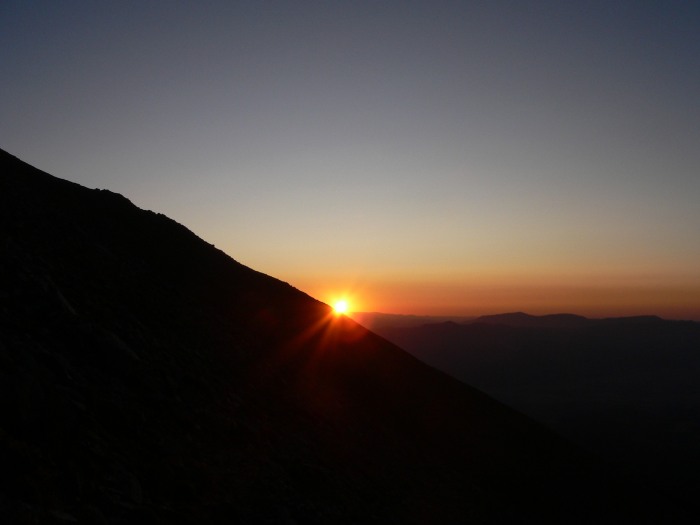
The sun was with us, although it took its sweet time getting here on this morning:
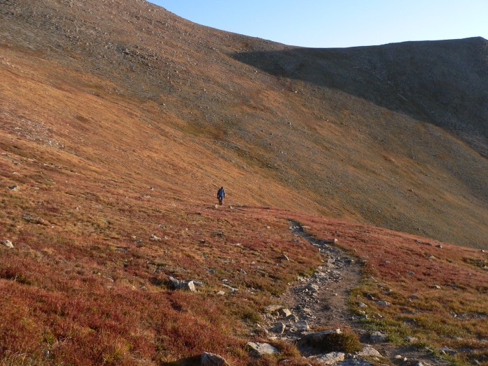
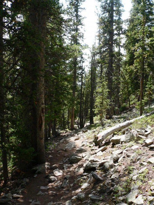
The trail up the hill seemed steep to me - not overly so, but very prolonged and drawn out. I would find out just how steep on the way back.
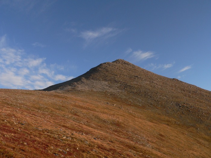
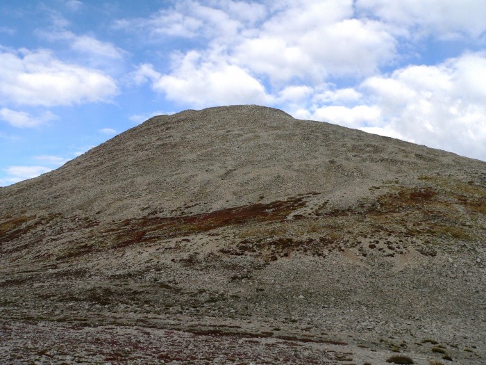
Finally, we're close to the summit of Shavano:
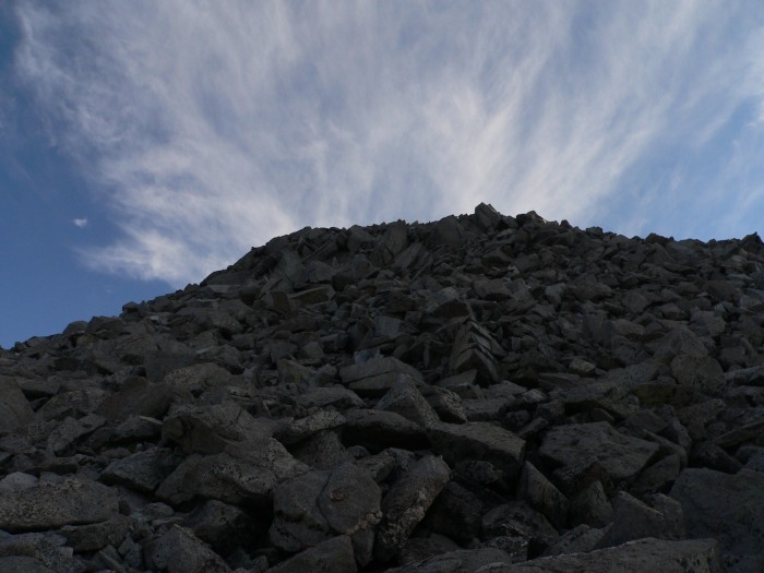
And it's a steep hike/climb up to the actual summit. As you can see from the topo, I took a wrong turn or two - I saw a cairn to my left at one point, headed that way, and discovered that I was headed back down the path I had somehow missed.
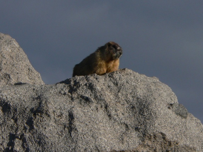
Eric was struggling, and it took some coaching to get him to the summit. We were the first to the summit that morning (8:55 am). Well, the first humans - this little marmot had the top rock all to himself when we arrived:
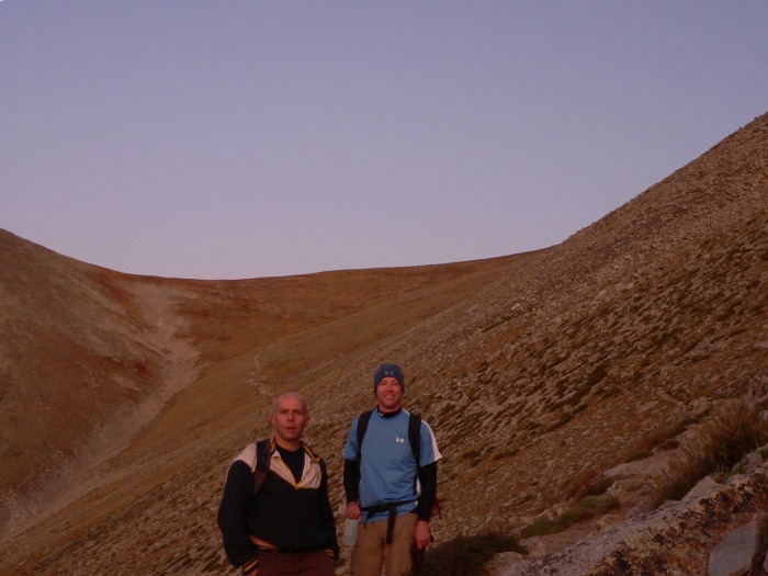
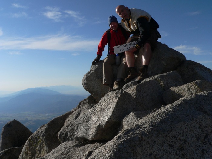
If we look crooked in this summit photo, it's because of us and not the camera:
Eric decided that one summit was enough on this day, and he would wait for me while I went over to bag Tabeguache. It should be pointed out here that Eric is the one who usually keeps me from doing stupid things on the mountains. Note the dark clouds:
The clouds turned out to just be clouds. Tab from the saddle:
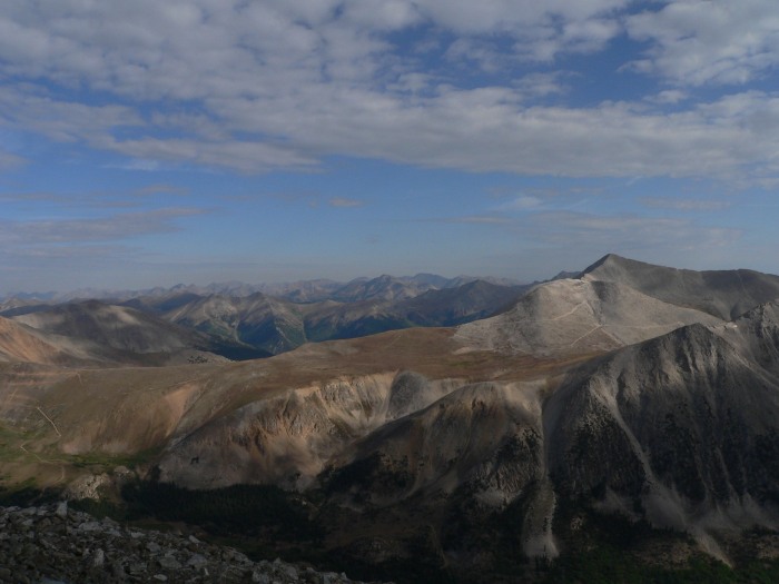
Some shots of Antero, and (I think) Mount Aetna, from the summit of Tabeguache:
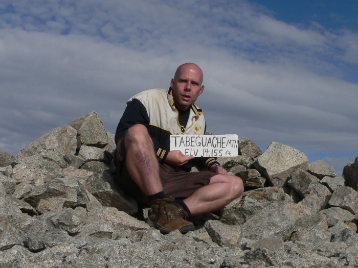
I was the first to summit Tabeguache that day (9:45 am), and I had the summit to myself for pretty much as long as I wanted it. It felt weird being by myself on a fourteener summit. You can see my softball "wound" in this shot - several people remarked on it, thinking that I had injured myself hiking. Little did I know...
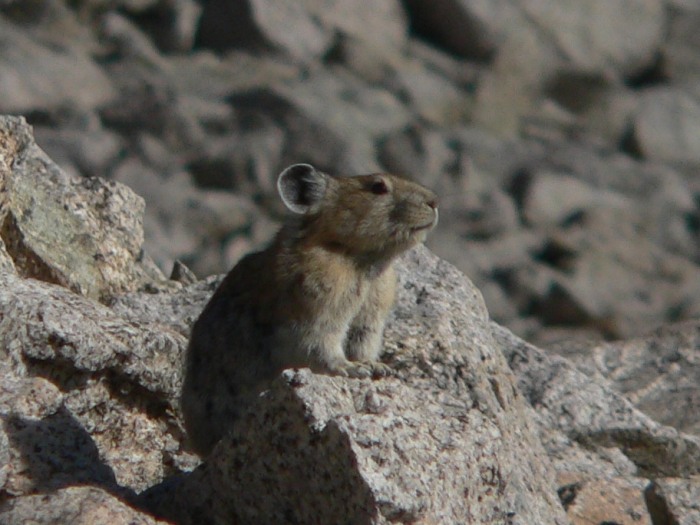
On the way down, this fierce little pica was defending his territory:
It was on the way down Tabeguache where I made a mistake. I was hurrying to get back to Eric, and I slid on some loose scree for about 15 feet before hearing a "pop" noise in my leg. (I would find out later that I partially tore my right quad where it attaches to my torso). Definitely not good for the descent to come.
At the saddle, I ran into a nice lady who informed me that Eric was feeling woozy and decided to head down to the trailhead. Now I really was trying to hurry, because I wanted to catch Eric. My leg wasn't being particularly helpful, though.
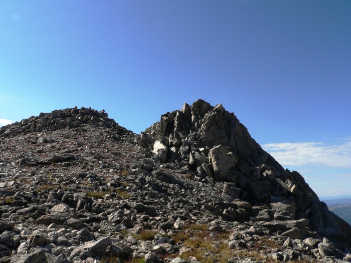
Going back up to Shavano - for the second weekend in a row, I had to reascend an already-summitted fourteener to reach my truck - I'd read enough to know to stay low and to the left, but I kept thinking that I should get high. The ridges were just so alluring:
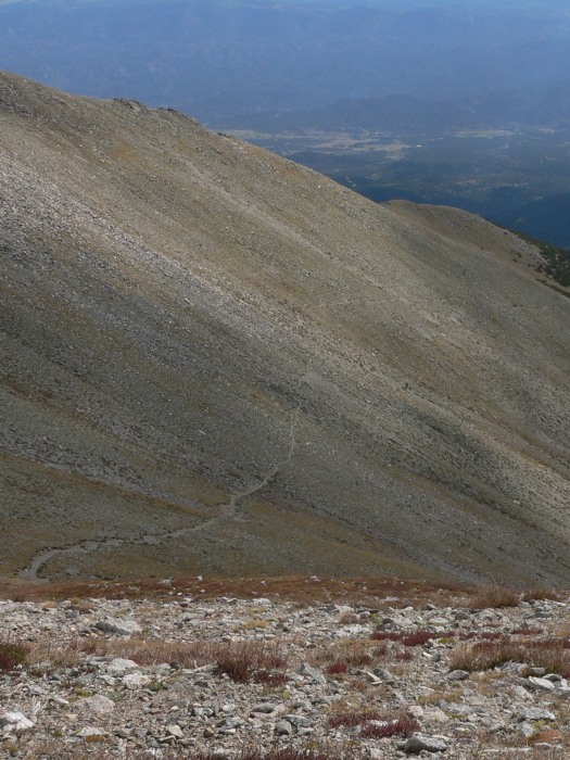
Coming down the steep Shavano summit to the trail, I slid again, and now I was in really bad shape. Two Advil and one leg were going to get me down this thing, and it was now hot and sunny on the descent. Here's a good shot of most of the trail down to treeline:
Finally able to see the trail below treeline, it's like they deliberately picked the rockiest surface possible to keep the Nebraskans out. My already-bad knees loathed every step here.
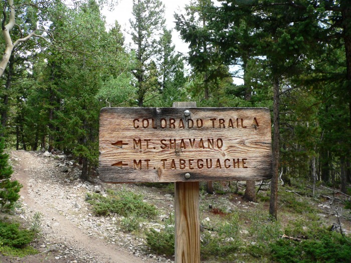
We didn't miss this sign on the way up - it didn't seem too hard to miss even in the dark. But if you do miss it, then you're walking all the way to Denver.
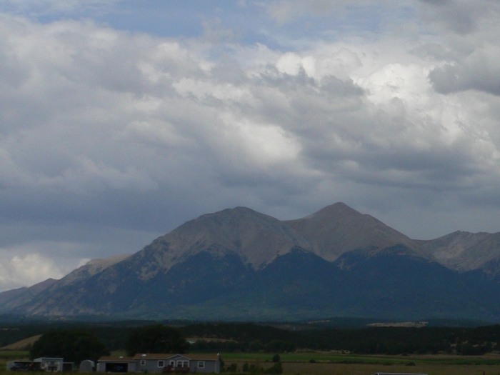
One last shot of my tormentor on the drive back to US-285:
In the end, no one ever conquers a mountain - they survive a mountain. And we survived. I never did catch up to Eric. It's now been two weeks later and I'm still sore. But it was a great hike with some great views, and I don't regret it for a second.
My GPS Tracks on Google Maps (made from a .GPX file upload):
I certainly learned about hubris on this hike (and the leg injury effectively ended my 2009 hiking season).
Your trip reports certainly inspire me to get out there this year (after my exam on April 30 - although I did sneak Quandary in last month :lol: )
Caution: The information contained in this report may not be accurate and should not be the only resource used in preparation for your climb. Failure to have the necessary experience, physical conditioning, supplies or equipment can result in injury or death. 14ers.com and the author(s) of this report provide no warranties, either express or implied, that the information provided is accurate or reliable. By using the information provided, you agree to indemnify and hold harmless 14ers.com and the report author(s) with respect to any claims and demands against them, including any attorney fees and expenses. Please read the 14ers.com Safety and Disclaimer pages for more information.
Please respect private property: 14ers.com supports the rights of private landowners to determine how and by whom their land will be used. In Colorado, it is your responsibility to determine if land is private and to obtain the appropriate permission before entering the property.