Download Agreement, Release, and Acknowledgement of Risk:
You (the person requesting this file download) fully understand mountain climbing ("Activity") involves risks and dangers of serious bodily injury, including permanent disability, paralysis, and death ("Risks") and you fully accept and assume all such risks and all responsibility for losses, costs, and damages you incur as a result of your participation in this Activity.
You acknowledge that information in the file you have chosen to download may not be accurate and may contain errors. You agree to assume all risks when using this information and agree to release and discharge 14ers.com, 14ers Inc. and the author(s) of such information (collectively, the "Released Parties").
You hereby discharge the Released Parties from all damages, actions, claims and liabilities of any nature, specifically including, but not limited to, damages, actions, claims and liabilities arising from or related to the negligence of the Released Parties. You further agree to indemnify, hold harmless and defend 14ers.com, 14ers Inc. and each of the other Released Parties from and against any loss, damage, liability and expense, including costs and attorney fees, incurred by 14ers.com, 14ers Inc. or any of the other Released Parties as a result of you using information provided on the 14ers.com or 14ers Inc. websites.
You have read this agreement, fully understand its terms and intend it to be a complete and unconditional release of all liability to the greatest extent allowed by law and agree that if any portion of this agreement is held to be invalid the balance, notwithstanding, shall continue in full force and effect.
By clicking "OK" you agree to these terms. If you DO NOT agree, click "Cancel"...
After completing the Fletcher Mountain to Drift Peak traverse this past Saturday (8/8/09) from Blue Lake, I had hoped to post a trip report and photos from the climb on 14ers.com. However, as I began the process of preparing my trip report, I ran into a slight problem...
The flash card I had used in my camera that day was corrupt, making the pictures irretrievable. Not wanting to post a report without photos, I decided instead to do a write up on my recent climb of Horseshoe Mountain (13,898 feet) from the infrequently used Gold Basin Trail off of Weston Pass.
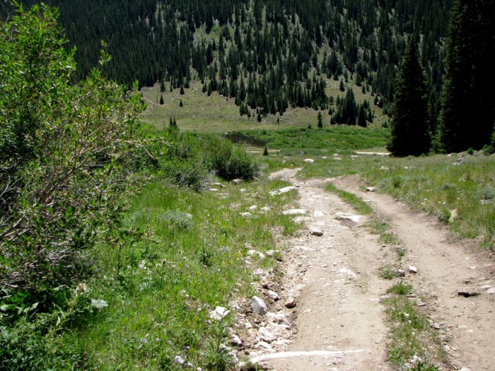
This trailhead is located approximately 7.5 miles up the west side of the Weston Pass 4WD road (Lake County 7) that runs between Leadville and Fairplay. The route begins by passing under large power lines 3 times as it climbs northwest for 1.1 miles, into the large grassy basin below Horseshoe Mountain on an old 4WD road.
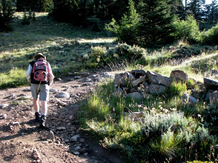
Pullout parking area just past the 4WD road trailhead.
The start of the trail into Gold Basin.
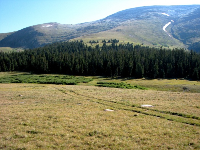
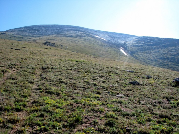
Horseshoe Mountain comes into view. Notice the light dusting of snow...
Passing a large cabin.
Looking southeast towards Weston Pass.
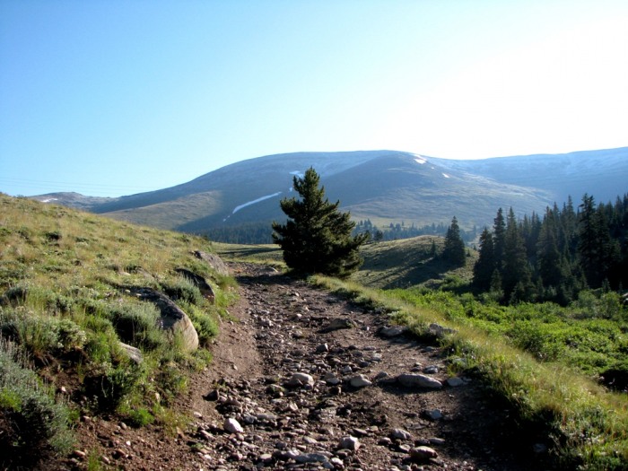
After hiking up the road for a little over a mile, we came to the top of a high point. From here we could clearly see the upper portion of the route. After this the route descends towards a broad saddle below the Horseshoe Mountain ridge.
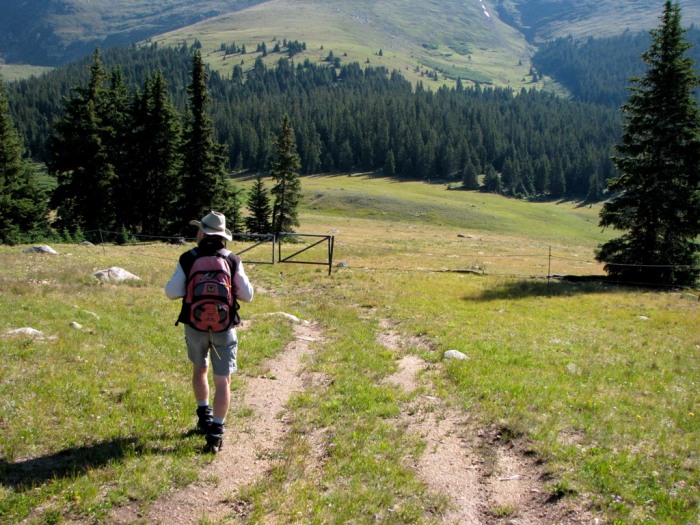
On the descent towards the saddle, you have to hike northwest for a ways to get around the fenced private property, after which it is a matter of finding an old set of vehicle tracks that will lead you through the trees and up the rounded slope below Horseshoe's summit. It was here that the wind began to begin picking up ever so slightly, and then began blowing harder and harder as we reached the summit...
Descending towards the saddle.
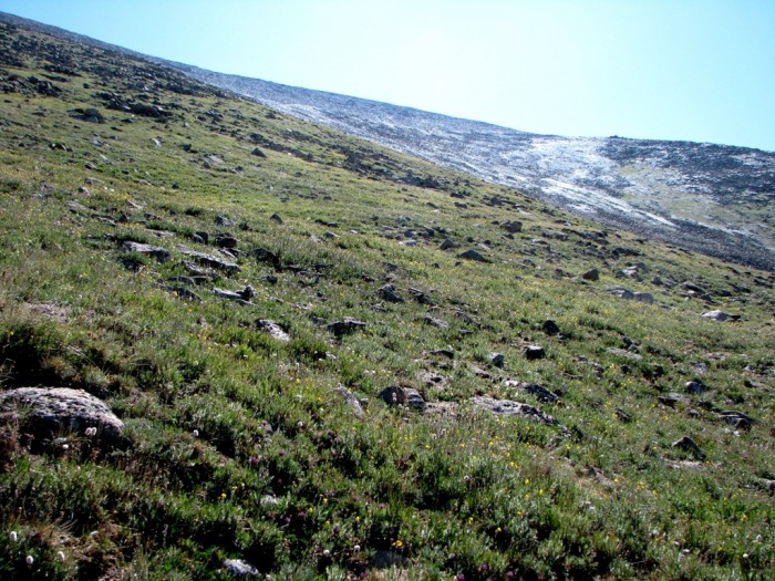
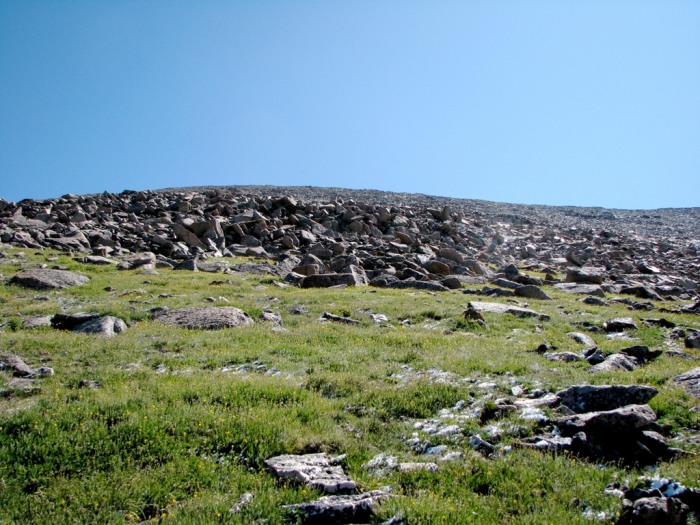
A view of the upper portion of the route. The trail ascends the grassy rounded slope (left) before reaching the talus slope near the snowfields (center).
The vehicle tracks that lead through the woods toward tree line.
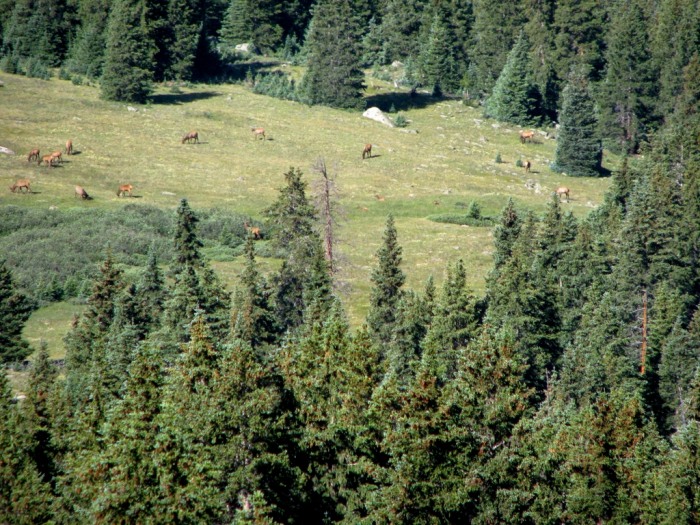
Elk grazing in a meadow below.
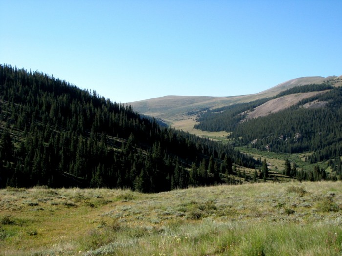
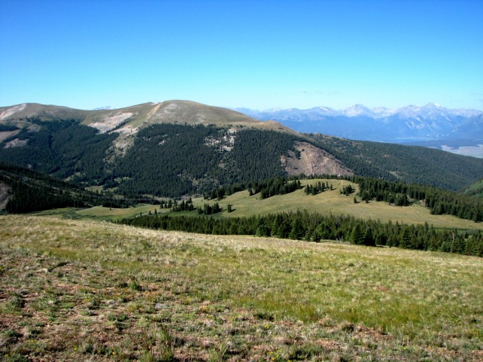
Looking back towards the trailhead from above tree line.
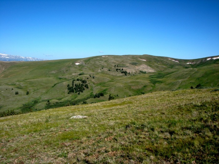
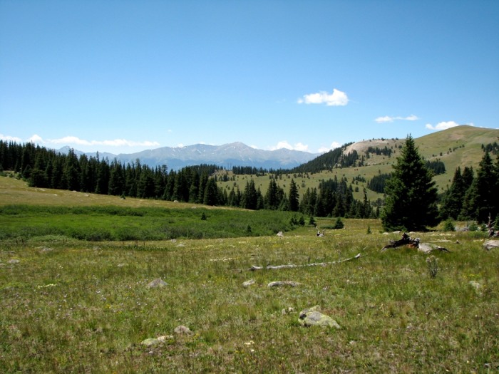
Upper Gold Basin to the northwest. It's just so green and grassy! Wait we're in Colorado, not the Swiss Alps right?
The summit of Horseshoe Mountain from approximately 13,000 feet. This road is relentless.
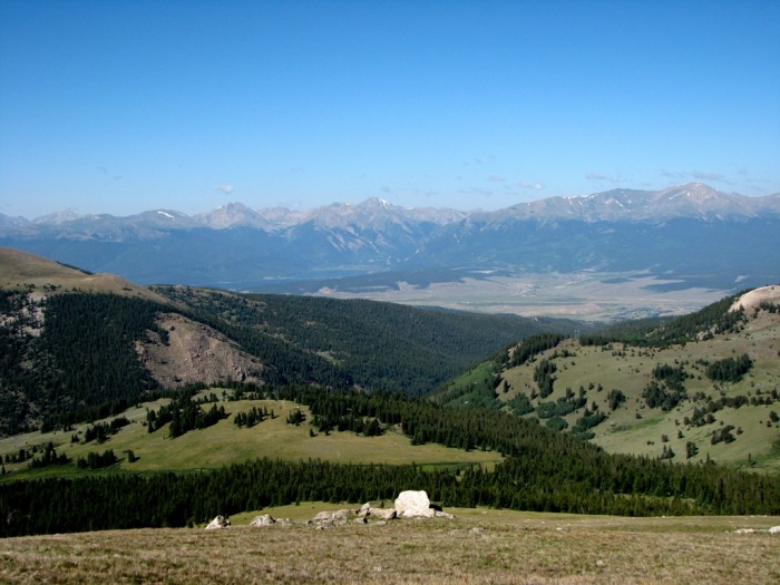
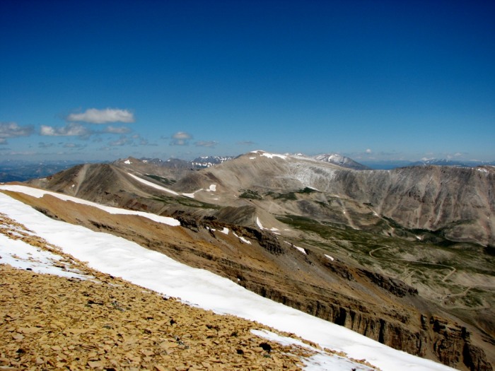
Looking southwest. Left to right: Huron, Mount Hope, LaPlata, the French Group (Casco, French Benchmark, Frasco, Lackawanna), and Mount Elbert.
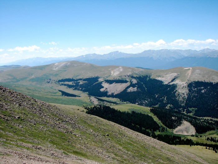
The view southeast. The Belford group is prominent in the foreground, while Harvard, Columbia, and Yale can just be seen on the horizon (far left).
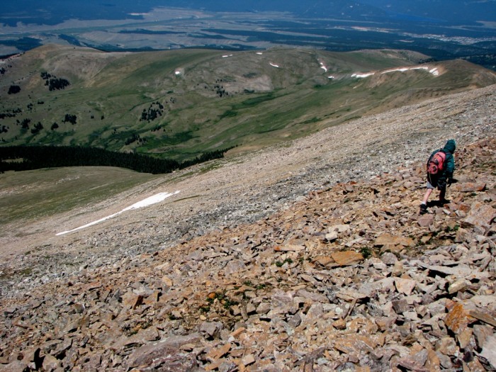
At around 13,000 feet the vehicle tracks disappeared, and the slope began to steepen. The grass that we'd been hiking on was soon replaced with Class 2 talus that we would stay on until we reached the summit plateau just south of Horseshoe's highest point. Once on the ridge we came to an abandoned mining building that we used as wind shelter to eat some lunch, before hiking about 500 feet northwest to the summit.
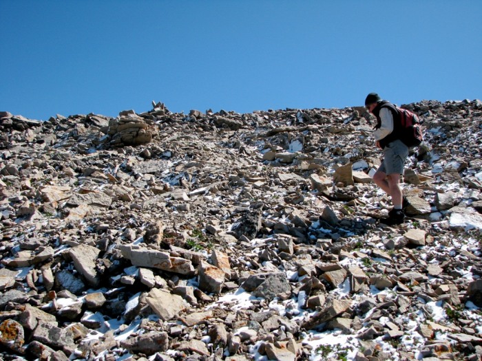
Reaching the start of the talus about 13,400 feet.
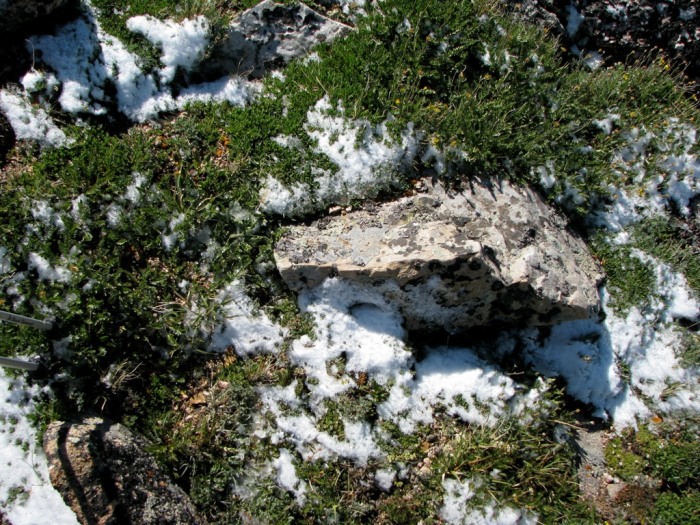
What? Snow on the 1st of August? Only in Colorado!
What looked like small cliff bands from below actually turned out to be a thin line of huge boulders that we were able to easily bypass on the right.
Making the traverse across the steepening talus slope.
The final bit of the trail leading to the flat and windy ridge.
Looking north from the summit ridge towards the Four Mile Creek drainage. Sheridan, Dyer Mountain, Sherman and Gemini Peak are in the distance (left to right).
After standing on the summit in gale force winds, for about 30 seconds (just long enough to snap a couple photos), we turned and quickly began to descend the ridge and talus slope below, zigzagging our way down. By the time we reached the lower grass slopes, the wind had died down and we had an enjoyable hike out the rest of way.
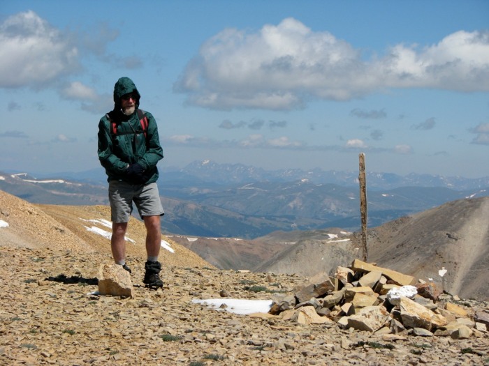
My climbing partner (aka Dad) braces himself against the wind as he poses on Horseshoe's summit.
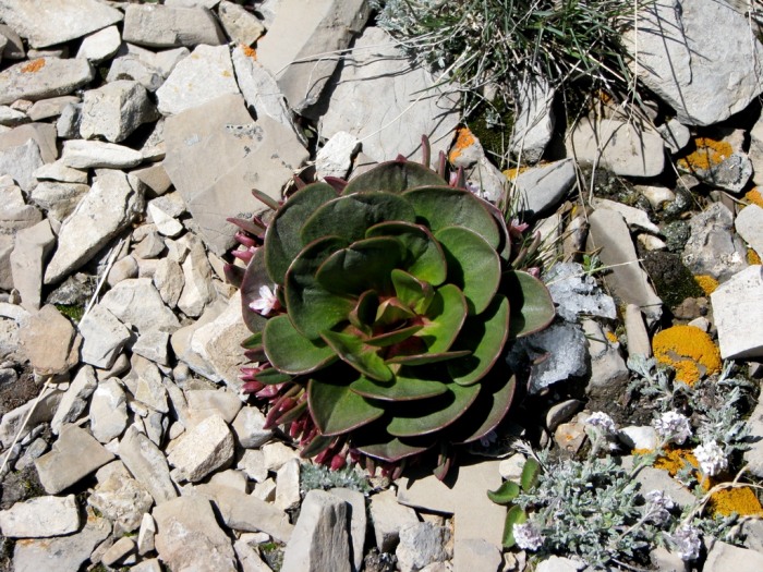
Flowers sticking through the summit rocks.
"Against the wind... Running against the wind..."
Mount Elbert beckons from behind the ridge.
The end of the trail.
Conclusion - While you don't get the sweeping views of Horseshoe's namesake circ from this side of the mountain, Gold Basin's grassy wildflower strewn slopes are equally as stunning. Also the peaceful serenity and views of the Sawatch Range make this one of the most overlooked approaches to a Centennial 13er. Even the wind couldn't put a damper on this great climb.
Please Note - While it is somewhat difficult to determine where the Forest Service boundary begins, hikers should careful to avoid crossing the private property in Gold Basin en route to Horseshoe's southwestern slopes.
Thumbnails for uploaded photos (click to open slideshow):
You might still have your photos. 8/12/2009 8:11am
http://www.flashfixers.com/ I sent them my card and they recovered a week of pics from Southern Utah slot canyons. I then bought their softward and have saved a couple other cards since then. Oh, and nice pics of your Horseshoe hike too. I love those wide open grassy mountains.
Caution: The information contained in this report may not be accurate and should not be the only resource used in preparation for your climb. Failure to have the necessary experience, physical conditioning, supplies or equipment can result in injury or death. 14ers.com and the author(s) of this report provide no warranties, either express or implied, that the information provided is accurate or reliable. By using the information provided, you agree to indemnify and hold harmless 14ers.com and the report author(s) with respect to any claims and demands against them, including any attorney fees and expenses. Please read the 14ers.com Safety and Disclaimer pages for more information.
Please respect private property: 14ers.com supports the rights of private landowners to determine how and by whom their land will be used. In Colorado, it is your responsibility to determine if land is private and to obtain the appropriate permission before entering the property.