Download Agreement, Release, and Acknowledgement of Risk:
You (the person requesting this file download) fully understand mountain climbing ("Activity") involves risks and dangers of serious bodily injury, including permanent disability, paralysis, and death ("Risks") and you fully accept and assume all such risks and all responsibility for losses, costs, and damages you incur as a result of your participation in this Activity.
You acknowledge that information in the file you have chosen to download may not be accurate and may contain errors. You agree to assume all risks when using this information and agree to release and discharge 14ers.com, 14ers Inc. and the author(s) of such information (collectively, the "Released Parties").
You hereby discharge the Released Parties from all damages, actions, claims and liabilities of any nature, specifically including, but not limited to, damages, actions, claims and liabilities arising from or related to the negligence of the Released Parties. You further agree to indemnify, hold harmless and defend 14ers.com, 14ers Inc. and each of the other Released Parties from and against any loss, damage, liability and expense, including costs and attorney fees, incurred by 14ers.com, 14ers Inc. or any of the other Released Parties as a result of you using information provided on the 14ers.com or 14ers Inc. websites.
You have read this agreement, fully understand its terms and intend it to be a complete and unconditional release of all liability to the greatest extent allowed by law and agree that if any portion of this agreement is held to be invalid the balance, notwithstanding, shall continue in full force and effect.
By clicking "OK" you agree to these terms. If you DO NOT agree, click "Cancel"...
Report Type
Full
Peak(s)
Mt. Massive - 14,427 feet
Point 14,169 - 14169
North Massive - 14340
Massive Green - 14300
South Massive - 14132
After reading Roach's guidebook and pondering different routes, I'd been intrigued with the idea of attempting the 'Tour de Massive'. I'm not a big fan of crowds, so I try to avoid popular routes and trailheads, also the idea of hitting so many summits above 14K sold me on this route.
Me, my brother and a few buddies drove up the night before and got an older Toyota Corolla about a mile from the TH. With slow/careful driving I'm sure we could have made it further but I didn't want to wreck the car since I was borrowing it. For all the other 2WD cars, don't be scared by the 4WD sign just past the regular TH for massive. I think it's just there to ward off the Texans from the N. Halfmoon TH.
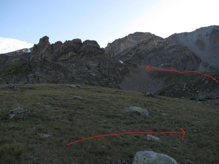
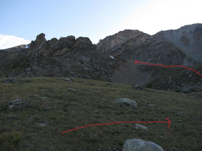
We carried our stuff up to the N. Halfmoon TH and set up camp. We woke up the next day just before 5 and hit the trail around 5:15. We made a decent pace and got to the trail junction around 6 and kept going to left towards the Halfmoon lakes. Once you get up to the first lake start looking for a real big tower. If you notice the tower soon enough, you can save a bit of time and break off the trail and head towards it. We didn't notice it in time, so we walked a bit further up the trail and were forced to cut to our right a good bit in order to be on the east side of this ridge. You can see our route in the picture:
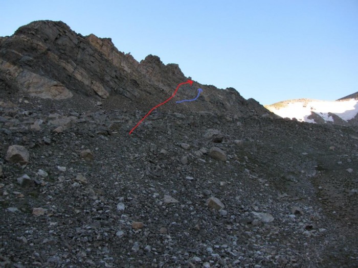
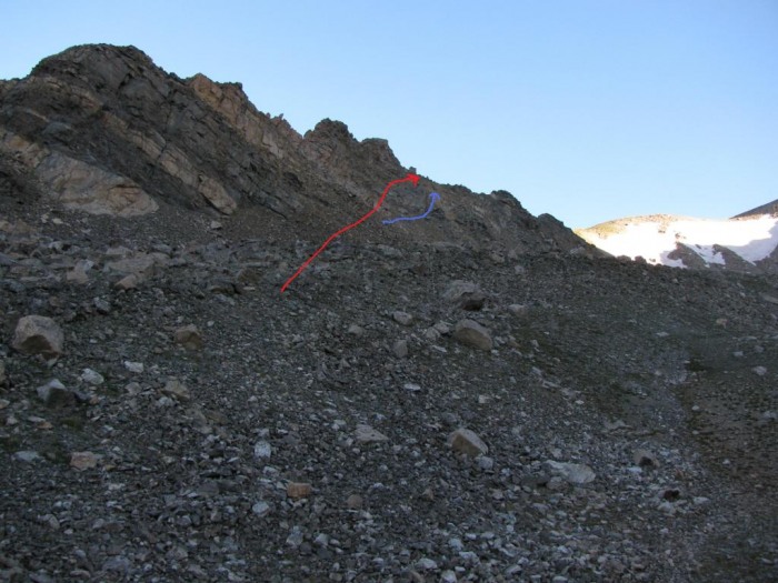
Once you're on the east side of this tower, you can choose your route up to the top of the ridge. It starts out pretty solid, but higher up it gets rather loose. In order to avoid a steep/loose section we took a higher route that required a couple class 3 moves. The route in blue may avoid these moves, but it didn't look like a whole lot of fun.
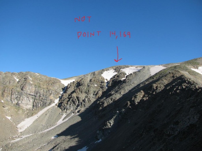
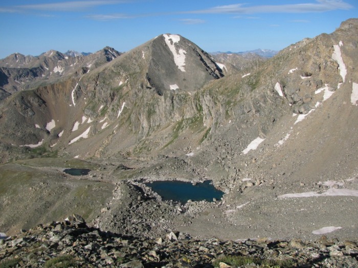
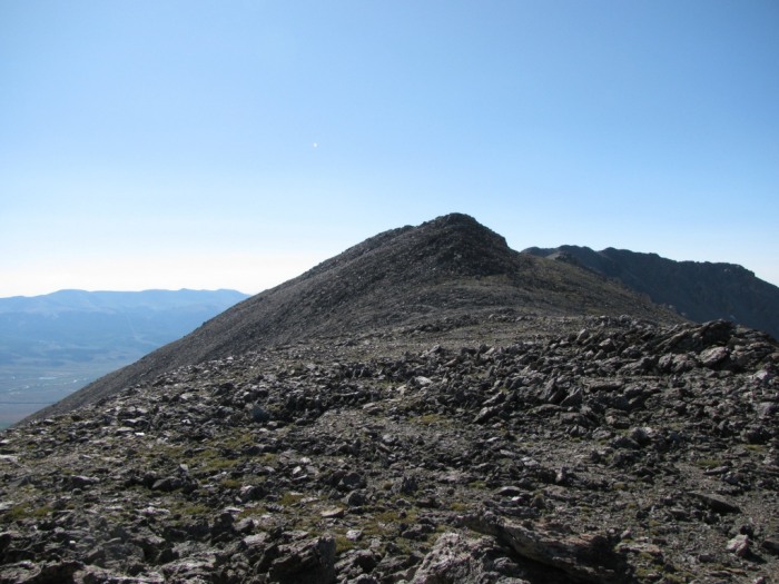
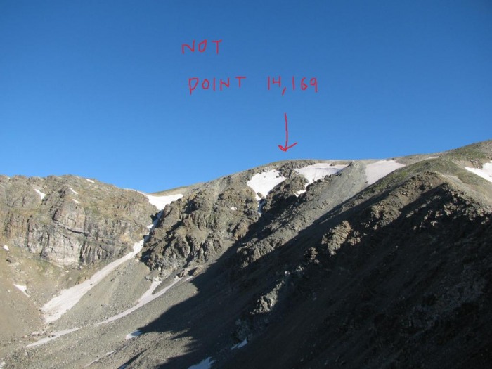
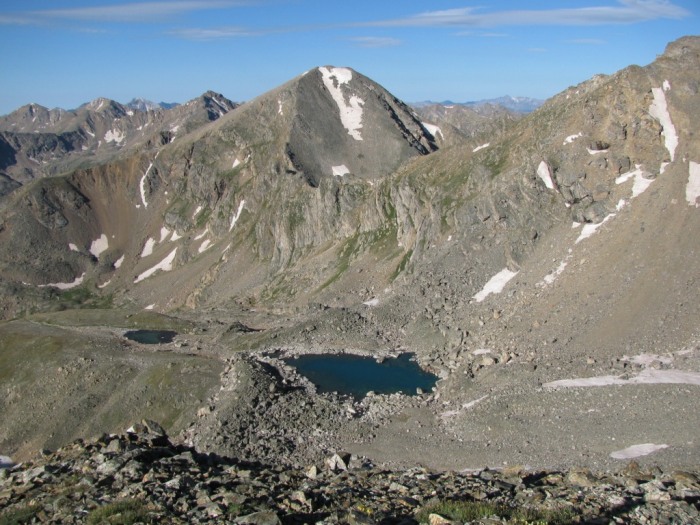
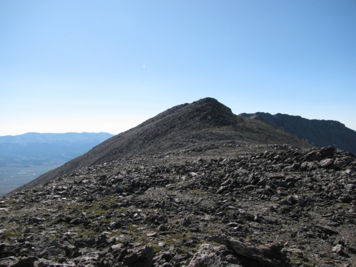
Once on the ridge you are offered some great views and some fun hiking. It's not too hard or exposed, just a bunch of fun in my opinion, I wished it lasted longer! On your way up this ridge don't confuse Point 14,169 with the random 'bulge' on the left. Point 14,169 isn't too impressive and you can't really even see it until you're all the way up the ridge. Just aim your hiking a little to the right of the bulge and you'll find Point 14,169 in no time. From this unexciting Point, N. Massive is just a few steps away.
North Massive
Halfmoon Lakes
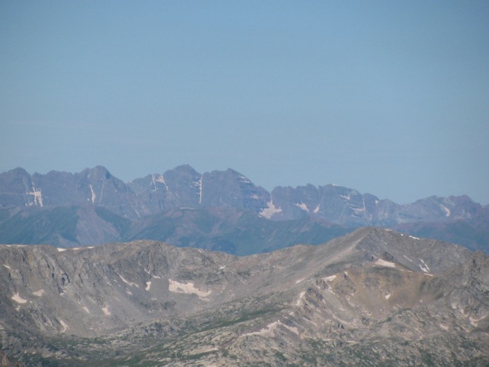
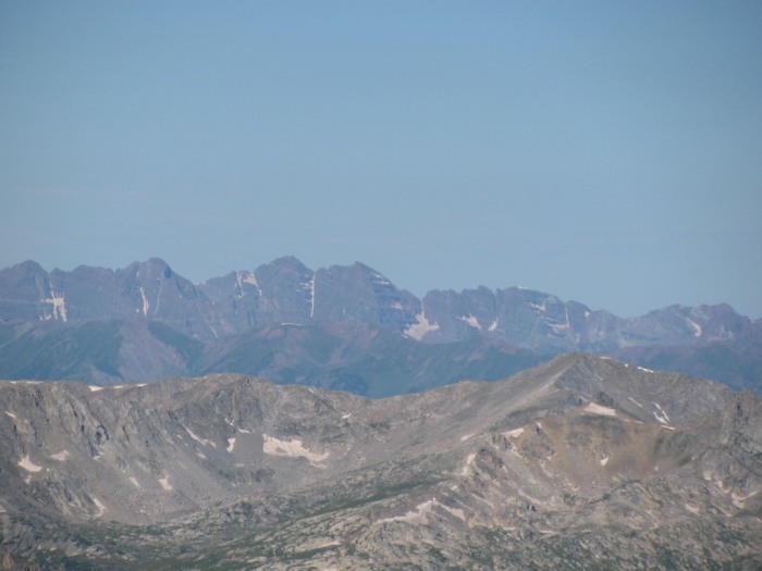
Bells + Pyramid
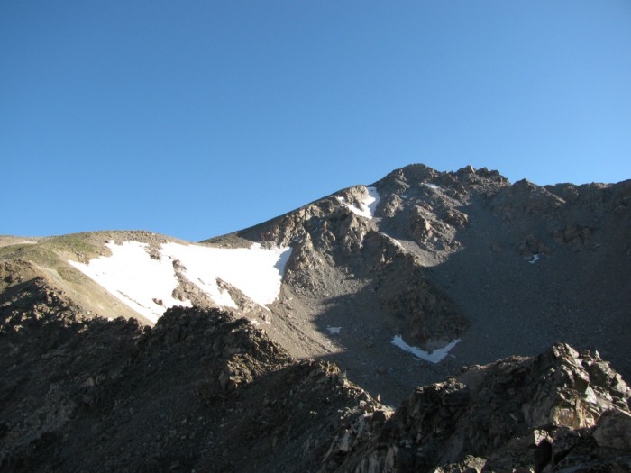
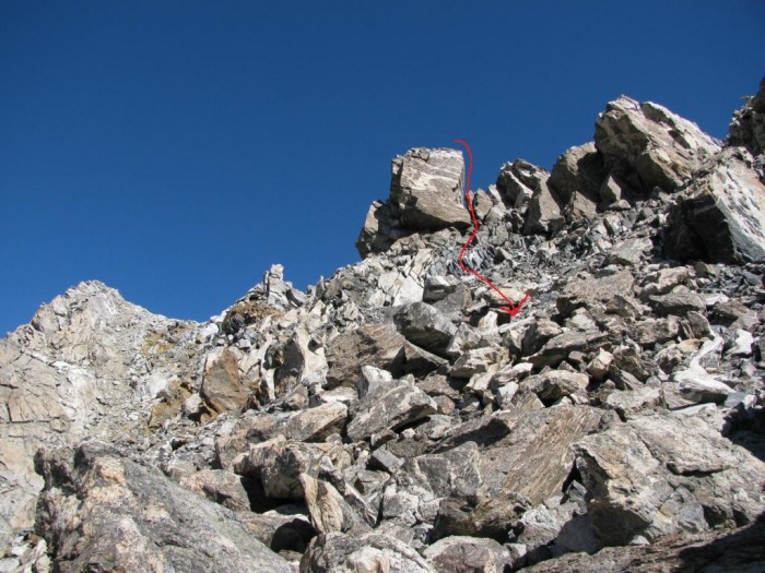
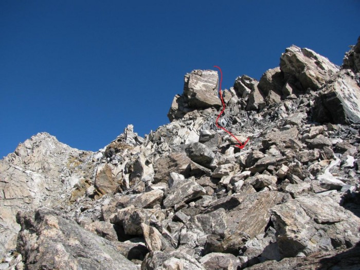
N. Massive is a very cool summit, more relaxing than actual Massive due to the solitude. Unfortunately the 'Tour' had just begun and we needed to ramble. From (West) N. Massive we went over to (East) N. Massive and checked out the enormous boulder of a summit. From here we found a little nook on the left (east) side that we downclimbed. I think there was on a couple of Class 3 moves here but there was almost no exposure. Here is a picture looking up at our decent route (West N. Massive is on the left and East N. Massive is the big ol' boulder):
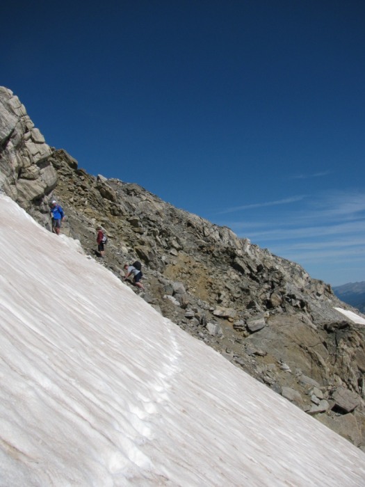
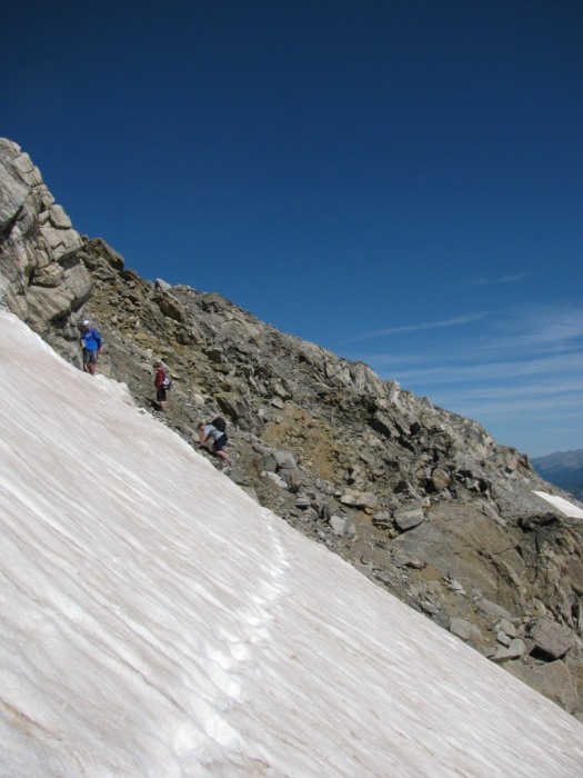
As we followed the ridge, we went East of the towers and ran into a steep snowfield that runs out into some nasty rocks. We didn't have axes so we hugged the area between the towers and the snow. The best way may well be on the West side of the towers but we didn't check it out.
After getting past the rock towers on this ridge the most complicated part of the route is over. From here it's just a matter of fighting fatigue and making it over to Massive Green, Mt. Massive, and S. Massive.
Massive Green
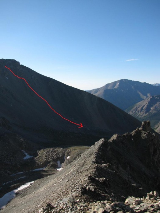
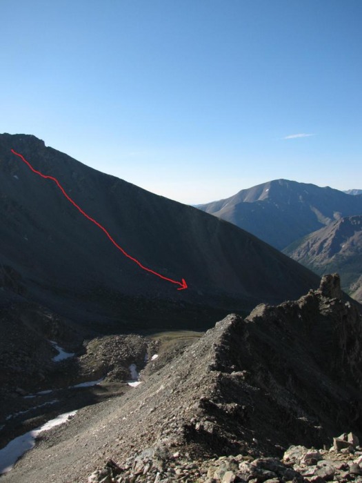
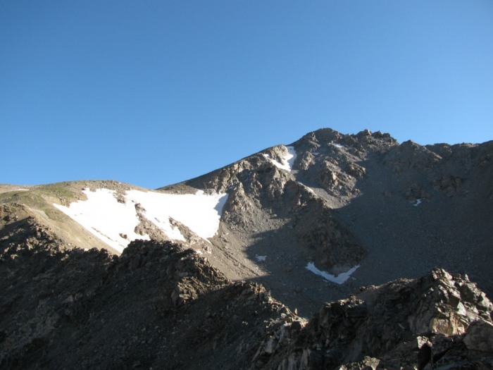
Ending this route turned out to be the most difficult part. On the way over to S. Massive, we noticed a sign that seemed to indicate the start of the SW Slopes decent route so we set the bags down while we went over to visit S. Massive. We returned from S. Massive picked up our bags and started down the (supposed) route but things just got worse and worse. The scree was miserable and there was no apparent trail. Rocks were sliding down everywhere. It took 2 or 3 times as long as anticipated to get down this ugly slope, which only led to the Halfmoon lakes (Not the trail junction). A pic from early in the morning shows our poorly picked decent. Finally we made it back to the trail, but nowhere near the SW Slope/W Slopes trail junction.
In Roach's book it looks like the SW Slopes decent would start near the saddle between Massive & S. Massive, but when we got down there it had a sign that it was closed for restoration? Maybe someone else knows more about it than me.
Overall the traverse of the summits was a blast, but getting back to the car was a real hassle! North Massive seems like a pretty underappreciated summit. I thought this route would take 9-10 hours, but it ended up taking almost 12 (including taking down camp and getting back to the car), so make sure to plan for the extra water and time.
Also, I'd like to thank Aubrey for his old TR, that helped us out in a few spots especially getting up onto the first ridge near the tower.
Thumbnails for uploaded photos (click to open slideshow):
I did this same route about two weeks ago (minus S. Massive), and I still have no clue where point 14169 is. I assumed that it was way off to the left after the initial ridge (when you veer right toward N Massive), but nothing looked tall enough. Maybe I crossed it and had no idea. Great pictures- the route you took through the basin was pretty close to mine- yours looks a little more efficient though. Great job!
Yes, you made your descent off of N. Massive harder than it needed to be! It‘s a Class 3 scramble any way you slice it, but there are multiple possible lines that stay away from lingering snow fields. Still, congrats on a nice ”tour”; glad the weather held out for you (which it didn‘t for me!).
James: I could hardly believe that that 14169 was taller than that bulge. Looking back from the top of Massive I could tell it was taller, but otherwise it was hard to tell. I knew I was on top though because it was on the Mt. Massive ridge that connected to N. Massive.
cftbq: I just read your TR, bummer on the bad weather! I think it will be a while before I try to go for the Massive Mania!
Also, I noticed FS has yet to remove the N. Massive register, which is odd.
Caution: The information contained in this report may not be accurate and should not be the only resource used in preparation for your climb. Failure to have the necessary experience, physical conditioning, supplies or equipment can result in injury or death. 14ers.com and the author(s) of this report provide no warranties, either express or implied, that the information provided is accurate or reliable. By using the information provided, you agree to indemnify and hold harmless 14ers.com and the report author(s) with respect to any claims and demands against them, including any attorney fees and expenses. Please read the 14ers.com Safety and Disclaimer pages for more information.
Please respect private property: 14ers.com supports the rights of private landowners to determine how and by whom their land will be used. In Colorado, it is your responsibility to determine if land is private and to obtain the appropriate permission before entering the property.