Download Agreement, Release, and Acknowledgement of Risk:
You (the person requesting this file download) fully understand mountain climbing ("Activity") involves risks and dangers of serious bodily injury, including permanent disability, paralysis, and death ("Risks") and you fully accept and assume all such risks and all responsibility for losses, costs, and damages you incur as a result of your participation in this Activity.
You acknowledge that information in the file you have chosen to download may not be accurate and may contain errors. You agree to assume all risks when using this information and agree to release and discharge 14ers.com, 14ers Inc. and the author(s) of such information (collectively, the "Released Parties").
You hereby discharge the Released Parties from all damages, actions, claims and liabilities of any nature, specifically including, but not limited to, damages, actions, claims and liabilities arising from or related to the negligence of the Released Parties. You further agree to indemnify, hold harmless and defend 14ers.com, 14ers Inc. and each of the other Released Parties from and against any loss, damage, liability and expense, including costs and attorney fees, incurred by 14ers.com, 14ers Inc. or any of the other Released Parties as a result of you using information provided on the 14ers.com or 14ers Inc. websites.
You have read this agreement, fully understand its terms and intend it to be a complete and unconditional release of all liability to the greatest extent allowed by law and agree that if any portion of this agreement is held to be invalid the balance, notwithstanding, shall continue in full force and effect.
By clicking "OK" you agree to these terms. If you DO NOT agree, click "Cancel"...
Report Type
Full
Peak(s)
Truchas Peak - 13103
North Truchas Peak - 13024
West Truchas Peak
Middle Truchas Peak
Peaks: Truchas Peak (13,103-ft), Middle Truchas Peak*, West Truchas Peak*, North Truchas Peak (13,024-ft)
Route: North to Middle to West to Middle to Truchas Peak
Date Climbed: July 4, 2009
Roundtrip Mileage: ~20-miles (~14-miles for approach and ~6-miles for summits)
Group: Andy & Sarah Thien, Matt Balkey, Alicia Garcia-Lopez
Having stared at these peaks for years from our vantage point in Los Alamos, Sarah and I have wanted to climb them for some time now. Truchas Peak is the second tallest peak in New Mexico, a mere 60-ft shorter than Wheeler Peak, the state's high point. With a poor weather forecast in Colorado for Independence Day weekend, we decided that it would be a great time to finally give the Truchas peaks a try. We made a last minute call to Matt and Alicia and found that they wanted to join us.
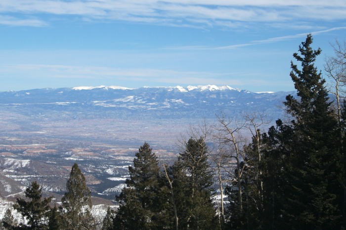
(view of the Truchas peaks from Pajarito Mountain in winter)
Sarah and I had previously hiked the Pecos Baldy and East Pecos Baldy from the Jack's Creek trailhead, so we decided to use the Santa Barbara trailhead for a change of scenery. We did not consider the shorter Quemado approach for fear of vandalism to our vehicles.
The four of us met at the Santa Barbara trailhead on Friday morning, and we enjoyed a leisurely approach hike to No Fish Lake. Aside from some really annoying trail destruction from all the livestock in the area, we enjoyed great views of the basin and amazing wildflowers along the way. Despite it being a holiday weekend, we had no problem finding a great spot to camp only a few hundred yards from the lake.
(a nice day for a hike)
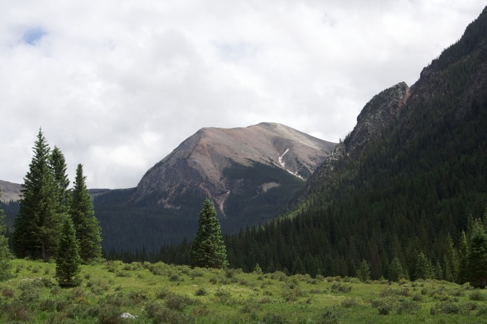
(Chimayosos Peak in the distance)
(Columbine in full bloom)
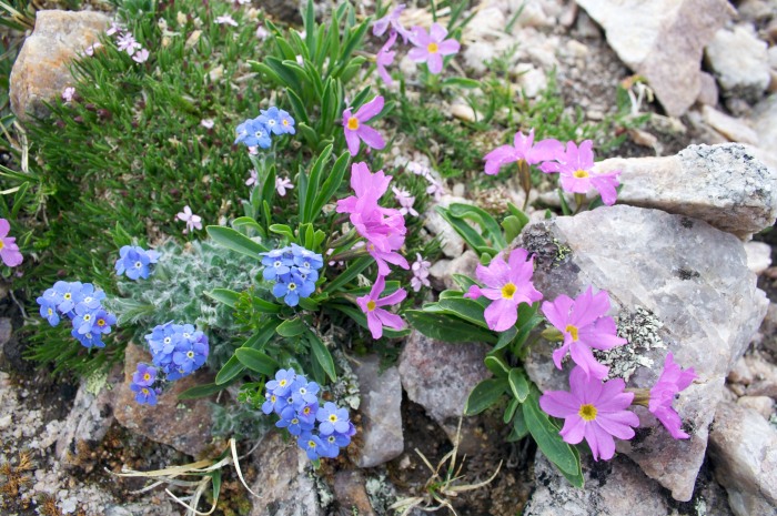
(amazing flowers along the way)
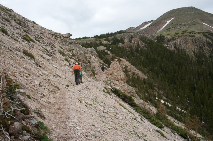
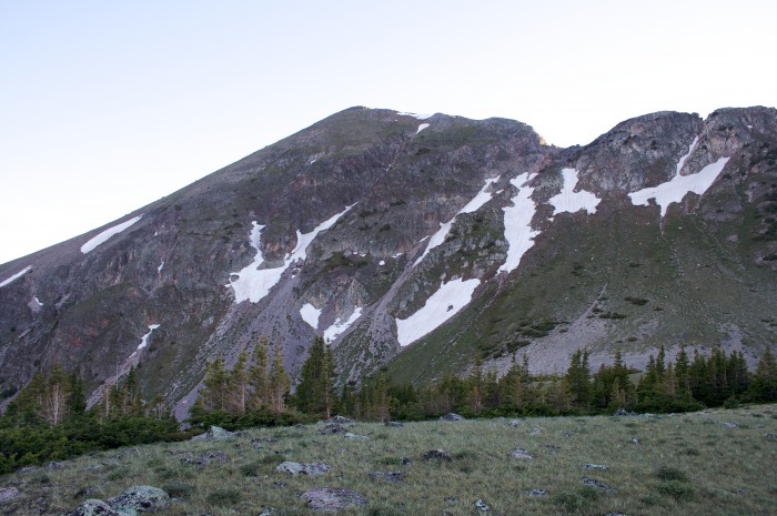
The following morning, we left our camp just after sunrise to try climbing all four peaks in the Truchas group. From the lakes, the trail climbs numerous switchbacks up to the saddle between Chimayosos Peak and North Truchas Peak. From the saddle, the route leaves the trail and climbs up the steep, grassy terrain on the east face of North Truchas Peak.
(making our way up to the saddle)
(the north face of North Truchas Peak)
(the east face of North Truchas Peak seen from the saddle)
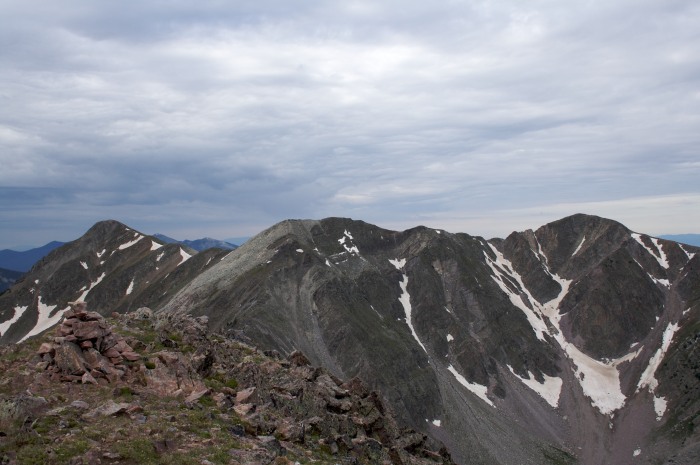
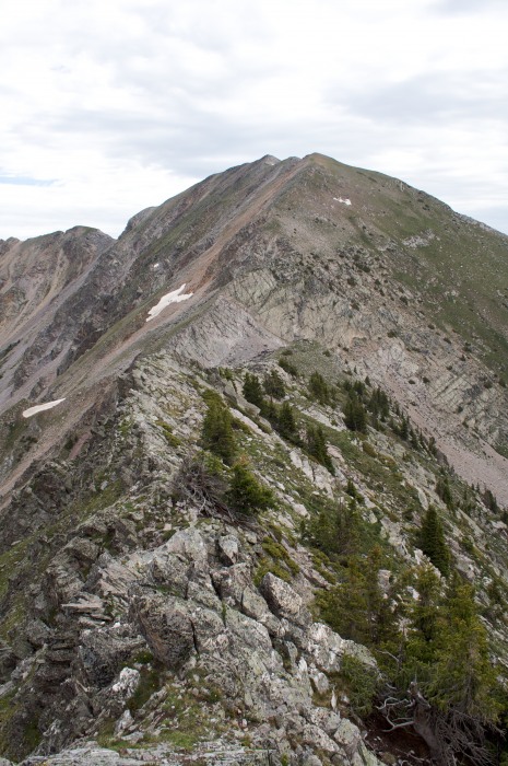
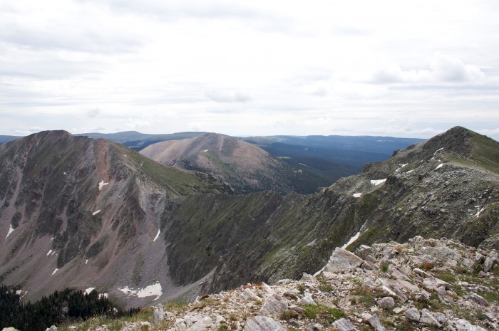
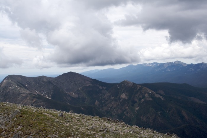
(L-R: Truchas Peak, Middle Truchas Peak*, and West Truchas Peak*)
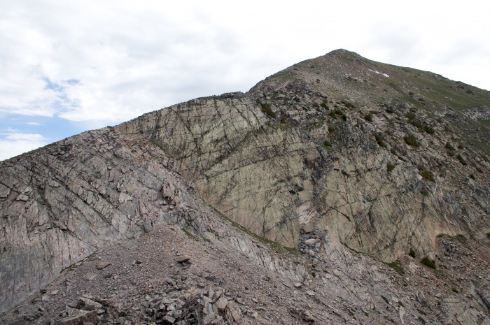
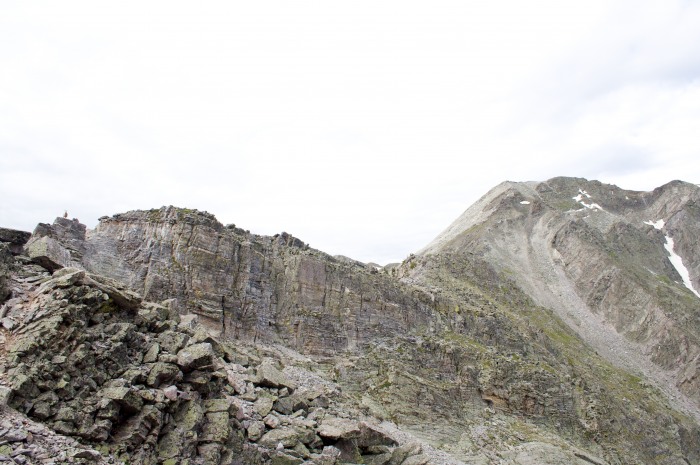
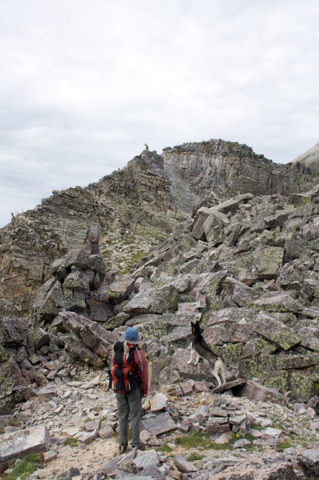
The ridge connecting North Truchas Peak to Middle Truchas Peak offers lots of enjoyable scrambling and a few mini knife edges along the way. The climbing never exceeded class 3, and our dog had no problem the entire way. The crux of the ridge is descending a somewhat smooth, 40-ft tall face down to the saddle between the two peaks. There were lots of options, and we chose to use a set of diagonal cracks to make our way down. Again, our dog had no problem with this section. From the saddle, there is a mini knife edge about 10-ft wide that offers plenty of scrambling opportunities. Aside from a bighorn sheep that refused to grant us passage, we really enjoyed this section in particular.
(Sarah and Nina standing on a fin just above the saddle - behind her)
(looking back at the crux from the saddle - note the diagonal cracks)
(a bighorn sheep guarding the mini knife edge)
(looking back along the ridge towards North Truchas Peak)
(the bighorn sheep stands his ground - "None shall pass!")
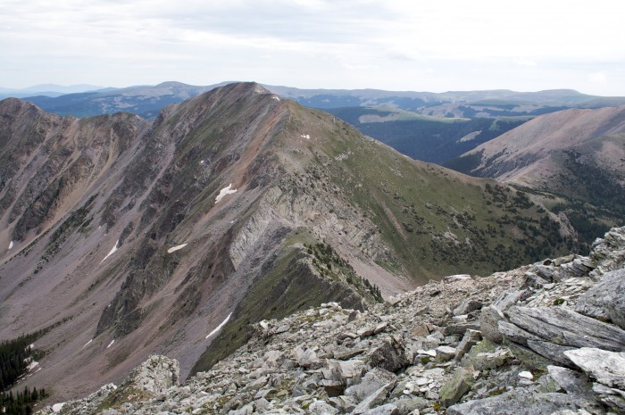
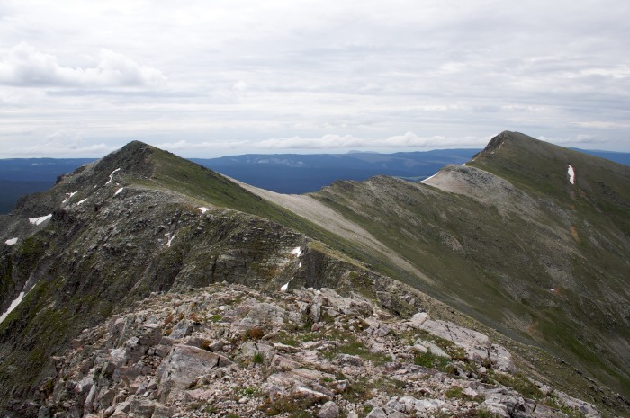
(North Truchas Peak and the connecting ridge as seen from Middle Truchas Peak)
Once we reached the summit of Middle Truchas Peak, all the scrambling was behind us. We made our way over to the summit of West Truchas Peak on the grassy slopes atop steep cliffs. The views were amazing, and we enjoyed spending so much time far above tree line.
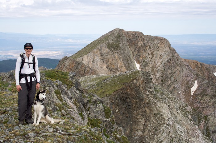
(Nina and I pose in front of West Truchas Peak)
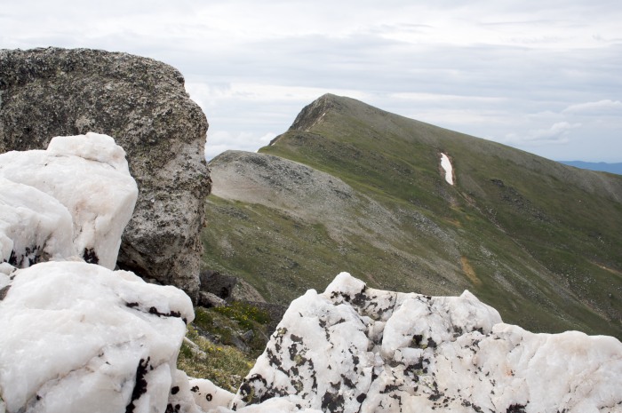
(North Truchas Peak (left) and Middle Truchas Peak (right) from West Truchas Peak)
(Middle Truchas Peak (left) and Truchas Peak (right) from West Truchas Peak)
From the summit of West Truchas Peak, we traversed around the southwest shoulder of Middle Truchas Peak and on to the summit of Truchas Peak, the tallest of the group and our fourth summit of the day.
(making our way towards Truchas Peak)
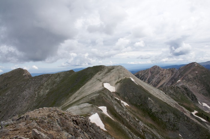
(L-R: West Truchas Peak*, Middle Truchas Peak*, and North Truchas Peak)
(L-R: Pecos Baldy & East Pecos Baldy in the foreground, Santa Fe Baldy in the distance)
We descended from the summit of Truchas Peak along the ridge to the south and eventually made our way down a steep, grassy gully on the west side of the south ridge. This gully took us directly to the trail (#251) which traverses high in the valley to Truchas Lakes, saving us a significant amount of elevation loss. Once past the lakes, we followed the trail up and over the saddle between North Truchas Peak and Chimayosos Peak. From the saddle, we made our way back down the switchbacks to our camp. Aside from getting caught in a crazy downpour and huddling in a grove of pine trees near Truchas Lakes for close to an hour as the Earth was rattled by thunder, we had a really enjoyable day on these rugged, rarely visited peaks of the New Mexico high country.
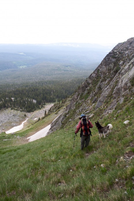
(Sarah and Nina hurriedly descending the gully into the Truchas Lakes basin)
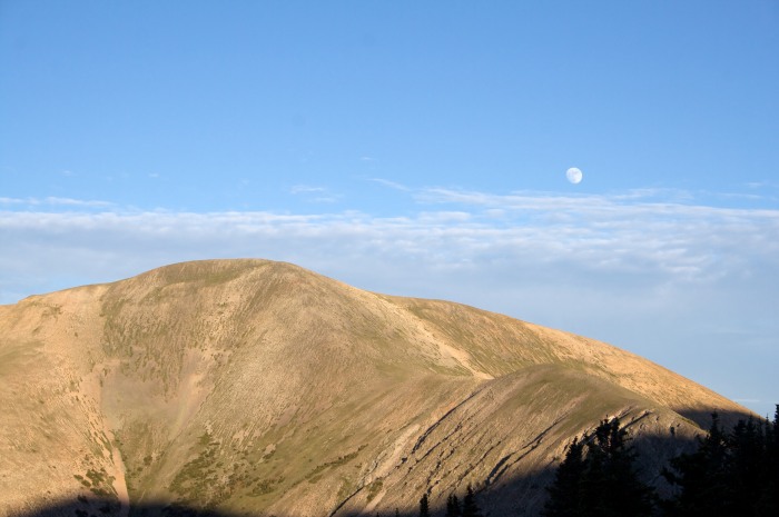
(moonrise over Chimayosos Peak)
*NOTE: The Middle Truchas Peak is not always named consistently. Here, I have chosen to refer to the peak directly between Truchas Peak and North Truchas Peak as Middle Truchas Peak. I then refer to the peak to the west of Middle Truchas Peak as West Truchas Peak. Some maps denote West Truchas Peak (as I call it here) as Middle Truchas Peak and leave the other peak unnamed.
Thumbnails for uploaded photos (click to open slideshow):
this group is high on our list too, preferably as ski descents! Way to get 'er done (while we were getting fat in the other LA). I've also seen what you call Middle Truchas referred to as "Medio Truchas" (yes, I know what the translation means; the Nuevo Mexicans tend to give un-named peaks a translated Spanish name and call it good). Scope out any promising trad lines?
I enjoyed the post. I saw those mountains when I did a road trip to northern NM last March. Wondered what it would be like to climb them - now I know. Thanks. I‘m anxious to visit the reopened St. James Hotel in Cimarron. Might give these mountains a try then...
Caution: The information contained in this report may not be accurate and should not be the only resource used in preparation for your climb. Failure to have the necessary experience, physical conditioning, supplies or equipment can result in injury or death. 14ers.com and the author(s) of this report provide no warranties, either express or implied, that the information provided is accurate or reliable. By using the information provided, you agree to indemnify and hold harmless 14ers.com and the report author(s) with respect to any claims and demands against them, including any attorney fees and expenses. Please read the 14ers.com Safety and Disclaimer pages for more information.
Please respect private property: 14ers.com supports the rights of private landowners to determine how and by whom their land will be used. In Colorado, it is your responsibility to determine if land is private and to obtain the appropriate permission before entering the property.