| Report Type | Full |
| Peak(s) |
Mt. Sneffels - 14,155 feet Uncompahgre Peak - 14,318 feet Redcloud Peak - 14,037 feet San Luis Peak - 14,023 feet |
| Date Posted | 07/06/2009 |
| Date Climbed | 07/01/2009 |
| Author | soybean56 |
| Happy 4th of July! 7 San Juans in 4 days. |
|---|
|
July 1: Sneffels July 2: Uncompahgre/Wetterhorn July 3: Redcloud/Sunshine/Handies July 4: San Luis Sneffels: Route: South Slopes Day: July 1 Started from the Yankee Boy Basin 2WD parking area around 3:30 (the moon was below the horizon so the stars in the clear sky were breathtaking) and made it to the top of the scree field at 7:00. The ascent up the coulier was quite difficult since I had no crampons or ice ax. What looks like snow in the attached picture was a nice, solid sheet of ice. Made it to the summit after 45 minutes of climbing the rocks on the sides of the collier and enjoyed the views. Amazingly, there was zero wind on the summit. Descended and drove to Lake City via 550 to 50 to 149. Along the way I stopped at Black Canyon and Blue Mesa Lake. Gorgeous weather for the entire hike. Image: looking up the collier from Scree/Lavendar Col (on descent).  Image: looking over Sneffels sharp north face 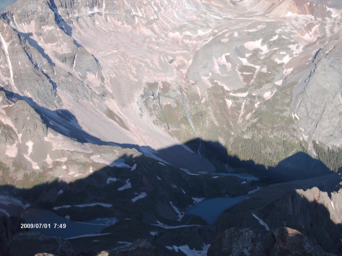 Uncompahgre/Wetterhorn: Uncomp Route: Ascended Southwest Slopes. Glissaded down gullies on west slopes. Wetterhorn Route: Southeast ridge Day: July 2 Started on the Matterhorn creek trailhead at 2:45. The air was exceptionally humid, and there were quite a few low-lying clouds. Stayed cloudy for the entire ascent, but I did run into a family of about 10 elk. The route to Uncomp was longer than I anticipated; never seemed to end. Summited around 7:45 and glissaded down the snow-filled gullies on the west face. By the time I got back to the junction for the Wetterhorn trail, I was pooped. Thought about calling it a day, but I got a second wind from somewhere and was at the yellow dirt before I knew it. I hurried and just made it to the summit before it started to rain. I didn't like the feel of the air so I took a quick picture looking west. In a rush, I messed up the time on the picture. It should be about 12:45 (see the weather coming in). Within a few minutes it was hailing, but no lighting. It rained and hailed for about an hour. Returned to Lake City, cooked some dinner, and headed to Grizzly Gulch trailhead for the next day. Image: The north face of Uncomp. 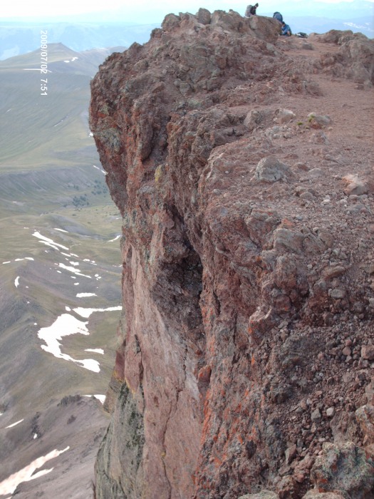 Image: Looking west of Wetterhorn. I take this small figure of the transformer Blitzwing to the top of every summit. I'm not a fan of pictures of me, so he stands in. 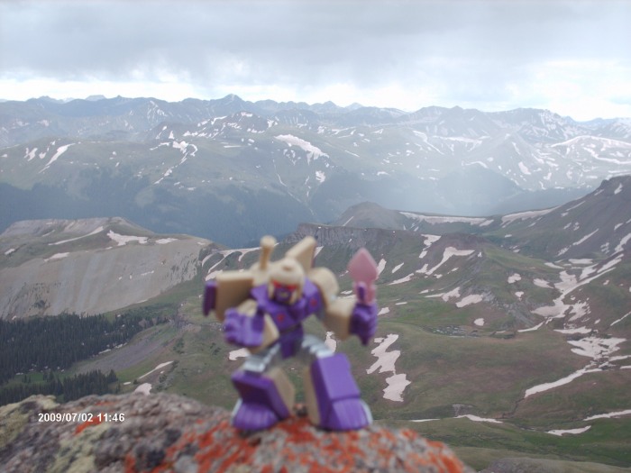 Redcloud/Sunshine/Handies Red/Sun Route: Northeast Ridge. Saddle to Sunshine. Back over Redcloud. Handies Route: East Slopes Day: July 3 On my way to the trailhead, a moose walked onto the road and proceeded to drunkedly stumble around for about 5 minutes before going back into the woods. Quite humorous. Rained off and on all night, and was drizzling when I hit the trail at 2:00. It rained about half the time on the ascent. Summited Redcloud and dropped off my pack for the trip to Sunshine. The saddle between the two was a 4 lane highway of awesome hiking on a perfect surface. Summited Sunshine at 4:45. Some fog and wind came in as the sun tried to rise. This created a truly ethereal setting as the clouds poured over the top of Redcloud and down into the northern valley. Returned over Redcloud and back to the trailhead by 7:45. Took a 15 minute break and was on the trail to Handies. Slowly but surely the clouds began to break up and it turned out to be a gorgeous day. 2.5 hours later I was on the summit. I have to say that Handies has the most picturesque summit I've been on so far. I stayed for about an hour and a half. Absolutely gorgeous. There was some rain on nearby mountains, but Handies stayed clear. Met some nice people up there. Image: From Sunshine looking back toward Redcloud (trust me).  Image: Looking into the valley southeast of Handies 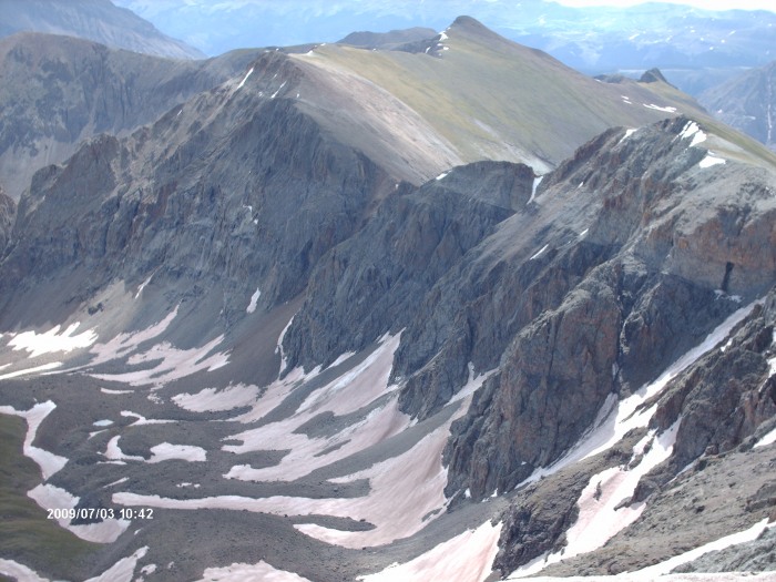 San Luis Route: South Ridge Day: July 4 What better way to celebrate the 4th than being out in nature and enjoying the beauty of this land? Started from West Willow Creek Trailhead at 2:15. A nice, enjoyable hike all the way to the summit at 6:15. Windy and chilly once I got to the ridge, but the rising sun to the east made for a gorgeous hike. There was a thin coating of ice on the rocks for the final 15 minutes or so of ascent. I celebrated the completion of my 7th peak in 4 days! Returned to the trailhead and drove from Crede to the Great Sand Dunes National Park. Spent a couple of hours there before hitting I-25 back to Fort Collins. All in all a fantastic trip! Image: Looking southwest to part of the route through the valley. 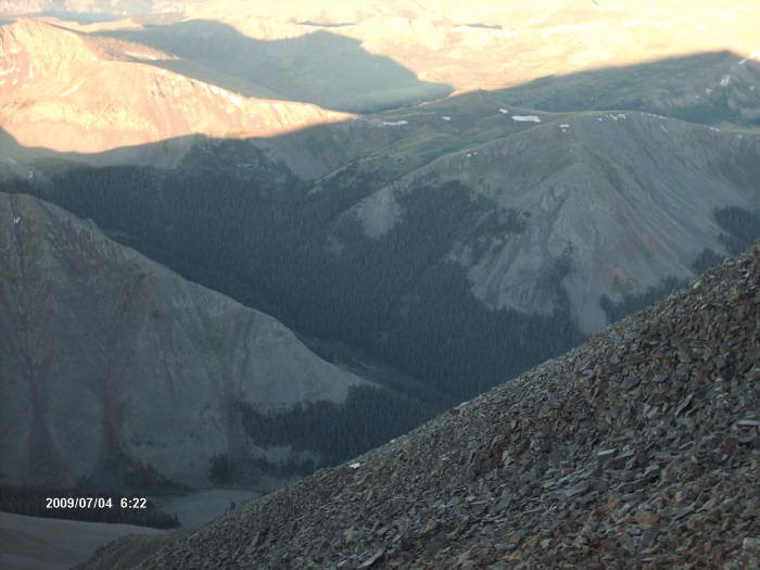 Image: Looking north off of summit. You can see the thin layer of ice. Just a cool shot with the mountain's shadow on the valley below. 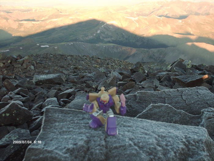 Thumbnails for uploaded photos (click to open slideshow): ")
")
")
")
")
")
")
")
|
| Comments or Questions |
|---|
|
|
Caution: The information contained in this report may not be accurate and should not be the only resource used in preparation for your climb. Failure to have the necessary experience, physical conditioning, supplies or equipment can result in injury or death. 14ers.com and the author(s) of this report provide no warranties, either express or implied, that the information provided is accurate or reliable. By using the information provided, you agree to indemnify and hold harmless 14ers.com and the report author(s) with respect to any claims and demands against them, including any attorney fees and expenses. Please read the 14ers.com Safety and Disclaimer pages for more information.
Please respect private property: 14ers.com supports the rights of private landowners to determine how and by whom their land will be used. In Colorado, it is your responsibility to determine if land is private and to obtain the appropriate permission before entering the property.

