| Report Type | Full |
| Peak(s) |
Blanca Peak - 14,350 feet |
| Date Posted | 06/30/2009 |
| Date Climbed | 06/24/2009 |
| Author | ClimberDave |
| Blanca - NW Face |
|---|
|
My dad and I drove up from Houston to hike up to Lake Como for some relaxing fishing and climbing. We drove up the road as far as my 2-wheel drive XTerra would take me - 8400'. Lake Como road just at the turn off from US150 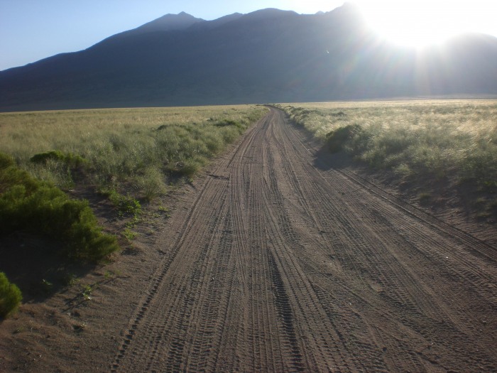 Stopped at around 8400'. We ready our camping and climbing gear.  After climbing to the lake, I took a day to get used to the altitude - I did not really need it but hanging out in this beautiful area is extremely relaxing. View of the lake from where the main stream comes in.  I decided to try Blanca on the the 24th. We got up at around 4:15 and checked on some nearby campers who were doing Ellingwood via the ridge. We then quickly prepared "Dave's Climbing Breakfast #4" (1 pkg apple cinnamon oatmeal, 1 pkg maple brown sugar oatmeal, 1 cup hot chocolate, 2 pop-tarts) and ate....incidentally, the only thing I had to eat during the entire climb was a GU shot. We hit the trail a little before 5am. My dad was only going as far as the area immediately above Lake Como, he was scouting fishing locations and wanted to catch some big Cuthroat while I climbed. Above the falls. View of the route.  My 66 year-old dad. After climbing 3200' to lake Como, he had neither the desire or the gear to climb the mountain. However, he was looking forward to fishing. 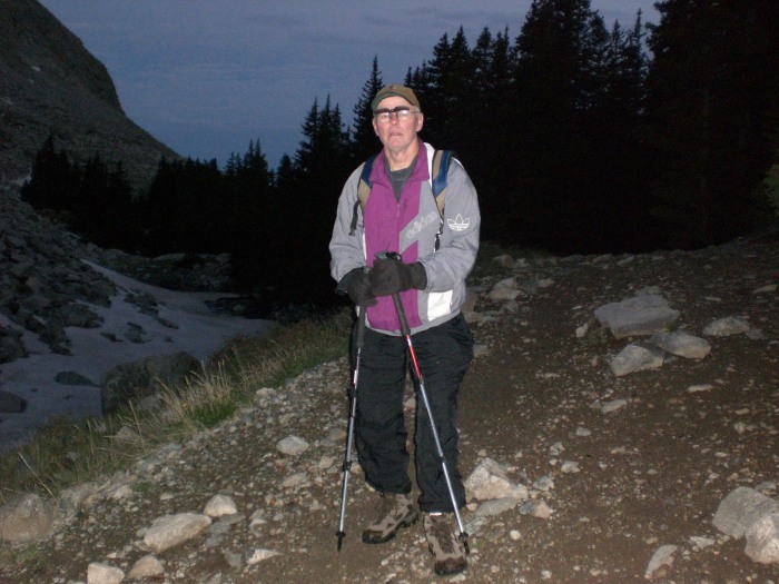 I'm ready to go.  After setting off on my own, I made my way up the trail to the falls, crossing a few small snow sections in the process. The trail was fine up the side of the files with just a little slick rock. View from a little ways above the falls.  As I climbed, I could see more of the NW face and began to think about the upper route I would be taking. The snow became more common and every lake I passed was almost completely covered in ice and snow. One of the upper lakes frozen over. 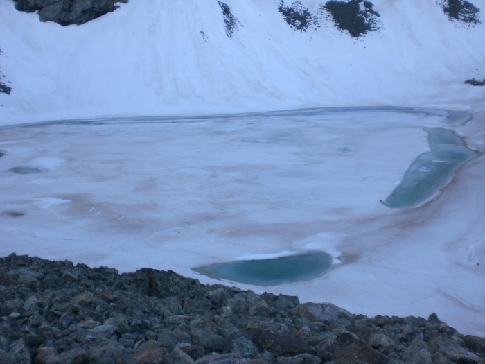 Below the ledges, I crossed several snow fields. I finally whipped out the ice axe for stability even though I had not started steep climbing. The snow was finicky and would be solid for a few steps and then I would sink up to my thigh. It became a little more consistent as I climbed but I was still postholing every now and then. I left the crampons strapped to the pack. Immediately below the ledges, I had to kick-step for about 40 yards or so while using the belay ice axe. Still I didn't take the crampons off the pack. I had a feeling that they would not really be needed above the ledges as the day warmed. And as it turned out, below the ledges was the only place I had to kick-step. A view of the route.  Another view from higher up. Consistent snow now.  Instead of skirting around the ledges as in the route description, I went straight up the middle. It was not bad at all, yet I had to watch out for a few loose rocks and be mindful of the vegetation that was emerging. I could see a snow route on the NW face that gained the ridge high. Next to it was a line of mixed snow and boulders/talus that also gained the ridge higher than the standard route. I chose to stick to rock as the snow was not as much fun as I had anticipated (though, it was not difficult). This proved to be a good route but required concentration as there were many loose rocks. I manged to climb without knocking a single rock down the slope. Gaining the ridge at a higher point was advantageous as most of it was covered with plenty of soft snow. Another view back down.  Higher still. The sun is chasing me!  A look back down the boulder/talus field where I am climbing. 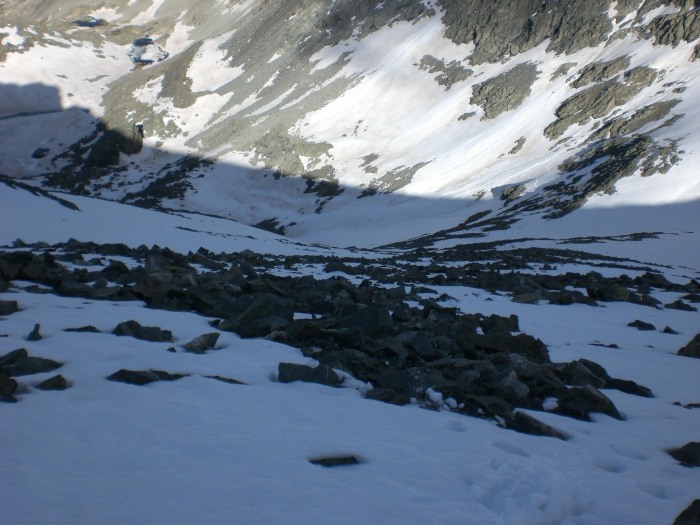 Good perspective view up to the ridge.  Near the summit, the standard route description says that it is possible to scramble around large boulders to keep the difficulty at "difficult" class 2. Now where is the fun in that?! In any case, doing this required jumping in and out of snow so I decided to climb up and over the boulders going straight up the ridge. This was not bad at all but rather quite fun and added to the climbing experience. This route is mostly solid with a few loose pieces of rock that are easily avoided...as long as you take it easy. I've gained the ridge. Not much left to go.  One of the moves required if climbing over (not around) the boulders near the summit.  From the same position as the previous photo, this looks over the ridge.  I make it to the top with mild wind and few clouds in the sky. The view was amazing. My altimeter watch had stopped giving an accurate reading and still showed 13,800'. After double-checking that I was indeed on the summit, I activated my ancient GPS and received a better altitude reading. Ellingwood still had a decent amount of snow. The traverse between LB and Blanca looked perfect for climbing with little snow. My old and cheap GPS. The elevation reading is somewhat close.  A pic of me on the summit. I had it to myself! 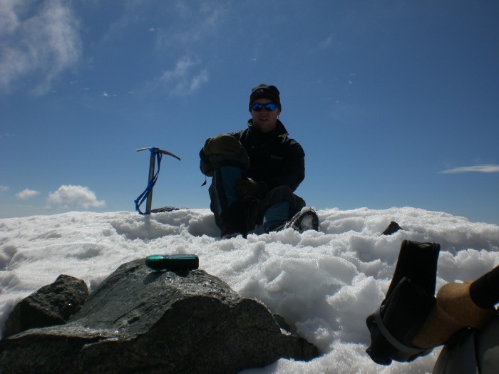 Spectacular view of Ellingwood.  Lake Como, the valley, and a good portion of the LB traverse. 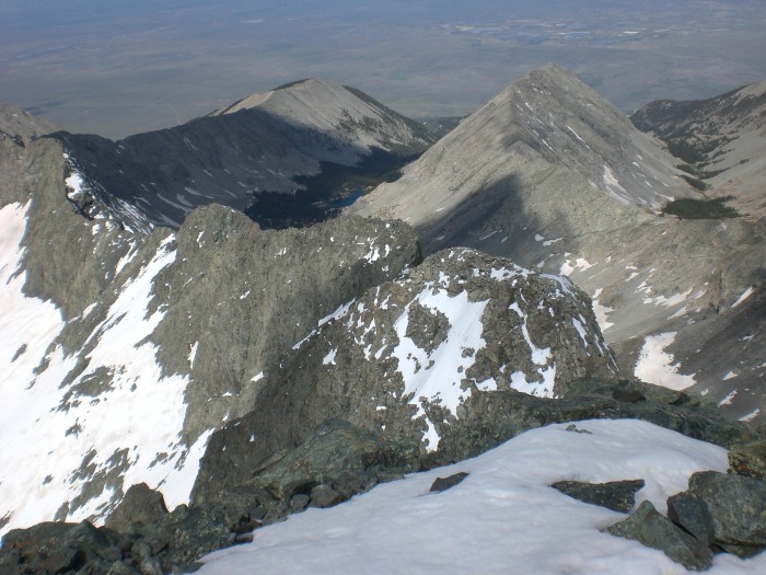 Lindsey.  Looking North - The Crestones way in the distance. 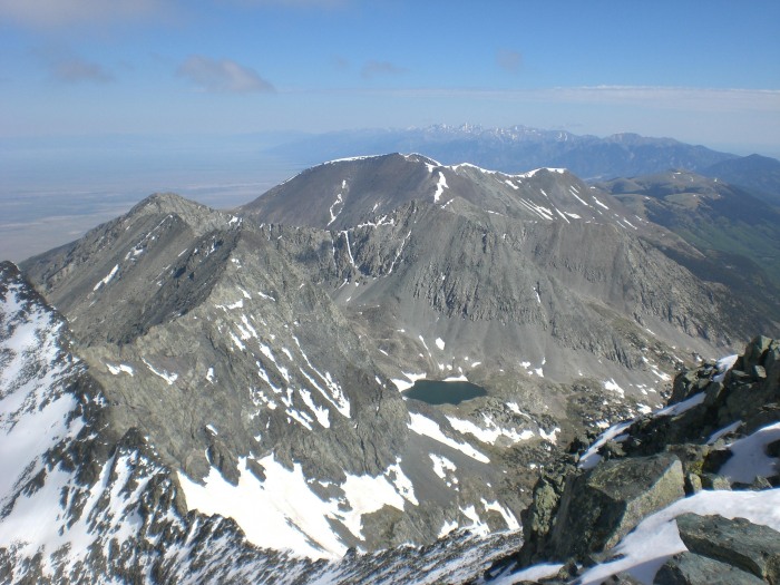 Little Bear. The "low" cloud was cool. I have a little video of it sweeping by while I am up there. 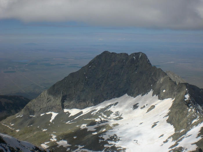 On the way down, I spied a glissade path a little North of the route I had climbed. I made my way over to it and put on the snow pants and helmet and quickly lost several hundred feet. Afterward, I stripped down to the short sleeve shirt and took off the snow pants. I broke out the MP3 player and put on some "mountain techno/trance" and enjoyed a beautiful and easy hike back to the lake. Below is the Spot track of my climb. I removed the track markers for the down-climb but you can still see the path. The path down is skewed quite a bit because one track showed up in the adjacent basin. I don't know what was up with that but I think it occurred while I was glissading. The whole path itself appears to be skewed to the North. I think I was much further South. My Spot (otherwise known as the "Dave Tracker") track up Blanca.  I had a beautiful day for climbing. Upon arriving back at Lake Como, I felt great. It appeared that my training had paid off. However, I did have quite headache from not drinking enough water. This is something I need to work on. In any case, with the snow melt, there are plenty of water opportunities on this route. Some are as high as 13,000' or better. The combo to Ellingwood looked tempting, although the snow would make it a little more difficult/dangerous than usual. I was feeling great but I had taken my time climbing Blanca so I decided to save Ellingwood for another day. Again, I didn't need crampons the entire route. There was one small section they would have helped but I left them strapped to my pack. The ice axe was quite necessary. The glissades on the way down were easy and fun but the snow was not very deep in a few spots. The snow is melting very fast. As for the Lake Como road - words cannot describe how much of a pain it is to hike up and down this "road". If you haven't hiked this road, take everything you have heard about it and amplify by 10. Give me a swampy Elk-trampled meadow any day - this road was horrid. There has been a lot of concern from people who have never been up it but wish to drive as far as possible. There are many, many places to pull off below 10,000' and quite a few above that. There would need to be a huge crowd up at the lake for you to be hurting for a spot to pull off. I don't see how that could ever be a concern. There is one bad spot around 9200'-9300' for those wishing to drive the road up to 10,000' in regular short wheel-base, high clearance vehicles. This spot is shown in the trail head info. on this site (the pic with the XTerra going over it). My XTerra made it to about 8300'-8400'. It only has two-wheel drive but I do have limited slip differential. I stopped at that point because I started spinning the tires on the river rock. I probably could have pushed it a little higher, maybe even beyond the river rock sections but I didn't want to damage a vehicle I need to drive back to Houston! I have a bunch of pics of the lower and upper road so PM if you need some info on the road. There's plenty of camping around lake Como and the lake itself is full of easily caught Brook trout. Do not leave any food laying around because chipmunks and squirrels are much better camp-invaders than the marmots and will chew through your trail mix. They did not bother a hanging food bag. It also seems that the 4x4 guys are prone to leaving trash around (assuming because I don't think hikers would pack in Tecate beer) so if you see it pack some out if you can! Thumbnails for uploaded photos (click to open slideshow): ")
")
")
")
")
")
")
")
")
")
")
")
")
")
")
")
")
")
")
")
")
")
")
")
")
|
| Comments or Questions | |||
|---|---|---|---|
|
Caution: The information contained in this report may not be accurate and should not be the only resource used in preparation for your climb. Failure to have the necessary experience, physical conditioning, supplies or equipment can result in injury or death. 14ers.com and the author(s) of this report provide no warranties, either express or implied, that the information provided is accurate or reliable. By using the information provided, you agree to indemnify and hold harmless 14ers.com and the report author(s) with respect to any claims and demands against them, including any attorney fees and expenses. Please read the 14ers.com Safety and Disclaimer pages for more information.
Please respect private property: 14ers.com supports the rights of private landowners to determine how and by whom their land will be used. In Colorado, it is your responsibility to determine if land is private and to obtain the appropriate permission before entering the property.


