Download Agreement, Release, and Acknowledgement of Risk:
You (the person requesting this file download) fully understand mountain climbing ("Activity") involves risks and dangers of serious bodily injury, including permanent disability, paralysis, and death ("Risks") and you fully accept and assume all such risks and all responsibility for losses, costs, and damages you incur as a result of your participation in this Activity.
You acknowledge that information in the file you have chosen to download may not be accurate and may contain errors. You agree to assume all risks when using this information and agree to release and discharge 14ers.com, 14ers Inc. and the author(s) of such information (collectively, the "Released Parties").
You hereby discharge the Released Parties from all damages, actions, claims and liabilities of any nature, specifically including, but not limited to, damages, actions, claims and liabilities arising from or related to the negligence of the Released Parties. You further agree to indemnify, hold harmless and defend 14ers.com, 14ers Inc. and each of the other Released Parties from and against any loss, damage, liability and expense, including costs and attorney fees, incurred by 14ers.com, 14ers Inc. or any of the other Released Parties as a result of you using information provided on the 14ers.com or 14ers Inc. websites.
You have read this agreement, fully understand its terms and intend it to be a complete and unconditional release of all liability to the greatest extent allowed by law and agree that if any portion of this agreement is held to be invalid the balance, notwithstanding, shall continue in full force and effect.
By clicking "OK" you agree to these terms. If you DO NOT agree, click "Cancel"...
The plan was to summit both Crestone Peak and Crestone Needle, provided the weather cooperated. The forecast looked pretty good, so we drove to just below the first creek crossing and hiked in. We should have known better...
There was a lot less snow on the trail than we saw three weeks ago, although it was pretty wet.
We set up camp Wednesday evening (6/24/09), thinking to try Crestone Peak the following day. There are some good (read: mostly snow-free) camping spots near Lower South Colony Lake, although there is still a fair bit of snow. The next morning, it was fairly cloudy, and we could not see the summit of Crestone Needle.
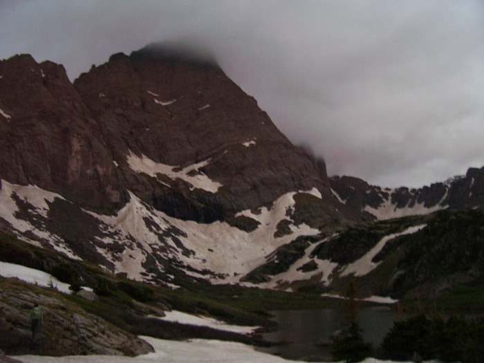
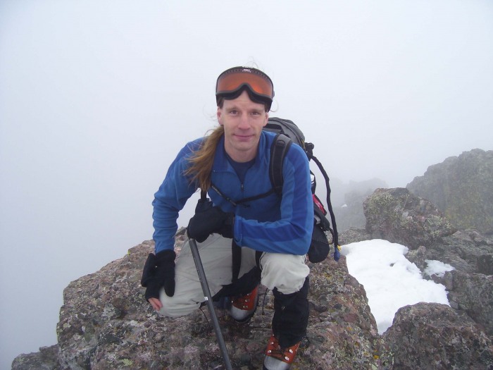
Not to be deterred, we decided to hike up to Broken Hand Pass and go for the Peak if the weather seemed okay. Although it was overcast, it was fairly warm, so we went for it. It rained pretty hard on the way up the South Face/Red Gully, so I don't have pictures of the way up. Most of it was snow covered, and we used ice axes and crampons to the "red notch" at the top of the couloir. From there, it was a mixed climb to the summit. The views from the summit were...well, you can decide.
We tried to get some pictures on the way down, but the camera was wet and they were blurry. For what it's worth, here's a picture of the South Face/Red Gully.
We were able to glissade much of it, but the snow was pretty soft and you could hear water beneath the snow in places.
On the way up the pass from Cottonwood Lake, the sun finally made an appearance.
Looking up at the pass from Cottonwood Lake.
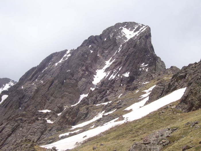
View of Crestone Needle.
Since clouds were building, we decided to head back to camp and try the Needle the following day. About an hour and a half after we reached camp, it began to rain and it rained for a long time. It also rained during the night. The next morning, we woke up to strong winds and overcast skies. We decided to hike up to Broken Hand Pass and see what conditions were like (given the weather, we had little hope of doing the Needle but at least wanted to try).
Looking down Broken Hand Pass towards South Colony Lakes (about 7am). Both times we went up the pass, we used crampons and ice axes. The lower steep section was mainly snow, with a little ice (you could avoid the ice by scrambling up the rocks).
The upper part of the Pass was snow free.
We were hoping the early morning clouds would burn off (or move on, given the high winds). Knowing it was unlikely we would summit, we decided to go up to the gullies and check out the conditions.
As the clouds rushed past, we got a better view (and saw the first patches of blue sky).
Given the high winds, iffy weather, and wetness of the rock, we decided to turn around, pack up camp and head out. Things were fairly uneventful until we reached the 4 WD road, where we encountered a violent hail storm.
We took the above pictures after it had stopped for awhile. The precip turned the creek crossings into much deeper, more interesting crossings. We were very glad we had chosen to park below the first crossing!!
Looks like it will take us three trips (at least) to South Colony Lakes to get the three peaks. If I think of it, I'll post a thread next time I go, since rainy/snowy weather seems to follow me.
Thumbnails for uploaded photos (click to open slideshow):
thanks for climbing around in the bad weather! I was thinking of climbing the needle and kat carson challenger this week but now im thinking ill wait another for more snow to melt. :D
Caution: The information contained in this report may not be accurate and should not be the only resource used in preparation for your climb. Failure to have the necessary experience, physical conditioning, supplies or equipment can result in injury or death. 14ers.com and the author(s) of this report provide no warranties, either express or implied, that the information provided is accurate or reliable. By using the information provided, you agree to indemnify and hold harmless 14ers.com and the report author(s) with respect to any claims and demands against them, including any attorney fees and expenses. Please read the 14ers.com Safety and Disclaimer pages for more information.
Please respect private property: 14ers.com supports the rights of private landowners to determine how and by whom their land will be used. In Colorado, it is your responsibility to determine if land is private and to obtain the appropriate permission before entering the property.


")
")
")
")
")
")
")
")
")
")
")
")
")
")
")
")


