Download Agreement, Release, and Acknowledgement of Risk:
You (the person requesting this file download) fully understand mountain climbing ("Activity") involves risks and dangers of serious bodily injury, including permanent disability, paralysis, and death ("Risks") and you fully accept and assume all such risks and all responsibility for losses, costs, and damages you incur as a result of your participation in this Activity.
You acknowledge that information in the file you have chosen to download may not be accurate and may contain errors. You agree to assume all risks when using this information and agree to release and discharge 14ers.com, 14ers Inc. and the author(s) of such information (collectively, the "Released Parties").
You hereby discharge the Released Parties from all damages, actions, claims and liabilities of any nature, specifically including, but not limited to, damages, actions, claims and liabilities arising from or related to the negligence of the Released Parties. You further agree to indemnify, hold harmless and defend 14ers.com, 14ers Inc. and each of the other Released Parties from and against any loss, damage, liability and expense, including costs and attorney fees, incurred by 14ers.com, 14ers Inc. or any of the other Released Parties as a result of you using information provided on the 14ers.com or 14ers Inc. websites.
You have read this agreement, fully understand its terms and intend it to be a complete and unconditional release of all liability to the greatest extent allowed by law and agree that if any portion of this agreement is held to be invalid the balance, notwithstanding, shall continue in full force and effect.
By clicking "OK" you agree to these terms. If you DO NOT agree, click "Cancel"...
Wetterhorn Peak and Uncompahgre Peak trip on 19th and 20th of June 2009.
After hiking Wetterhorn the day prior in perfect blue-bird conditions, ( http://www.14ers.com/php14ers/tripreport.php?trip=6225 ) we awoke from our campsite to heavy cloud cover. We had camped at the trail juction on MAtterhorn Creek trail where left gets you to Wetterhorn Peak, and a right takes you up over the pass toward Uncompahgre Peak. After a good breakfast and getting hte gear together, we started hiking over the pass toward Uncompahgre at 7:45 am. By the time we got up to the top of the pass, the sky was looking better.
Forgive the dirty lens in some of these pics.
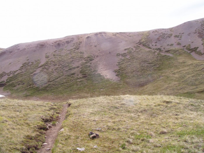
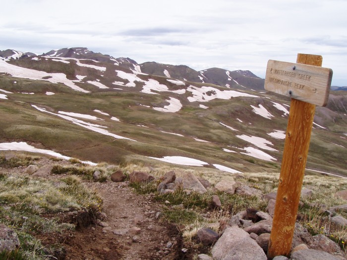
Here's the view looking back toward Matterhorn and Wetterhorn Peaks.
Here's the view of Uncompahgre from the top of the pass. Looks good from here.
View looking back, showing the on and off snow as you hike. The snow was firm and we never post-holed unless at the very edges of the snow, and there it is only 2-3 inches deep.
Kathy hiking ahead on the trail heading around one of the dirt humps.
Kathy hiking ahead on the trail.
View of Uncompahgre, here the trail crosses one of the largest of the 2,753 stream crossings. This one had plenty of rocks to hop across. Nearly of the other streams are only 1-3 inches deep and 1-3 feet wide. We hiked all day with dry feet so no worries.
Kathy hiking ahead on the trail. There are 3 or 4 of these mini ridges to get over along the trail.
Kathy hiking ahead on the trail.
Kathy hiking ahead on the trail.
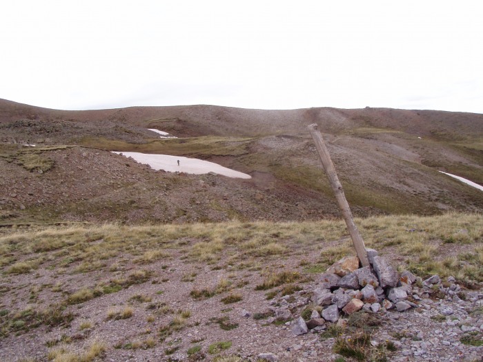
View of the route ahead near where our trail meets the Nellie Creek Trail.
View looking back down the Nellie Creek Trail at the junction with our trail from Matterhorn Creek Trail.
As you continue to climb up the class 1 grass slope toward the class 2 section, you pass 3 or 4 large "ramparts" to your left with cliffs below. You can see from the view between tow of them, looking back at the pass we came through how the weather has been changing as we've been hiking.
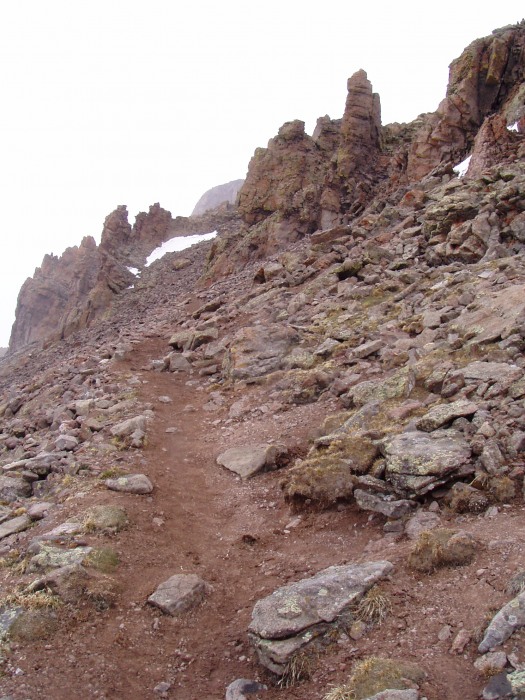
THe easy hiking is over. After completing the big Z turn switchback up to the first cliff band, the trail tucks around the left side of the cliffs, and this is your view of the trail leading upward.
Follow the trail until it leads you to this snote chimney. Trail stair-steps up on the right side of the chimney. Lots of options, but some of the stones are loose. Take care to look back from the top so you recognize your route down. Remember on the way back down to look for that chimney as your marker and the trail will be to the left. (That mental note helped me a lot!)
THe trail meanders around rock outcroppings eventually meeting up with the next cliff band as it makes it's way toward the right.
After gaining the 2nd cliff band, we are now on the sloped summit platuae. This is our view as we are hiking, so I didn't take many pics in this area.
Success! I would have preferred a nice view, the the conditions did make for interesting pics not the less. We didn't spend much time o the summit. Although the ground was free and clear off all snow, the air, however, was full of it!
Hiking back down the grass slopes below the cliff bands.
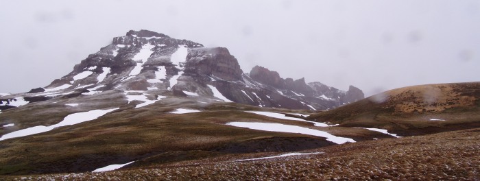
Approaching the pass back toward Matterhorn Creek. THe clouds are finally starting to break and reveal Wetterhorn and Matterhorn summits.
At the top of the pass, looking back at Uncompahgre Peak.
Ground mist rising up from the ground as the sun begins to pierce the clouds. Blue sky ahead!
Crossing the pass.
Nearing camp, naturally artistic fall marks in the steep snow.
AFter breaking camp, a view of Wetterhorn and Matterhorn. Hard to believe we just hiked through 5 hours of snowfall!
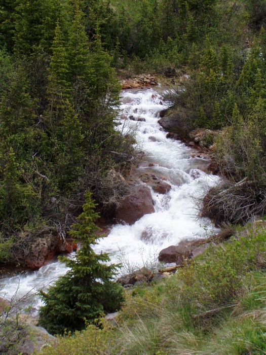
Nearing the trailhead, there are many nice views of Matterhorn Creek.
Thumbnails for uploaded photos (click to open slideshow):
It's a really good thing I couldn't tell how close I was to the edge of that abyss! :shock: Why do I listen to you?? lol :lol:
Caution: The information contained in this report may not be accurate and should not be the only resource used in preparation for your climb. Failure to have the necessary experience, physical conditioning, supplies or equipment can result in injury or death. 14ers.com and the author(s) of this report provide no warranties, either express or implied, that the information provided is accurate or reliable. By using the information provided, you agree to indemnify and hold harmless 14ers.com and the report author(s) with respect to any claims and demands against them, including any attorney fees and expenses. Please read the 14ers.com Safety and Disclaimer pages for more information.
Please respect private property: 14ers.com supports the rights of private landowners to determine how and by whom their land will be used. In Colorado, it is your responsibility to determine if land is private and to obtain the appropriate permission before entering the property.


")
")
")
")
")
")
")
")
")
")
")
")
")
")
")
")
")
")
")
")
")
")
")
")
")