Download Agreement, Release, and Acknowledgement of Risk:
You (the person requesting this file download) fully understand mountain climbing ("Activity") involves risks and dangers of serious bodily injury, including permanent disability, paralysis, and death ("Risks") and you fully accept and assume all such risks and all responsibility for losses, costs, and damages you incur as a result of your participation in this Activity.
You acknowledge that information in the file you have chosen to download may not be accurate and may contain errors. You agree to assume all risks when using this information and agree to release and discharge 14ers.com, 14ers Inc. and the author(s) of such information (collectively, the "Released Parties").
You hereby discharge the Released Parties from all damages, actions, claims and liabilities of any nature, specifically including, but not limited to, damages, actions, claims and liabilities arising from or related to the negligence of the Released Parties. You further agree to indemnify, hold harmless and defend 14ers.com, 14ers Inc. and each of the other Released Parties from and against any loss, damage, liability and expense, including costs and attorney fees, incurred by 14ers.com, 14ers Inc. or any of the other Released Parties as a result of you using information provided on the 14ers.com or 14ers Inc. websites.
You have read this agreement, fully understand its terms and intend it to be a complete and unconditional release of all liability to the greatest extent allowed by law and agree that if any portion of this agreement is held to be invalid the balance, notwithstanding, shall continue in full force and effect.
By clicking "OK" you agree to these terms. If you DO NOT agree, click "Cancel"...
Wetterhorn Peak and Uncompahgre Peak trip on 19th and 20th of June 2009.
Trip was from Matterhorn Creek Trailhead.
After leaving Lake City, while driving along Henson Creek toward the trailhead, we passed a grader and steamroller. Yes, that road was about as smooth as can be today. After turning off toward Matterhorn Creek TH, this road wasn't too bad either, easy for a 2wd car driver who knows how to drive a dirt road. Plenty of space to park if you choose not to drive the 1/2-mile to the 4x4 TH. Dry ground, no sign of any snow. Summer is here, almost officially.
After car-camping Thursday evening, me and Kathy woke-up, ate a quick breakfast and hit the trail around, I forget, we'll say 7:00 am.
The trail was dry and zero snow all the way to tree line. Above tree line, still no sign of snow on the trail.
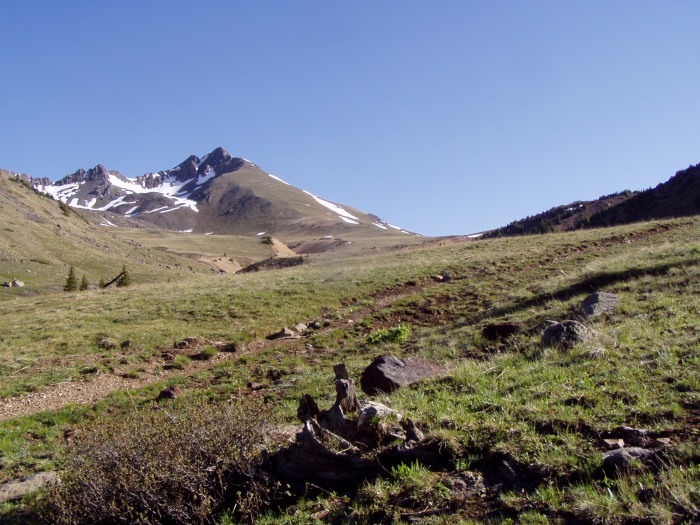
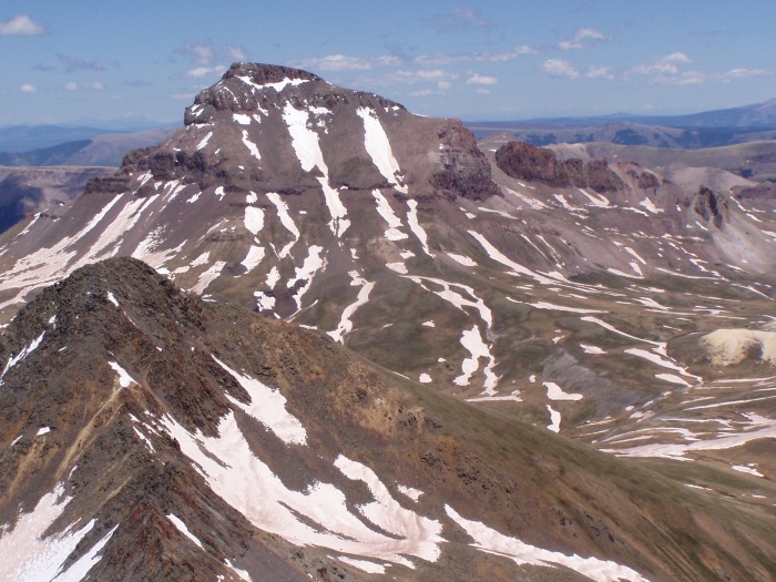
After breaking through treeline, you are on the west side of broadening canyon making a slow left curve around a large rocky hill. Soon you come into view of Matterhorn Peak. As you continue to hike, Wetterhorn joins via their traverse.
After passing a creek that has turned everything it touches bright orange, you quickly come to another creek that has a junction with a sign. Left for Wetterhorn, Straight for "stock trail # something": (Toward Uncompahgre)
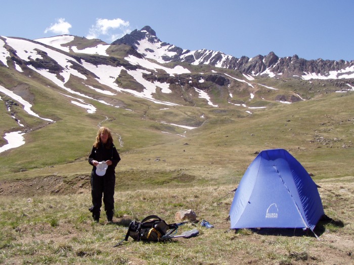
After spending 20 minutes or more looking for the best flat tent site, we decided on the ONLY flat camping spot...
The grassy-knoll ~200 feet to the south-west is where we pitched our tent. This pic can be found at the end of the trip report.
It was a perfect blue-bird day. Not a cloud in the sky. We decided that Wetterhorn needed to be climbed today if the weather insisted on staying this nice.
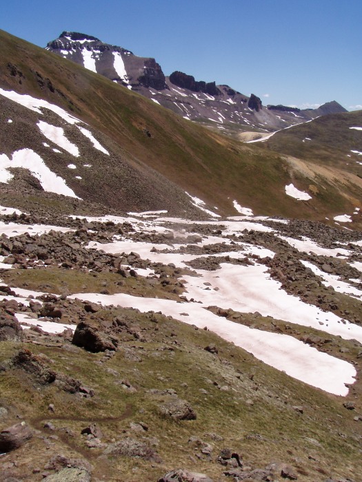
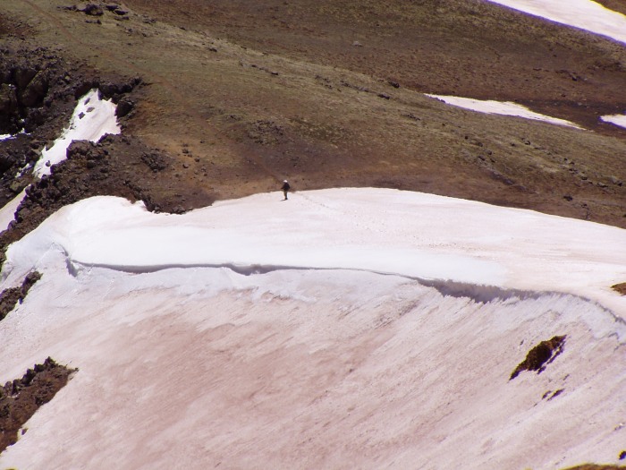
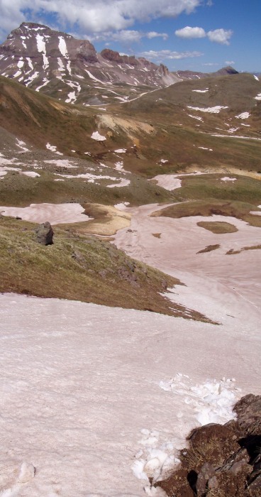
The peak didn't look very snowy from camp. (This picture taken the next day--still shows conditions.)
The trail toward Wetterhorn starts up gently inclined grass. Soon you are winding your way between rocks.
This is where we passed a guy coming down who told be that he needed to use his crampons and ice axe on a couple cols up there and that one slip and I would slide to my death. After Kathy talked to him for a few minutes, her confidence was shot to hell. ---I've got an ice axe, but I don't yet own crampons. I'll turn around if I have to, but we continue onward.
The rocks are joined by snow fields that you can either walk around or choose to walk across. I chose to wind around, staying on the snow as it seemed to the the path of least resistance. The snow was good and firm. I may have only post-holed 5 or 6 times all day.
Soon we are past the rocks, and the trail turns to crossing back and forth on a steeper grassy hill/ridge. There are snow fields here and there. Some we walk up or across, others we walk around. Hiking poles are helpful but no crampons or ice axe were used. Later in the report, pic #18 from the summit shows the hillside.
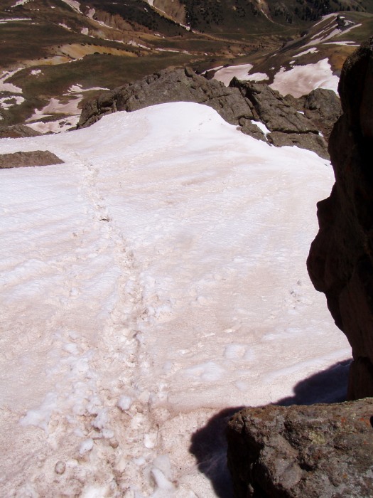
Walking along the ridge toward the summit a dry trail until you come to the yellow dirt hill. It is all snow, but not too steep and easily to kick-step your way up quickly.
Remember that guy that we met on the way up? Well that gave Kathy all the reason she needed to stop. She chose to stay here and read while I continued onward. She did fly back from sea-level a week ago so I didn't spend much time trying to talk her into continuing even though we've done much harder than this in the past. anyway...............
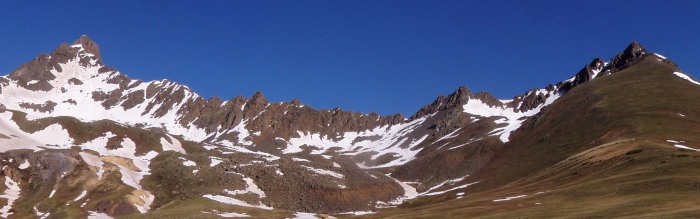
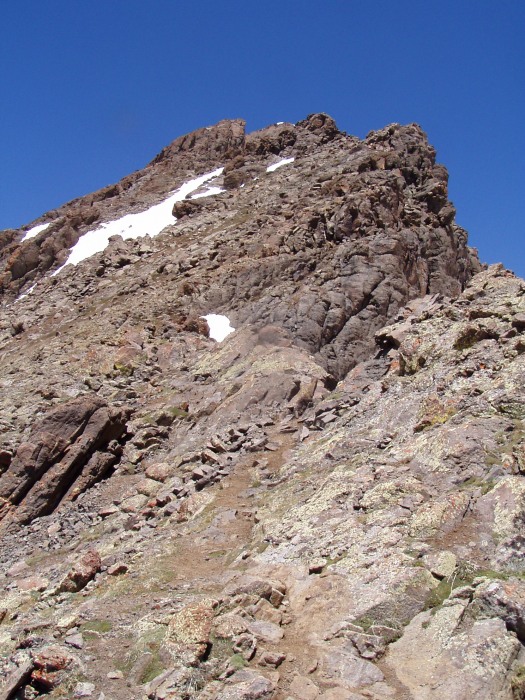
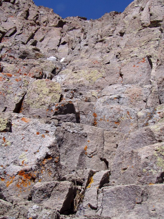
Here's what conditions are looking up toward the peak:
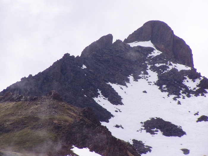
The "prow" is at the top of picture, just left of center.
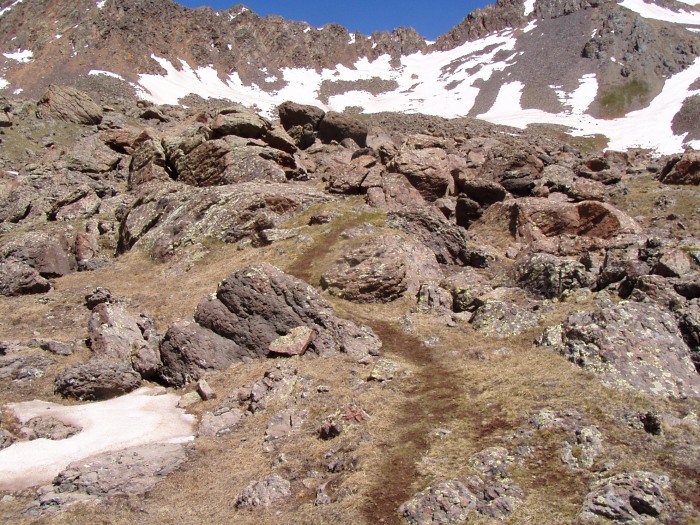
You can see trail segments leading you upward along cairns toward some snow.
At the snow, I just climbed 90-degrees to the right, straight up, over and around rocks until I am above the snow, and pass by it without a sweat. NO CRAMPONS NEEDED! I had to do this a couple times. It would be slightly more involved than the class 3 section at the top, maybe class 4 in a couple places.
This is the boulder hopping you do to avoid snow.
Looking back down.
Far below I see Kathy going up and down the snow that had scared her earlier. She did it 3 times for practice. She kept going back down to shoo-away a marmot that kept getting into her pack.
While Kathy is chasing marmots, I turn my focus back to the mountain, staying high on the ridge.
Sometimes I'm on the left-side of the ridge...
Sometimes I'm on the right side of the ridge...
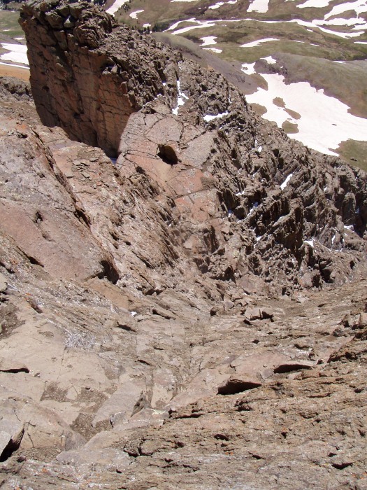
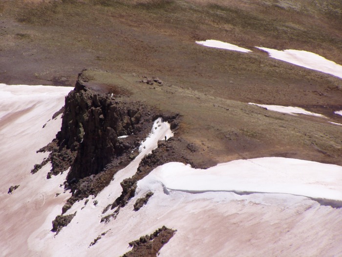
There was a small snow field under, around the right-side and above the prow. It wasn't steep. I either walked on the snow or stepped on the rocks poking up. The snow leads up to the rocky crack that you see in the route guide.
This is a pic of that snow. I'm standing in the crack looking back down. The Prow is off screen to the right of the pic, in-front and above you. I didn't take a pic of it here because it is too big and too close.
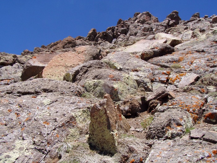
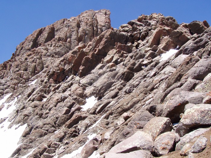
Very quickly you come to the class 3 section. No more snow to the top.
Looking up the class 3 from below. This section took about two minutes of climbing time with easy route finding. It's pretty much a big wide staircase with stairs varied from 6-18 inches tall, 3-12 inches deep, and many slope into the hill.
I was fliming video with my helmet cam and got some great footage of this stuff. If I ever figure out a way to post that here, I'll put up a link.
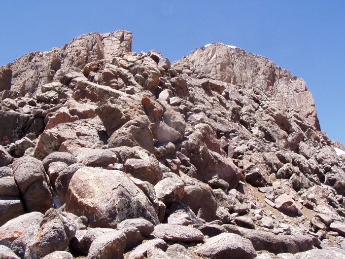
Looking down the class 3 from above. The Prow can be seen at the top of the pic.
After climbing over abouit 30 feet of class 2 rocks, I was at the top! 1:45 P.M.
14er #36!
The top was capped with snow with a small arc or rocks with the summit register attached. Creat views and still great wather with only a few clouds way in the distance.
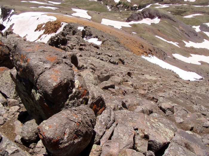
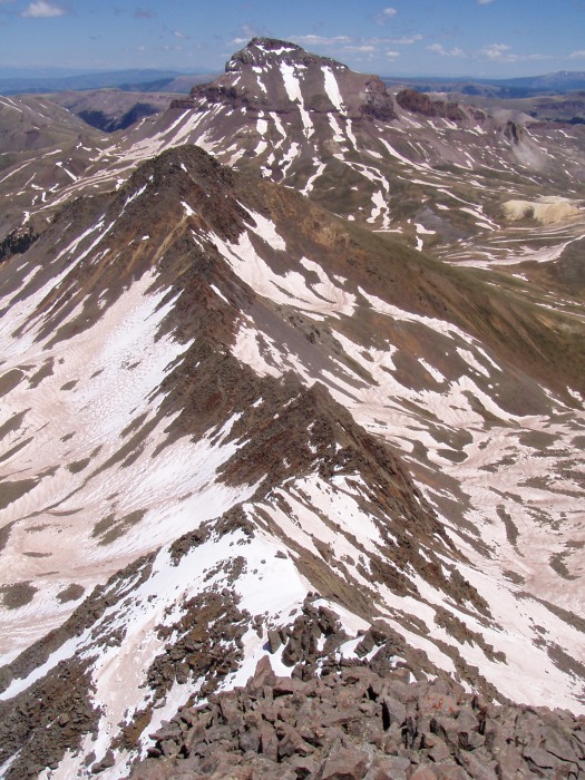
View of the ridge traverse toward Matterhorn, for those about to rock..... Not me. Uncompaghre Peak is hidden somewhere in this pic as well.
The route is high along the ridge on the right side of the pic. It avoids 99% of the snow in the pic.
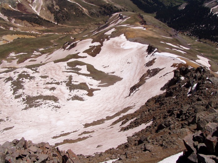
Uncompahgre Peak looking good for tomorrrow's hike. Matterhorn in the foreground.
Kathy done chasing Marmots, watching me cliimb, taking pictues.
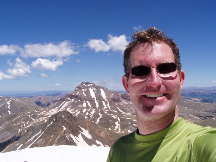
Me
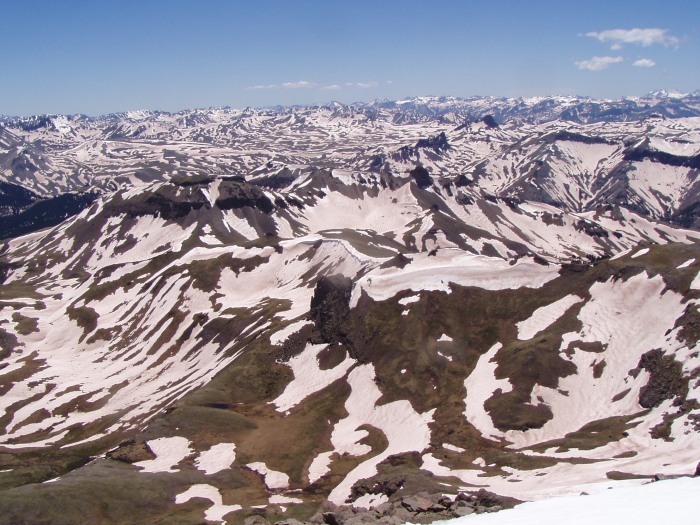
Summit view, I think it was West.
About to begin one of our glissades; the only time the ice axe left my back.
view of peak about 3/4 back to the tent.
We were joined by two other hikers a bit later. We encouraged them to camp near us as there really isn't anywhere else in the immediate area that is flat for pitching tents. We didn't mind the company at all. This is a great place to share with others.
The next day was to be Uncompahgre Peak in a snow storm. That trip report can be viewed here:
Looks like you had an awesome trip. Thank you for posting the pics. They will really help me plan my upcoming trip for Wetterhorn next week. I hope I have the same weather you had !
I‘m glad the pics will help you. But before you comment on the weather, be sure to look at the trip report for the next day on Uncompahgre. :wink: that day was quite the opposite, but still a good climb.
Thanks for the report! It's crazy how your pic of the summit pitch from the slab looks so "easy", then from the top it looks smooth and vertical. Can't wait to see for myself!
Caution: The information contained in this report may not be accurate and should not be the only resource used in preparation for your climb. Failure to have the necessary experience, physical conditioning, supplies or equipment can result in injury or death. 14ers.com and the author(s) of this report provide no warranties, either express or implied, that the information provided is accurate or reliable. By using the information provided, you agree to indemnify and hold harmless 14ers.com and the report author(s) with respect to any claims and demands against them, including any attorney fees and expenses. Please read the 14ers.com Safety and Disclaimer pages for more information.
Please respect private property: 14ers.com supports the rights of private landowners to determine how and by whom their land will be used. In Colorado, it is your responsibility to determine if land is private and to obtain the appropriate permission before entering the property.