| Report Type | Full |
| Peak(s) |
Mt. Princeton - 14,200 feet |
| Date Posted | 06/17/2009 |
| Modified | 06/18/2009 |
| Date Climbed | 07/12/2008 |
| Author | plasticman |
| Mt Princeton - My First Ski Descent |
|---|
|
Having done a decent climb the month before and sealing the deal on Quandary, I got the itch to try a ski descent on a 14er. I figured I would be climbing it anyway- why not bag my first descent at the same time. The best laid plans of mice and men. We were camping out near 11-Mile reservoir at a friend's place- so we had about a 90 minute drive to the 4WD trailhead at Princeton's radio tower around 7:30 am. We were bringing the skis in the Jeep with a 50% anticipation that there would be enough snow to bother bringing equipment on the hike. When we got a good view of our target from 24, I snapped a few pics of the looming summit. It's something like 5,000' from floor to ceiling- pretty crazy. Second pic is a closeup at full zoom. 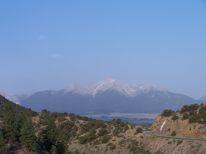 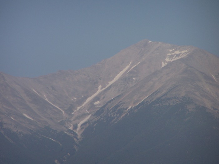 Buena Vista below. 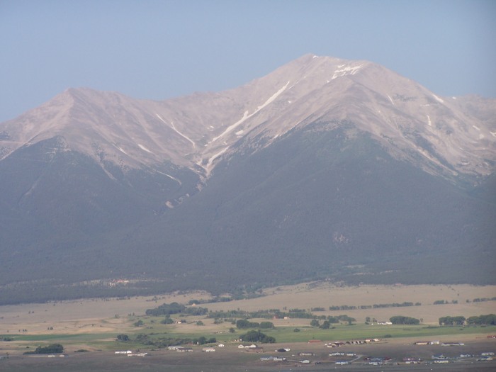 Picture of the 2WD parking lot- the Chalke Cliffs are visible in the top left- Princeton on the right. 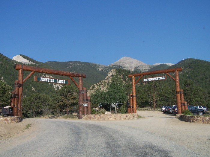 From our fist pause for some air- a view of the snowfield in the distance with our eventual line drawn in. 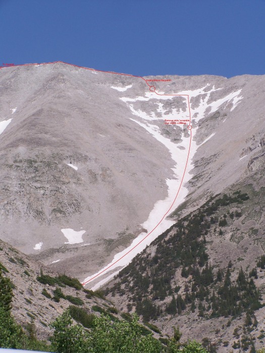 I call this one "when retards attack". Thus begins our eventual demise. As you can clearly see by this photo, we had missed our trail by about a mile or so. What do you do when you aren't familiar with the trail or the mountain? Make shit up and bushwhack. We decided to try and dog-leg over this mistake and it ened up costing us a lot of time. I quickly discover how unruly and unforgiving the talus is when I almost rolled a boulder over my leg. Add some skis, and the walking is slow. Instead of going straight for the trail, we decide to climb up thinking the trail had to climb also. The trail cuts into the main bowl and then stays low until the summit sadde. We had to scramble across all that crap up, and then back down to the same elevation to regain the trail. Add about 90-120 minutes.  Back on the trail and fatigued, we had already gone through about 1/3 of our water and were basically 15% done with the day. The climb up once on trail was uneventful- we had our eyes over Antero the entire time we could see it- the day loomed like it would turn electric, but it held off all day. This was the only pic we could take on the summit- the flesh-biting bugs were HORRENDOUS! 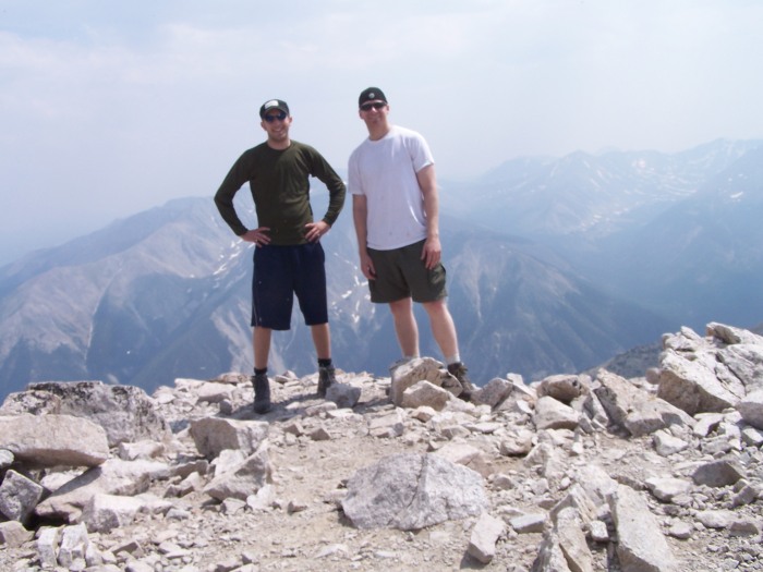 We debated the sanity of a ski descent in between mouth-fulls of bugs. B1 managed to convince me that the time was right- after all we carried this stuff all the way up here. Although at first willing to walk down, I was quickly convinced to continue on with the plan. At this point, we stopped taking pictures- mostly with concern for time. It was slightly concerning when we were approaching our last thousand feet of vertical- we were being passed by the last party on the mountain on their downclimb. The emptiness was welcome. The quiet was sobering. We were on our own at this point. The next day I measured it out on Google Earth- it's about a .75 mile hike across Princeton to our snowfield. Getting on the skis was rough. The downclimb was very sheer- nothing more than a rough scramble- but a fall on the slope would make hamburger out of you on the rocks. The route was obvious from the ridge- we spotted our weakness in the rocks and attacked, ass first. We found some really crappy rocks to "sit" on to get our boots on. We pretty much had to kick a spot in the snow to get the skis on- and how the quads did ache at this juncture. The first "turn" skiers left to get onto the main line was silly. The top of the bowl was an easy 40 degrees- probably steeper. After the traverse onto the main finger of snow, the sphincter relaxes just a touch and you actually get to enjoy some of that snow. We were a little nervous about the snow- it was very late, and it was wet sliding pretty readily. Nothing to write home about, but it piled up under your feet and made standing on the outside ski tough. You'd have to pick it up to let the slough under so you could get back onto the downhill ski for stability. After the bowl opened up, we let the turns fly and headed down our snow field to the first set of rocks. This took all of 5 minutes to walk over and get resituated. Back on the snow, we took the skier's right option. We knew if we went left we would end up in a gully we wouldn't be able to climb out of. We hugged our snowfield to around the treeline and begain our third climb of the day- the hike back out to the car. We crossed 2 or 3 smaller snowfields, and several scree slopes. All of this was bushwhacking and slow. One step forward, two steps sliding backwards. The sun had dropped down behind us, and it was around 4:00pm when the skiing was all done and we were optioning our exit. We knew we had a ridge to get around to pick up the road. What we didn't count on was the second ridge, which kinda crushes the spirit about 9 hours into the hike. We picked up the road with about another mile or so out to the car. We got back to the car at exactly 12 hours after begining our adventure. I can't tell you the feeling of finding that stupid dirt road. It was such a relief. We thought about ditching the skis (and coming back tomorrow) if we didn't find the road an hour or so before dark- but we didn't end up needing to do that. As we were walking out to the radio tower, a volunteer off duty fireman driving an Outback stopped us and gave us some much needed water. It was only the last mile back to the Jeep, but that water never tasted so sweet. Afterwards I measured out our hike to round out over 10 miles (including the ski travel). I figure we had an easy 2,000' of descent on snow. I told B1 as we were walking back out to the Jeep that this was undoubtably the hardest thing I had ever done in my life...and that I couldn't wait to top it. Does anyone know if this line is named? If not we would like the honors... Thumbnails for uploaded photos (click to open slideshow):
|
| Comments or Questions | |||
|---|---|---|---|
|
Caution: The information contained in this report may not be accurate and should not be the only resource used in preparation for your climb. Failure to have the necessary experience, physical conditioning, supplies or equipment can result in injury or death. 14ers.com and the author(s) of this report provide no warranties, either express or implied, that the information provided is accurate or reliable. By using the information provided, you agree to indemnify and hold harmless 14ers.com and the report author(s) with respect to any claims and demands against them, including any attorney fees and expenses. Please read the 14ers.com Safety and Disclaimer pages for more information.
Please respect private property: 14ers.com supports the rights of private landowners to determine how and by whom their land will be used. In Colorado, it is your responsibility to determine if land is private and to obtain the appropriate permission before entering the property.


