Download Agreement, Release, and Acknowledgement of Risk:
You (the person requesting this file download) fully understand mountain climbing ("Activity") involves risks and dangers of serious bodily injury, including permanent disability, paralysis, and death ("Risks") and you fully accept and assume all such risks and all responsibility for losses, costs, and damages you incur as a result of your participation in this Activity.
You acknowledge that information in the file you have chosen to download may not be accurate and may contain errors. You agree to assume all risks when using this information and agree to release and discharge 14ers.com, 14ers Inc. and the author(s) of such information (collectively, the "Released Parties").
You hereby discharge the Released Parties from all damages, actions, claims and liabilities of any nature, specifically including, but not limited to, damages, actions, claims and liabilities arising from or related to the negligence of the Released Parties. You further agree to indemnify, hold harmless and defend 14ers.com, 14ers Inc. and each of the other Released Parties from and against any loss, damage, liability and expense, including costs and attorney fees, incurred by 14ers.com, 14ers Inc. or any of the other Released Parties as a result of you using information provided on the 14ers.com or 14ers Inc. websites.
You have read this agreement, fully understand its terms and intend it to be a complete and unconditional release of all liability to the greatest extent allowed by law and agree that if any portion of this agreement is held to be invalid the balance, notwithstanding, shall continue in full force and effect.
By clicking "OK" you agree to these terms. If you DO NOT agree, click "Cancel"...
Huron Peak - North Ridge from Clear Creek - June 12, 2009 - unclegar
My wife and I had planned on staying with relatives in Bailey and my wife was going to visit while I hiked the following day. I was thinking of climbing Yale but after looking at trip reports, etc. decided not to do it alone. I thought that was the end of climbing this week, but then my brother-in-law suggested Huron. I checked into it and it looked pretty good so off to Bailey it was.
The next morning I headed for Winfield. I have done Missouri, Oxford and Belford and have always heard of Winfield but really wasn't sure what it was. As it turns out, it looked like a small village of what must be historic buildings.
Winfield
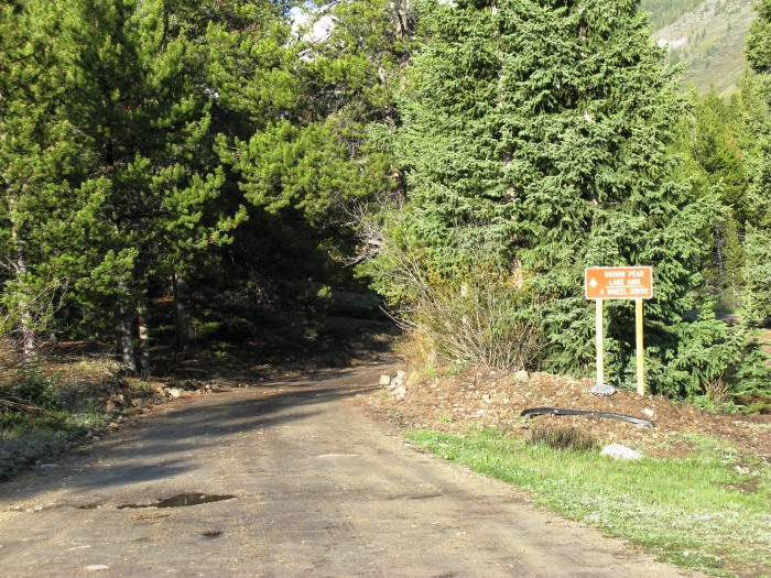
Next was the 4-wheel drive trail. I was in a CRV so it has AWD but not great clearance.
4-wheel drive road to Huron TH from Winfield
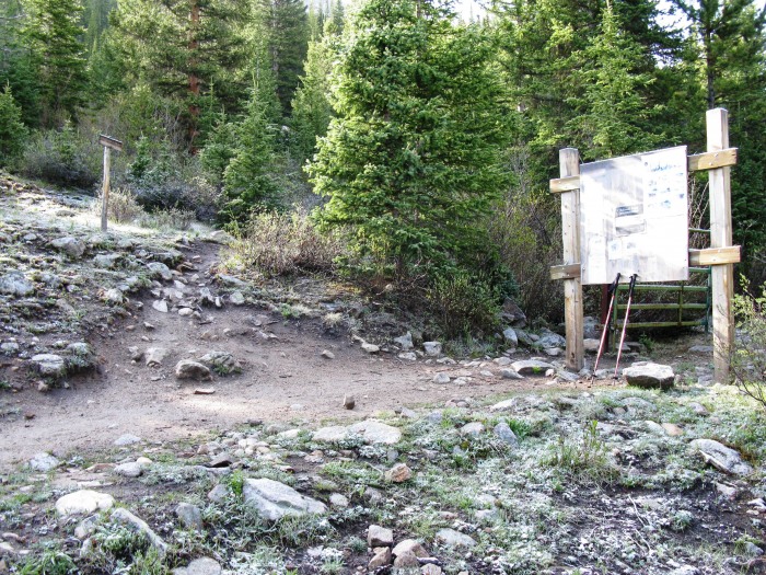
How bad could it be? I'll just say I went beyond my comfort zone over and over by crossing the small streams and passing over large rocks in the road that tested the clearance of the CRV and finally decided to stop before some large mud pits in the road. I had visions of the CRV planted in the mud with no cell phone coverage and no way to get it out. I backed up, parked under a tree, and hiked the rest of the road, which I believe was about .7 mi. to the TH. I parked the car at 7:40 and arrived at the sign-in box just past the beginning of the trail at 8:20.
Trailhead
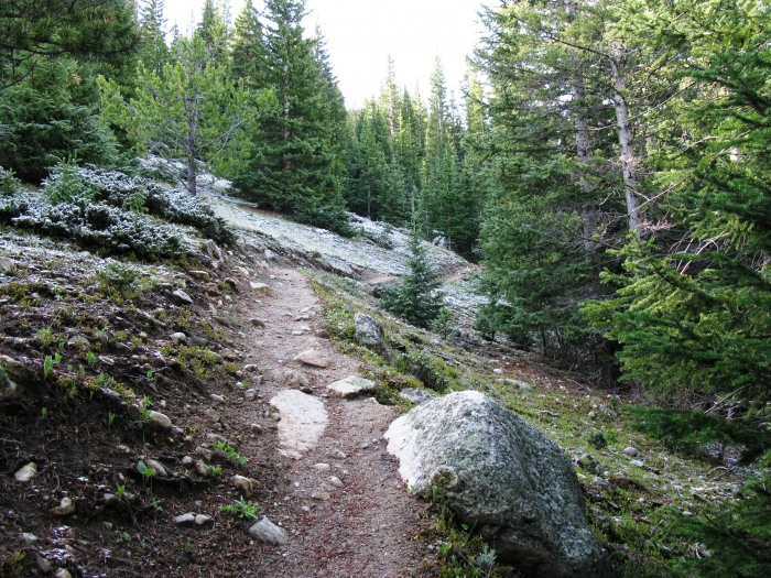
The trail began with switchbacks that were completely clear of snow.
Switchbacks
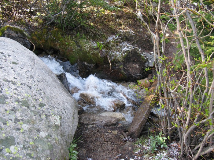
I reached the log bridge but opted to hop across the rocks in the stream since the log was covered in a sheet of ice.
Bridge
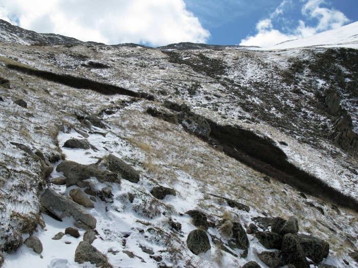
It was a beautiful day with nice views everywhere.
View from lower switchbacks
Snow began completely overtaking the trail in a few spots around 11550'. Most of the trail was just dusted though and the snow was easily skirted. I also began noticing tracks in the snow. Up to this point I had assumed I was the sole Huron hermit hiker of the day since there were no vehicles at the TH. Soon after I noticed the tracks, I met a hiker and his dog coming down from an early start.
Trail at around 11550'
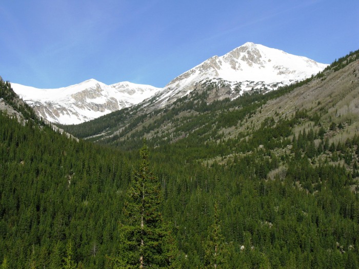
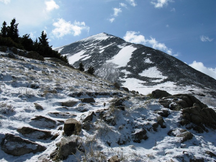
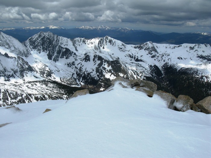
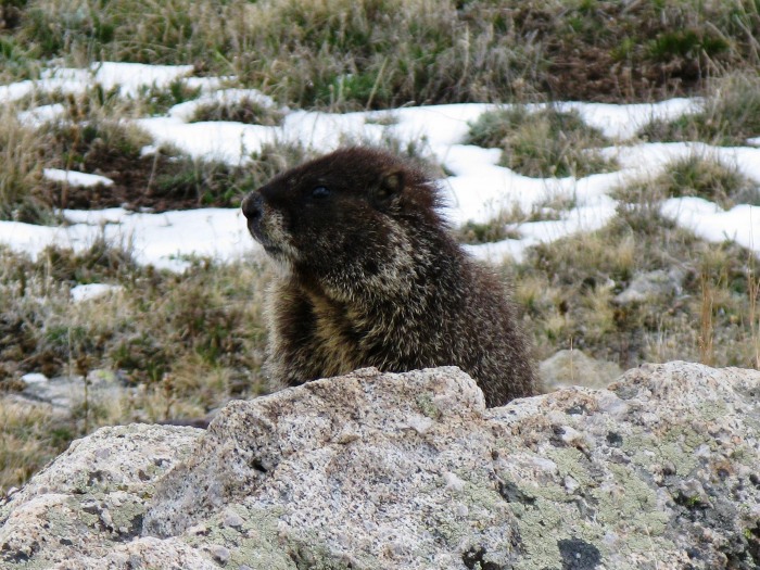
The Apostles looked pretty majestic around 11700'.
Apostles and Ice Mtn
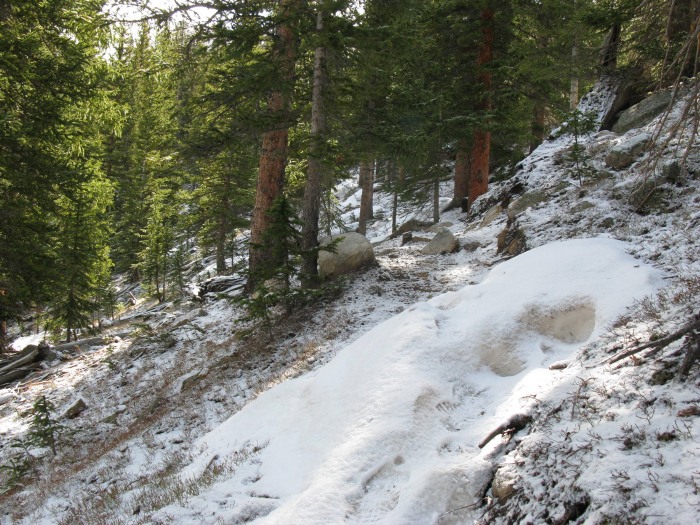
The trail was covered with shallow snow through the upper portion of the woods, but still no problem with just boots.
Trail in upper woods
Just after leaving the woods around 11950' the trail was back to dirt for a short time.
Trail after leaving woods
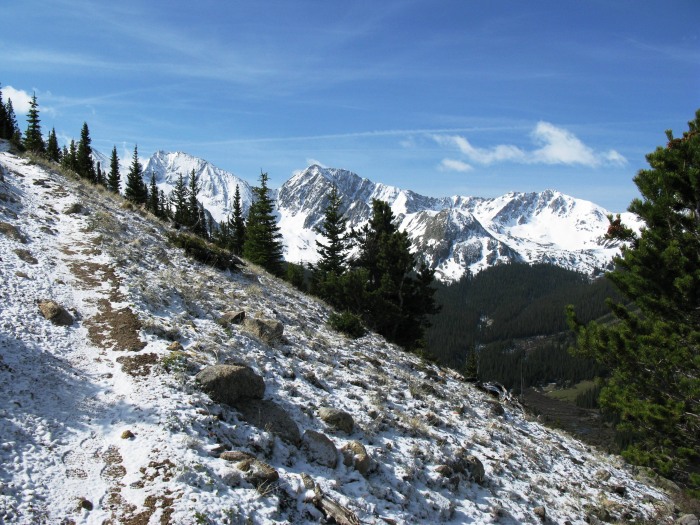
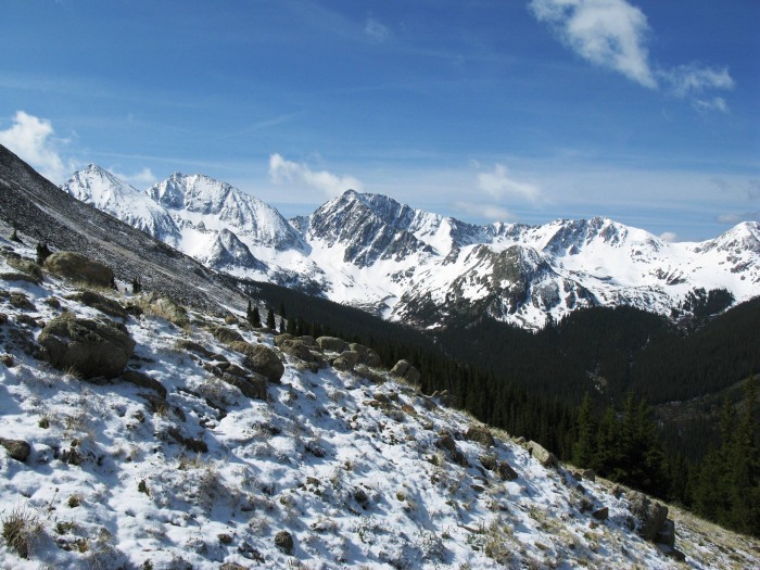
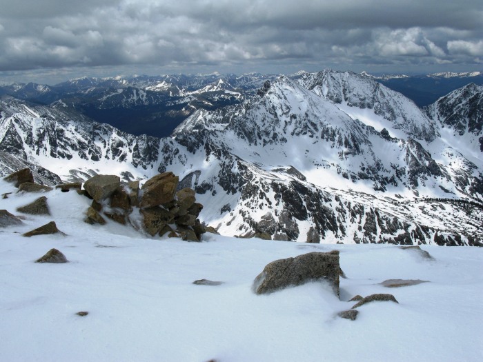
Back to shallow snow on the trail, Huron came into view.
Three Apostles again
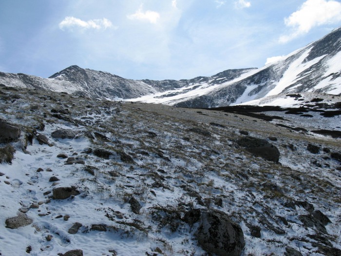
The trail straightened out as it went up a hill just before the basin. This is where I met another hiker on his way down.
Just before the basin with Browns Peak ahead
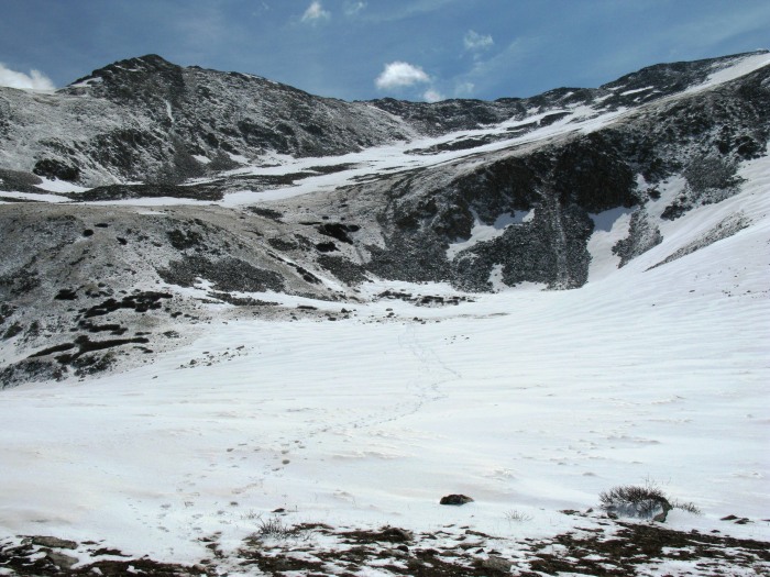
At the top of the hill (about 12300') I stopped and put on gaiters to prepare for the basin.
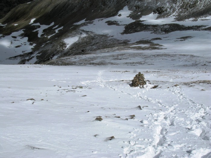
The basin with tracks (and some posthole tracks)
I was able to make it across the basin with minimal postholing by treading lightly. I followed the tracks to stairs and switchbacks on the other side. Just above the stairs I met the third and final hiker I would see descending on this day. Now I truly was the Huron hermit.
Trail on far side of basin
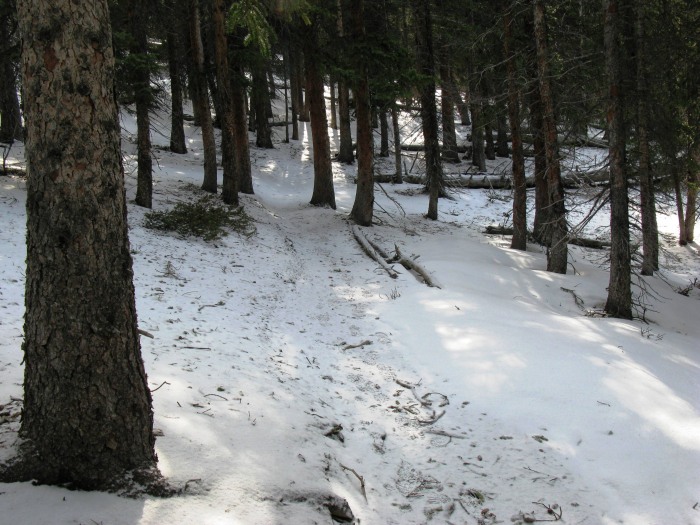
After following the trail until it turned toward Huron, it disappeared into the snow. Now footprints in the snow were the only trail to follow. Some traction devices might be helpful here, but I never used any.
Footprints in the snow
This is looking back down the trail toward a large cairn. On the way down I had great fun glissading this area using an ice ax for speed control. I had never done this before.
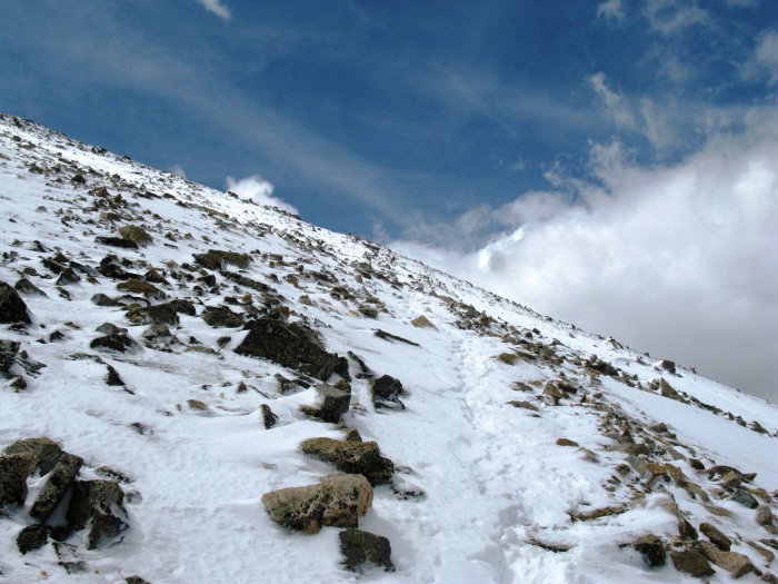
I continued following the footprints until they disappeared due to the high winds.
Higher on the trail
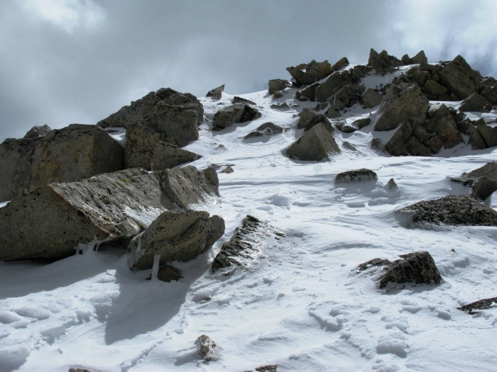
At this point I should have continued toward the ridge ahead but instead circled toward the right hoping to avoid climbing a false summit. Convinced it wasn't a false summit above since there was no higher peak (or peak at all) over the ridge, I climbed straight up to get to the top of Huron. The snow was pretty deep toward the top and the winds were high and cold.
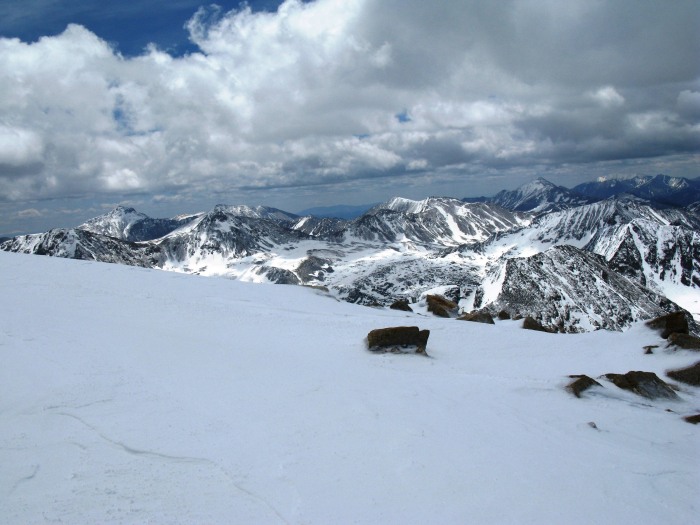
I arrived at the summit at 11:45. Views from the top were pretty amazing. It was one of those times when I sit and marvel at the awesome Creator of it all.
View from the top
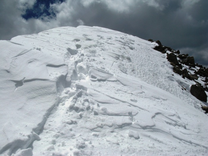
As I started down, I was able to follow tracks down that followed the ridge more closely.
Looking back up at the tracks from the summit.
This was looking back up near the top. Glad I didn't walk over to that area to take pictures!
After again crossing the basin I found once again that I really was not the Huron hermit.
I got back to the trail sign-in box exactly 6 hours after leaving it. A long walk back to the car and another crazy drive on a 4-wheel road meant for real 4-wheel vehicles and I was on my way home. It was a beautiful and satisfying day. Hope this helps to show current trail conditions.
Thumbnails for uploaded photos (click to open slideshow):
Not sure about camping. I believe there are sites along the 4-wheel drive road and some back in Winfield. Since I don‘t usually camp, I‘m sure others could answer that better.
Nice report...wish I‘d seen it before we climbed on Sunday! :) I would definitely recommend traction devices for the last 500 vertical feet or so...with the high winds I didn‘t feel secure at all since the rain the night before had created a slick top layer that was hard to kick steps into. Though, you can stay on rock patches almost all the way to the top and pretty much circumvent the snow climb if you want to. My climbing partners said it was perfect glissade conditions too (I didn‘t partake myself). Snow will definitely be there for a couple more weeks though I would think.
As far as camping, there are tons of good spots, all with fire pits and flat tent spaces, along the 4WD road. We got up it no problem in a stock Off Road edition Xterra. We stayed at one about .4 miles from the trailhead that is up a short little steep drive on the left as you‘re driving in. Perfect spot under some large pines sheltered from wind and rain and overlooking the valley! Enjoy...its gorgeous up there!
I put your information to good use and summitted myself today. The trail is pretty much snow-free now until you reach the basin, and even the basin is showing grassy patches. Ditto on mountaineer47‘s description on the higher portion. I hiked up without traction devices, but put them on for the descent. I got a couple of glissades in. Summitted about 10:00 AM and managed to get back down without post-holing. SCORE! :D
mountaineer47 - Thanks for the camping update and clarification. It looked like there were good spots but I wasn't sure. I didn't bring any traction devices or I would have used them too. I was able to kick steps when needed though.
George - Thanks for the trail update and glad to hear you made some glissades. I only postholed a few times and then it wasn't too deep, so I feel fortunate considering how late it was. By the way, does it alway hurt your butt to glissade?
Congratulations on this climb! I want to get on this one soon. Can't wait to see the views in person. This report should prove very helpful. Wondering about camping out up here around the trail head.
Caution: The information contained in this report may not be accurate and should not be the only resource used in preparation for your climb. Failure to have the necessary experience, physical conditioning, supplies or equipment can result in injury or death. 14ers.com and the author(s) of this report provide no warranties, either express or implied, that the information provided is accurate or reliable. By using the information provided, you agree to indemnify and hold harmless 14ers.com and the report author(s) with respect to any claims and demands against them, including any attorney fees and expenses. Please read the 14ers.com Safety and Disclaimer pages for more information.
Please respect private property: 14ers.com supports the rights of private landowners to determine how and by whom their land will be used. In Colorado, it is your responsibility to determine if land is private and to obtain the appropriate permission before entering the property.