Download Agreement, Release, and Acknowledgement of Risk:
You (the person requesting this file download) fully understand mountain climbing ("Activity") involves risks and dangers of serious bodily injury, including permanent disability, paralysis, and death ("Risks") and you fully accept and assume all such risks and all responsibility for losses, costs, and damages you incur as a result of your participation in this Activity.
You acknowledge that information in the file you have chosen to download may not be accurate and may contain errors. You agree to assume all risks when using this information and agree to release and discharge 14ers.com, 14ers Inc. and the author(s) of such information (collectively, the "Released Parties").
You hereby discharge the Released Parties from all damages, actions, claims and liabilities of any nature, specifically including, but not limited to, damages, actions, claims and liabilities arising from or related to the negligence of the Released Parties. You further agree to indemnify, hold harmless and defend 14ers.com, 14ers Inc. and each of the other Released Parties from and against any loss, damage, liability and expense, including costs and attorney fees, incurred by 14ers.com, 14ers Inc. or any of the other Released Parties as a result of you using information provided on the 14ers.com or 14ers Inc. websites.
You have read this agreement, fully understand its terms and intend it to be a complete and unconditional release of all liability to the greatest extent allowed by law and agree that if any portion of this agreement is held to be invalid the balance, notwithstanding, shall continue in full force and effect.
By clicking "OK" you agree to these terms. If you DO NOT agree, click "Cancel"...
Ute Creek Trailhead
RT Mileage ~12.1 miles
Elevation Gain ~3700'
Bison Peak had been on my list for about a year now.
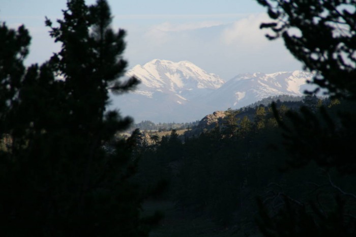
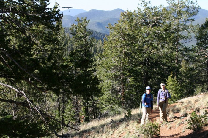
My wife, sister, and I started on the trail at about 6:30 am. The first 2.5 miles are pretty uneventful, but the views of the Tenmile and Mosquito ranges are great.
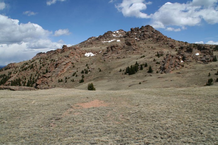
The trail then steepens and switchbacks up to Bison pass at mile 4. At the fork in the road, we took a right up to Bison's arm. The trail finally leaves the trees and switchbacks up to the huge summit plateau.
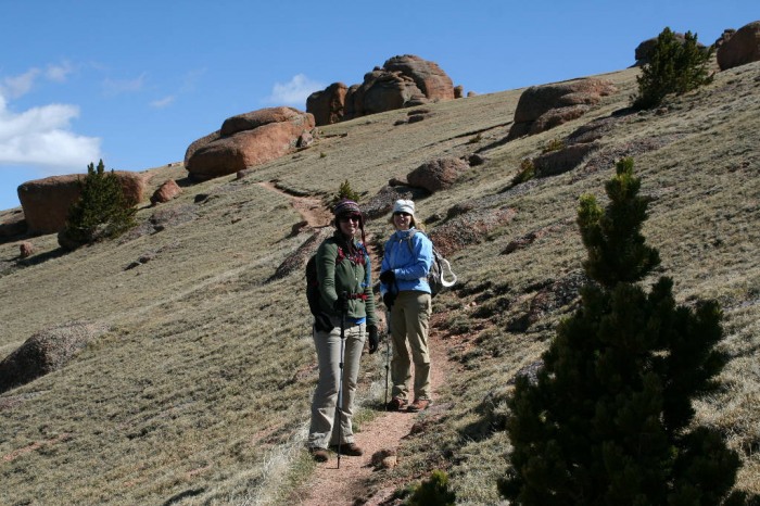
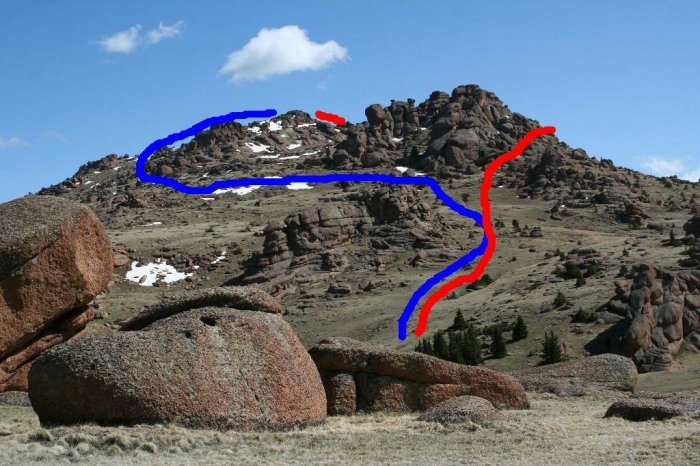
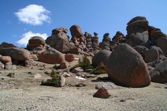
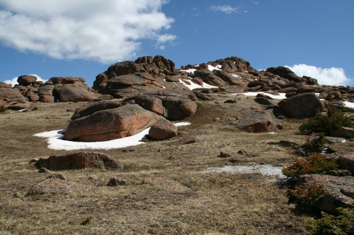
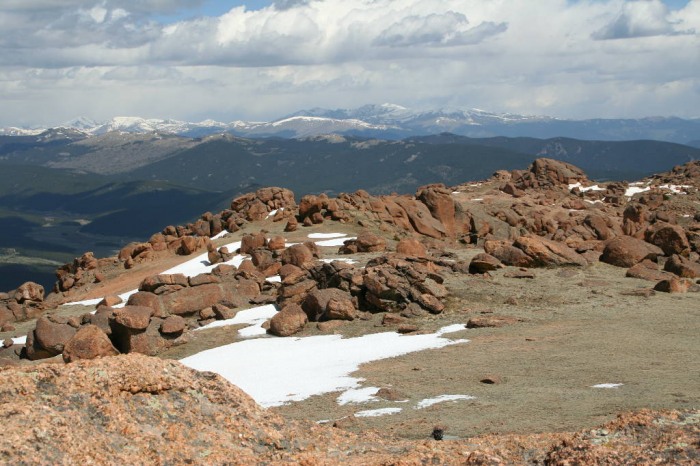
Finally we saw what we came for...the rock formations. They are AWESOME!! First things first...we wanted to hit the summit. The trail ended at Bison Pass (~11,800), and there were a couple of different options to get to the summit. We chose to go left, and we reached the summit 1 mile beyond the top of the pass. Blue- Ascent Red- Descent
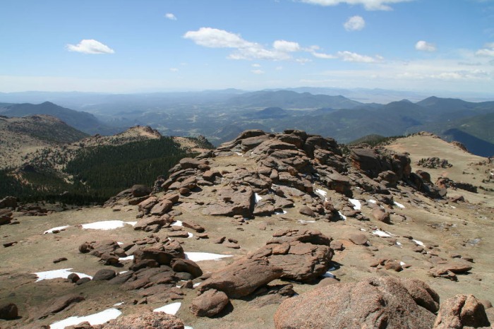
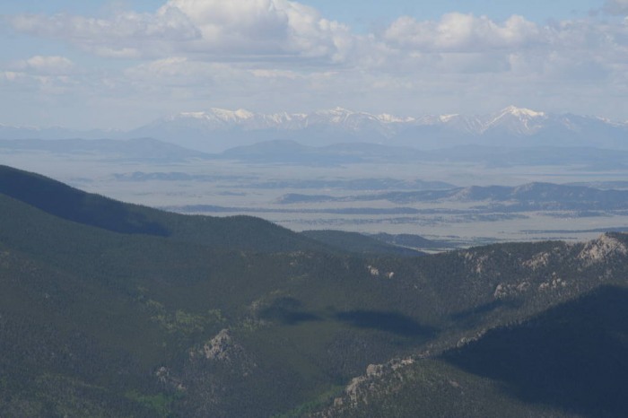
The views were incredible. We could see Pike's, Sherman, the southern Sawatch, Lincoln, Bross, Democrat, and even the Sangre's. The best views of the day were all of the rock formations on the summit. AMAZING!!!
The traditional summit shot with the wifey...
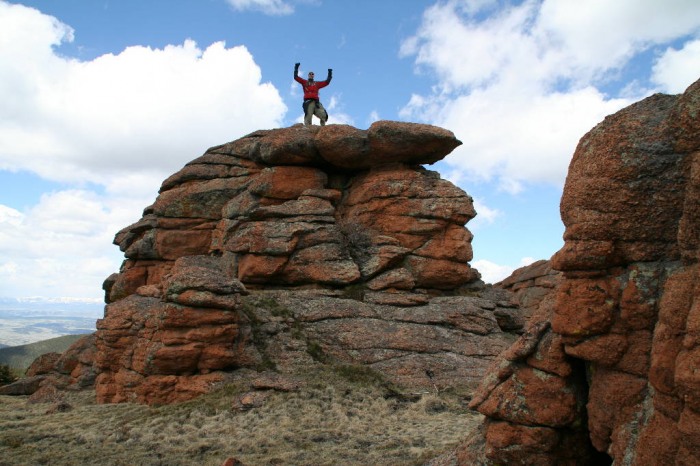
Even though it was cold and windy, I had to climb at least one of the formations...FUN!!!
The way down went quickly. Then it was back to the city for Chili's chips and salsa...YUM!!!
Notes: This was a really fun hike. Even though it was a weekend in June, we only saw about 6 other people all day, and all on the way down. The solitude was really nice from the crowds that are always climbing the 14ers. I would recommend this to all. You will have so much fun at the top of Bison.
Thumbnails for uploaded photos (click to open slideshow):
Nice report! My friend and I also did Bison this past weekend (Saturday), and you‘re right those rock formations are amazing. One of the cooler summits out there even though it‘s ”only” a 12er.
Yeah I was looking at those rock formations from Devil‘s Head Lookout and thinking I gotta get me some of those!
Nothing better than a rock castle at the end of a hike...
Caution: The information contained in this report may not be accurate and should not be the only resource used in preparation for your climb. Failure to have the necessary experience, physical conditioning, supplies or equipment can result in injury or death. 14ers.com and the author(s) of this report provide no warranties, either express or implied, that the information provided is accurate or reliable. By using the information provided, you agree to indemnify and hold harmless 14ers.com and the report author(s) with respect to any claims and demands against them, including any attorney fees and expenses. Please read the 14ers.com Safety and Disclaimer pages for more information.
Please respect private property: 14ers.com supports the rights of private landowners to determine how and by whom their land will be used. In Colorado, it is your responsibility to determine if land is private and to obtain the appropriate permission before entering the property.