| Report Type | Full |
| Peak(s) |
Mt. Silverheels - 13,828 feet |
| Date Posted | 06/01/2009 |
| Modified | 06/02/2009 |
| Date Climbed | 05/31/2009 |
| Author | Rainier_Wolfcastle |
| Mount Silverheels - South Ridge |
|---|
|
Goal: Mount Silverheels, Centennial 13er at 13,822 Elevation Gain: ~ 4,000 Roundtrip Distance: ~ 13.9 Miles Time: 9 hours My wife Kathy and I wanted a new close hike with max altitude but minimum winter mountaineering. I saw Roach's description of Silverheels' South Ridge Route and figured: class 1 ridge, southern exposure, trailhead right out of downtown Fairplay, a centennial 13er with thousands of feet of prominance...let's do it. We drove up to Fairplay Sat night. Took 4th st East from Co 9. North onto Bogue st at the T, continued as it turned into Beaver Creek Lane, Turned East onto FS 413 2.8 miles from Co 9. Then reached the "Winter" Forest Service Gate at mile 3.1. Apparently this gate is closed this year until June 15th. Our roundtrip just went from ~ 9 miles to 13.6. And as many of you know, it snowed Saturday afternoon so we knew we would have another 2-5 inches to deal with...better get to sleep in the back of the Blazer. Woke at 4:30, started just after 5...which as luck would have it was also sunrise. Now I am no expert, but there is no reason for this 2wd road to be closed...it was as it appears in this photo (with Silverheels in the distant background).  After the 2.3 mile road hike on FS 659, you turn onto FS 184. This is a 4wd road that starts with crossing Beaver Creek. The creek was 10 feet across and 3-4 deep at this point...a little bush waking to the right and I found a 5 foot spot to jump across. About 100 feet up the road there is a T, go right. Another 100 feet or so and there is a tree down blocking the road. About a mile in there is a turn left off the road onto an old 4wd road now closed to motor vehicles. Lots of elk and deer tracks on the road (we saw two elk..too slow for a pic, maybe a dozen deer, and zero people all day). Maybe a half mile up the closed 4wd road is another T..go left as the other route takes you back down to Beaver Creek (only on the other side of the creek from FS 659). We are now hiking in 2 inches of snow, so trails are difficult to see. We see Point 12,282, we get off the road and climb up its West slope. There are a couple of large cairns on the summit/ridge. The sky is clear but the wind has picked up to 30-40 mph...directly from the North..so we are going straight into it. Next up is a ~200 elevation loss as you hike down to a saddle leading to Point 13,004. Here is pick of Silverheels...Point 13,004 is off the photo to the right.  Suddenly at around 13,250 the wind stops and the summit is clear...Lincoln and Quandary are still getting hit though. We stop for a bite and my wife notices we are at 13,728 on her Garmin...no false summits here. We break trail in 2-3 feet of snow (no layers, just powder) to the summit. There are two large cairns at the top...no idea which one is the summit in all this snow. There are some nice cornices on the summit...so we avoid the North edges. Here is the route we took in green. The red represents the 4wd road that skirts pts 12,282 and 13,004 and would provide a nice alternative route.  Here is Kathy with Grays and Torreys in the background: 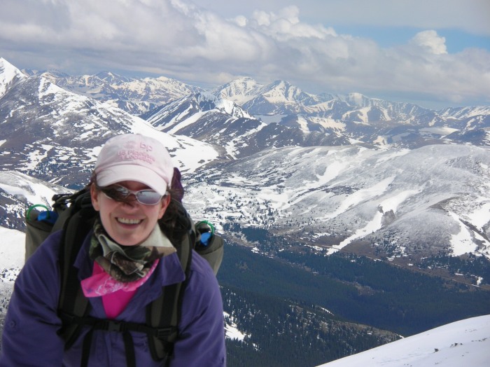 This is a ridge on top pointing East: 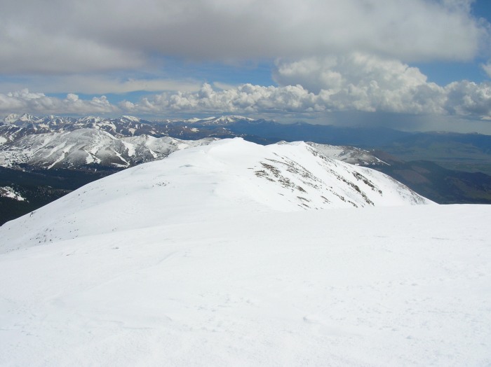 Quandary: 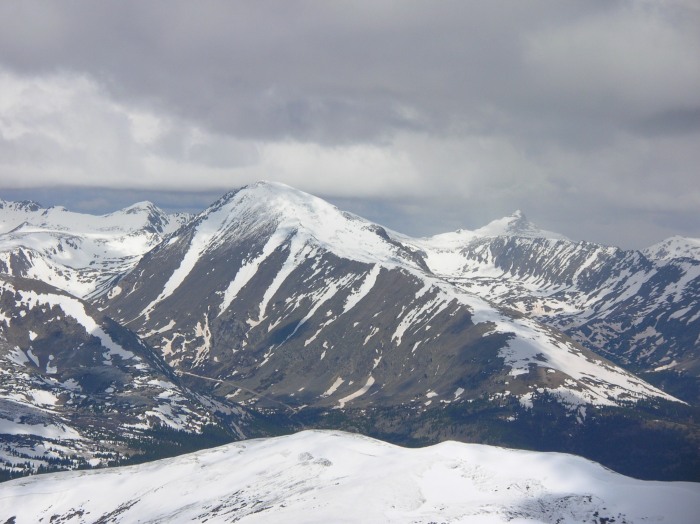 Pikes from a distance: 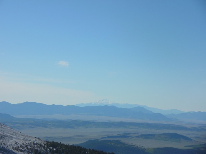 And looking directly across Co 9 to Lincoln: 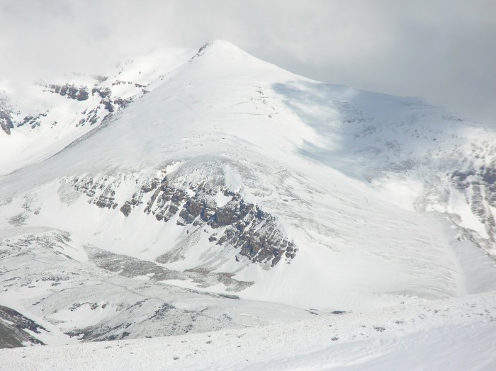 The hike out was way easier as we followed our snow tracks and below 12K all the snow had melted. Beaver Creek had raised 4 inches so the leap was a little more difficult. And the second we crossed it the sleet started and continued for our 2.3 mile hike back on the road. Thumbnails for uploaded photos (click to open slideshow):
|
| Comments or Questions |
|---|
|
|
Caution: The information contained in this report may not be accurate and should not be the only resource used in preparation for your climb. Failure to have the necessary experience, physical conditioning, supplies or equipment can result in injury or death. 14ers.com and the author(s) of this report provide no warranties, either express or implied, that the information provided is accurate or reliable. By using the information provided, you agree to indemnify and hold harmless 14ers.com and the report author(s) with respect to any claims and demands against them, including any attorney fees and expenses. Please read the 14ers.com Safety and Disclaimer pages for more information.
Please respect private property: 14ers.com supports the rights of private landowners to determine how and by whom their land will be used. In Colorado, it is your responsibility to determine if land is private and to obtain the appropriate permission before entering the property.


