Download Agreement, Release, and Acknowledgement of Risk:
You (the person requesting this file download) fully understand mountain climbing ("Activity") involves risks and dangers of serious bodily injury, including permanent disability, paralysis, and death ("Risks") and you fully accept and assume all such risks and all responsibility for losses, costs, and damages you incur as a result of your participation in this Activity.
You acknowledge that information in the file you have chosen to download may not be accurate and may contain errors. You agree to assume all risks when using this information and agree to release and discharge 14ers.com, 14ers Inc. and the author(s) of such information (collectively, the "Released Parties").
You hereby discharge the Released Parties from all damages, actions, claims and liabilities of any nature, specifically including, but not limited to, damages, actions, claims and liabilities arising from or related to the negligence of the Released Parties. You further agree to indemnify, hold harmless and defend 14ers.com, 14ers Inc. and each of the other Released Parties from and against any loss, damage, liability and expense, including costs and attorney fees, incurred by 14ers.com, 14ers Inc. or any of the other Released Parties as a result of you using information provided on the 14ers.com or 14ers Inc. websites.
You have read this agreement, fully understand its terms and intend it to be a complete and unconditional release of all liability to the greatest extent allowed by law and agree that if any portion of this agreement is held to be invalid the balance, notwithstanding, shall continue in full force and effect.
By clicking "OK" you agree to these terms. If you DO NOT agree, click "Cancel"...
RT - 5 miles from Visitors Center to summit, 2.5 miles from bottom of Banana Couloirs to car at Endovalley
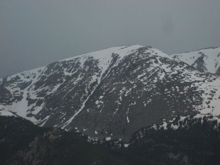
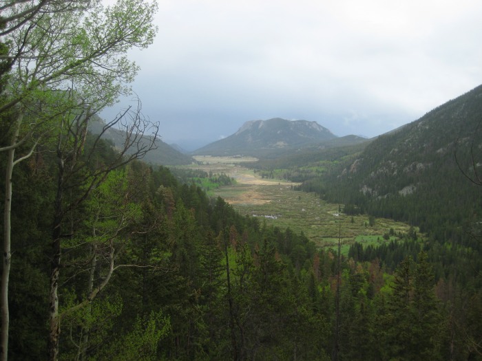
Earlier in the week, a friend from out of town showed up on my doorstep and wanted to do some hiking. After a dayhike around the flatirons in Boulder, she expressed some interest in checking out Rocky Mountain National Park. As we were heading up Trail Ridge, I noticed a very prominent couloir heading up the southern slopes of some mysterious peak in the south end of the Mummy Range. When I got back home, I searched long and hard for beta on that aesthetic line. After some browsing, I pikced up my "Front Range Ski Descents" book and noticed that exact same line. It was part of Mt.Chiquita and the guidebook author claimed to have never actually skied it. While I‘m sure many others have done this route, it intrigued me nonetheless.
Here is what I was looking at from Trail Ridge...
The description sounded like an easy approach, but the hike out was anything but. It was referred to as "moderate deadfall". I would love to sit down with the author and have him explain his definition of "extreme deadfall" cause from the bottom of the couloir to the car was cruel and unusual punishment.
Anyways, Chris and I both drove up since we needed a car shuttle for this ski. We stashed his Outback at the Endovalley picnic area around 4:30am and made our way for the recently open Visitors Center further up the road.
We were presented with a nice sunrise....
And a very blue sky at the parking lot of the Visitors Center...
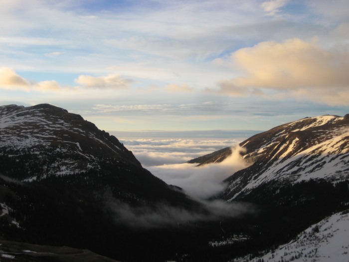
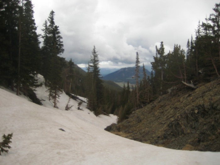
We began the hike down the snow covered Fall River Rd and put on our skis for the descent to Chapin Pass TH not too far below. We had a surreal view of the park above the clouds...
Chris skinning down the road with the sun rising over the mountains..
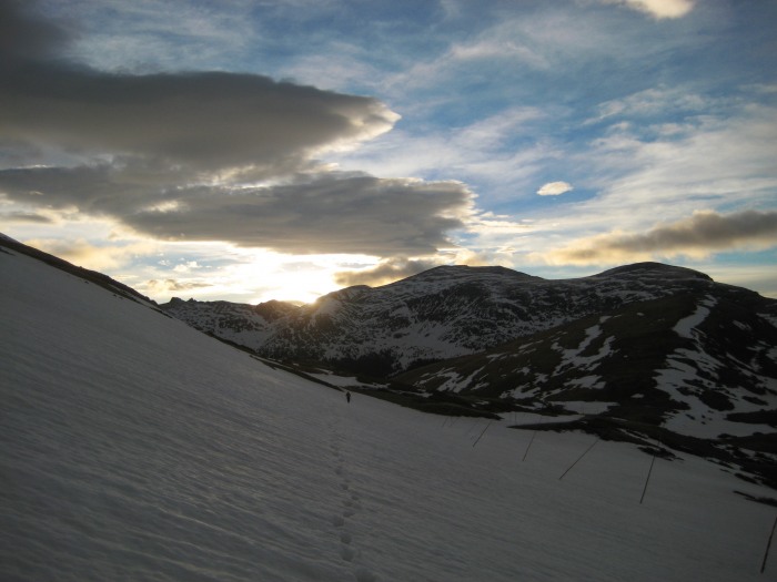
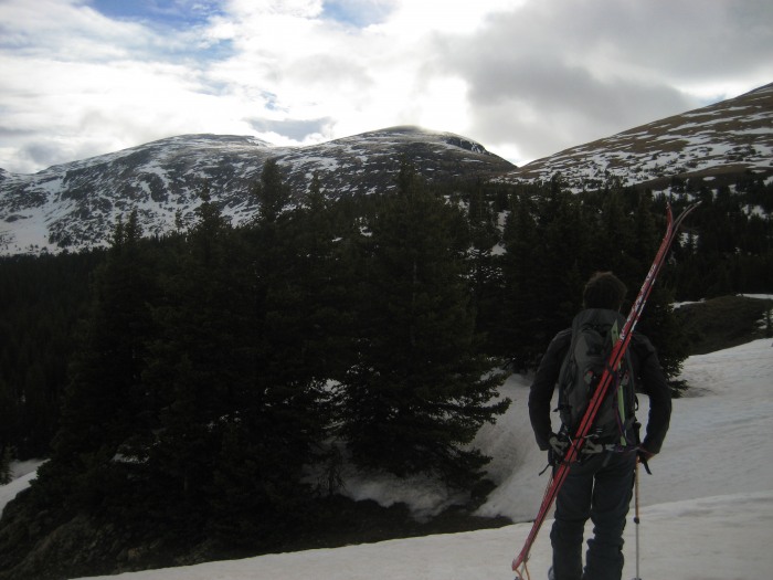
We put on our skins at the TH and began our ascent. We were in the trees for less than an hour before we reached an opening and saw our objective, Chiquita and the Mummy Range.
I was thoroughly anticipating my virgin trip into the Mummy Range, this place really is designated a national park for a reason. To have a region like this in your backyard is a blessing to say the least. Climbers definately get to see this place in a much different light than someone jsut driving along, taking pictures of Elk all day. We don‘t have to spend the 20$ to drive on a road, we don‘t deal with the crowds and we get to see some of the most pristine wilderness in the state, not to mention some of the most aesthetic peaks. Chris and I experienced all of this sunday.
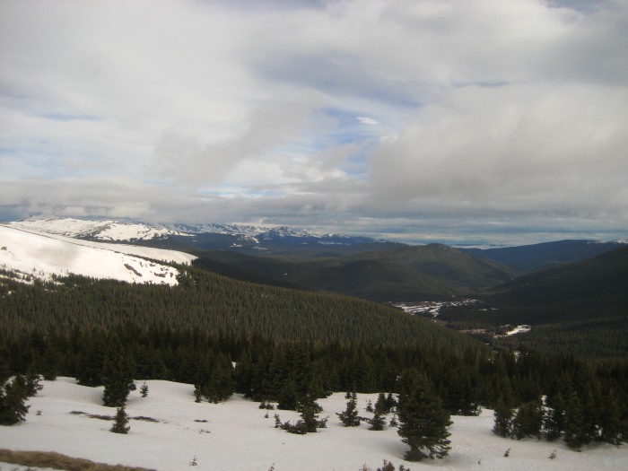
Some scenics of the Mummy Range and beyond -
Looking North along the western edge of the Mummy‘s
Looking SE from the saddle between Chiquita and Chapin
Looking NW towards the very snow covered Never Summers (Richtofen, Static, Nokhu Crags)
A litte note on the snow. The park range, along with many other parts of the state, had been getting rained on lately, making the snow, atleast down low, very hard to travel through. There was basically zero consolidation around treeline and this made a summit ski descent highly unlikely, but we both agreed to atleast summit and scout.
Once at the saddle, we headed North towards Chiquita, or atleast what we though was Chiquita, on a faint, but obvious trail. We traversed around what we thought was Mt.Chapin, only to find out the peak we were headed for was Ypsilon. Luckily, Chiquita is right next to Ypsilon and when we reached the saddle between the two, we were only 200 feet below its summit.
South Face of Ypsilon, looks like some interesting routes
Chris checking out the NE face of Chiquita.
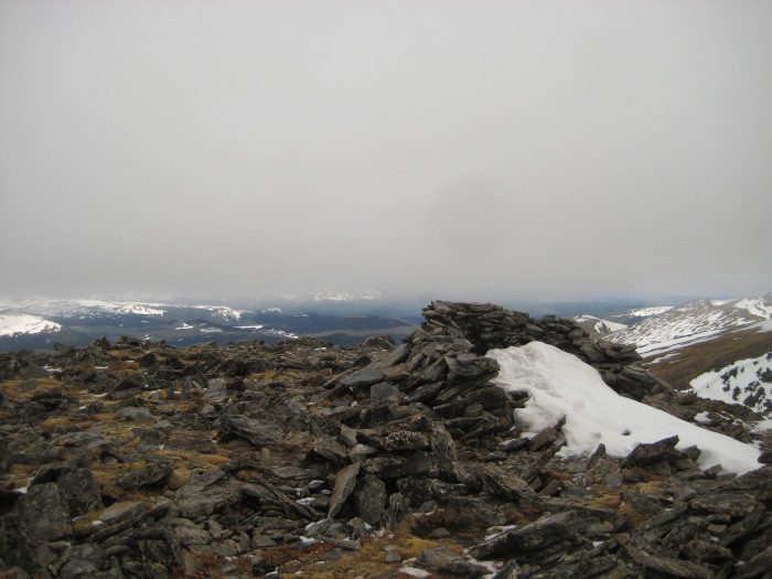
Minutes later we were on the flat summit of Chiquita with clouds quickly rolling in.
Summit of Mt.Chiquita @ 13,069 feet
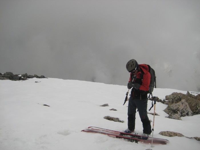
After some nacho cheese bugals, toffee encrusted cashews, some sweet and spicy trail mix and a stong lemonade, we made our way back to our packs a litte bit away to begin our descent.
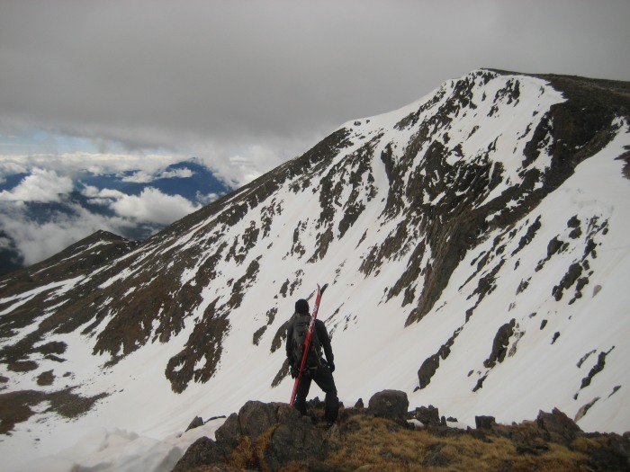
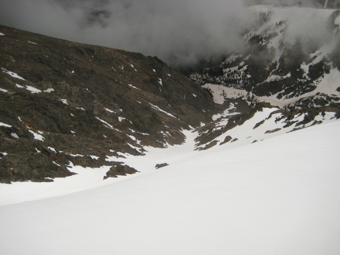
The snow began a bit below the summit and we did some recon of the reclusive Banana Couloir, which all of a sudden wasn‘t so apparent from the summit. The snowfield was easy to find, but we had 2-3 different couloirs below us.
Here‘s a shot of the obvious couloir seen from Trail Ridge road, which neither of us believed was the couloir. It looked really thin in the middle and not as intense as described.
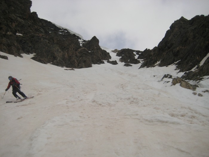
To skier‘s right, there was a much steeper and exposed couloir heading SW off the summit with a large cornice at the top. Simply put, this one looked much tougher and more interesting than the actual Banana Couloir, so after a quick discussion, we decided to make a go for it. The snow felt much better at this point and we both felt confident it‘d make for a decent ski.
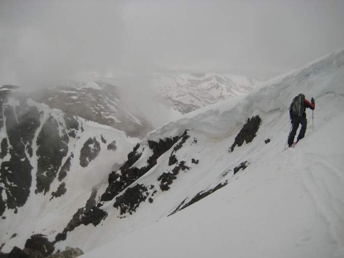
Chris entering the couloir
And navigating his way through the very soft and wet snow
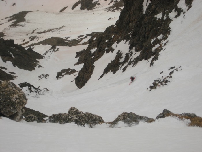
We quickly found out that our assesment of the snow quality was a tad off to say the least. Each turn was a monumental effort and the sloughing was more like small to mid-sized slides. The snow was so heavy, a turn would send slough down the slope, creating deep runnels and we‘d have to make sure to shake the snow off the tops of our skis to prevent it from pulling us down the slopes. Needless to say, we were extra cautious.
Anyways, about 3/4 of the way down, we got cliffed out and had to climb back up about 20 feet to find continuous snow.
Chris fighting the snow about 1/2 way down
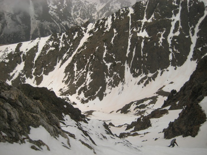
Looking up the chute, right about where we got cliffed out.
We found a small chute skier‘s right and we were able to find an exit to this maze. After skiing some moguls through a large avy debris path, we finally made it to the bottom. We were both relatively relieved to be down that thing and were now looking foward to the long haul out of there to or car at Endovaley through over 2 miles of thick deadfall. Whomever said this was "moderate deadfall", don‘t be mistaken, its unnaturally thick deadfall. You‘ve been forewarned.
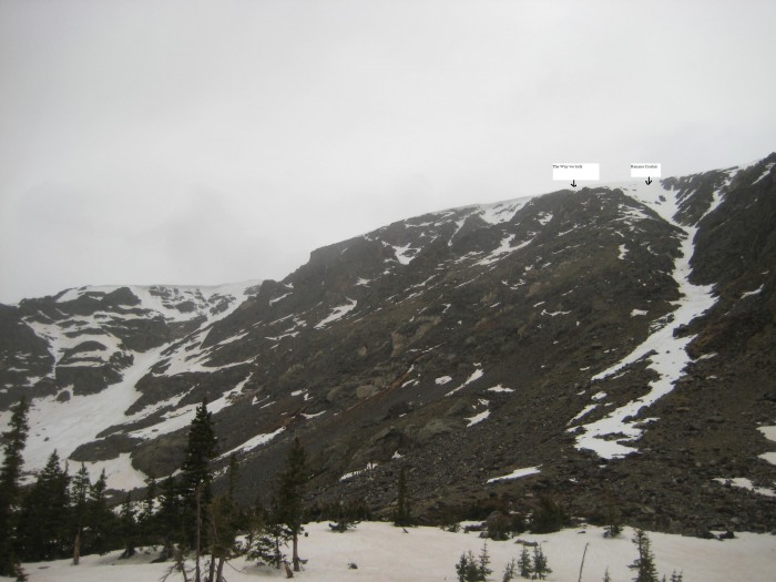
A look up our line in green, we called it "Banana Split"...
And a look at what we set out to ski, but never did, the actual "Banana Couloir"
Those little white boxes with text describe the various routes down the South Face. Here‘s a look at what we had to look foward to.....
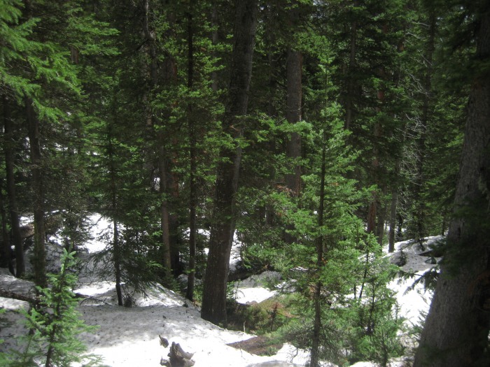
The hike out ended up being just as much of an event as the climb and ski itself. After reading about what to expect, we were ready for the worst, we prepared for it atleast, so we couldn‘t end up getting frustrated. Chris even threw a couple F-bombs out there, which is rare. The deadfall was very thick and very long and it got progressively worse and worse. It was your typical bushwack. Skis getting caught on every branch, poles getting caught on every root, slipping on every downed tree, etc.
It was both a beautiful area
And very unforgiving
But for every nightmarish route, there is always a light at the end of the tunnel
Right after this clearing, we had about another 200-300 feet to descend. It reminded me of that scene from "Perfect Storm" when George Clooney sees the clouds clearing and the waves getting smaller, only for the storm to get worse. We basically descended down a waterfall, then some thornbushes and finally reached the Fall River Rd, which led us to Chris‘ Subaru for a grand total of 9.5 hours.
We were both miserable, physically, for the majority of the climb, we felt like we had lost a fight in a landslide when we were done. Despite this, it was probably the most fun, most aesthetic ski descent I‘ve done to date. We were both in for an adventure and thats exactly what we got and we couldn‘t have found a better place for it than an inaugural trip to the Mummy Range.
Thumbnails for uploaded photos (click to open slideshow):
doubleA, thanks man. We never took out the inclometer, but we both agreed on 53-55 right under the corniced entrance, then it quickly mellowed to about 45, then finished off with 35-40 and a cliff at the bottom you have to navigate around. Definately the most interesting line I‘ve done to date.
Sweet right up man....I really need to just put down the money on some ski equip. Kinda sad to finally toss the straights, but there is no comparison with the new gear. I‘ve not been in the Mummy range, but it looks sweet. Great report, as usual :D
sunny1866 - I was wondering what this route would be like in summer, since the initial downclimb is along a road, near a nat‘l park visitors center and all. I‘m glad I did it when I did. Thanks for the comment
Mark - thanks man, these skis have opened up the floodgates in terms of access and will to get out. Mummy‘s are sweet, hope to have a few more endeavors up there.
Stephanie - I‘m thinking, with all the rain and relatively higher temps, it won‘t be around for long. It was pouring at the end of the day, almost felt like summer with thunder in the distance. I‘ll definately give the Comanche Peaks a chance, especially being the IPW‘s neighbor.
skibrendan - the sunrise did set the tone for the day. Hopefully it won‘t dwindle too fast.
sweet shot of you headin down the couloir with Longs in the background. If we had any sort of visibility, maybe we could‘ve snapped that same one. Despite the deadfall, I really do think that face, along with many others in that region, are very much worth the hardship. At the very least, its off the beaten path and will put your patience and determination to the test.
is great (again)! Love the sunrise shots - have hiked this peak in summer, kudos to you for doing it in the "slop season". The downfall looks PAINFUL. You get a gold star for persistence!
Nice write up, once again - thanks for posting!
Wow, nice route! Great pictures of the clouds too. Sure beats what we tried to do this weekend. Any idea on how long the snow might stick around in it? If you like the Mummy range you should check out the Commanche Peaks area too... tons of hidden gems.
Way to spot a sweet line and then go get it a few days later!
Caution: The information contained in this report may not be accurate and should not be the only resource used in preparation for your climb. Failure to have the necessary experience, physical conditioning, supplies or equipment can result in injury or death. 14ers.com and the author(s) of this report provide no warranties, either express or implied, that the information provided is accurate or reliable. By using the information provided, you agree to indemnify and hold harmless 14ers.com and the report author(s) with respect to any claims and demands against them, including any attorney fees and expenses. Please read the 14ers.com Safety and Disclaimer pages for more information.
Please respect private property: 14ers.com supports the rights of private landowners to determine how and by whom their land will be used. In Colorado, it is your responsibility to determine if land is private and to obtain the appropriate permission before entering the property.