Download Agreement, Release, and Acknowledgement of Risk:
You (the person requesting this file download) fully understand mountain climbing ("Activity") involves risks and dangers of serious bodily injury, including permanent disability, paralysis, and death ("Risks") and you fully accept and assume all such risks and all responsibility for losses, costs, and damages you incur as a result of your participation in this Activity.
You acknowledge that information in the file you have chosen to download may not be accurate and may contain errors. You agree to assume all risks when using this information and agree to release and discharge 14ers.com, 14ers Inc. and the author(s) of such information (collectively, the "Released Parties").
You hereby discharge the Released Parties from all damages, actions, claims and liabilities of any nature, specifically including, but not limited to, damages, actions, claims and liabilities arising from or related to the negligence of the Released Parties. You further agree to indemnify, hold harmless and defend 14ers.com, 14ers Inc. and each of the other Released Parties from and against any loss, damage, liability and expense, including costs and attorney fees, incurred by 14ers.com, 14ers Inc. or any of the other Released Parties as a result of you using information provided on the 14ers.com or 14ers Inc. websites.
You have read this agreement, fully understand its terms and intend it to be a complete and unconditional release of all liability to the greatest extent allowed by law and agree that if any portion of this agreement is held to be invalid the balance, notwithstanding, shall continue in full force and effect.
By clicking "OK" you agree to these terms. If you DO NOT agree, click "Cancel"...
Handies Peak Ski Descent (West Slopes) - American Basin TH
Handies Dust Storm Spring Ski
Date: Saturday, May 9, 2009 Group: Bill, Lance, and I Route: Southwest Slopes standard ascent (2.7mi.) and West Slopes ski descent (2mi.) from American Basin Stats: 4.7 miles; 2,800' climbed (3,100' for Bill); 2,800' skied; 5 hrs 45 min RT
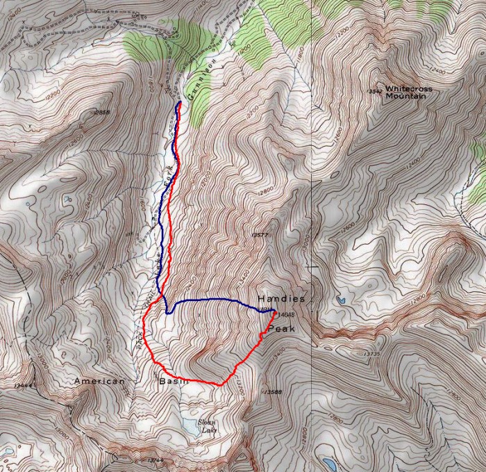
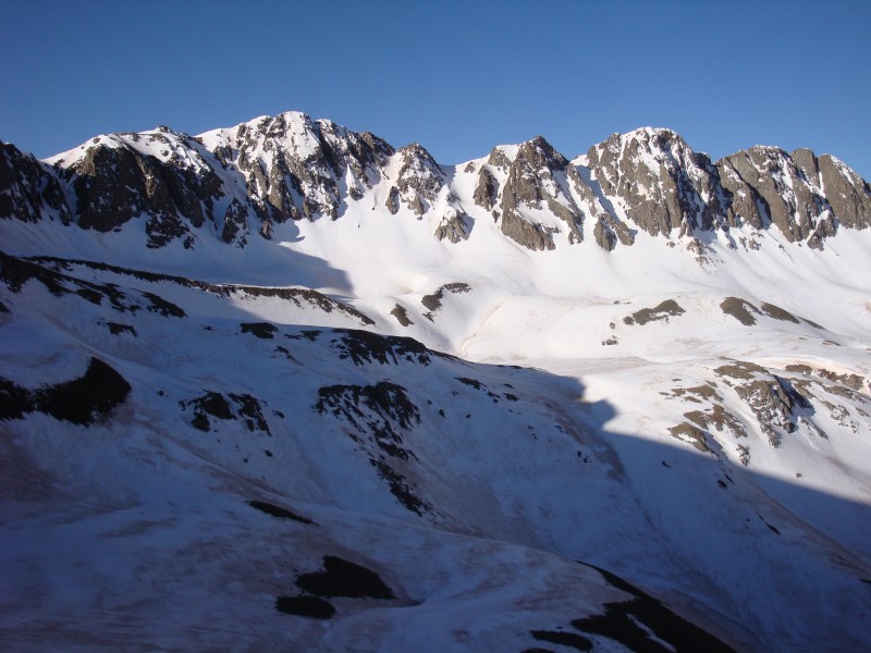
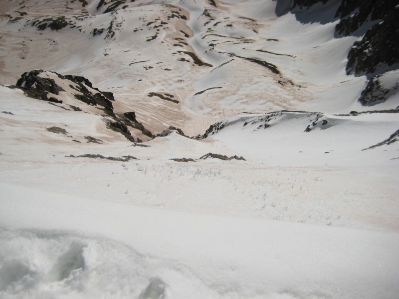
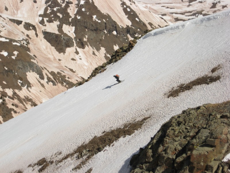
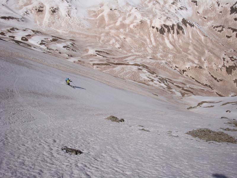
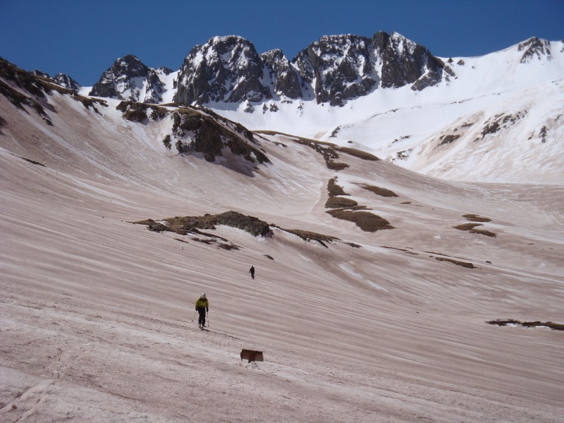
Our ski route seen from 12,200' in American Basin:
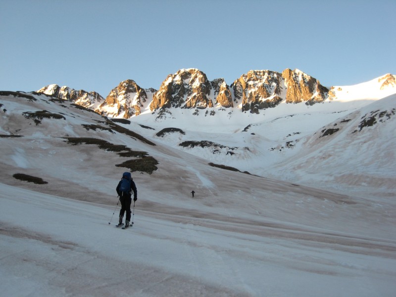
Topo of the route (red=climb; blue=ski):
Dust, dirt, and crust were the theme of our game Saturday.
We drove down Friday evening and arrived at the plow turn near the stream crossing at 11,300', just shy of a mile below the upper American Basin trailhead. The original plan was to climb and ski the standard route on Handies, and then hit one of the couloirs on American Peak if time allowed. We began the tour skinning immediately at 5:20am from the cars up through lower American Basin. We kept eyeing ski lines off the northwest side of Handies and, shortly after, were greeted with a nice sunrise over the American Peak couloirs.
Bill and comin2getcha skin before American Peak's emerging couloirs:
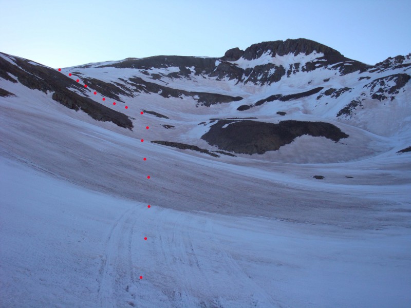
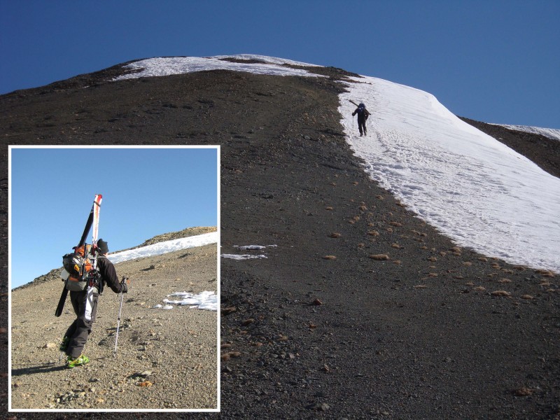
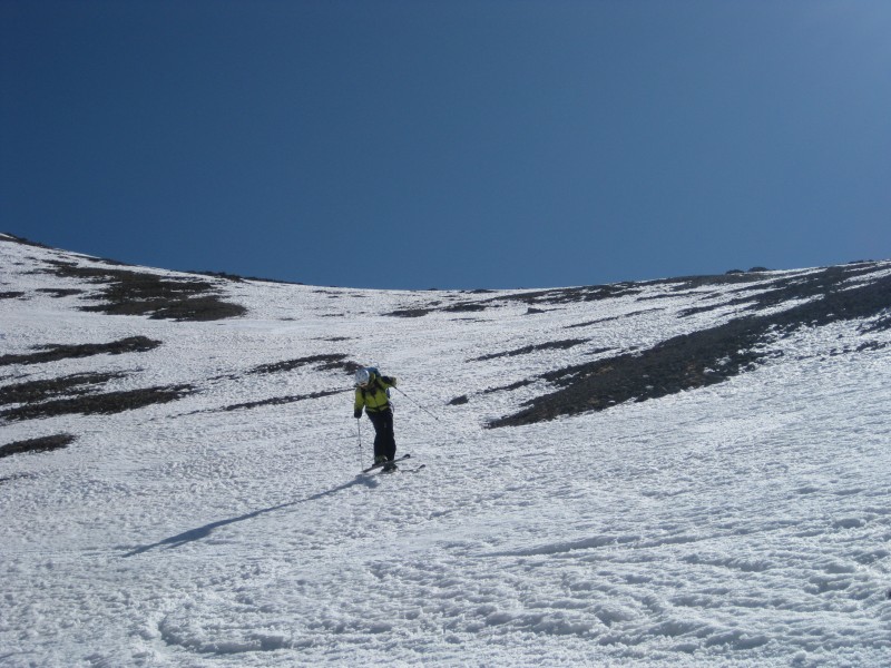
As we rounded the basin, we spotted a nice line off the west side of the intended. Once in the upper basin, we were able to see that a ski of the standard route was out due to lack of snow coverage. Shortcutting the standard route in the upper basin, we toured to where we found continuous snow to ascend the SW slopes. The dirt and sand really chewed up our skins, so Bill and I chose to crampon up here; comin2getcha elected to skin most of it. Surface granule on top of a firm base allowed for nice bite.
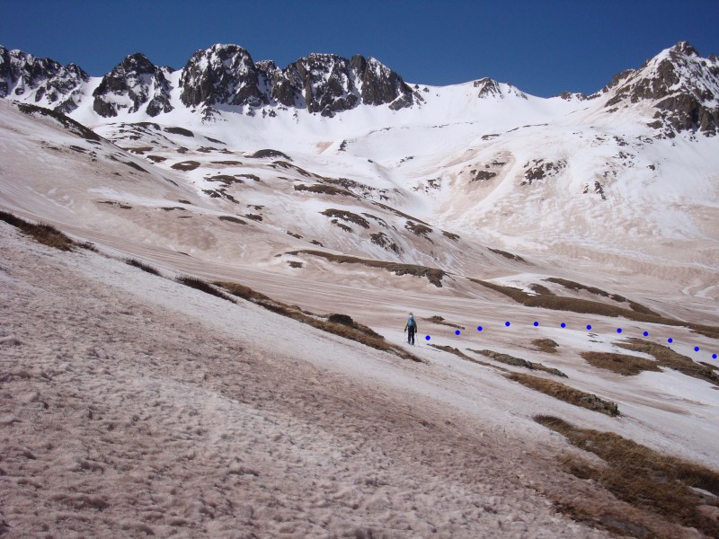
Ascent line to the Southwest Slopes; taken from upper American Basin (the summer route is lookers' right of the marked route):
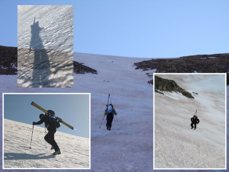
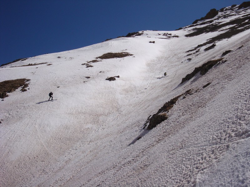
Bill, comin2getcha, and I climb the SW Slopes:
American Peak and her inviting couloirs (taken from ~13,400'):
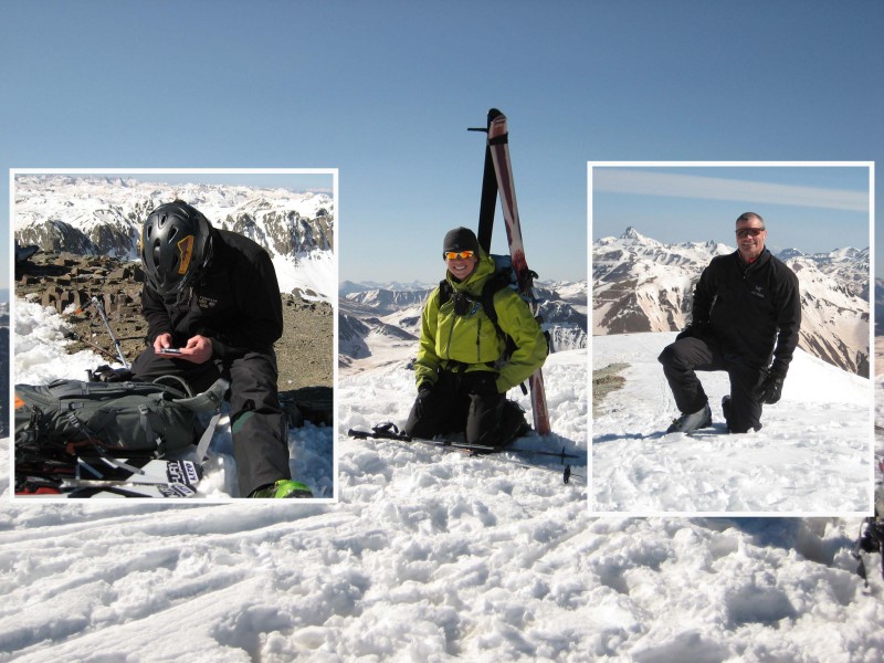
Since the standard route ski was out, we knew one of American's couloirs was out too, and therefore weren't pressed for time. The terrain on the South Ridge proper gave us a Mars-like feel (there is a narrow strip of snow off the summit for a pieced-together standard route ski though). We were on the windy summit at 9:10am, planning to wait as long as possible for the snow to soften on the western aspect where we would ski. The lines off the East Face direct looked great, but the slog out of Grizzly Gulch would have been nasty.
Bill (inset) and comin2getcha nearing the summit:
The crew on the summit - Bill texting his coordinates to 14ers.com (nerd alert!):
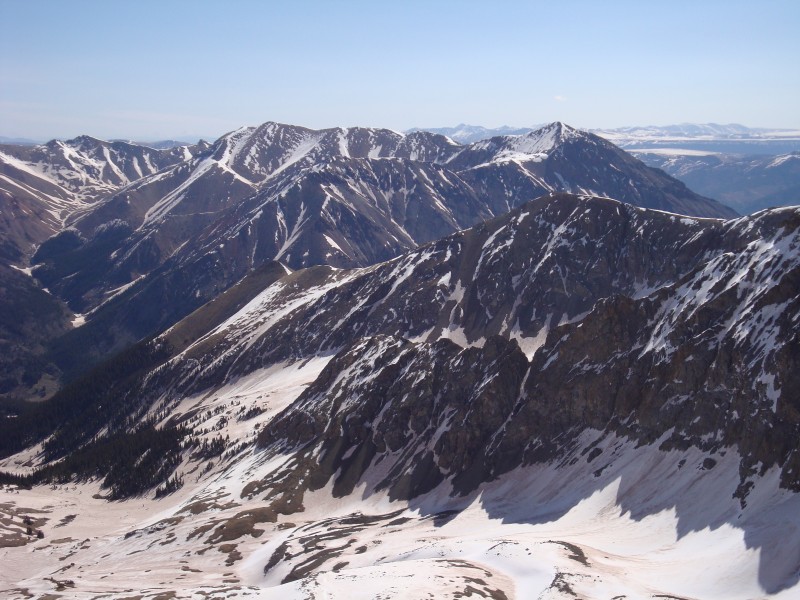
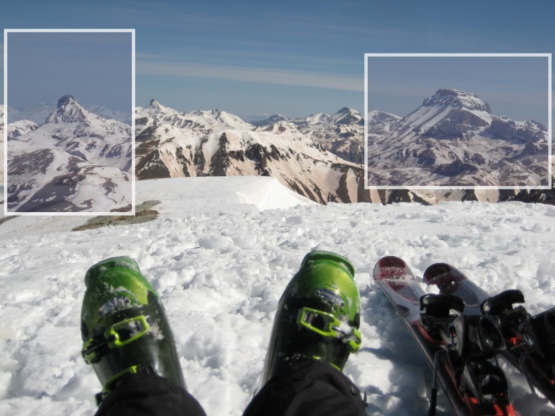
Redcloud and Sunshine look sparse:
Wetterhorn and Uncompahgre in the distance (zoomed-up insets):
Looking down Handies' tempting East Face - Mmmmmmm!
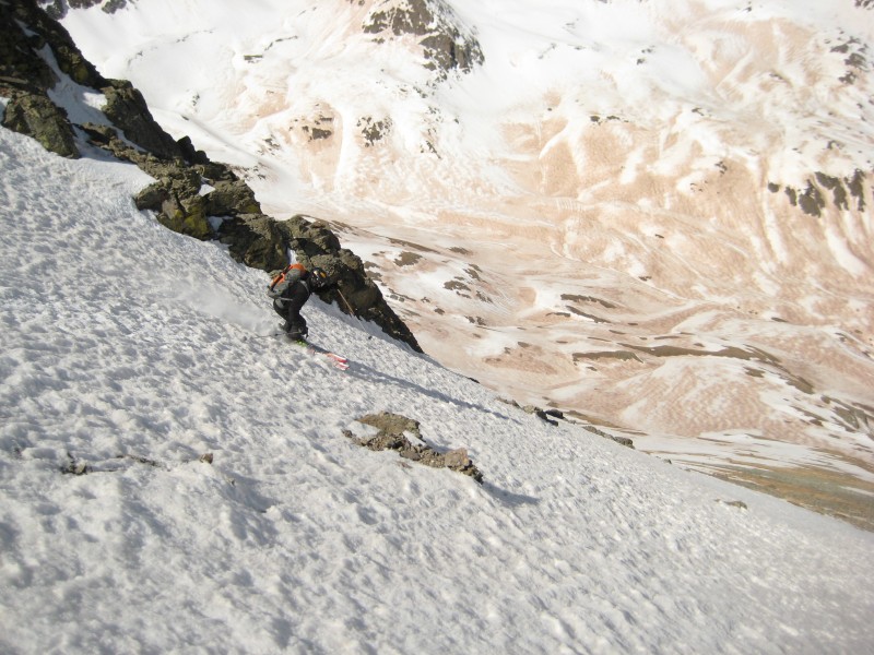
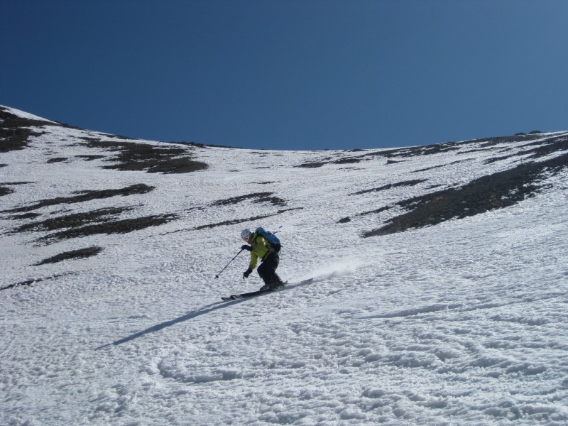
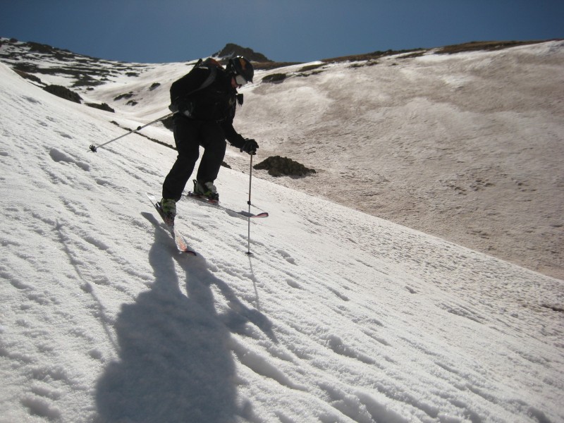
It was getting pretty cold after an hour of passing time, so we decided to ski. We took an immediate left (west) from the summit to find thin snow coverage for the first few hundred feet and involved a little extra time to navigate through before entering the main gully on the west side. Bullet-proof snow was the primary terrain we skied to about 12,000'.
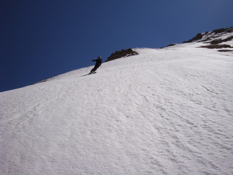
Bill off the summit:
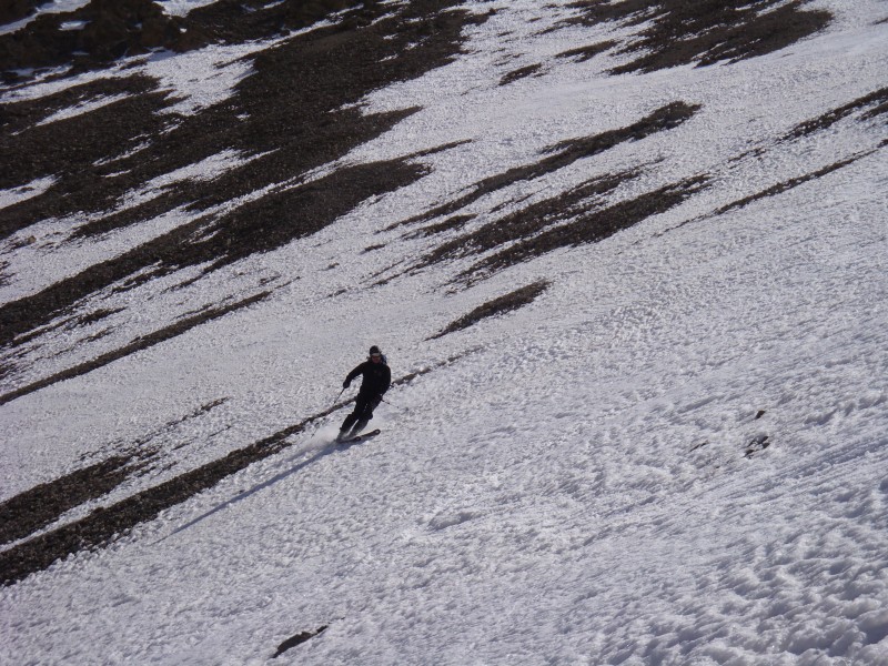
Lance skied next:
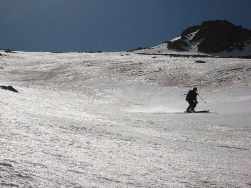
I followed:
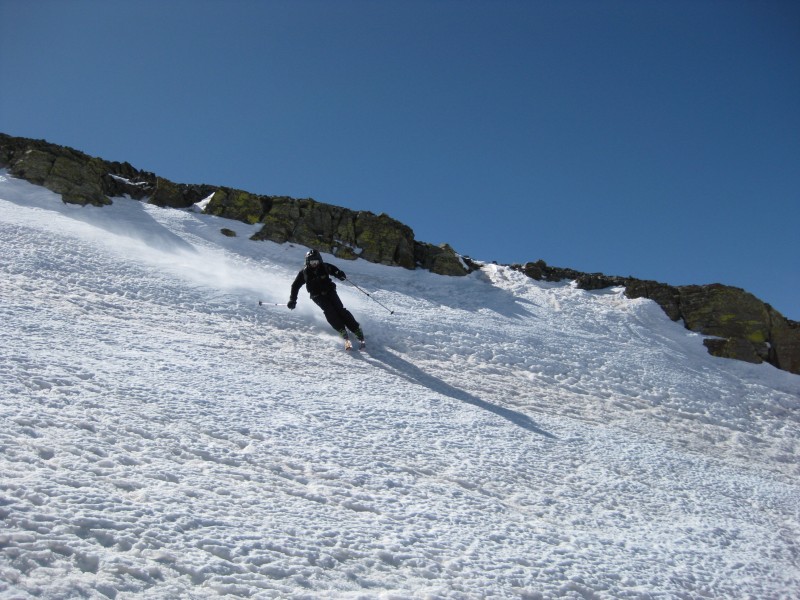
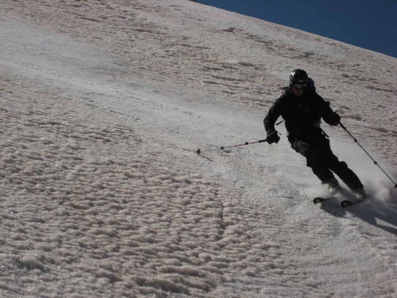
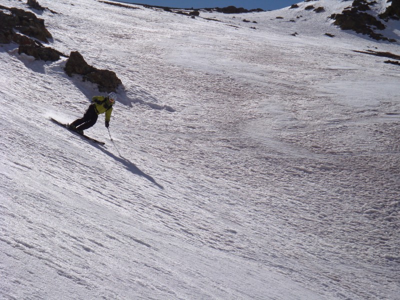
Skiing more hardpack, we entered the gully near 13,400' and flirted with skiing the north and south sides for most of the line. The couloir averages 32 degrees (max. slope angle: 38 deg. near 13,200').
Bill rips the gully:
Lance hitting it:
I get mine:
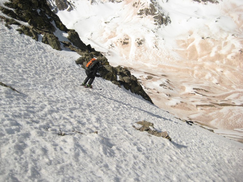
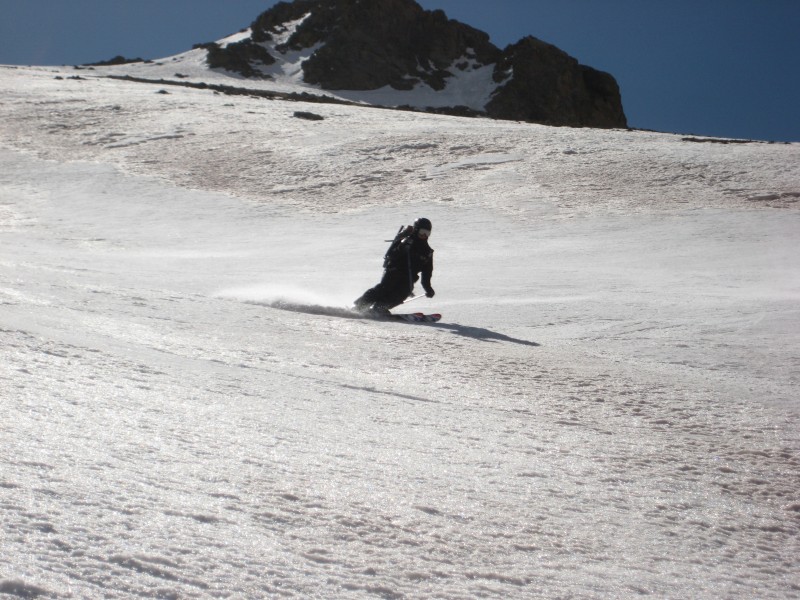
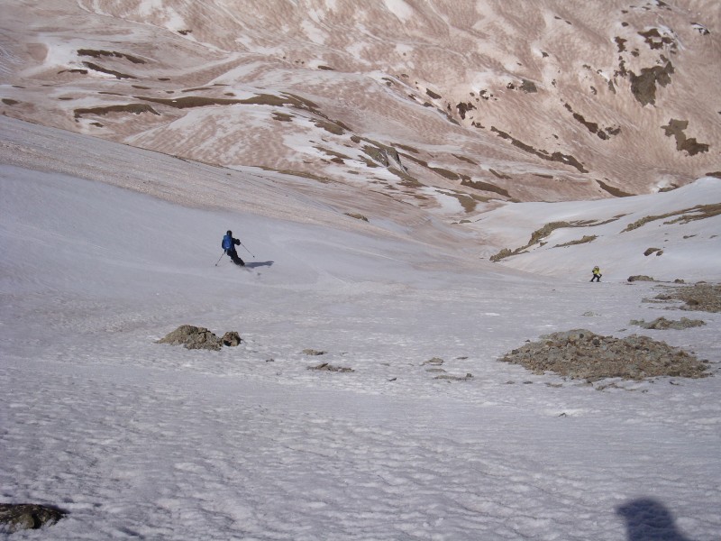
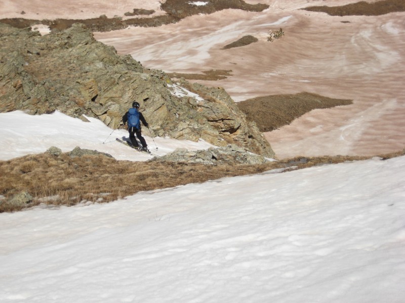
We traversed south to find an exit point back into lower American Basin:
comin2getcha works the exit chute:
After the small chute, a few final corn turns were made before the dirt ski back to the car.
What would a San Juan ski be right now without some dust? Skiing out of American Basin:
The ski descent took us just short of an hour to reach the cars (at 11:05am). The West Slopes of Handies is a mellow descent, and a great first San Juan ski. Great day boys! comin2getcha - it was so nice to be in the mountains with you again.
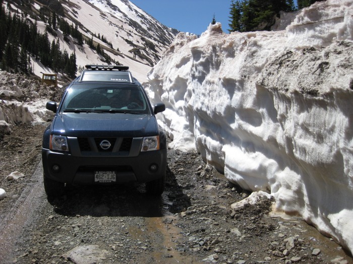
Where the snow lacks on the mountain can be found on the road:
Thumbnails for uploaded photos (click to open slideshow):
Does the dust on the snow wear the wax off your skis by the end of the day? I would think that it would act like a super fine sand paper by the end of the day.... just curious.
It was great skiing with you guys! Skiing wasn‘t perfect, but at least we had a top-to-bottom line that none of us had hit before. Good stuff.
Prairie Native: A Civic won‘t make it much past the Grizzly Gulch/Silver Creek TH, if you make it that far. So, that would leave you 4 miles below the turn-off to American Basin and a total of 5 miles away from the American Basin summer, 4WD TH.
Easy Rider: Do you mean how far is the road up Cinnamon Pass plowed? All the way over - it‘s open.
MUni Rider: The dust does strip ski wax. We were without wax by the time we got down to 11,800‘. It also wears some of the nylon off of skins while skinning up in the morning. Crazy.
Getting handy with the photoshop I see! I like the inset pictures :D
Looks like it was a great day despite the dusty snow! That dust layer is going to keep getting higher and higher up the mountains, hopefully it doesn‘t shorten the season by too much :cry:
The photos are great! It looks like the snow is melting quite fast and some nasty dirt to ski on. Great job to all and again, another nice trip report!
would‘ve been a pretty damn miserable experience, on skis that is. Atleast you got to ski back to the car. Those routes off American look pretty cool regardless and look to be pretty dust free
They looked very thin. We could see that the approach up Silver Creek was pretty dry for the first mile. There‘s a new photo I put on the Redcloud/Sunshine page that might provide some help.
Ha! Well, I‘m actually surprised that Caroline didn‘t mention this...
When we were putting on crampons on the slope that climbs out of A-Basin, I dropped my helmet and watched it bounce down 200‘ of hard snow. So, I skied down to retrieve it and climbed back up and continued up the snow. If that wasn‘t bad enough, I later determined that I left my camera back where we put the crampons on, so I had to go back down there AGAIN!
Not sure what my problem was. All was better when the skis went on.
I agree with Carl and Brian, nice to have you head down and check on things before we took the plunge...and you got a ski out of it so everyone wins this way. Let‘s go back and get Red/Sun this winter :D.
Nice TR Caroline. Some great pics in there. It look like those layers of brown frown are really taking down the snowpack in the San Juans quickly. I‘m planning on a couple trips down there in the next few weeks to see for myself.
Where did you get the extra 300 feet Bill? Did you climb up and down the summit cairn a few hudred times to stay warm while waiting or did you just have to walk around a bit to get a signal for your nerd alert?
Joe: I was looking at your Handies TR and read/saw that you had interest in the west side of the peak. Not a ton of info out there on it.I still think the east side looked more fun!
Bill: I didn't mention it because I didn't want to make you feel bad, so I subtly placed it in the stats section! :wink: Agreed, it‘s always better when the skis go on - that was proved on La Plata!
Ben: You better know I'm already ready to go back down this winter to nail R/S!
I was told that the trailhead was closed a crazy mileage from the summer trailhead, this report seems to say otherwise? How far would a round trip to the American Peak summit would be if I approached with a Civic?
and reporting back before the trip we had planned. Too bad about the dusk. Nice write up though Caroline.
Caution: The information contained in this report may not be accurate and should not be the only resource used in preparation for your climb. Failure to have the necessary experience, physical conditioning, supplies or equipment can result in injury or death. 14ers.com and the author(s) of this report provide no warranties, either express or implied, that the information provided is accurate or reliable. By using the information provided, you agree to indemnify and hold harmless 14ers.com and the report author(s) with respect to any claims and demands against them, including any attorney fees and expenses. Please read the 14ers.com Safety and Disclaimer pages for more information.
Please respect private property: 14ers.com supports the rights of private landowners to determine how and by whom their land will be used. In Colorado, it is your responsibility to determine if land is private and to obtain the appropriate permission before entering the property.