Download Agreement, Release, and Acknowledgement of Risk:
You (the person requesting this file download) fully understand mountain climbing ("Activity") involves risks and dangers of serious bodily injury, including permanent disability, paralysis, and death ("Risks") and you fully accept and assume all such risks and all responsibility for losses, costs, and damages you incur as a result of your participation in this Activity.
You acknowledge that information in the file you have chosen to download may not be accurate and may contain errors. You agree to assume all risks when using this information and agree to release and discharge 14ers.com, 14ers Inc. and the author(s) of such information (collectively, the "Released Parties").
You hereby discharge the Released Parties from all damages, actions, claims and liabilities of any nature, specifically including, but not limited to, damages, actions, claims and liabilities arising from or related to the negligence of the Released Parties. You further agree to indemnify, hold harmless and defend 14ers.com, 14ers Inc. and each of the other Released Parties from and against any loss, damage, liability and expense, including costs and attorney fees, incurred by 14ers.com, 14ers Inc. or any of the other Released Parties as a result of you using information provided on the 14ers.com or 14ers Inc. websites.
You have read this agreement, fully understand its terms and intend it to be a complete and unconditional release of all liability to the greatest extent allowed by law and agree that if any portion of this agreement is held to be invalid the balance, notwithstanding, shall continue in full force and effect.
By clicking "OK" you agree to these terms. If you DO NOT agree, click "Cancel"...
It's hard to do a trip report on a peak that is climbed as often as Quandary. If nothing else, this report will supply a few pretty pictures and give future climbers a representative snapshot of how Quandary looks this time of year.
STATS:
Distance: 6.7 miles
Average Speed: 1.0 mph
TH to Summit: 4:06
Time on Summit: 0:30
Summit to TH: 2:08
QUICK OVERVIEW:
Friday (24 April 09) ended up being a beautiful day for a climb. We were a bit concerned about Saturday with a 70% chance of snow. So, bbishop02 and I took the day off work and met at the trailhead a little before 7 am. About the only complaint I can make is that we had a fairly strong wind in our face most of the way up. We were both glad we brought ski goggles and something to cover our faces.
I‘ll explain the rest of the trip in pictures!
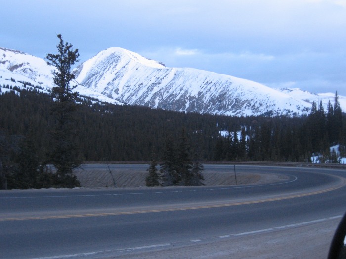
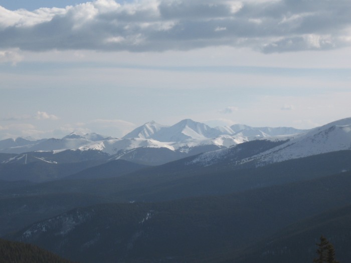
Quandary Peak from Hoosier Pass as I was approaching from the south.
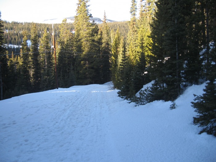
The true trailhead is still snowed in, but it is a VERY short walk from Blue Lakes Road. Snow in the morning was hard and crusty - easy to walk on without snowshoes.
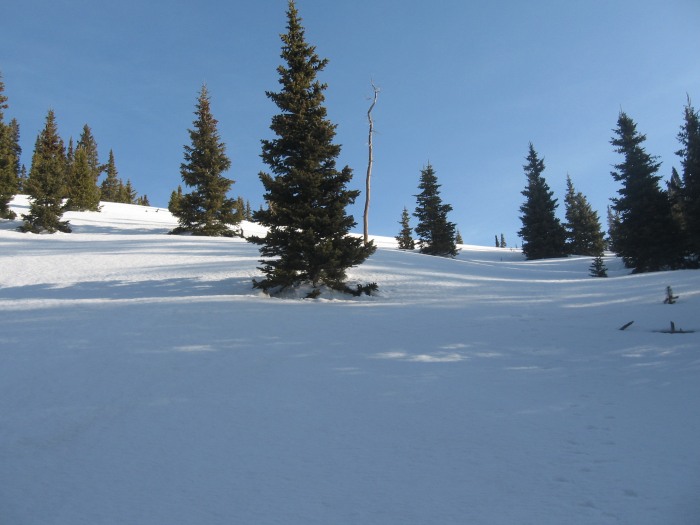
It started out as a beautiful day! We got a little off trail at one point and had to bushwack (if you can call it that) up this slope to get back to the trail. Up until this point, no snowshoes were required, but after a couple small postholes and some slipping on the steep slope, we decided to put them on, and were glad we did!
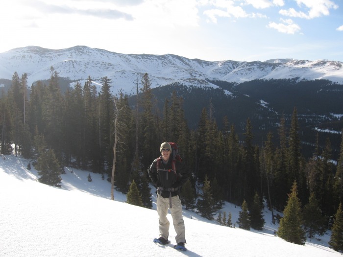
Here's bbishop02 looking happy on the way up! This was pretty close to treeline. The snow was still easy to walk on, but even easier with the snowshoes.
Clouds began moving in, but we never did see any precipitation. Off to the north-east, you can easily see Grays and Torreys.
Looking west, the sky was still blue. The summit is in view!
Looking to the south, one of the Blue Lakes was still frozen over. I decided this wasn't the best place for glissading.
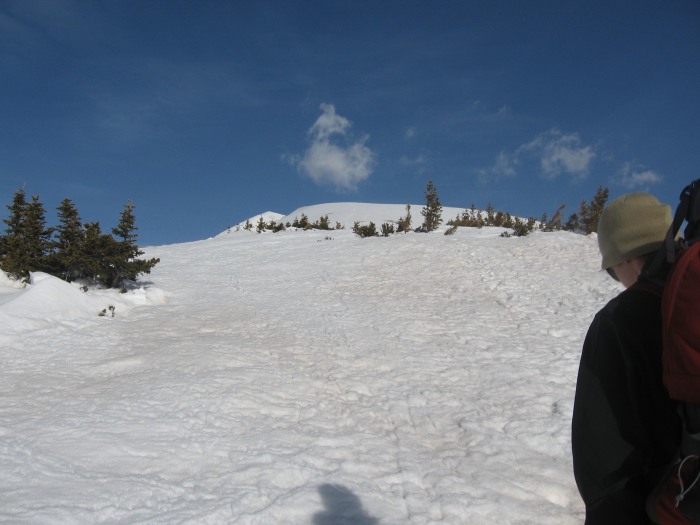
As we approached the final steep pitch to the summit, we passed this wind-swept section. We were able to keep our snowshoes on and keep ascending to the left of the rocks.
Looking off to the south (on the way up the final slope), Bross, Lincoln, Cameron and Democrat become visible. That "hump" in front of them is North Star Mountain according to my maps
Looking North, Grays & Torreys are visible as well as the back side of Breckenridge.
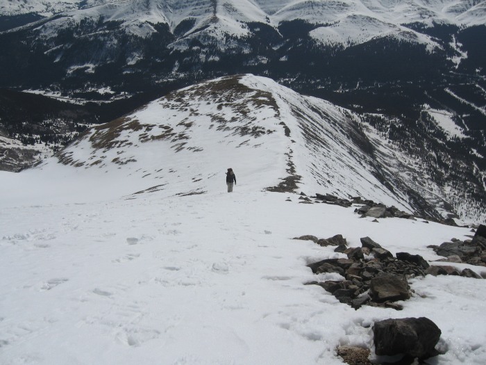
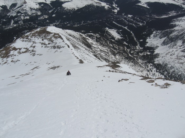
Looking back (east) down the slope, bbishop02 is right behind me!
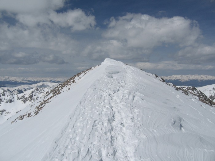
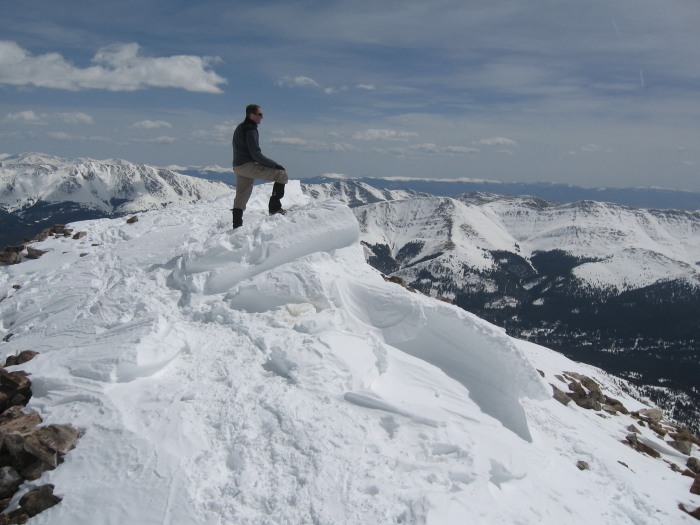
Looking ahead (west) towards the summit, the way became quite a bit more snow packed. In fact, I'm going to claim this as a 14,268 foot peak for this climb. We had at least an additional 3 feet of snow on top!
The Summit! Like I said, that snowbank is at least an additional 3 feet of climbing!
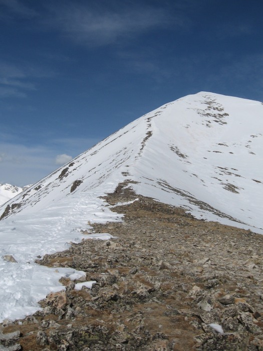
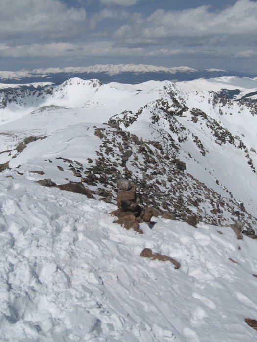
Here's a view west down the Class 3 section of the west ridge. Something I hope to do someday... in the summer.
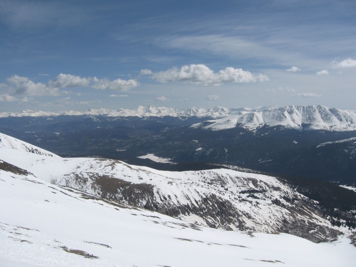
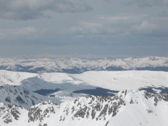
Here's a representative picture from the top. As you can see, things were getting hazy. Also, you can see that the region still had quite a significant amount of snow. Views were similar in all directions.
Mandatory summit shot. Have to prove I made it!
Our attempts at glissading proved only marginally successful. Above 13,000 feet, the snow was still hard and crusty... making it painful and sometimes difficult to maintain control. I didn't bring my ice axe, so I was a bit skittish about going too fast. Below 13,000 feet, it was so slushy that it just wasn't feasible to glissade.
TRIP NOTES:
- We were greeted at the trailhead by Horton the Quandary Dog! Unfortunately, he followed a pair of hikers going up just ahead of us.
- No problems with post-holing until treeline on the way back down. With careful navigation, you could avoid a lot of it, but bbishop02 and I both sunk in a few times up to our waist. In one case my legs went at odd angles and I had to "dig" myself out!
- After getting back to the trailhead, my car wouldn't start! Looks like it may have been the fuel pump, but I had to get it towed to a mechanic (where it still remains). I'm just glad this didn't happen last summer on South Colony Lakes Road!
- I don't know what is wrong with me, but I get sunburned every time I hike. Despite SPF 50+ sunscreen and wearing a balaclava most of the time, my face was red and peeling the last couple days. Anyone have any advice?
Thumbnails for uploaded photos (click to open slideshow):
Nice report. You got some better pics of the mountain, but your weather looked just like ours - except on Saturday the wind was howling.
Caution: The information contained in this report may not be accurate and should not be the only resource used in preparation for your climb. Failure to have the necessary experience, physical conditioning, supplies or equipment can result in injury or death. 14ers.com and the author(s) of this report provide no warranties, either express or implied, that the information provided is accurate or reliable. By using the information provided, you agree to indemnify and hold harmless 14ers.com and the report author(s) with respect to any claims and demands against them, including any attorney fees and expenses. Please read the 14ers.com Safety and Disclaimer pages for more information.
Please respect private property: 14ers.com supports the rights of private landowners to determine how and by whom their land will be used. In Colorado, it is your responsibility to determine if land is private and to obtain the appropriate permission before entering the property.