Download Agreement, Release, and Acknowledgement of Risk:
You (the person requesting this file download) fully understand mountain climbing ("Activity") involves risks and dangers of serious bodily injury, including permanent disability, paralysis, and death ("Risks") and you fully accept and assume all such risks and all responsibility for losses, costs, and damages you incur as a result of your participation in this Activity.
You acknowledge that information in the file you have chosen to download may not be accurate and may contain errors. You agree to assume all risks when using this information and agree to release and discharge 14ers.com, 14ers Inc. and the author(s) of such information (collectively, the "Released Parties").
You hereby discharge the Released Parties from all damages, actions, claims and liabilities of any nature, specifically including, but not limited to, damages, actions, claims and liabilities arising from or related to the negligence of the Released Parties. You further agree to indemnify, hold harmless and defend 14ers.com, 14ers Inc. and each of the other Released Parties from and against any loss, damage, liability and expense, including costs and attorney fees, incurred by 14ers.com, 14ers Inc. or any of the other Released Parties as a result of you using information provided on the 14ers.com or 14ers Inc. websites.
You have read this agreement, fully understand its terms and intend it to be a complete and unconditional release of all liability to the greatest extent allowed by law and agree that if any portion of this agreement is held to be invalid the balance, notwithstanding, shall continue in full force and effect.
By clicking "OK" you agree to these terms. If you DO NOT agree, click "Cancel"...
Route: Left Fork of North Creek TH (out and back) Total Distance/Total Time: 5.87 mi / 5 hours
I always thought the Subway seemed like a magical place in Zion National Park so I made it a must-do when I spent 5 days there in April 2009.
There are two main trailheads from which to reach the Subway. The Wildcat Canyon TH is the technical route and requires a car shuttle. I chose the non-technical route, Left Fork of North TH, which does not require a shuttle or technical canyoneering gear.
I started at 10 am. The trail starts out flat for the first mile until you reach the lip of the canyon. The trail then goes straight down for about 400' to the Left Fork of North Creek. From there, the route is straight forward: follow the creek northwest to the Subway, *only* about 2 miles away.
The view from the lip of the canyon:
At the bottom of the canyon you begin following the creek northwest. It is very important you don't miss the exit back up the canyon on the way out ( N37*17' 19.1" W 113*05' 07.9").
After reaching the creek at the bottom, the fun begins. There are cairns marking the route but they don't have to be followed; just follow the creek. In fact, it seemed like walking in the creek was often easier than walking on the "trail", which is a boulder and log strewn mess created by many flash floods.
I wasted a lot of time looking for cairns before I realized the path of least resistance is up to the hiker. If you were prepared for wet feet (I wore Keens and kayaking socks) you can just walk in the creek. The unprepared have to try to follow the trail, which crosses the creek dozens of times anyhow.
My opinion: there are two routes up. For those who don't mind getting wet, follow the creek and use the trail only when necessary. If you want to stay dry (which is impossible, really) try to follow the cairns and trail. I had much more fun in the water than on the trail.
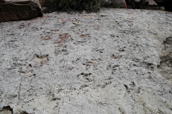
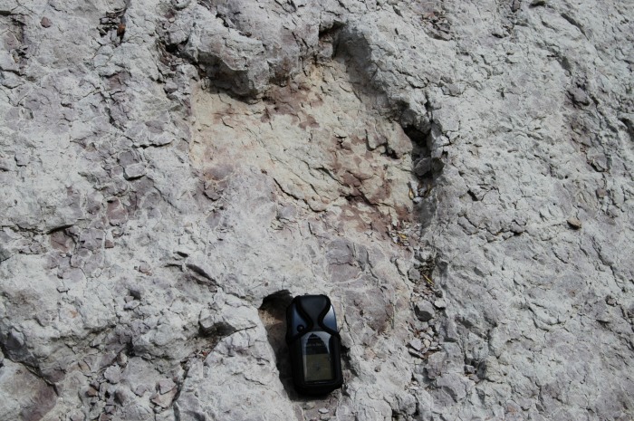
At N 37*17' 58.0" W 113*04' 12.0" you will cross some excellent dinosaur tracks preserved in mudstone. They are on two slabs that lean toward the trail on the left (north) side of the creek (if ascending). They are at eye level and above, so if you are looking at the trail you'll miss them.
Dinosaur tracks:
With my GPS for perspective:
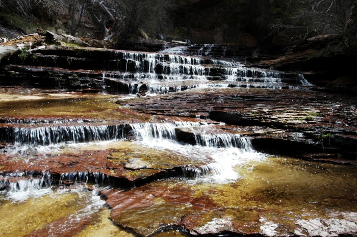
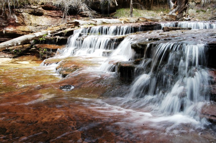
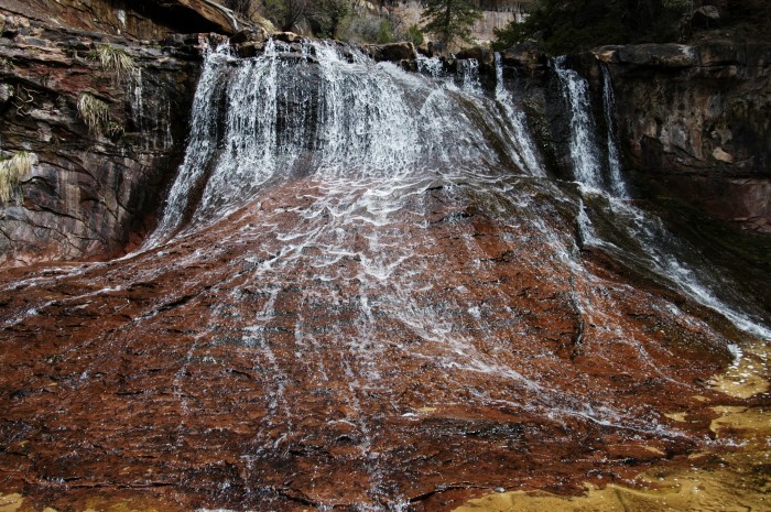
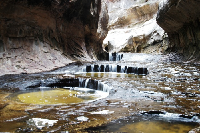
From there, you continue the bushwhack. Before the Subway you pass many cascading waterfalls.
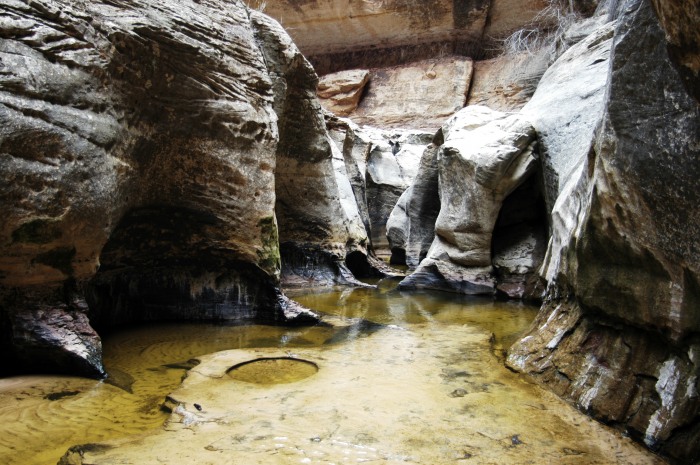
Before you reach the Subway (N 37*18' 32.0" W 113* 03' 07.0"), the creek bottom turns from sand and boulders to sandstone. Wet and with algae, the sandstone is quite slippery.
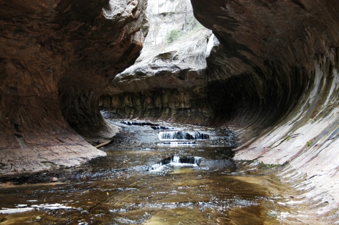
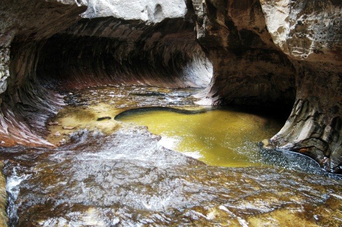
The Subway:
To go further requires crossing a couple of deep pools (at least they were deep when I was there in April during spring run-off). A fall visit would yield diffferent conditions, I'm sure. Bring dry bags for your electronics.
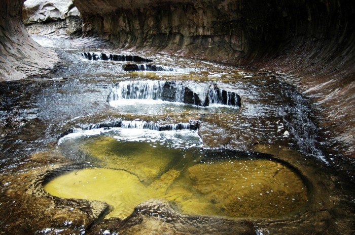
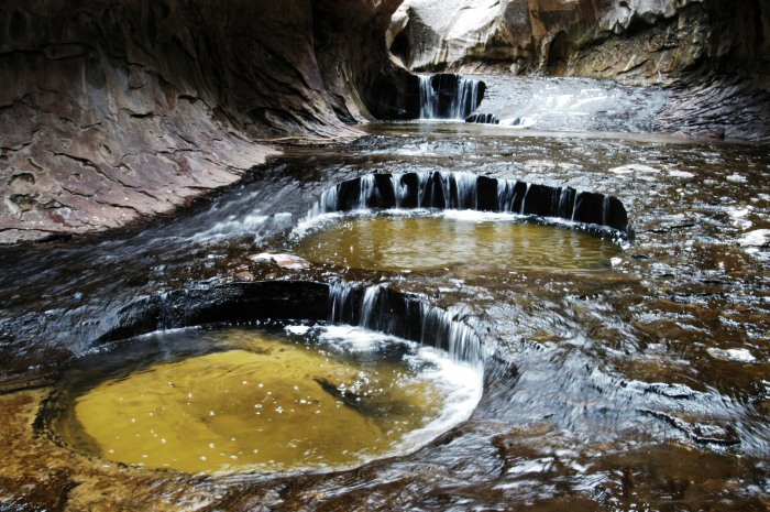
Where the canyon becomes a slot, the pools get deeper.
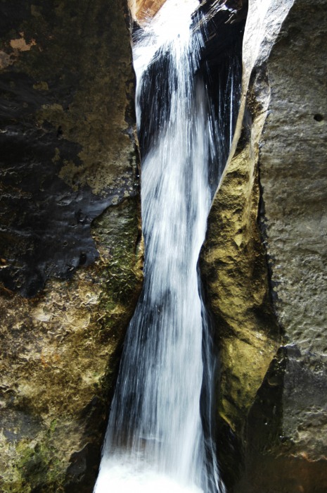
The hike ends at Keyhole Falls, which is about 12' high. The alternate route from Wildcat Canyon requires a rap of these falls.
From there, hike back out, being careful not to miss the exit to the canyon lip. The hike out is not pleasant but short.
Parting shot:
Thumbnails for uploaded photos (click to open slideshow):
i saw an article about this in may‘s backpacker magazine, then got on here and saw this trip report!guess its a sign. if i dream about it tonight then its happeninnnnn! :D
I had the opportunity this last fall to visit it for the first time. The place is awesome. On the way out I tried to keep my feet wet on the way back I was like Scr@w it, so much easier.
As I was sitting in PT two weeks ago rehabing my knee, swapping Utah backpacking stories with my physical therapist, he kept mentioning a place in Zion called ”The Subway”. Thanks for posting this!
We did the Subway via the same route last May, and it remains one of the most spectacular scenic hikes I‘ve ever done.
After comparing some of my pics with yours, it appears that water levels for your trip are a bit higher than for us. Neoprene socks make it all better.
Thanks for posting this. I hope more people check the place out.
It‘s been years since I was out there. I actually used to fly tours up to Bryce and I‘d fly over Zion on the way. I hiked up there once and visited a couple of times. I always thought it was one of the most beautiful places I‘d ever been. Your report makes me want to go out soon!
Caution: The information contained in this report may not be accurate and should not be the only resource used in preparation for your climb. Failure to have the necessary experience, physical conditioning, supplies or equipment can result in injury or death. 14ers.com and the author(s) of this report provide no warranties, either express or implied, that the information provided is accurate or reliable. By using the information provided, you agree to indemnify and hold harmless 14ers.com and the report author(s) with respect to any claims and demands against them, including any attorney fees and expenses. Please read the 14ers.com Safety and Disclaimer pages for more information.
Please respect private property: 14ers.com supports the rights of private landowners to determine how and by whom their land will be used. In Colorado, it is your responsibility to determine if land is private and to obtain the appropriate permission before entering the property.