Download Agreement, Release, and Acknowledgement of Risk:
You (the person requesting this file download) fully understand mountain climbing ("Activity") involves risks and dangers of serious bodily injury, including permanent disability, paralysis, and death ("Risks") and you fully accept and assume all such risks and all responsibility for losses, costs, and damages you incur as a result of your participation in this Activity.
You acknowledge that information in the file you have chosen to download may not be accurate and may contain errors. You agree to assume all risks when using this information and agree to release and discharge 14ers.com, 14ers Inc. and the author(s) of such information (collectively, the "Released Parties").
You hereby discharge the Released Parties from all damages, actions, claims and liabilities of any nature, specifically including, but not limited to, damages, actions, claims and liabilities arising from or related to the negligence of the Released Parties. You further agree to indemnify, hold harmless and defend 14ers.com, 14ers Inc. and each of the other Released Parties from and against any loss, damage, liability and expense, including costs and attorney fees, incurred by 14ers.com, 14ers Inc. or any of the other Released Parties as a result of you using information provided on the 14ers.com or 14ers Inc. websites.
You have read this agreement, fully understand its terms and intend it to be a complete and unconditional release of all liability to the greatest extent allowed by law and agree that if any portion of this agreement is held to be invalid the balance, notwithstanding, shall continue in full force and effect.
By clicking "OK" you agree to these terms. If you DO NOT agree, click "Cancel"...
HIKED DOWN MARCH 5th ON THE SOUTH KAIBAB TRAIL, TIME - 5 HOURS
STAYED OVERNIGHT AT PHANTOM RANCH 2 NIGHTS
DAYHIKE MARCH 6th HALFWAY UP THE NORTH KAIBAB TRAIL AND RETURN TO PHANTOM RANCH
HIKED UP THE BRIGHT ANGEL TRAIL, TIME - 7 HOURS
WEATHER: 70 DEGREES, AWESOME
In November 2008 my wife and I decided that in all of our visits to Phoenix to see family, we should really do a hiking trip down into the Grand Canyon. When calling up for reservatoins to Phantom Ranch, the first availability was 4 months later in March, hence that's when we went. I knew I didn't want to go in the summer, but we lucked out as March is pretty ideal - 70 normal daytime highs in the canyon, though
it was generally 40's at the rim. It breifly snowed on the way up out of the canyon, but more of those details below:
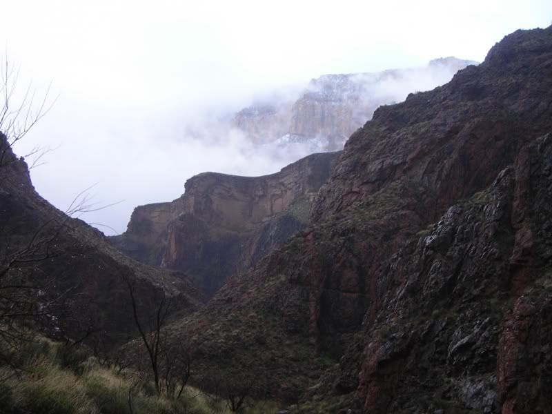
Day 1, Hike down S. Kaibab trail
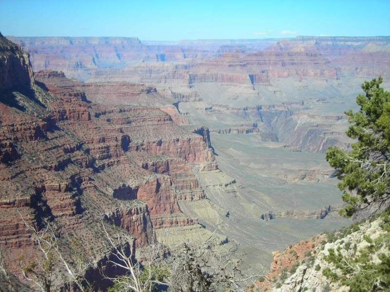
A rim view from near the top:
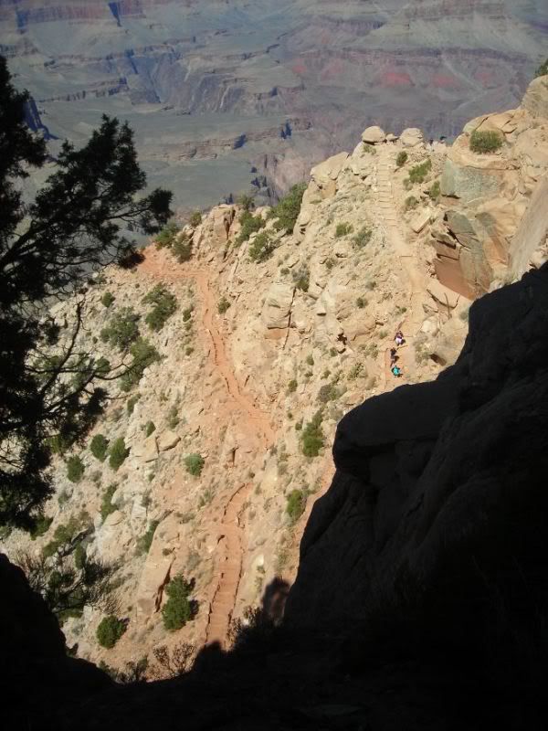
All the trails were always at least 4 feet or more wide. Except for one icy and tilted spot on Bright Angel (2 days later), I never had any fear of exposure, though in many sections it does drop off at the edge of the trail. The 4 feet or more makes you very comfortable - anyone can handle it exposure-wise.
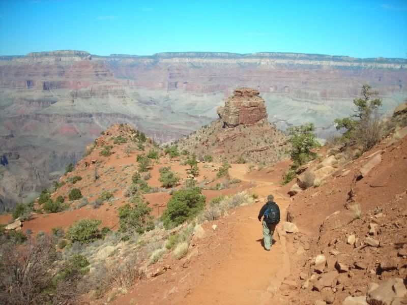
Starting down the trail:
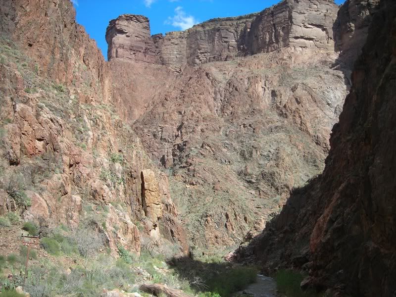
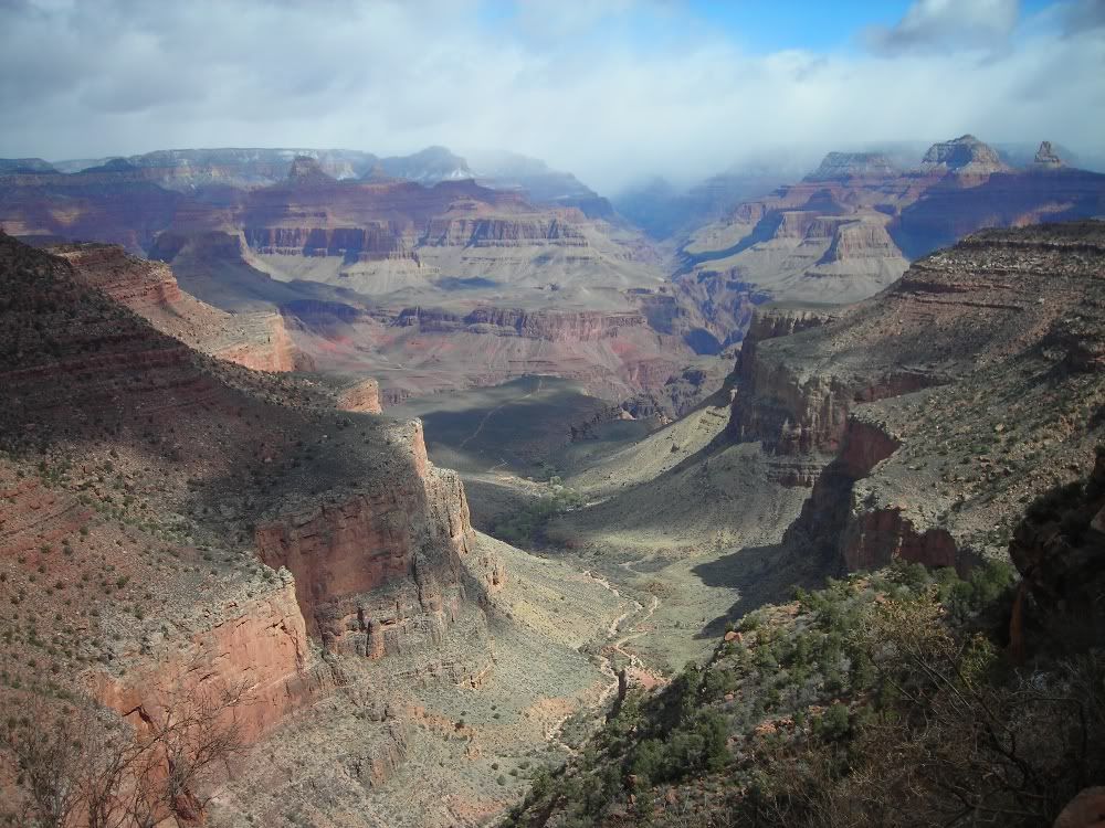
The Grand Canyon is of course a reverse mountain climb (or hike!). With mountain hikes you have false summits. Similary, note the "false bottom" we eyed for a few hours below us. This would be a joke for a while on the trail for us. The Colorado river is tucked out of site in the smaller deeper canyon in the photo.
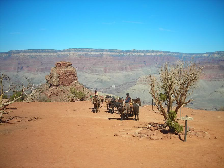
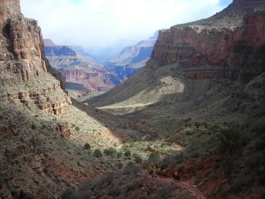
At one of the rest-room (outhouse) areas with mule team taking a break as well. Later we stopped and talked to two workers on mules. They indicated they were doing "trail maintainance" I realized a few minutes later this meant "poop scoop detail" The trails, though traveled by the supply and tourist mule trains really did not have that many landmines to avoid.
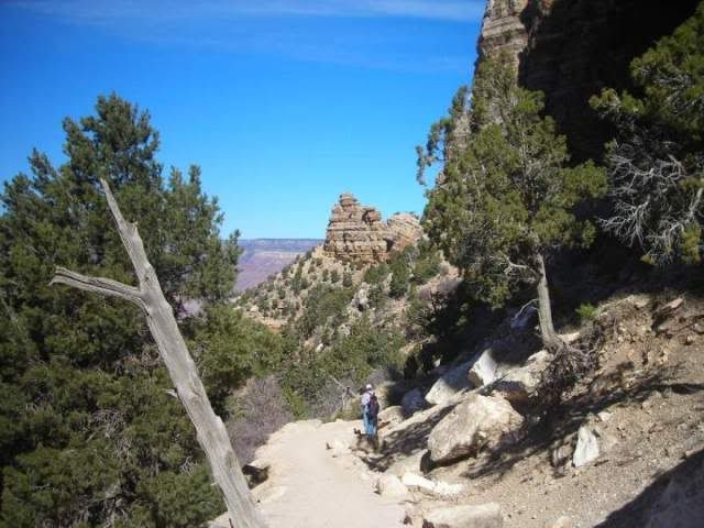
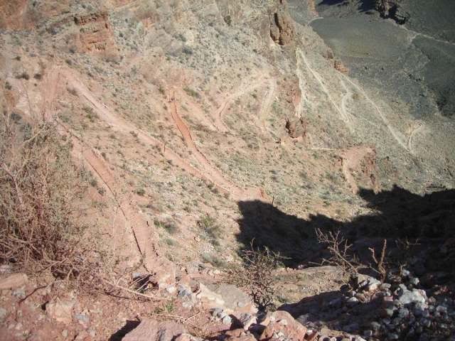
Switchbacks:
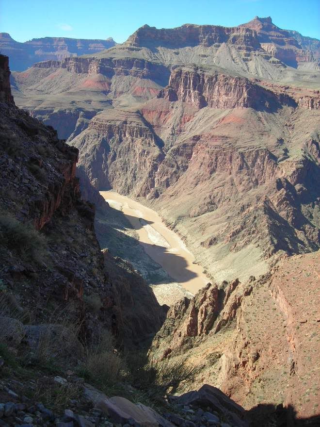
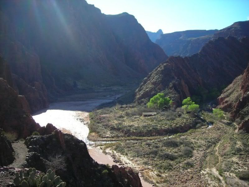
First good view of the Colorado River:
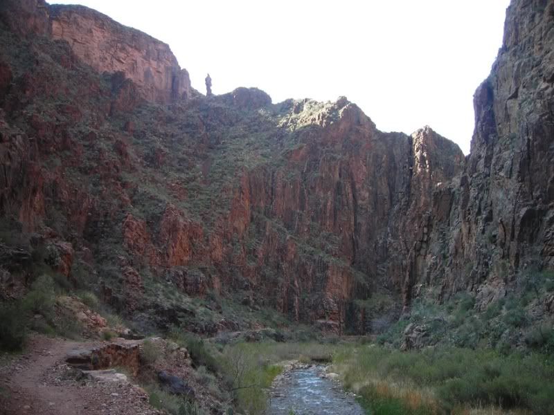
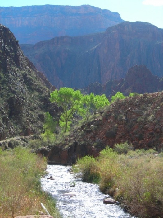
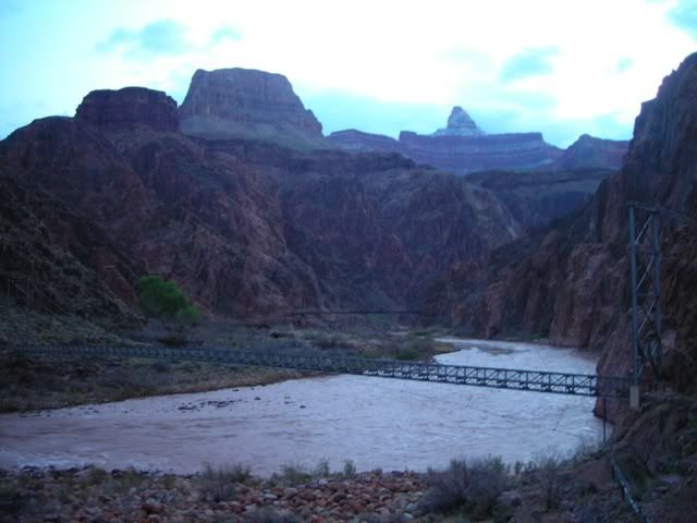
Bright Angel creek confluence with the Colorado River. Phantom Ranch and the Bright Angel campground is shortly up the Bright Angel canyon
Looking back at the S. Kaibab trail
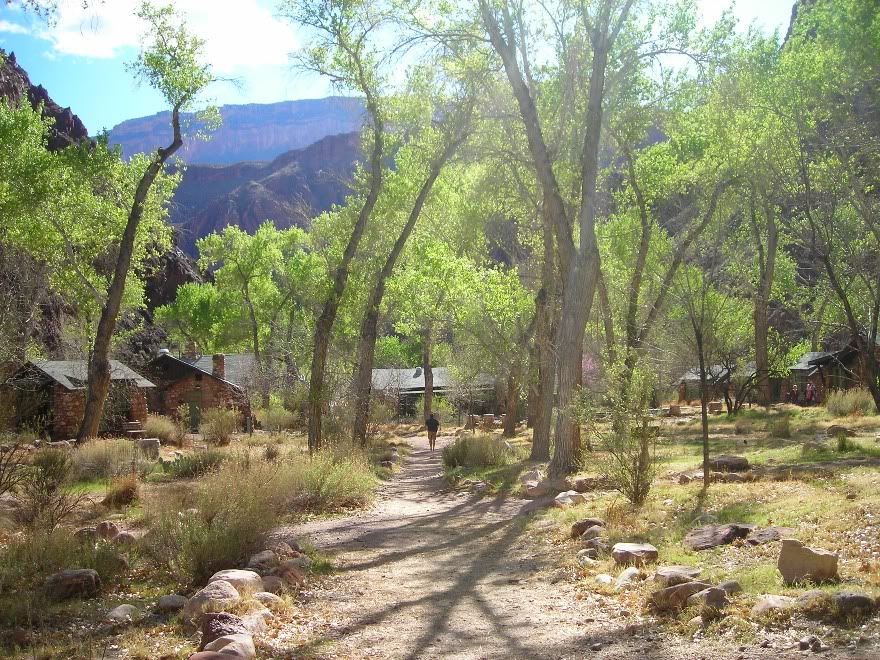
Phantom Ranch
(Photo taken next day). While the cabin lodging is not so terrribly expensive, the food is - it has to be hauled in by mule everyday, and of course there's no other competition for food service down there. I think we paid something like over $40 each for a steak dinner one night. Other meals are less. But ... well worth it to avoid having to carry tents, sleeping gear, and 3 days worth of food - made the hiking much more enjoyable. We brought as few clothes as possible to lighten up the packs more to fit everything into our daypacks (camelbacks). The second day truly was a dayhike as we could leave the rest of the gear behind at the ranch except of course sack lunch, water, and other typical day items.
As you can see Phantom Ranch is a collection of cabins. The cabins are dormitory style, simply meaning men only in some cabins and women only in the other cabins. There is a central dining building and meals are served family style where the main and side courses are served on platters and guests help themselves. Believe me though, there is more than enough food and you won't go hungry!
Day 2, N. Kaibab Trail (day hike)
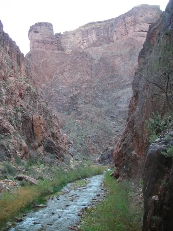
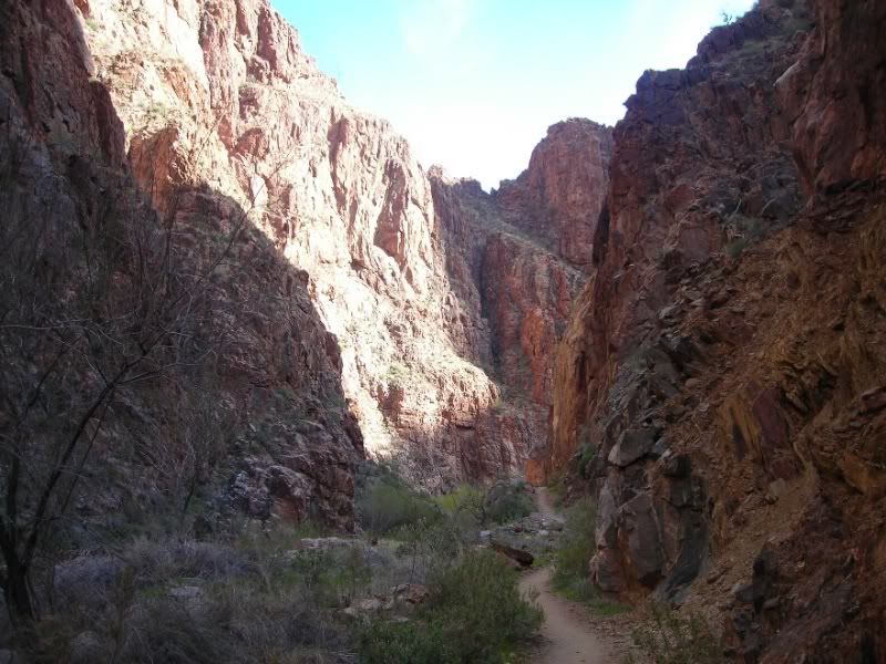
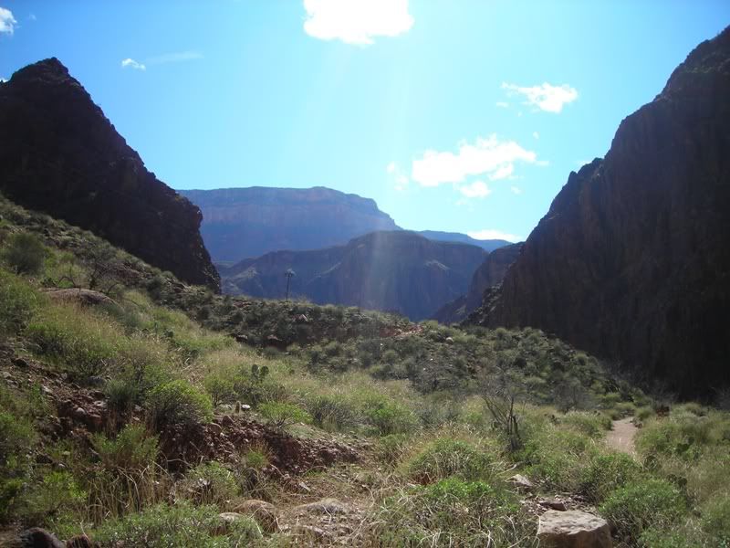
We did a dayhike maybe a little less than half way up the N. Kaibab trail. The end of the trail is the North rim, thus we traveled roughly 3/4 rim to rim. The original plan was to hike the Clear Creek trail, the trail junction is less than a mile along the N. Kaibab trail from Phantom Ranch. We stopped for a minute and pondered. I'm a "stick-to-the-plan" kind of guy, but the N. Kaibab trail really enticed us to go that way so we did. As you will see, the first few miles follow in a narrow canyon along the Bright Angel creek. We were continually curious "what's around the next bend?" it was very fun and very pretty. The trail (at least the part we were on) makes a great day hike as the elevation gain is very modest, whereas the clear creek trail rises 1,000 feet almost immediately. Flat was good to have in-between the other two days of descending and climbing. Someday though..... maybe will try the clear creek trail - so many trails, so little time. Anyway:
One of my favorite spots on the trip:
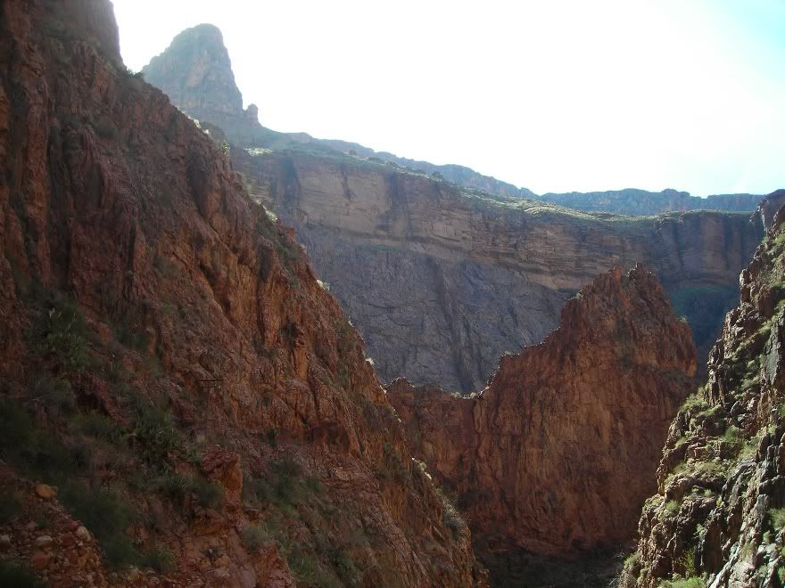
End of the line for us. We turned around here where the canyon opens up. Rim is still, I'm guessing 7 or so more miles away???? - A good hike yet.
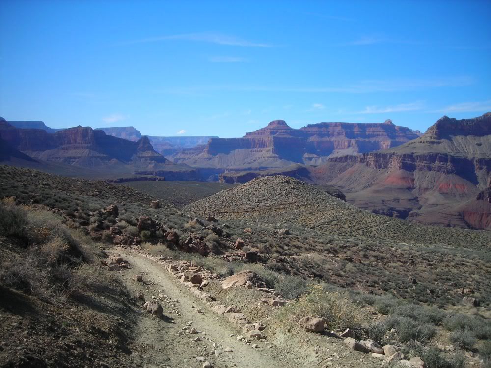
Area of the Clear Creek trail junction
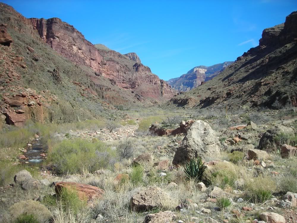
Approaching Phantom Ranch
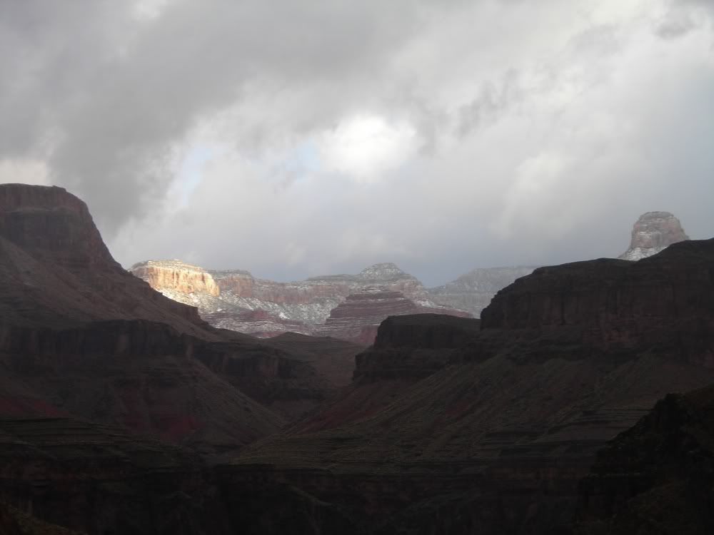
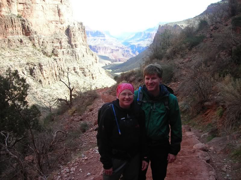
Day 3, Return up the Bright Angel Trail
I was told the Bright Angel trail was not as interesting as some of the others. I thoroughly enjoyed all the trip, each part is unique, but I was not let down by this trail. Many of my best pictures were from this day. It started off with a good stiff wind and some rain. It let off quick enough and the sun came out for the second half of the trail. It got colder as we ascended - high 30's or low 40's by the time we reached the rim. Had all of my layers on for much of the hike up.
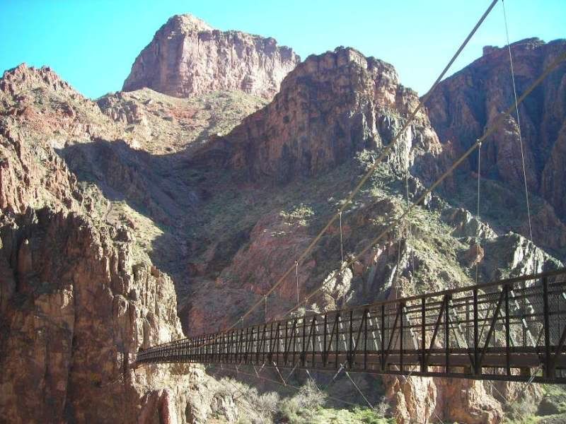
Looking back at the river and 2 bridges:
Turning away from the river and heading up the trail:
Moring glory:
Switchbacks:
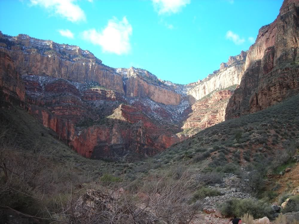
Just above Indian gardens, a good look at the remainder of the climb:
Mule train descending below.
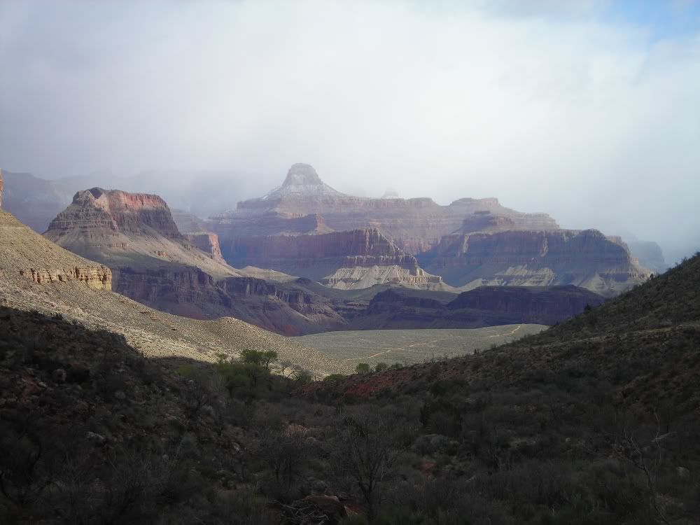
One of my favorite shots:
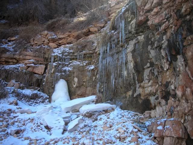
Ice and snow near the top:
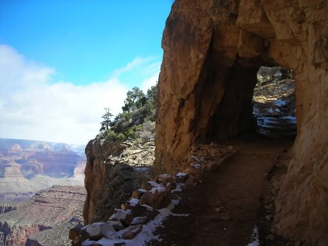
Near the top:
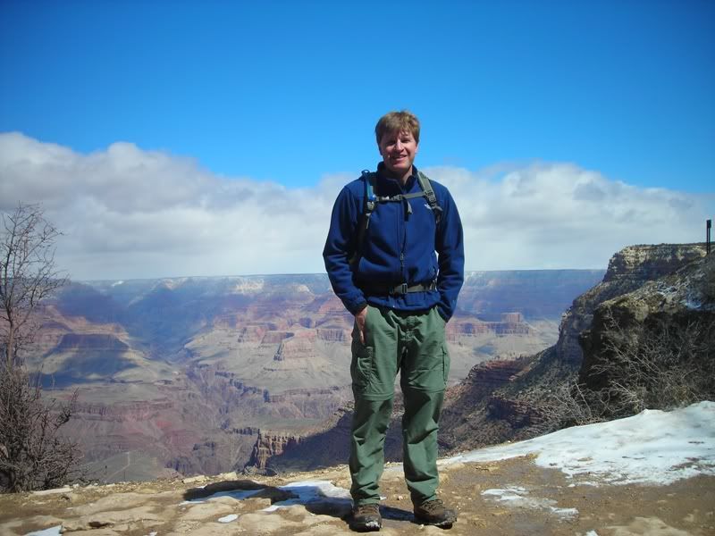
Mugshots:
Thumbnails for uploaded photos (click to open slideshow):
thanks for this report, desert TRs make the trip report section a lot more diverse and interesting. My brother and I did a similar trip back in 05‘ after college, remember that bridge quite vividly. Nice, detailed, off the beaten path report (although Kaibab is pretty beaten, especially in summer when we were there).
And your favorite shot happens to one of mine as well.
Funny, but I took exactly the same trip as you last May, right down to staying at Phantom Ranch. The only difference was that I added in a hike of the Clear Creek Trail while I was there. Our photo albums look a lot alike, with the exception of those fabulous pictures you got of the south rim with fresh snow and clouds. Gorgeous pics - thanks for sharing !
Thanks for posting the excellent report, especially the outstanding photographs. They remind me why the Grand Canyon is one of my favorite places. I need to get back there...
I did the rim to rim to rim deathmarch last October and loved every minute of it. This reminds me why I need to go back and take some time to just enjoy the scenery.
Thanks for posting this - the rim hike is definitely on my ”Bucket List”!! You‘ve provided useful info here that‘s helpful in that regard, thanks.
Love the pics and agree your fave is one of my fave‘s off this report.
Caution: The information contained in this report may not be accurate and should not be the only resource used in preparation for your climb. Failure to have the necessary experience, physical conditioning, supplies or equipment can result in injury or death. 14ers.com and the author(s) of this report provide no warranties, either express or implied, that the information provided is accurate or reliable. By using the information provided, you agree to indemnify and hold harmless 14ers.com and the report author(s) with respect to any claims and demands against them, including any attorney fees and expenses. Please read the 14ers.com Safety and Disclaimer pages for more information.
Please respect private property: 14ers.com supports the rights of private landowners to determine how and by whom their land will be used. In Colorado, it is your responsibility to determine if land is private and to obtain the appropriate permission before entering the property.


")
")
")
")
")
")
")
")
")
")
")
")
")
")
")
")
")
")
")
")


