Download Agreement, Release, and Acknowledgement of Risk:
You (the person requesting this file download) fully understand mountain climbing ("Activity") involves risks and dangers of serious bodily injury, including permanent disability, paralysis, and death ("Risks") and you fully accept and assume all such risks and all responsibility for losses, costs, and damages you incur as a result of your participation in this Activity.
You acknowledge that information in the file you have chosen to download may not be accurate and may contain errors. You agree to assume all risks when using this information and agree to release and discharge 14ers.com, 14ers Inc. and the author(s) of such information (collectively, the "Released Parties").
You hereby discharge the Released Parties from all damages, actions, claims and liabilities of any nature, specifically including, but not limited to, damages, actions, claims and liabilities arising from or related to the negligence of the Released Parties. You further agree to indemnify, hold harmless and defend 14ers.com, 14ers Inc. and each of the other Released Parties from and against any loss, damage, liability and expense, including costs and attorney fees, incurred by 14ers.com, 14ers Inc. or any of the other Released Parties as a result of you using information provided on the 14ers.com or 14ers Inc. websites.
You have read this agreement, fully understand its terms and intend it to be a complete and unconditional release of all liability to the greatest extent allowed by law and agree that if any portion of this agreement is held to be invalid the balance, notwithstanding, shall continue in full force and effect.
By clicking "OK" you agree to these terms. If you DO NOT agree, click "Cancel"...
Party: Jason solo
Start: 12:50 PM
Summit: 1:50PM
Start Descent: 2:10 PM
TH: 3:20 PM
I've been wanting to hit Thunder Butte for some time but something always came up to keep me from visiting this still scenic (even with the burn) area. Having worked my tail off the last few weeks (and week ends) our family was ready to get away from the house and do some exploring. It‘s been 3-4 years since we last drove through this area. With our two littlest kiddos now more appeciative of what‘s going on in the world it was also a great opportunity to show them the destructive force of a forest fire, teach them about the awesome responsibility God has given us to protect/respect his Creation and show them that you can still enjoy nature in the middle of destruction. It also doesn't hurt to get ice cream snacks at the great pulloff country store in Deckers.
Back to the hike. I never found any designated trails - just game trails and faint semblances of trails. This even though there was plenty of signatures in the summit register. The only benefit of the forest fire to achieving this summit is that it makes for easier wayfinding. I could see major issues with finding your way back to the TH if this area was fully forested. I was able to use Signal Butte as a bearing point to the TH, although this landmark proves useless as you get closer to the TH due to topography. Still, I only came up a few hundred feet shy of hitting the mini van dead on at the TH. What's nice is that you have Sheeps Nose as a pretty constant bearing point to your left on the descent.
All in all a great hiking day and awesome opportunity to find some solitude and rest from the crazy, hectic world. Kiddos got to goof off, Momma got to read her book and Dad only focused on trying not to get lost and enjoy God‘s creation. Thanks for the restoration team that has done work in this area. It‘s still a very bleak landscape and makes me appreciate all the more the fragile world that we live in.
Pikes Peak in background; Sheep's Nose in foreground at right of center
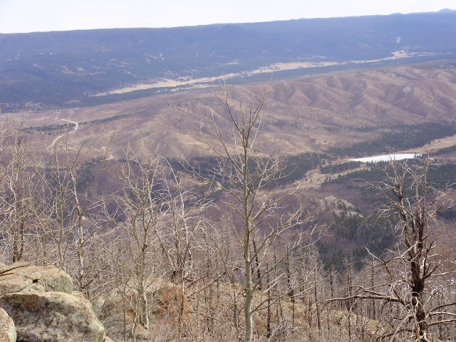
Pikes Peak from summit; striking contrast in this pic between forested area and the Hayman burn zone
Signal Butte in view. Makes for a great bearing point from the TH where I parked (pull off parking area about 1.5 miles from intersection of Nine J Rd and CO 68.
SW view with Tarryall Mountains in foreground; what appears to be Mt Princeton poking up behind
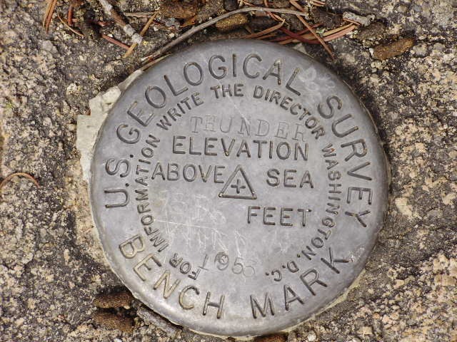
USGS summit bench mark (elevation 9836')
Close up of Sheeps Nose
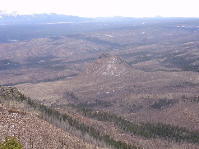
Town of Westcreek in middle of pic; Hwy 67 at left hand side of pic shown meandering off to Woodland Park
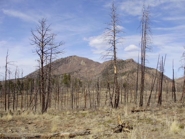
Thunder Butte from TH
Warning sign, typical of this area; strongly advise to not enter the burn zone during a downpour as there is still lack of erosion control measures in several spots
Rather comical sign given the present surroundings
Thumbnails for uploaded photos (click to open slideshow):
There‘s green in them thar hills 3/16/2009 12:39pm
If you look closely enough... you‘ll be surprised by all the new growth in that area - already! Nice report, and really a very pretty peak. The reason for all the signatures on that register: Thunder Butte is the highest point in Douglas county, so it‘s on many peak-baggers‘ lists. Sheep Nose looks like a lot of fun - almost made it up that one (after Thunder Butte) last year, but the rain beat us to it!
Thanks for posting a report on an oft-visited, seldom reported peak in an area that‘s still flourishing, amidst the devastation. Nature is so cool...
Congrats on climbing Thunder Butte, it‘s an interesting hike. It‘s nice to go into the burn area now and then and see how they are recovering. I was on UN 8790 (another ranked peak north of Thunder Butte) on Saturday. I found tons of yucca plants, bushes, grasses, and even new aspen trees growing. No new pine trees that I could find, those probably take longer. There are also plenty of deer in the area, I guess they can find enough to eat even there.
for the kuddos on the report. This area is very beautiful even with the burn. Susanjoypaul - you obviously know your county highpoints. That was my primary reason for hitting this peak. County highpoints do provide a great reason to explore out of the way places not ventured by 14er baggers.
Steve - pretty much the same plants were growing on Thunder Butte. Even in my limited hiking path I saw plenty of evidence that deer are in the area however we never did see any that day.
Caution: The information contained in this report may not be accurate and should not be the only resource used in preparation for your climb. Failure to have the necessary experience, physical conditioning, supplies or equipment can result in injury or death. 14ers.com and the author(s) of this report provide no warranties, either express or implied, that the information provided is accurate or reliable. By using the information provided, you agree to indemnify and hold harmless 14ers.com and the report author(s) with respect to any claims and demands against them, including any attorney fees and expenses. Please read the 14ers.com Safety and Disclaimer pages for more information.
Please respect private property: 14ers.com supports the rights of private landowners to determine how and by whom their land will be used. In Colorado, it is your responsibility to determine if land is private and to obtain the appropriate permission before entering the property.


")
")
")
")
")
")
")
")
")
")


