Download Agreement, Release, and Acknowledgement of Risk:
You (the person requesting this file download) fully understand mountain climbing ("Activity") involves risks and dangers of serious bodily injury, including permanent disability, paralysis, and death ("Risks") and you fully accept and assume all such risks and all responsibility for losses, costs, and damages you incur as a result of your participation in this Activity.
You acknowledge that information in the file you have chosen to download may not be accurate and may contain errors. You agree to assume all risks when using this information and agree to release and discharge 14ers.com, 14ers Inc. and the author(s) of such information (collectively, the "Released Parties").
You hereby discharge the Released Parties from all damages, actions, claims and liabilities of any nature, specifically including, but not limited to, damages, actions, claims and liabilities arising from or related to the negligence of the Released Parties. You further agree to indemnify, hold harmless and defend 14ers.com, 14ers Inc. and each of the other Released Parties from and against any loss, damage, liability and expense, including costs and attorney fees, incurred by 14ers.com, 14ers Inc. or any of the other Released Parties as a result of you using information provided on the 14ers.com or 14ers Inc. websites.
You have read this agreement, fully understand its terms and intend it to be a complete and unconditional release of all liability to the greatest extent allowed by law and agree that if any portion of this agreement is held to be invalid the balance, notwithstanding, shall continue in full force and effect.
By clicking "OK" you agree to these terms. If you DO NOT agree, click "Cancel"...
Participants: solo
RT: 13 miles
Vertical: 4,100 ft.
I'd climbed this peak in every calendar month except February, and two attempts in 2008 had both been unsuccessful due to deep snow. Since it had been basically a month since any significant snow fell in these parts, I decided this first Saturday of the month was my best chance to remedy this omission. Boy, was I right!
The Pikes Peak region has really gotten off easy on snowfall so far this winter, and what I found on the way to Rosa was super easy going as a result. I left the Gold Camp Road closure trailhead at 5:40 am, over an hour before sunrise, just to make sure I would have enough time. There were a few icy sections on the Saint Marys Fall trail, but everything was crisp and tractiony in the early morning chill.
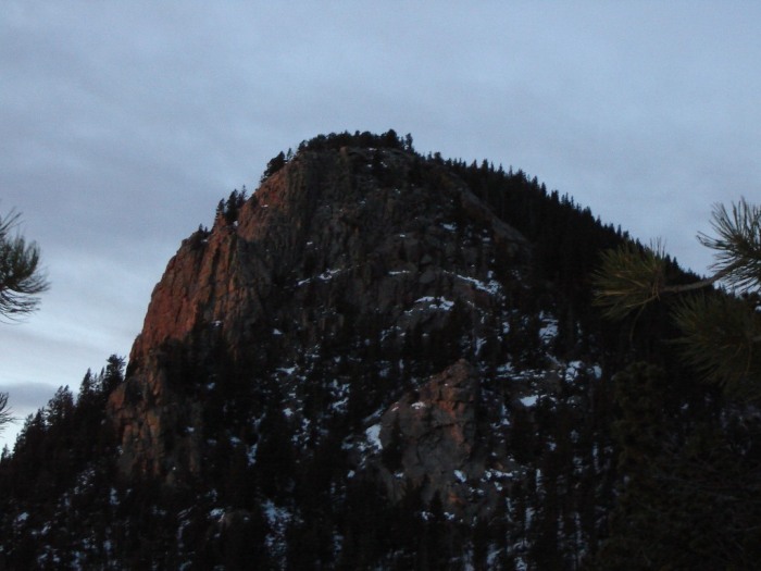
I caught the first sunlight on the east face of Stove Mountain:
Less than two hours brought me to the point where the trail intersects FS379. There I finally put on gaiters, anticipating deeper snow ahead.
It was a little deeper, but nothing like what I was prepared for. Numerous recent tracks made the trail clearer than I have ever seen in in winter, and there were even stretches where bare ground showed! I zipped on up the switchbacks and came out on the north ridge in less than 45 minutes.
When I got to the base of the final climb up the north slopes, I finally found consistent snow cover, but with a pleasant surprise: recent showshoe tracks, which gave me a good surface to walk on virtually all the way to the summit! The tracks actually followed the real trail almost all the way to the summit. Following them, I topped out at 9 am.
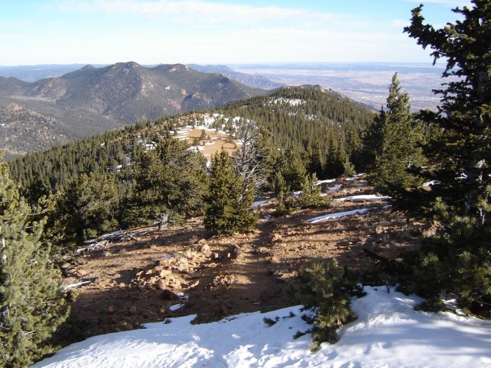
It was windy on top, and therefore cold, and I couldn't get the register canister open, but it was sweet all the same. I snapped one picture, drank some water, and headed back down. Here's a look at the saddle area about half way down:
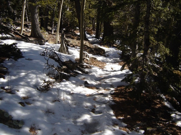
Even down in the trees on the east side of the ridge, I found conditions like these:
By that time, I was finally getting hot, so I stopped when I got back to the road intersection to strip off a layer and east some. Even with the sun beginning to soften the snow, I cruised back down the trail until I got below the falls. There, the icy portions of the trail had finally become treacherous, and I really had to slow down and be careful. I managed only to slip a couple of times, but it took some doing!
To my surprise, I was well below the falls before I met anyone else on the trail. Back at the collapsed tunnel, the going got considerably easier, and I picked up speed again. I made it back to the car at 11:53. Not a record, but not bad time at all for winter!
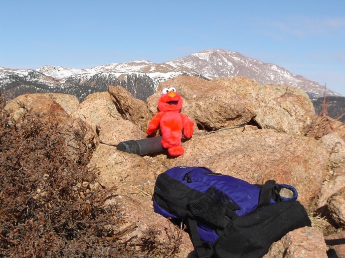
Of course, there's a summit shot:
This makes climb #21 of this great peak for me!
Thumbnails for uploaded photos (click to open slideshow):
I‘ve been eying Rosa for awhile now. Thanks for the info!
To add to dcbates80911, I too just tested some micro-spikes on the icey creek bed of Stanley Canyon. They worked great!
Susan:
Thanks. Familiarity with the trail really helps. And, well, yes, Elmo got a little help but, as you know, we‘re two sides of the same coin, so I/he/we is/are in this together!
Dave:
What a difference, indeed! Wish I‘d been coming up behind you on one of those outings last February: I might have made it! Think the micro-spikes are more useful than Yak-Trax?
fox_inthesnow: Rosa is one of the most satisfying hikes in the region, that view when you come around the last corner to the summit is knock-your-socks-off quality.
Glad to see you finally got this month down for Rosa. What a difference a year makes. Last year, I tried Rosa in February and we were breaking trail through 2.5' - 3' of snow and never made it. Looks pretty bare right now. I just returned from St. Mary's falls to test out some new gear. Probably the best tested were my micro-spikes. The trail was pretty icy from just past the tunnel in about 1.5 miles. Gongrats again.
I've been wanting to do Rosa for a while. Gold Camp Road is closed all the way at its start, so I'll probably have to start at St Mary's Falls like you did. Is the trail obvious and easy to follow, even during the night? Any places where it intersects other trails where I might get lost? Thanks!
bdloftin77: Yes, the trail is easy to follow all the way, even at night, as long as it isn't hidden by snow. When you get to the wire fence with the pedestrian gate in it (about 10,200 ft.), you have to jog north (right) a short distance along the FS road, then pick up the trail again--on your left. There is (or was...) a rock cairn to mark this point, but it might take a little looking in the dark. On the last 500 feet to the summit, up the north slopes, there are a few places where the trail is a bit indistinct. But if you jut stay close to the ridge crest, it's virtually guaranteed that you will re-encounter the trail. There is also a much shorter, and uglier, route from Frosty Park on the west side.
Caution: The information contained in this report may not be accurate and should not be the only resource used in preparation for your climb. Failure to have the necessary experience, physical conditioning, supplies or equipment can result in injury or death. 14ers.com and the author(s) of this report provide no warranties, either express or implied, that the information provided is accurate or reliable. By using the information provided, you agree to indemnify and hold harmless 14ers.com and the report author(s) with respect to any claims and demands against them, including any attorney fees and expenses. Please read the 14ers.com Safety and Disclaimer pages for more information.
Please respect private property: 14ers.com supports the rights of private landowners to determine how and by whom their land will be used. In Colorado, it is your responsibility to determine if land is private and to obtain the appropriate permission before entering the property.