Download Agreement, Release, and Acknowledgement of Risk:
You (the person requesting this file download) fully understand mountain climbing ("Activity") involves risks and dangers of serious bodily injury, including permanent disability, paralysis, and death ("Risks") and you fully accept and assume all such risks and all responsibility for losses, costs, and damages you incur as a result of your participation in this Activity.
You acknowledge that information in the file you have chosen to download may not be accurate and may contain errors. You agree to assume all risks when using this information and agree to release and discharge 14ers.com, 14ers Inc. and the author(s) of such information (collectively, the "Released Parties").
You hereby discharge the Released Parties from all damages, actions, claims and liabilities of any nature, specifically including, but not limited to, damages, actions, claims and liabilities arising from or related to the negligence of the Released Parties. You further agree to indemnify, hold harmless and defend 14ers.com, 14ers Inc. and each of the other Released Parties from and against any loss, damage, liability and expense, including costs and attorney fees, incurred by 14ers.com, 14ers Inc. or any of the other Released Parties as a result of you using information provided on the 14ers.com or 14ers Inc. websites.
You have read this agreement, fully understand its terms and intend it to be a complete and unconditional release of all liability to the greatest extent allowed by law and agree that if any portion of this agreement is held to be invalid the balance, notwithstanding, shall continue in full force and effect.
By clicking "OK" you agree to these terms. If you DO NOT agree, click "Cancel"...
After returning from hiking Kilimanjaro, I wanted to get one more 14er in this fall with Sam. We wanted to camp somewhere and avoid some of that recent snowfall, so we choose Missouri Mtn from the West. Turns out this was a great choice.
We left around noon on Friday from Carbondale, and followed the directions to the TH. Most of the snow had melted from the access road; but those trees don't melt. First roadblock was about 1/4 mile from the wilderness area gate.
first downed tree
We were able to break this one with the truck, and with some other trees for leverage pull it out of the road (almost got stuck doing it, chainsaw would have been much easier). But only 250 feet further we ran into a few more; and these weren't moving
big blowdown
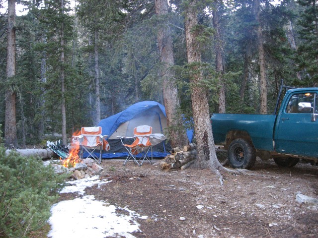
Luckily there was a perfect campsite (and/or turnaround area) between the two blowdowns. This was the campsite for the weekend.
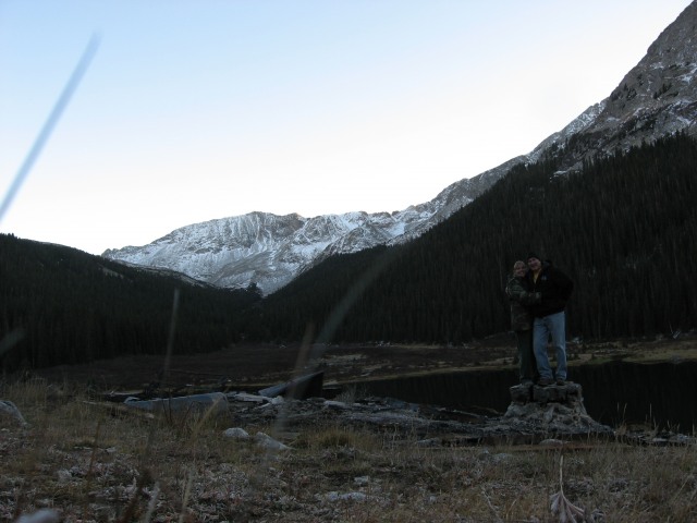
We decided to hike up to the lake after the camp was set up (around 5pm). Beautiful weather and no wind allowed for some gorgeous reflection shots.
Emerald Peak? in reflected in the lake
Sam and I goofing at the old burnt out cabin; if this had a deck still would have been an amazing view.
With the gorgeous weather forcasted we figured a late start wouldn't be a problem, so we set out around 9 am. The only other people we saw were the two hunters, which I am sure were rather annoyed at our noisy tromping through the valley. Not sure what they were after at that altitude; but we made sure we scared whatever it was off
me ready with snowshoes at the wilderness gate if necessary (turns out they weren't)
The trail was relatively easy to follow, just heed Bill's directions and keep to the left. We took the lower spur on the way up and the upper one on the way down. In my opinion either trail is a good route. About 1 hour later we topped out in the lower basin (after dropping our post hike coors light's in the stream to chill).
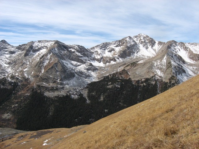
view of Huron Peak from the lower basin (11,950)
Sam with his best Capt Morgan's pose with Missouri in background.
Other than the wind, the day was awesome. We actually shed pants and jackets (and the unnecessary snowshoes) in the basin before the long hike up the "grassy slope". We were hoping those damn marmots were hibernated for the winter, and we wouldn't have any nibbles out of our snowshoes!
Since there wasn't much of a trail past this point we decided to head for a point in the ridge closer to the flat summit ridge (this was a mistake, more on this later).
about halfway up the slope with Huron in the background
It took us almost two hours to gain the ridge, and the direction we took ended up being over some loose scree and was steeper than it needed to be. We ended up gaining the ridge at 13,500. There was some limited snow patches which obscured what litte of a trail there was and we ended up scrambling a little to far left (north) on the steep section, which again took some time and made it a little more difficult than necessary. We finally made the summit ridge around 2pm.
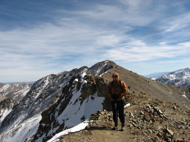
me with the summit in the background
A quick 1/2 hour and we were on the summit. The views were immense. I will definitely be climbing more in October; there wasn't another soul around except for our herd of mountain goats.
Harvard and Columbia across the Pine Creek basin
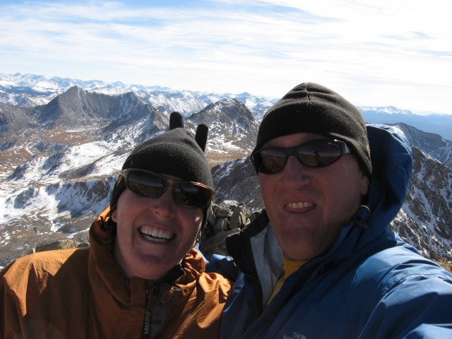
Sam and I goofing on the summit
On the way down we noticed this rock shaped like a rabbit.
When climbing this route, this is a good place to find your route to the top of the ridge. We took this picture from the rabbit rock
If you look to the lowest point on the ridge, you can see the faint outline of a cairn. This is the direction we came down, and it was much easier than the route we took up. This direction you gain the ridge at around 12,950 and have a much shallower climb without scree!
This is our route. The pink is up and the yellow is down (and the easier of the two).
As for the creek crossings, no problem this time of year. I imagine they can be quite interesting in the early summer. The rest of the road was rough, but should be passable in a 4x4 with decent clearance.
the green bomber on the way out at the upper creek crossing on Sunday.
Thumbnails for uploaded photos (click to open slideshow):
Having done Missouri from the standard, was wondering where the west route came up. Thanks for posting the details and map. Good report.
Caution: The information contained in this report may not be accurate and should not be the only resource used in preparation for your climb. Failure to have the necessary experience, physical conditioning, supplies or equipment can result in injury or death. 14ers.com and the author(s) of this report provide no warranties, either express or implied, that the information provided is accurate or reliable. By using the information provided, you agree to indemnify and hold harmless 14ers.com and the report author(s) with respect to any claims and demands against them, including any attorney fees and expenses. Please read the 14ers.com Safety and Disclaimer pages for more information.
Please respect private property: 14ers.com supports the rights of private landowners to determine how and by whom their land will be used. In Colorado, it is your responsibility to determine if land is private and to obtain the appropriate permission before entering the property.


")
")
")
")
")
")
")
")
")
")
")
")
")
")
")
")
")


