Download Agreement, Release, and Acknowledgement of Risk:
You (the person requesting this file download) fully understand mountain climbing ("Activity") involves risks and dangers of serious bodily injury, including permanent disability, paralysis, and death ("Risks") and you fully accept and assume all such risks and all responsibility for losses, costs, and damages you incur as a result of your participation in this Activity.
You acknowledge that information in the file you have chosen to download may not be accurate and may contain errors. You agree to assume all risks when using this information and agree to release and discharge 14ers.com, 14ers Inc. and the author(s) of such information (collectively, the "Released Parties").
You hereby discharge the Released Parties from all damages, actions, claims and liabilities of any nature, specifically including, but not limited to, damages, actions, claims and liabilities arising from or related to the negligence of the Released Parties. You further agree to indemnify, hold harmless and defend 14ers.com, 14ers Inc. and each of the other Released Parties from and against any loss, damage, liability and expense, including costs and attorney fees, incurred by 14ers.com, 14ers Inc. or any of the other Released Parties as a result of you using information provided on the 14ers.com or 14ers Inc. websites.
You have read this agreement, fully understand its terms and intend it to be a complete and unconditional release of all liability to the greatest extent allowed by law and agree that if any portion of this agreement is held to be invalid the balance, notwithstanding, shall continue in full force and effect.
By clicking "OK" you agree to these terms. If you DO NOT agree, click "Cancel"...
Climb date: 4 September 2008. Bluebird day. All day. But very windy.
My 35th Birthday was actually on the 2nd, but close enough!
This is more of a picture tour this time. Enjoy.
My rollerskate (Toyota Yaris) parked under the big "C" cliff overhang.
My camping spot below Potosi Peak.
My rollerskate parked at the trailhead. Yep, it made it. I did have to stack rocks on one section and banged a rim without any real damage. The plastic hubcap was already scratched so who cares. I don‘t recall hitting the bottom of the car on anything. Still, a bumpy ride for sure.
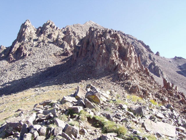
The ridge lies ahead. Full route from saddle to peak is in view. I just love the look of those tall spiked spires on the lower end. Note the break in the ridge in the middle of the picture. That's the gully that you use to connect to the upper 2/3 of the ridge route.
View of route from the top of the pass/saddle.
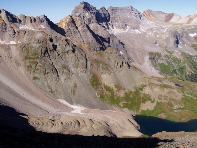
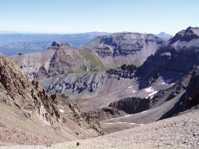
View over the other side of one of the Blue Lakes and interesting talus/skree "pudding" feature.
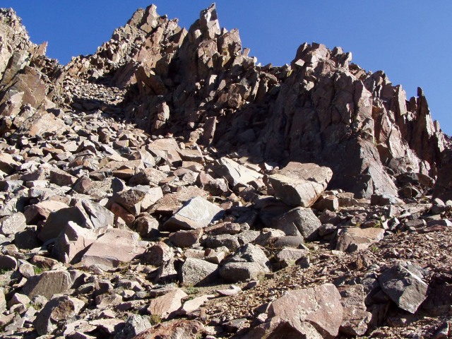
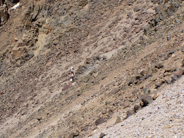
First real climbing section, just after you pass by the backside of the big tall spiked spires at the beginning.
Getting interesting, but easy path to follow.
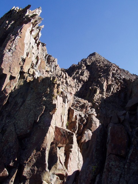
The view back down from this point.
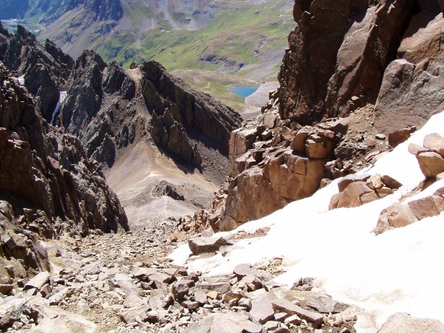
Now I have to downclimb a bit, and head straight up the gully.
Upper part of the gully.
A really neat rock wall with windows as you reach the top of the gully.
The peak is hiding somewhere up there.
Now just this smoother inclined solid rock to the top.
Success! ---sporting the 14ers.com shirt.
I shared the summit with 3 others who shared their victory wine. Good stuff. I had previously decided to return via Lavender Col. After a bit it was time to go.
Looking down the gully leading to the top of Lavender.
Looking back up the gully from the top of Lavender Col.
View in shades of gray from the top of Lavender Col.
View down Lavender Col.
You can see how steep Lavender Col really is here.
***************************************************
I actually had a pen and paper with me for the first time ever. I was't speed racing by any means, but I did use it to keep track of my progress throughout the day. Here's the play-by-play for those of you who may be interested:
8:00 a.m. start time from the 2wd parking @ the restroom. Aiming for the SW Ridge.
8:12 Passing the sign telling me it's 2 miles to Blue Lakes Pass.
8:13 I'm now hiking in the sun, (warm, nice).
8:25 Trail roster and sign-in.
9:00 Reach the plateau before heading up to Blue Lakes Pass. Lots of wide open flat grassy camping potential. However there are zero trees, thus exposing you to any wind and lightning. Good view of entire Lavender Col from here.
9:25 Reach the top of Blue Lakes Pass.
10:35 Summit of Mt. Sneffels!
11:09 Start down via the standard Col/Gully route.
11:12 Reach the top of the gully.
11:30 Reach the saddle top of Lavender Col.
11:45 After "sking" down Lavender Col, I reach the connector trail headed back over to the Blue Lakes Pass trail.
12:15 p.m. Pass the TH register and sign-out.
12:40 Back at the car.
Thumbnails for uploaded photos (click to open slideshow):
Me and two of my kiddos hiked up Handies on the 4th, it was a windy, chilly one that day there too. I was showing my kids Sneffels since it, Uncompahgre and Wetterhorn are the easily recognizable 14ers from Handies summit. We made summit right at 11 am so we were watching you enjoy your summit time without even realizing it!!! Congrats and great report with some excellent photos!
I was there a few weeks back in my 08‘ Civic. I got to the 4.7 mile mark and had turned around. Too much for my car. I can‘t believe you got all the way up.
Congrats on the climb and the road to the trailhead.
Caution: The information contained in this report may not be accurate and should not be the only resource used in preparation for your climb. Failure to have the necessary experience, physical conditioning, supplies or equipment can result in injury or death. 14ers.com and the author(s) of this report provide no warranties, either express or implied, that the information provided is accurate or reliable. By using the information provided, you agree to indemnify and hold harmless 14ers.com and the report author(s) with respect to any claims and demands against them, including any attorney fees and expenses. Please read the 14ers.com Safety and Disclaimer pages for more information.
Please respect private property: 14ers.com supports the rights of private landowners to determine how and by whom their land will be used. In Colorado, it is your responsibility to determine if land is private and to obtain the appropriate permission before entering the property.


")
")
")
")
")
")
")
")
")
")
")
")
")
")
")
")
")
")
")
")


