Hiking Partner -Purplepaddler (Lauren)
Distance - 16.7 Miles RT (based on GPS tracking)
Trailhead - High Drive
Class - 2
Elevation Gain ~ 5500ft Do to the ups and downs
This is my third in the series of local Colorado Springs adventures.
Almagre (Al-Ma-Grey) or La Sierra Del Almagre was first mapped in 1779 by Mexican Governor Don Juan Bautista de Anza. The name means "red earth" helping describe the pink colored rocks found in these mountains. Almagre was the first name given to what is known today as Pikes Peak. The tallest peak to the south assumed the name later in history after Zebulon Pike explored the region.
Ever since I first climbed this mountain in 2006, I wanted to try a more difficult route. The standard is a 4X4 road with the last mile dedicated to hikers only. On the way down, I noticed a trail descending towards an area I have hiked many times, Jones Park. Love the area and wanted to find the elusive route to Almagre.
Before continuing, I cannot post this TR without thanking two fellow 14er.com members for giving me useful information on this hike. Yosemite98 and 53_Peaks planned to do this approach and Yosemite98 gave me a rough idea of the possible routes earlier this summer. Hope your trip is successful, guys.
Now, this one needed some company so I contacted one of my faithful partners (Lauren). We finished Missouri last weekend and she expressed the desire for more. Our trip started at the High Drive parking area at 6:10am with good weather expectations. I know the trail to Jones Park intimately, so this part of the trip passed without incident stopping at a multiple trail junction just west of Mt. Kineo.
Sunrise


Bear Creek

At the trail junction, we ate, drank, and examined the National Geographic Map to settled on a route. We planned to take TR 668 south to where we would meet a marked (per my map), but unnamed trail taking us to TR 701 (for the record, this trail does not appear on my NG Topo Maps' program, just the hard copy map from the stores).
We followed 668 until it met with 720. What This doesn't look right This doesn't look right However, we followed 720 where it went uphill and veered to the north. Then we found another junction where 720 headed directly west (just like the map). HMMM!!! We followed with the expectation to meet up with 701 and did. OK, the map is starting to look right, again. However, we followed 720 where it went uphill and veered to the north. Then we found another junction where 720 headed directly west (just like the map). HMMM!!! We followed with the expectation to meet up with 701 and did. OK, the map is starting to look right, again.
See the trail is there according to this map

At this point, a decision had to be made. Not necessarily a good one, but a decision. We saw what looked like an established trail heading uphill towards the west. I had read about another approach that moved up a bare area and along a ridge towards Almagre's summit. There are many unmarked trails in this area so it felt right. We decided to follow this trail instead of heading south a mile and trying to find the unmarked trail up to Stratton Reservoir.
Map of the route (Ascent - Red, Descent - Blue, Missing Trail - red dashed)

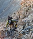
At first, this trail looked well established, but was very loose. After going several 100 yards, the trail completely disappeared. Lauren and I continued up to the saddle where we stopped and examined the map. We decided to continue up to the ridge and head towards the summit. This part up to the ridge turned out to be the hardest part of the climb. With no established trail, we were forced to bushwhack up climbing over an endless supply of downed trees and boulders.
Trail we followed until it disappeared

Baldy from the Saddle, Almagre still hidden - road for the standard route clearly visible

View Southeast - Antennae on Cheyenne Mountain

At one point, both of us felt drained and wondered if we should head down (about 7 miles in). We stopped for a rest, ate some food, and continued up the hill. Along the way, we ran into what at first looked like an old cabin. Upon further investigation, it was an old collapsed mine. We immediately left the area and gave this location a wide berth. You just never know about the mines.
Mine


Lauren doctored it just a tad

Finally, we reached a saddle where the views were open with Pikes Peak to the Northwest, and Almagre directly west. Based on my GPS, we had roughly 700ft in elevation gain left. Our goal was to reach a point where we would meet the standard trail and follow it up, which is what we did. There, we ran into three people and their dog leaving the summit. We talked for a few minutes then continued on our ways. Wasn't sure if they were impressed when told them our starting location or if they thought we were crazy. Either way, they were very nice people and even offered us a ride down. Thanks guys for the offer. 
Pikes Peak from the upper Saddle - Starting last push for summit

If you go to this link, you can change the settings to view in higher quality by clicking under the picture
http://www.youtube.com/watch?v=8P99rFJstNs
Lauren and I reached the summit almost exactly 6 hours after leaving the TH. The views were awesome, but the wind had picked up and chilled us a bit causing us to add a layer. We ate some food, took pictures and began to descend after about 20 minutes.
Lauren's Summit Shot

Cameron's Cone - I need to get this one off my list

Mt Baldy

Colorado Springs

Approach was up to the bare saddle center picture, then to the left across the ridge and up

Cheyenne Mountain and Mount Rosa

Seven Lakes area with the Sangre De Christo Range in the distance

We descended the standard trail towards the reservoir where we veered to the east (west side is very sandy and can be hard to walk on) crossing the dam and heading towards the gate closure. At this point, we identified the trail to take us down the drainage. The trail is fairly steep and does fade quickly as you descend on the Pikes Peak Granite.
Descent Trail

For those who are unfamiliar with Pikes Peak Granite, this rock tends to fragment into smaller rocks. The loose rocks layer on the solid granite below. I have heard others call this phenomena as walking on granite marbles. Step carefully, or you could take a serious tumble. On the down-climb, I did just that. Landed on my hand and managed to roll and jab my ribs into another larger rock. Luckily, there was no long-term damage, just some minor pain and a bruised ego.
I regained my composure and we continued down the steep and tight drainage until meeting TR 701. This part of the hike was beautiful with the dense forest and falling stream. It was a very nice down-climb (although the ascent would have been tough). After reaching the established trail, our route back was easy. We walked the mile and met up with TR 720, then at one point veered east onto an unmarked trail heading the right direction only stopping to take in the sight of a large beetle. We reached the car at 4:30 pm, just over 10 hours after starting.
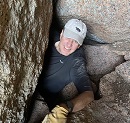
I needed to filter some more water

Downclimbing the drainage


Lauren's hands next to beetle for size reference

Final view of Cheyenne Mountain as the day's activity ends

I thought this would be a challenge and it did not disappoint. Some of my favorite hikes are the ones where you need to use your head. Not sure if all our decisions were the best, but they were made on solid and best data at the time. Some of our data turned out to be inaccurate and we traveled about 1.5 miles farther than anticipated. Moreover, we chose some tough routes, but in hindsight, I am not sure the planned route would have been any better. Regardless, this hike helped hone one's skills to focus on the environment and not just a preconceived trip plan. Additionally, by using our senses in this manner, we are more prepared if we ever get into trouble out in the wilderness. Overall, it was a great day spent in the mountains with an awesome partner. Thanks for going, Lauren.
|