Download Agreement, Release, and Acknowledgement of Risk:
You (the person requesting this file download) fully understand mountain climbing ("Activity") involves risks and dangers of serious bodily injury, including permanent disability, paralysis, and death ("Risks") and you fully accept and assume all such risks and all responsibility for losses, costs, and damages you incur as a result of your participation in this Activity.
You acknowledge that information in the file you have chosen to download may not be accurate and may contain errors. You agree to assume all risks when using this information and agree to release and discharge 14ers.com, 14ers Inc. and the author(s) of such information (collectively, the "Released Parties").
You hereby discharge the Released Parties from all damages, actions, claims and liabilities of any nature, specifically including, but not limited to, damages, actions, claims and liabilities arising from or related to the negligence of the Released Parties. You further agree to indemnify, hold harmless and defend 14ers.com, 14ers Inc. and each of the other Released Parties from and against any loss, damage, liability and expense, including costs and attorney fees, incurred by 14ers.com, 14ers Inc. or any of the other Released Parties as a result of you using information provided on the 14ers.com or 14ers Inc. websites.
You have read this agreement, fully understand its terms and intend it to be a complete and unconditional release of all liability to the greatest extent allowed by law and agree that if any portion of this agreement is held to be invalid the balance, notwithstanding, shall continue in full force and effect.
By clicking "OK" you agree to these terms. If you DO NOT agree, click "Cancel"...
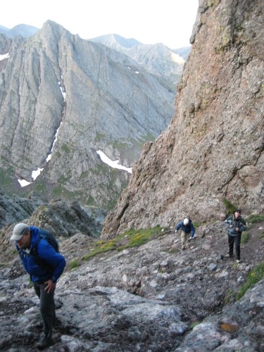
The 4 of us started from the upper trailhead at 4:15am.
The sign that sends you to Broken Hand pass:
Arrived at the top of Broken Hand pass right at sunrise. Trail to pass is excellent and there is work under way for the section going through the pass. As of right now though the pass itself consists of loose rock where you may need to use your hands a couple of times on the way up depending on the line you choose. Keeping on the left side will seemingly keep you on the path the trail is being built on.
For an indication of the level of difficulty I did not remove my hiking poles ascending the pass but did use both hands a couple of times.
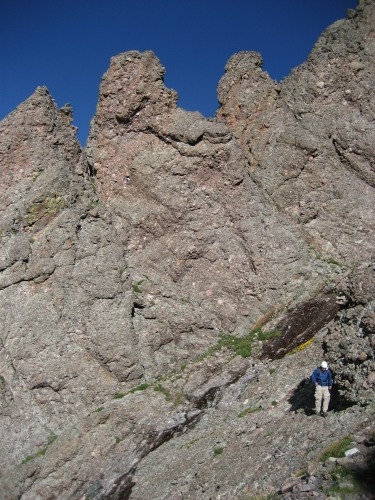
Broken Hand pass close up with climbers descending:
On top of Broken Hand we turned right on the very clear trail that ends at the bottom of the East gully.
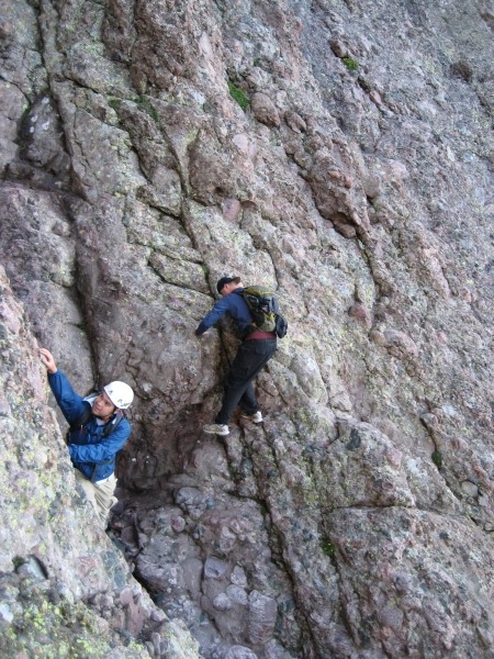
The trail to the gully has a couple of very short sections where you do some short scrambling, the most interesting about half way to the gully. There are several self evident options available here, during the ascent we hooked to the right and stepped over to an adjacent rock, coming back we went straight up to the cairn. A couple of pictures of this part, first one going up, 2nd one from the descent:
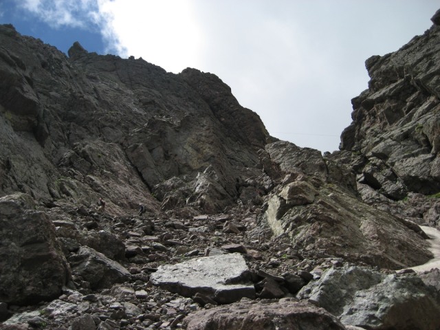
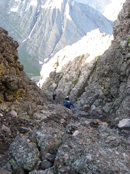
The trail ends at the east gully. (A faint goat or camp trail continues for a few yards however it‘s very clear that you are standing at the bottom of the east gully.)
In this pic we are just above the start of the east gully (coming back down we exited east gully after only descending 2/3 thinking we were at the bottom, there was a good trail heading in the direction of Broken Hand however we soon figured out that we were too high and retraced our steps). When exiting the east gully one wants to be at the bottom of the rock tower to the right in this photo:
If you look back on your exit from the east gully and see this you have about a third left to go to the bottom still, this is a photo of the too early exit taken on the way down, bad idea:
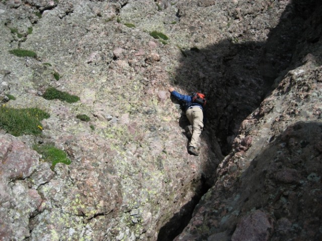
We ascended the east gully looking for the exit to the west gully. The two of us leading the climb were half way up what I assume is the class 4 section of the east gully before we spotted the crossing point below us. It‘s difficult to see when you are right next to it as exampled by the other two in our party that were standing right on the crossing path while almost unable to see it from their point of view. If you have a GPS it would be a good thing to reset the altitude at the start of this hike and follow Bill‘s directions for at what altitude the crossing is, we failed to do this which resulted in a little bit of extra exercise for half the group. The streamer anchored on the top of the rib of the crossing is blue and orange. If you find yourself thinking you are in some seriously steep territory for a class 3 climb you are likely too high, look down and you should see the path for the crossing.
Crossing the rib is probably the days most interesting part (if you do not spend some bonus time going up and down the upper portion of the east gully that is...). First photo shows where you exit east gully and cross the water (going up). Second photo shows descending from the sharks tooth (on the way back), if you look closely above and to the left of the white helmet you can see the orange and blue anchored streamer marking the crossing (Can‘t see it? Neither could we until we stood next to it...).
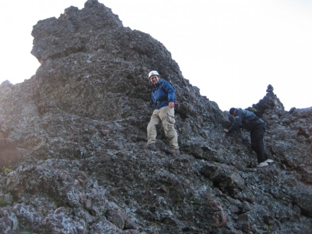
Once on top of the rib with the sharkstooth we were looking down in to the west gully, we climbed in and ascended to the top of the gully. This pic shows nearing the top of the west gully:
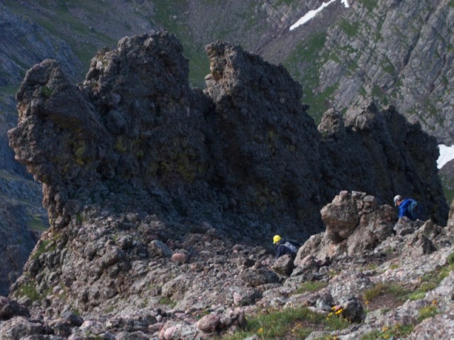
Looking up from the top of the west gully there are a couple of options for heading to the summit, we took one of the gullies on the left side up but came down the next one over since from above we could see the climbers trail being more worn on that one. We also marked off a couple of spots where we saw challenges for route finding while descending with temporary streamers (stamped with time and date and numbered to insure 100% retrieval on the way down). There are plenty of minor gullies however just a couple that head in what fairly clearly appears to be the proper direction, the summit push is pretty much straight ahead up to the ridge and then a short scramble to the left. Many cairns in this area, some leading in interesting directions.
From the top of the gully there is a mix of scrambling and walking to the summit. This photo was taken close to the summit ascending the left gully, west gully top is by the 3 point formation right of high center in the next photo (there is a small white snowfield that forms an arrowhead pointing to the formation in this pic):
Descending from the summit we headed toward the rock formation in the next photo where the top of the west gully starts.
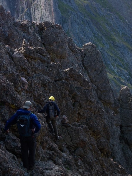
Next pic shows the exit from the west gully going across the rib to the east gully. Notice the cairn directly in front of the first climber and the one directly above marking the crossing point. Below this section the west gully appears to deteriorate fast.
After climbing up on the rib again we climbed down by the sharkstooth and crossed the water back to the east gully. Video shows a climber dropping down from the sharkstooth. Watch the birdie...
This picture shows a climber that just came down from the sharkstooth (see 8th pic above) and now reaching around the bend for a good handhold just before crossing the water.
As mentioned previously we exited the east gully too early but it only took us minutes (and a vertical drop off...) to realize this. Once back on the correct path we returned to Broken Hand pass.
This climb was a lot of fun, the area is stunning. We were a mixed experience group (1 rock climber, 1 14er obsessed with just a few to go, 2 with mostly class 2 and a little bit of easy scrambling experience) and everyone had a good time. 4 pairs of eyes made for only 3 occasions where we had route issues and they did not last long. Marking areas with a couple of temporary streamers helped in making the downclimb a non route finding one (well, with the exception of the dooh moment getting out of the east gully on the way back...). We found the difficult sections to be mostly a mental challenge more then a technical one. Testing hand and footholds of course being the key to joy, happiness and absence of pain. Helmet is recommended, mine took care of a pebble that would have left a mark on my skull. I like for my skull to remain dent free and in all original condition!
The road to the upper th is bad, we fortunately had an expert driver as part of the group. We did however see this vehicle parked at the upper th... I would not take that as an indication of anything but the drivers expertise or possibly a steel plated undercarriage. Everything else up there was atv or good clearance 4wd type vehicles:
Two of us headed for Crestone Peak but turned around a short distance below the summit due to weather. Peasoup coming from below and above eliminating any chance of views combined with a sketchy forecast made for the turn around decision.
The red gully on the Peak seemed less of a challenge then Needle gullies for the portion we climbed, route description though indicates that the last section is harder then the rest. Red gully looks more imposing from down below then it seems to be when entering it. The red rock slabs seem to be mostly providing very high friction and I was able to walk with my grippy Montrail Hardrock‘s on some fairly steep slabs. There is a lot of water coming down the center and there is a short section where you most likely will choose to walk in the snow. Did not get any good pictures since we were chasing the summit on the way up and completely in the gray on the way down... More on the Peak when I find me a ride to the upper th again. Walking the road between the 2wd and 4wd th seems to be just about as much fun as walking Lake Como road... The area surrounding Cottonwood Lake is amazing in it‘s beauty.
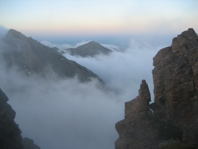
One final pic from the ascent taken when the morning fog was swirling around the peaks.
Thumbnails for uploaded photos (click to open slideshow):
Might have something to do with the screams of agony I hear when presenting the trip plans and the top line lists something like ”Set alarm to 00:20, start driving 00:45” ; )
Thanks, when putting together the tr I focused on areas where my self preservation instinct was making the most noise and it‘s an attempt to show those particular parts from my perspective. This would make this tr a tad biased toward looking scary. Most of the climb was plain good solid scrambling. Staying on route was our greatest concern, using streamers going up was a good thing. Not doing it alone was even better : )
The last pic of the minivn at the top is the best pic of a Crestone Needle trip report I have ever seen. Not to say your climbing pics weren‘t great, but to get a minivan to the top of that road is much more impressive than climbing the needle! WOW!
We were in awe. There were some, what I assume to be purely speculative, comments made in the parking lot that this might be the result of a less then amicable separation. I.e. the final drive and possibly end destination before handing over the keys.
I believe we passed your decent immediately above Broken Hand. We climbed the gullies in the afforementioned pea soup and were 50/50 on turning back but glad we didn't. I agree the gully crossing is confusing. I managed to find it going up but the other 2 in our party stayed on the east side for some class 4 fun. I think the minivan was brought in by helicopter.
Everytime I‘ve convinced myself that I can climb that beast, someone posts new pictures that make it look harder and steeper than I imagined :!: Nice job!
Thanks for posting this trip report. The 3 of us saw your group of 4 descending just after your group left the east gully. Totally agree with your comment that the shift from the east gully to the west gully was the crux. There was definitely a couple of tricky moves there! Your pics captured it well. Also agree that the majority of it was good fun scrambling.
Caution: The information contained in this report may not be accurate and should not be the only resource used in preparation for your climb. Failure to have the necessary experience, physical conditioning, supplies or equipment can result in injury or death. 14ers.com and the author(s) of this report provide no warranties, either express or implied, that the information provided is accurate or reliable. By using the information provided, you agree to indemnify and hold harmless 14ers.com and the report author(s) with respect to any claims and demands against them, including any attorney fees and expenses. Please read the 14ers.com Safety and Disclaimer pages for more information.
Please respect private property: 14ers.com supports the rights of private landowners to determine how and by whom their land will be used. In Colorado, it is your responsibility to determine if land is private and to obtain the appropriate permission before entering the property.