Download Agreement, Release, and Acknowledgement of Risk:
You (the person requesting this file download) fully understand mountain climbing ("Activity") involves risks and dangers of serious bodily injury, including permanent disability, paralysis, and death ("Risks") and you fully accept and assume all such risks and all responsibility for losses, costs, and damages you incur as a result of your participation in this Activity.
You acknowledge that information in the file you have chosen to download may not be accurate and may contain errors. You agree to assume all risks when using this information and agree to release and discharge 14ers.com, 14ers Inc. and the author(s) of such information (collectively, the "Released Parties").
You hereby discharge the Released Parties from all damages, actions, claims and liabilities of any nature, specifically including, but not limited to, damages, actions, claims and liabilities arising from or related to the negligence of the Released Parties. You further agree to indemnify, hold harmless and defend 14ers.com, 14ers Inc. and each of the other Released Parties from and against any loss, damage, liability and expense, including costs and attorney fees, incurred by 14ers.com, 14ers Inc. or any of the other Released Parties as a result of you using information provided on the 14ers.com or 14ers Inc. websites.
You have read this agreement, fully understand its terms and intend it to be a complete and unconditional release of all liability to the greatest extent allowed by law and agree that if any portion of this agreement is held to be invalid the balance, notwithstanding, shall continue in full force and effect.
By clicking "OK" you agree to these terms. If you DO NOT agree, click "Cancel"...
I met up with Frank (casali), John and Len at the Dry Creek RTD station, where my car would be staying for the weekend. We proceeded down to the Springs to pick up Andy (BobbyPeru). After grabbing some Subway in Westcliffe we arrived at the South Colony Trailhead. Since Frank's Corolla probably wouldn't make it too far up the infamous road to South Colony Lakes, we consolidated all the gear on Len's Jeep. Andy and Frank walked up the road while the rest of us took advantage of Len's mad 4WD skills. The three of us in the Jeep hiked in to the lakes and got our tents set up right before the day's rain started - quashing our plan to get Humboldt the first day. Andy and Frank arrived a few hours later.
Hiking in
Day 2 - 7/26/08 - Crestone Peak
The alarm clock went off bright and early at 3:30 AM. (Okay, maybe "bright" wasn't the correct word...) After some oatmeal we hit the trail at 4:30.
The route finding up to Broken Hand Pass wasn't too difficult in the dark. There were only a few small snowfields to cross - trekking poles were sufficient. Since none of us had been on this particular trail before, I was impressed that we managed to make it to the top of the pass without getting lost. We started the descent to Cottonwood Lake just as the sun was starting to rise.
Cottonwood Lake
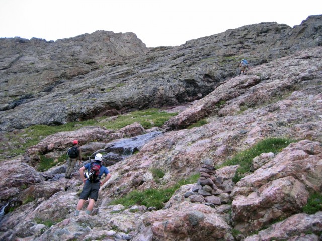
The climb up Red Gully was an interesting experience for me. Prior to this my class 3 experience was limited to the Evans/Bierstadt Sawtooth and the Longs Keyhole. This climb put both of those to shame. The class 3 is pretty sustained for almost the entire climb. The rock is fairly solid, but the gully also has its fair share of scree. There aren't too many exposure issues until the final pitch to the summit, where some ledge traversals are required. The route finding is easy since the gully leads almost directly to the summit.
Bottom of the gully
Len crossing the sole snowfield in the gully
Andy was climbing much faster than the rest of us and summited at about 7:30. The rest of us made it a little after 8.
Victory pose
The Peak has a spectacular summit. Sheer drop-offs all around, and great views of the Peak's East Summit and the Needle to the south, and Kit Carson and Challenger to the north. Some portions of the Great Sand Dunes can also be seen, along with an unobstructed view of the San Louis Valley.
Panorama looking north
After some pictures and recovery we started down. Andy shot ahead and continued on to the Needle - the rest of us took our time. We only met a few other parties on the way down.
Heading back down
Friendly marmot along the trail
Back at Cottonwood Lake we took a snack break and were accosted by a very precocious marmot. We called him "Bob". When he failed to get any grub he tried to eat Len's shoelaces.
Len fights off Bob's advances
We ascended back up to Broken Hand Pass and found Andy's note indicating he had gone on to the Needle. We were exhausted by this point (and dismayed by the weather moving in), so we elected to head back to camp. Downclimbing the pass we came across a RMFI trail crew. They were in the process of constructing a proper tail up the pass to mitigate the screefest/erosion nightmare on the east side of the pass. Keep up the good work guys (and gals)!
Lots of columbines in the area!
We returned to camp around 11 and collapsed. Andy made it back a few hours later with inspiring tales of the Needle. After a lunch/dinner of Mountain House and a few thunderstorms, we hit the hay at around 7.
Thumbnails for uploaded photos (click to open slideshow):
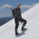
Most of the remaining snow is easily avoided. The one field we did have to cross was easily done with just poles.
Caution: The information contained in this report may not be accurate and should not be the only resource used in preparation for your climb. Failure to have the necessary experience, physical conditioning, supplies or equipment can result in injury or death. 14ers.com and the author(s) of this report provide no warranties, either express or implied, that the information provided is accurate or reliable. By using the information provided, you agree to indemnify and hold harmless 14ers.com and the report author(s) with respect to any claims and demands against them, including any attorney fees and expenses. Please read the 14ers.com Safety and Disclaimer pages for more information.
Please respect private property: 14ers.com supports the rights of private landowners to determine how and by whom their land will be used. In Colorado, it is your responsibility to determine if land is private and to obtain the appropriate permission before entering the property.


")
")
")
")
")
")
")
")
")
")