| Report Type | Full |
| Peak(s) |
Culebra Peak - 14,053 feet Red Mountain - 13,911 feet |
| Date Posted | 07/27/2008 |
| Date Climbed | 07/23/2008 |
| Author | cftbq |
| Cielo Vista Surprise |
|---|
|
Participants: trishapajean, cftbq Distance: 9.1 miles Vertical: 3,590 ft. We finally sucked it up and shelled out to the owners of Cielo Vista Ranch so we could climb Culebra and, at some point in the future, finally really have all the 14ers. Given that, it seemed reasonable to hit Red Mtn. on the same trip, rather than regretting it later. So we snagged about five hours sleep in the back of the Forester at the ranch gate, and roused ourselves with a 5 am MDT alarm. We chatted with the seven other climbers who were also waiting (nearly all of whom were from out of state), until, just as expected, Carlos drove up a few minutes before 6 am. We drove the 2 miles in to the ranch buildings, forked over our money and waivers, and set off up the road to Fourway about 6:45. The road is not bad by Sangres standards, because it is not terribly rocky. It is, however, badly gullied by wash-outs in places, and very steep over most of its length. It basically goes right up the fall line. Fourway sits at a saddle on the ridge which ultimately leads to the summit, but the standard route actually drops off the ridge first, then regains it from the south. We went this way. We had decided that starting at Fourway was good enough, although it's not quite 3,000 ft. below the summit, since some up-and-down on the ridge gives over 3,000 ft. of total climb. We basically took the Roach route up: following the old road south past the upper trailhead, until it tops out on a ridge, then following the crest of that ridge north to meet the main (NW) ridge of Culebra. We ascended into clouds just above timberline, unable to see much. We couldn't see our first major route milestone, the megacairn, until we were almost upon it. The megacairn:  For the next hour, the clouds gradually dissipated in fits and starts, allowing occasional glimpses of what was around us. As we neared the false summit, we were mostly above the clouds, and the route ahead of us, at least, was visible:  As we neared the summit, Red Mtn. finally appeared out of the mists:  We chatted for a while with the seven other climbers, who had made it to the summit ahead of us. They included 14ers.com member Jim Larkin and people from as far away as Baltimore. But we were the only ones continuing on to Red, so about 10:30, we took off to the south. There's actually a decent climber's trail from just below the summit of Culebra, all the way to the summit of Red. We basically followed it, but bypassed the major ridge point at 13,599. Soon, we reached the summit of Red. It was twenty minutes to noon, so we had lunch there: the traditional lunch meat and cheese on pita sandwiches. We found a register in better condition than the one on Culebra, although it had gotten wet. Perusing it, we discovered an entry by 14ers.com member Nathan Hoobler from just four days earlier. By that time the skies were mostly clear, offering fabulous views in all directions. To the south, Vermejo Pk. Is prominent: 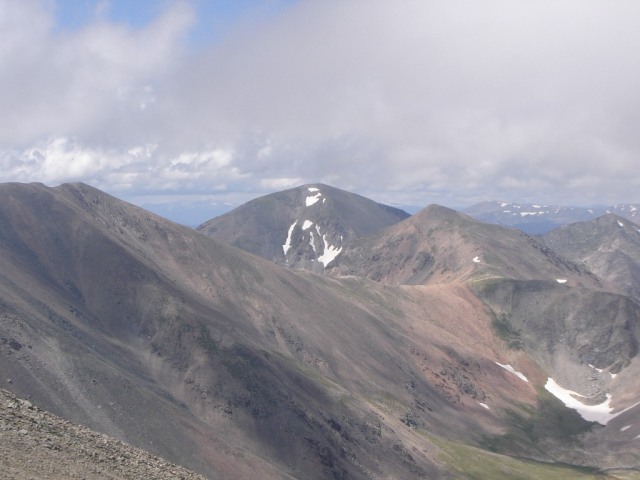 Here's the view of Culebra that most climbers never see:  For the return, we opted not to re-summit Culebra. Instead, we descended back to the saddle, then did a gently ascending traverse westward, re-joining our ascent route somewhere around 13,500 or 13,600 ft. I climbed Pt. 13,599 this time, and found out that it was just as easy as the way we had taken on the way up. Here's the approach to it: 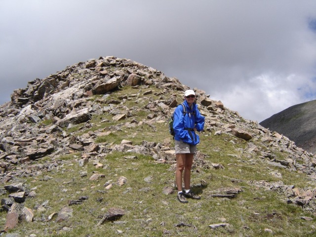 Here's a last close-up look at Red, from near the saddle: 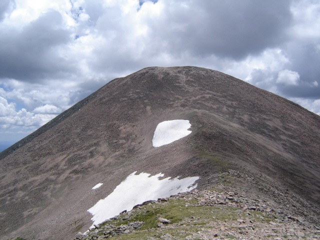 With the sky clear, we got a better view of Carneros Lake and the Carneros Basin than we had on the way up:  This is the last major ridge point to be re-climbed before descending off the ridge. You can see the megacairn on the right:  We also got a mediocre view (due to lighting) of the Blanca group:  We dropped down into the basin above the upper TH, looking for the talus route trail, which I had glimpsed while ascending. For some reason, we couldn't find it. So, on the spur of the moment, we decided to do another gently ascending traverse, re-gain the ridge crest (which is very mellow by this point), and follow it back to the Fourway"a sort of modified version of the "ridge route." It proved to be an easy and interesting route, sporting wisps of trail and occasional cairns. If I ever do this peak again, I'm strongly tempted to take this route all the way up. We were both pleasantly surprised with Culebra. It still annoys me to have to pay a fee, but the mountain is beautiful, interesting, and pristine, and the whole climb was just plain fun; that's hard to beat. More of the pictures are at: http://picasaweb.google.com/tcogwr/Culebra Thumbnails for uploaded photos (click to open slideshow): ")
")
")
")
")
")
")
")
")
")
|
| Comments or Questions |
|---|
|
|
Caution: The information contained in this report may not be accurate and should not be the only resource used in preparation for your climb. Failure to have the necessary experience, physical conditioning, supplies or equipment can result in injury or death. 14ers.com and the author(s) of this report provide no warranties, either express or implied, that the information provided is accurate or reliable. By using the information provided, you agree to indemnify and hold harmless 14ers.com and the report author(s) with respect to any claims and demands against them, including any attorney fees and expenses. Please read the 14ers.com Safety and Disclaimer pages for more information.
Please respect private property: 14ers.com supports the rights of private landowners to determine how and by whom their land will be used. In Colorado, it is your responsibility to determine if land is private and to obtain the appropriate permission before entering the property.


