| Report Type | Full |
| Peak(s) |
Wilson Peak - 14,021 feet El Diente Peak - 14,175 feet Mt. Wilson - 14,256 feet |
| Date Posted | 07/22/2008 |
| Date Climbed | 07/22/2008 |
| Author | fillae |
| Wilson Group - and then there was one |
|---|
|
I came into this summer needing 7 peaks to complete my 14er tour. Earlier this year I climbed Uncompahgre, Wetterhorn and San Luis Peak. This left the Wilson Group and Mt. Massive. I wanted to save an "easier" peak to finish on, so the Wilson Group was my next goal. I knew these peaks would be tough, and the reports I had been reading indicated there was still a lot of snow up there, especially the standard North Slopes route of El Diente. I placed a "help wanted" post on this site hoping to recruit some willing participants. When it was all said and done, JoeJaranero agreed to go so we began to do some planning. The most common way to do all three in the Wilson Group is to backpack into Navajo Basin where all three are then accessible. I have zero snow climbing experience other than kicking steps in soft slopes on a couple peaks, so the North Slopes route was not an option I was willing to consider. So I began looking at the South Slopes route from Kilpacker basin. A friend of mine did this route a few years ago and recommended it. I have really come to love BillMiddlebrook's routes on this site, so I was somewhat anxious climbing a route based solely on textual descriptions. In the end though, this seemed like the best opportunity to climb El Diente at this point. Next, if we were to climb El Diente from Kilpacker basin, we needed to figure out the best way to get Mt. Wilson, and be in position for Wilson Peak as well. I finally decided to camp at the Navajo and Kilpacker trail junction. This would allow us to climb Wilson Peak on Saturday, and then attempt El Diente with the traverse to Mt. Wilson on Sunday. We still had Monday as an extra day in case the traverse was not going to happen. Friday morning I picked up Joe from his friends house in the Springs at 6 am. From there it was off to Telluride. We ate lunch in downtown Telluride before heading to the Navajo Basin trailhead. There was a ranger at the trailhead checking the log and he gave us the encouraging parting words of "don't get struck by lightning". Great, thanks. We quickly strapped on our packs and headed out for the short 2.5 mile hike to where we were going to camp. The clouds were coming in and we could hear thunder off to the northwest. It sprinkled a little, but the clouds never opened up on us. We got a really good view of El Diente.  El Diente on approach We arrived at the Navajo and Kilpacker trial junctions at about 3:30 pm. While pumping water we decided to go ahead and attempt El Diente and the traverse to Mt. Wilson in the morning rather than doing Wilson Peak first. After deciding on a 4 am departure we both escaped to our tents to try and get a good nights sleep. I slept on and off until my alarm went off at 3:30 am. We ate a quick breakfast and headed down the Kilpacker trail at 3:45 am. We arrived at the Kilpacker Creek and according to a trip report I found, this is where we needed to climb up through some meadows. I found a faint trail and we started up. It wasn't long though and we lost the trail. I wasn't too concerned because I knew we were heading up into the right basin. After a while we spotted another climbers headlamp further up in the basin. Fortunately we had a full moon so we could see the large shape of El Diente, and had a good view of the valley below. 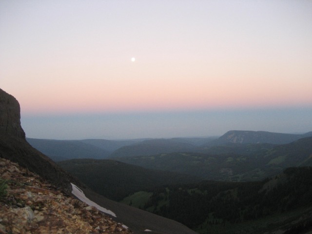 Looking back down the valley with a full moon visible Then we got a view of the upper falls and soon after found the trail again. Once we got above the lower falls, Joe set out on a faster pace than me.  Joe heading up Kilpacker basin This is where things started to get a little sketchy. There was still quite a bit of snow on the South Slopes of El Diente. We started heading up to an orange rib that I had read about. We ended up climbing some loose rock trying to avoid as much snow as possible. In some places we had to use our axes to chop some steps as the snow was pretty hard this early in the morning. We were able to get to the base of the orange rib and turned left. We traversed a big snow field in places, and were able to walk between the snow and the orange rib in other places. 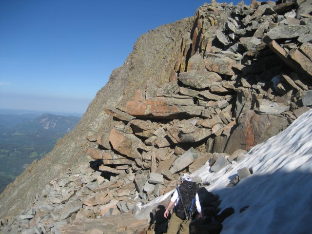 Joe traversing under the orange rib We soon reached the end of the rib and turned the corner to climb up a gully towards the infamous Organ Pipes. We were greeted with a great view of the summit! 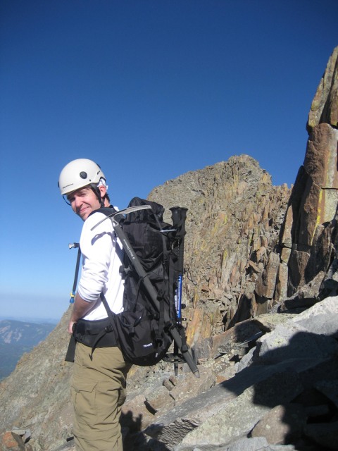 Joe with El Diente looming above We quickly scrambled up to the Organ Pipes and followed the remaining North Slopes route to the summit. 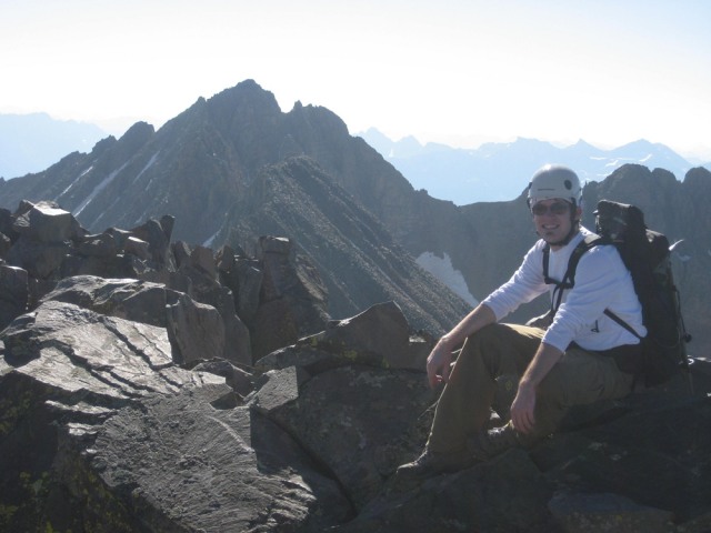 Joe on the summit with the connecting ridge to Mt. Wilson We only stayed long enough to take a couple photos then retreated the way we had come to start the long traverse to Mt. Wilson. I didn't stop to take too many pictures along the way. I seem to get singularly focused when on difficult terrain and always wish later on that I had done a better job of documenting things. I did happen to snap this shot looking back on El Diente about half-way across the ridge. It shows some of the snow still lingering on the south slopes. Also, this shot shows how well the weather was cooperating with us.  Looking back on El Diente We eventually made our way across some tougher terrain and ended up below the crux of Mt. Wilson's summit ridge. After thinking it over, Joe decided he had extended himself as much as felt comfortable with. I left my pack with Joe and made the quick scramble up to the summit. I was extremely happy at this point, but I also knew we still had a long descent in front of us. I tried to use my timer on my camera to do a self portrait, but in my haste I didn't even look to see if I had myself framed correctly. As you can see my photographic skills were extremely challenged on this day.  Take my word for it, that is me The plan now was to descend the standard route of Mt. Wilson, then hike back out Navajo Basin to where we were camped at the Navajo and Kilpacker trial junction. Since we did not ascend Mt. Wilson from this way, we were never completely sure we were going the right way. After a nice glissade down a large snow slope, we turned right and finally found some cairns marking the way down. 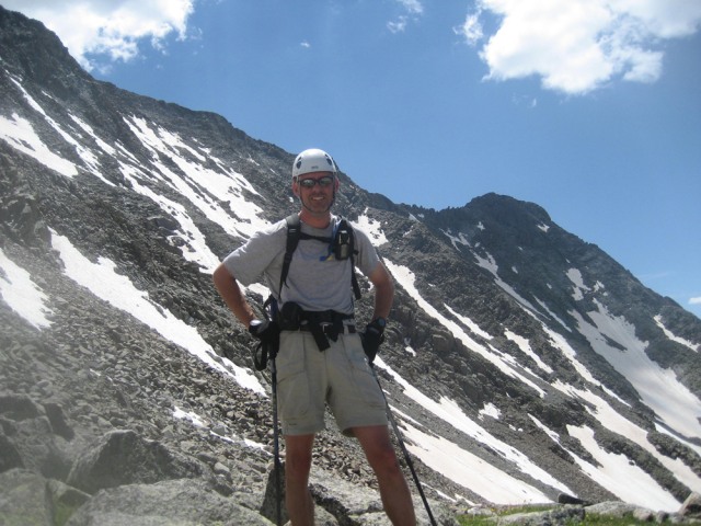 Me with El Diente in the upper right The view of Navajo Lake from here was spectacular. 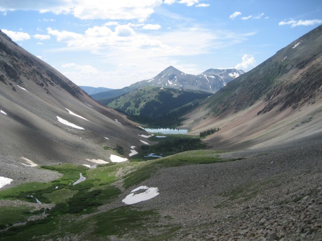 Navajo Lake and the rest of Navajo Basin We decided at this point that we were going to get back to our tents, pack up, backpack out, and then drive over to the Silver Pick TH to climb Wilson Peak in the morning. I had always intended to climb Wilson Peak from Navajo Basin because of the land dispute, but I was so thoroughly exhausted that my judgment was probably partially clouded. I also wanted to get back in cell phone range so I could call my wife and let her know how things were going. In hindsight it would probably been easier doing it from where we were camped because Silver Pick basin still had a lot of snow. Oh well. After driving around to Silver Pick Joe decided his trip was complete and he crashed in the back of my truck. I set up my tent and tried to eat a little before going to sleep. I again awoke at 3:30 am and was on the Silver Pick road by 3:45 am. In the darkness I lost the trail in Silver Pick basin a couple times. 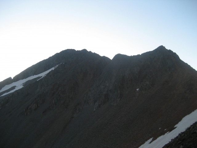 View of Wilson Peak on the ascent to Rock of Ages The upper part of the basin still has a lot of snow, and with the route I picked some of it was unavoidable. As soon as there was enough light in the sky I could see the trail I needed to be on traversing up to Rock of Ages saddle. I scrambled up some scree until I got on the trail, and then I walked it up to Rock of Ages saddle. On the saddle I got a great view of El Diente and Mt. Wilson. It was a great feeling to know that I had done that the previous day! 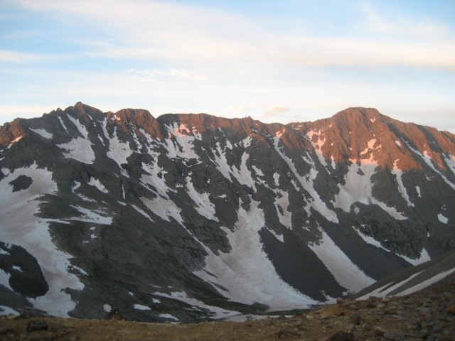 View of El Diente (right) and Mt. Wilson (left) with the connecting ridge From the saddle I also got a view of the saddle ahead that connects Wilson Peak and Gladstone Peak. The route traverses below the point you see in the picture. Once you gain the saddle you make a left turn and head up towards the Wilson Peak ridge. 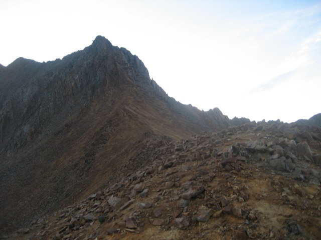 View towards the Wilson Peak / Gladstone Peak saddle The route from here is very straight forward (see the route description on this site). I was moving pretty good and quickly made it up to the false summit. I had read about the false summit and was expecting it, but all the same it is pretty dramatic. From the false summit there is a steep descent of about 50 feet, then a steep ascent to the summit proper. I was particularly careful through this section. I didn't want to make a mistake at this point. I found some solid rock and scrambled up to the summit. Wow! The summit was a bit sobering due to the debris left from the Sept 06 plane crash. I took a couple photos, one of the prop and one of the memorial plaque, but couldn't bring myself to take a picture of some of the personal items that are still there. I had to wait on the summit for a while as a large group of people were on the false summit and one-by-one were making their way to the top. As I found out when I returned home, this was Aubrey and Jen's group as they completed their final 14er. I wish I would have known I would have congratulated them. Well anyway, congratulations Aubrey and Jen! Someone in their group was kind enough to take my picture. 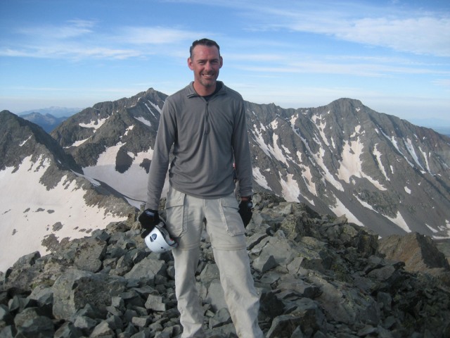 Me on Wilson Peak! I took my time getting back to Rock of Ages saddle and enjoyed my trek back to the trailhead. With the basin now in full light I could see where I had taken a wrong turn earlier in the morning. I was able to avoid most of the snow on the way back. This was the most exciting two days of climbing I have had. Peaks #55, #56 and #57 were not easy, but most certainly rewarding. Thumbnails for uploaded photos (click to open slideshow):
")
|
| Comments or Questions | ||||||||||||
|---|---|---|---|---|---|---|---|---|---|---|---|---|
|
Caution: The information contained in this report may not be accurate and should not be the only resource used in preparation for your climb. Failure to have the necessary experience, physical conditioning, supplies or equipment can result in injury or death. 14ers.com and the author(s) of this report provide no warranties, either express or implied, that the information provided is accurate or reliable. By using the information provided, you agree to indemnify and hold harmless 14ers.com and the report author(s) with respect to any claims and demands against them, including any attorney fees and expenses. Please read the 14ers.com Safety and Disclaimer pages for more information.
Please respect private property: 14ers.com supports the rights of private landowners to determine how and by whom their land will be used. In Colorado, it is your responsibility to determine if land is private and to obtain the appropriate permission before entering the property.