Well, the first 14'er ascent of the summer came much later than I expected this year. I've had a busy year at work, and haven't been spending as much time in the mountains as I'd like! Nevertheless, I had some of my old friends in from out of state this week, and they wanted to climb a Colorado 14'er (a first for the three of them, despite years of hiking/climbing experience between them)
Abstract (for those who hate to read):
5 climbers, 1 dog. All summited. Great weather. Nice trail.
Logistics:
We decided to attempt Mt Massive via the standard route. To facilitate this trip we camped along the Halfmoon Rd west of Leadville (just over a 2 hour drive from the west side of the Denver metro area). There is a ton of great car-based camping along this road, and we had no trouble finding a spot. We ended up setting up base camp near the top of a hill that is approximately 1/2 mile past the standard Mt. Massive trailhead (coordinates of: 13S 0376893E 4334572N, elevation approximately 10,150ft).
From here we were also able to take the 4WD road up to the Upper Halfmoon Trailhead for an acclimation hike up to North Halfmoon Lakes. This was an excellent and uncrowded 6-7 mile hike, and I'd recommend it to anyone who has some extra time to spend in the area!
The road conditions to the standard trailhead are probably suitable for any passenger car, and I imagine you wouldn‘t have any trouble making it as far as the campsite we used. A few pot holes may require careful/slow navigation in the lowest clearance vehicles, but we saw a number of passenger cars out as far as our campsite.
Beyond the campsite that we used the road gets quite a bit more rough. This obviously isn‘t an issue for the standard trailhead (our route), but may present an issue for climbers who are seeking access to the mountain via the Upper Halfmoon TH. One fairly significant rock feature presents itself about 1/3 of a mile from the upper trailhead, and navigating this obstacle in anything less than our stock Cherokee probably wouldn‘t have been advisable.
The Climb:
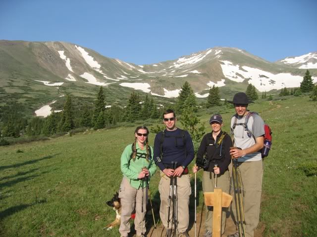
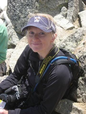
The six of us (myself, Julie (coloradojulie), Matt, Laura, George, and Juno (our dog)) decided to get an early start in hopes of giving our out-of-town friends the best chance of summiting. We ended up departing from the standard TH at approximately 0515 hrs, with only one other vehicle in the parking area at that time.
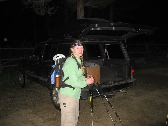
Julie preparing to leave from the trailhead:
The first few miles of this hike (along the Colorado Trail) were completely uneventful. The grade is easy through this section, and we averaged around a 3mph pace. The trail is very well defined through this section, and it allowed us to quickly breeze through this part of the trail.
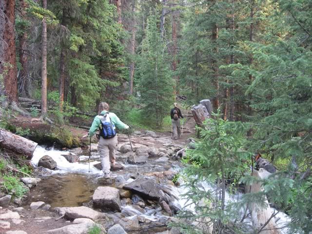
Julie crossing the first of two easy stream crossings:
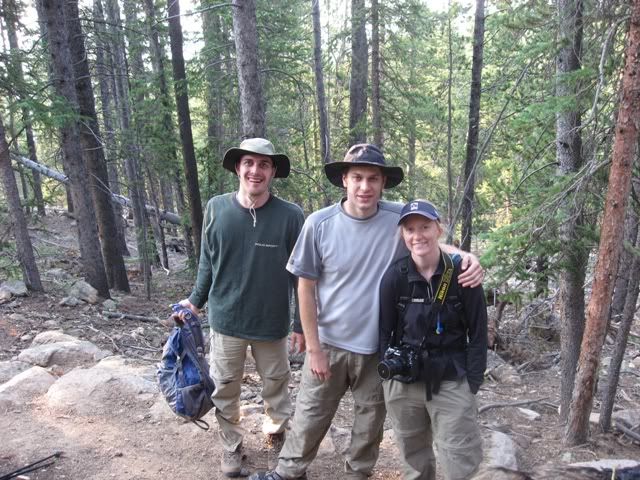
George, Matt, and Laura in the first couple of miles:
We took our first break near the Mt Massive/Colorado Trail split, where the mosquitos quickly found our group and reminded us to keep moving! We also noted that this trail junction is NOT quite where it is shown on the USGS Topo maps (my gps showed that the actual split is approximately 2.76 miles from the trailhead... Although I didn't create a waypoint for this new split, my GPS tracklog would indicate that this junction will be found at approximately: 13S 376692E 4337947N).
Map of our tracklog versus indicated trail:
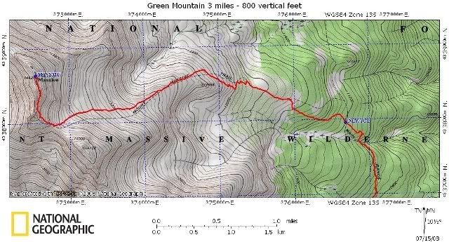
It appears that a new trail has been completed along the lower sections of the Mt Massive trail, and you will now hit this trail junction a bit prior to where you would have previously intercepted the old trail. This spot is well-signed, and easy to find, but a GPS user might suffer some slight confusion at this point if they aren't paying attention (ask me how I know this!). You would be very hard pressed to miss this junction, so I wouldn't suggest that anyone concern themselves with the navigational discrepancies through this section!
After a quick (and bug filled) break, we began hiking the first significant uphill sections of the day. The trail climbs steadily through the trees, and it is quickly apparent that this section of dirt is very new. Numerous survey markers decorate the side of the trail, and freshly cut tree branches are evident throughout the next mile or so.
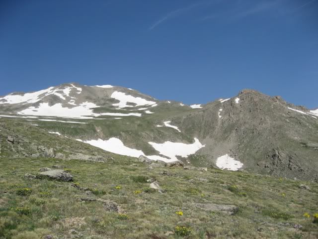
We hit treeline a short time later (a distance I would estimate as less than a mile), and took a few minutes to take in the scenery. It was a beautiful morning, despite some haze hanging over Leadville and the surrounding valley. At this point I think our friends had their first big realization that this was going to be a long day, as the mass of Massive was now directly in front of them.
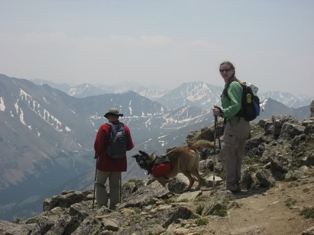
Juno, Julie (coloradojulie), Kevin (coloradokevin), Laura, and Matt at treeline:
Our climb above treeline continued to be pleasant, on a well-defined trail that never got too steep or rocky for comfort. After some time we passed a trail crew that was in the process of constructing other portions of the new trail that we had just traveled. We spoke briefly with these folks, and thanked them for their dedication to the mountain.
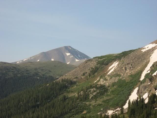
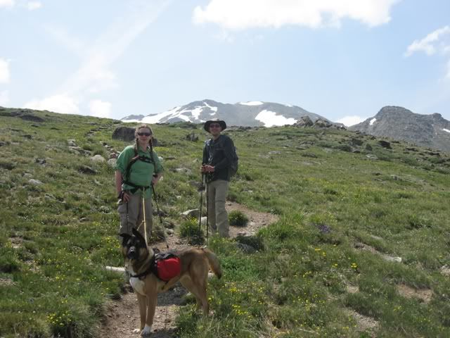
View of Mt Elbert from this alpine meadow:
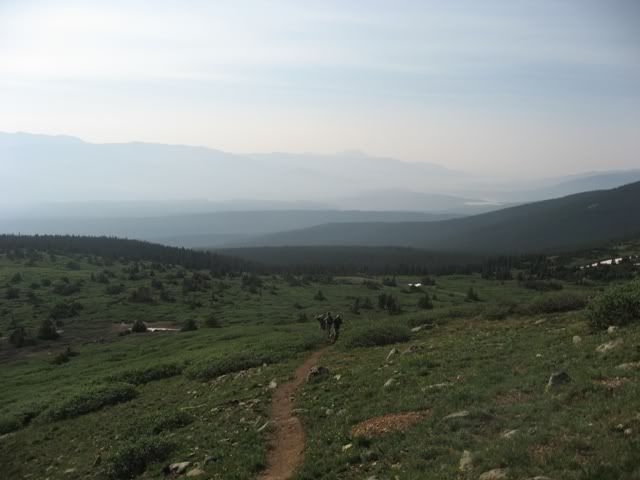
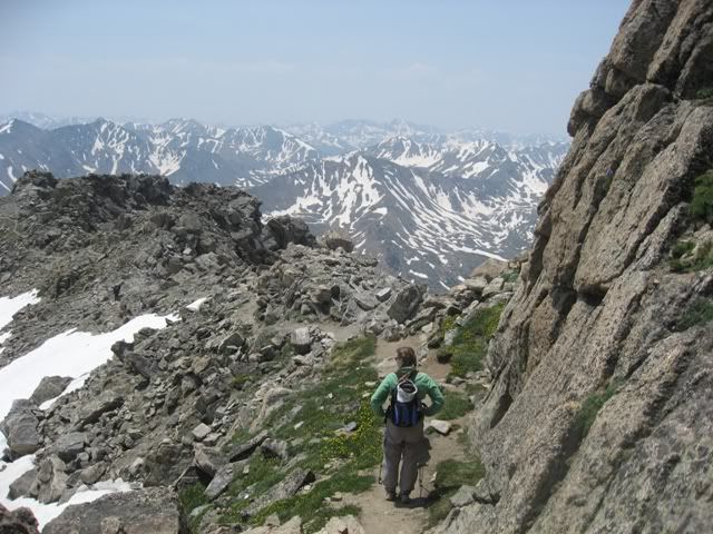
Our group hiking up the trail:
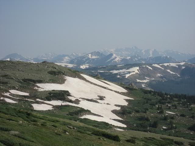
Another view from the meadow:
By this time the Ohio-based contingent of our group was starting to feel the effects of the thin air. In particular, Laura was worried about slowing our group's pace too significantly. We decided to divide our team at this point, with myself, Juno, and Matt leading the group. Although Julie was feeling very strong (and hiking quite fast), she agreed to slow down and bring up the rear to assist Laura. George was happy doing his own thing, and told us that he would stay somewhere in the middle.
The upper reaches of the mountain:
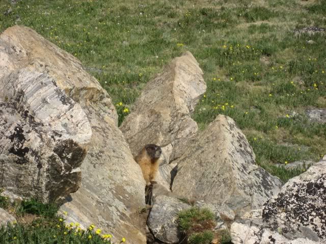
Matt was climbing strong, despite having only a week at altitude under his belt. We weren't climbing to break any records, but still quickly gained the saddle south of Massive's summit, and took another brief break in the company of some overly-ambitious marmots (who had apparently dealt with the hiking community quite a bit in the past). We watched as the rest of our group worked their way up through the meadow, and eventually decided to push on towards the summit.
Marmot just prior to the saddle:
From the saddle to the summit we noticed that the trail became notably less defined. This didn't really present any significant navigational barriers, but the trail still didn't flow with the speed/ease of the sections up until this point (all the same, I'd categorize this as a hard class 1, and not quite a class 2 section). Some snowfields remained along the side of the route, though they were easily avoided without leaving our intended path to the summit. Juno, on the other hand, nearly yanked me off the mountain a couple of times as she tried to roll in the snow (my dog loves snow, and with a weight of 75lbs of lean muscle, she has quite a pull on a leash when she is motivated!).
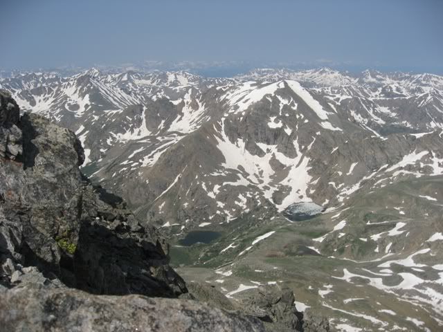
I enjoyed the ridge towards the summit, and took some time to look at the Halfmoon Lakes, far below us. The weather was still great, and we took our time in gaining the actual summit. We ultimately topped out in a leisurely 5 hours or so, and were joined on the summit by a handful of other folks.
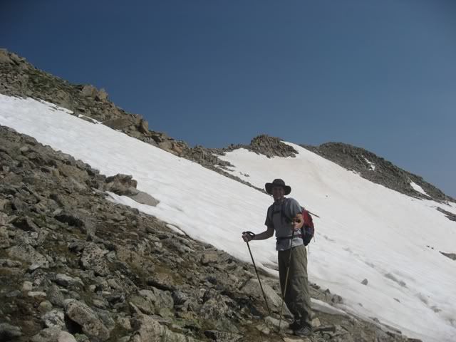
Matt above the saddle:
North Halfmoon Lakes from far above:
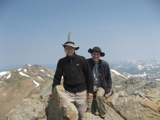
Matt and I on the summit:
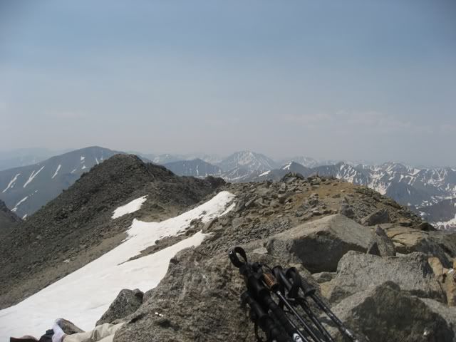
Looking back at the summit ridge:
I never did locate a summit register (perhaps due to the wilderness designation?), but snapped a few pictures and enjoyed a well-deserved lunch on the top of Massive. George joined us on the summit after about a half an hour, and Julie and Laura topped out about an hour and a half after we did. Juno was happy to grab a nap on the top, and was acting a bit cranky today... Usually my dog thrives on attention, but today she didn't really take well to the strangers who wanted to greet her (still, the dog-friendly folks on the summit quickly convinced Juno that people are still fun!). I checked her paws for any injury, and made sure that she was appropriately fed and watered. She didn't otherwise appear any worse for wear, so I let her enjoy her summit nap as we ate our jerky/M&M's/powerbars.
Juno napping next to George on the summit:

George taking in the view from the top:
Julie and Laura on the final few steps to the top:
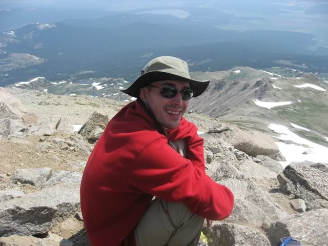
Laura taking a break on the summit:
After nearly two hours on the summit, we started back down. The Ohioans were definitely feeling the effects of this long climb by this point, and were quite happy when we finally reached the car (10:55 hrs after our start, including LONG breaks and a very leisurely pace).
George, Juno, and Julie starting down:
Julie descending the summit ridge with Juno:
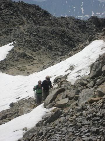
Julie, Juno, and George descending the meadow below the saddle:
Overall we couldn't have asked for better weather, and the hike was quite enjoyable! A big congratulations to Matt, George, and Laura on their very first 14'er summits!!!
|


